Wickenburg is a town in Maricopa and Yavapai counties, Arizona, United States. As of the 2020 census, the population of the town was 7,474, up from 6,363 in 2010.

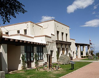
Black Canyon City is an unincorporated community and census-designated place (CDP) in Yavapai County, Arizona, United States. The population is 2,677 as of the 2020 census.

Clarkdale is a town in Yavapai County, Arizona, United States. The Verde River flows through the town as does Bitter Creek, an intermittent tributary of the river. According to the 2021 census, the population of the town was 4,419.

Dewey–Humboldt is a town in Yavapai County, Arizona, United States. The population of the town was 3,894 according to the 2010 census. The Dewey–Humboldt area was a census-designated place (CDP) at the 2000 census, at which time its population was 6,295.

Seligman is a census-designated place (CDP) on the northern border of Yavapai County, in northwestern Arizona, United States. The population was 456 at the 2020 census.

State Route 89A is an 83.85-mile (134.94 km) state highway that runs from Prescott north to Flagstaff in the U.S. state of Arizona. The highway begins at SR 89 in Yavapai County and heads northward from Prescott Valley, entering Jerome. From Jerome, the route then heads to Cottonwood and Clarkdale. The road then continues out to Sedona. The highway is notable for its scenic value as it winds over and through Mingus Mountain as well as passing through Sedona and the Oak Creek Canyon. The route then enters Coconino County soon after leaving Sedona. The highway proceeds to Flagstaff, where it crosses Interstate 17 (I-17) and I-40. The highway ends at I-40 Business in Flagstaff. What is now SR 89A became a state highway in the late 1920s as SR 79. The highway was extended and improved several times through 1938. SR 79 was renumbered to U.S. Route 89A in 1941 and then to SR 89A in the early 1990s.

State Route 69 is a highway that serves as the main road to Prescott, Arizona, from Interstate 17. The highway mainly consists of four-lanes, although some sections in Prescott and Prescott Valley are wider. Prior to the construction of Interstate 17 in the 1960s and early 1970s, State Route 69 continued south to Phoenix, Arizona, as the Prescott-Phoenix Hwy or Black Canyon Highway on a different alignment, through the ghost towns of Bumble Bee and Cordes.
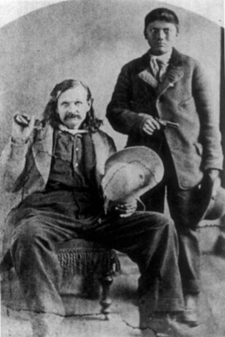
John W. "Jack" Swilling was an early pioneer in the Arizona Territory. He is commonly credited as one of the original founders of the city of Phoenix, Arizona. Swilling also played an important role in the opening of the central Arizona highlands to white settlement. His discoveries resulted in a gold rush to the region, and this in turn led to the establishment of Arizona's first territorial capital at the mining town of Prescott.

Lake Pleasant Regional Park is a large outdoors recreation area straddling the Maricopa and Yavapai county border northwest of Phoenix, Arizona. The park is located within the municipal boundaries of Peoria, Arizona, and serves as a major recreation hub for the northwest Phoenix metropolitan area.

The Agua Fria River is a 120-mile (190 km) long intermittent stream which flows generally south from 20 miles (32 km) east-northeast of Prescott in the U.S. state of Arizona. Prescott draws much of its municipal water supply from the upper Agua Fria watershed. The Agua Fria runs through the Agua Fria National Monument. The river then flows through a small canyon called "Black Canyon" into Lake Pleasant, a popular recreation area near Peoria, Arizona. (There is a large "Black Canyon" on the Colorado River along the Arizona–Nevada border.)
Jerome State Historic Park is a state park of Arizona, US, featuring the Douglas Mansion, built in 1916 by a family of influential mining entrepreneurs in Jerome, Arizona, a mining region in the northeast of the Black Hills, east Yavapai County. A museum is located in the old Douglas Mansion.

Jacob Snively (1809–1871) was a surveyor, civil engineer, officer of the Texian Army and the Army of the Republic of Texas, California 49er, miner, and Arizona pioneer.

Gillett, Arizona, is a ghost town in Yavapai County, Arizona, United States. It has an estimated elevation of 1,362 feet (415 m) above sea level. Historically, it was a stagecoach station, and then a settlement formed around an ore mill serving the Tip Top Mine, on the Agua Fria River in Yavapai County in what was then Arizona Territory. It was named for the mining developer of the Tip Top Mine, Dan B. Gillett and is spelled incorrectly as Gillette on U. S. Topographic Maps and elsewhere.

Trinidad Swilling Shumaker, known as "The Mother of Phoenix" was a pioneer and the wife of Jack Swilling, the founder of Phoenix. Mrs. Swilling was involved in local civic activities and promoted the public recognition of her husband as founder of Phoenix. She was also involved in dispute which made the local news as to who was the first White woman to settle in the Phoenix townsite. In 1868, Swilling founded the first pioneer home in the Salt River Valley.

Joseph Mayer was an American businessman, gold prospector and pioneer who founded the town of Mayer, Arizona.


 Inside the Swilling residence.
 Different view inside the Swilling residence.
 Grave of Col. Jacob Snively
 Wells Fargo Stage Stop – 1872.
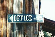 Wells Fargo Stage Stop office sign.
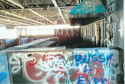
 Maggie Mine Bridge – 1870s.
 Maggie Mine Bridge over Black Canyon Creek.
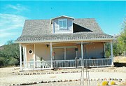 Vernacular House – 1885.
 Early Pioneer Residence – 1894.
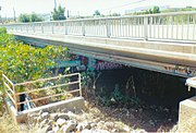 Black Canyon City Bridge – 1925.
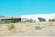
 Abandoned Store Building – 1900.
 The Rock Springs Hotel (now the "Rock Springs Cafe) – 1918.
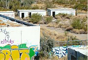
 Black Canyon City School House – 1926.
 Front view of the Black Canyon City School House – 1926.
 "A" Frame House (the "Jean Harlow Museum") – 1950.
 Jean Harlow's bed on exhibit in the museum.
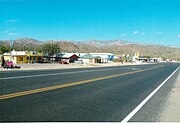 The paved section of the Old Black Canyon Hwy which was originally built in 1860.