Maricopa County is in the south-central part of the U.S. state of Arizona. As of the 2020 census the population was 4,420,568, or about 62% of the state's total, making it the fourth-most populous county in the United States and the most populous county in Arizona, and making Arizona one of the nation's most centralized states. The county seat is Phoenix, the state capital and fifth-most populous city in the United States.

Pinal County is in the central part of the U.S. state of Arizona. According to the 2020 census, the population of the county was 425,264, making it Arizona's third-most populous county. The county seat is Florence. The county was founded in 1875.

Pima is a town in Graham County, Arizona, United States. As of the 2010 census, the population of the town was 2,387, up from 1,989 in 2000. The estimated population in 2018 was 2,512. Pima is part of the Safford Micropolitan Statistical Area.

Gila Bend, founded in 1872, is a town in Maricopa County, Arizona, United States. The town is named for an approximately 90-degree bend in the Gila River, which is near the community's current location. As of the 2020 census, the population of the town was 1,892.

Marana is a town that mostly lies in Pima County with a small portion in Pinal County, in the U.S. state of Arizona. It is located northwest of Tucson, Arizona. As of the 2020 census, the population of the town was 51,908.

Florence is a town in Pinal County, Arizona, United States. Florence, which is the county seat of Pinal County, is one of the oldest towns in that county and includes a National Historic District with over 25 buildings listed on the National Register of Historic Places. The population of Florence was 26,785 at the 2020 census.

Sacaton is a census-designated place (CDP) in Pinal County, Arizona, United States. The population was 3,254 at the 2020 census. It is the capital of the Gila River Indian Community.

Maricopa Association of Governments (MAG) is a Council of Governments (COG) that serves as the regional agency for the greater Maricopa region in Arizona, United States. This includes the Phoenix area and the neighboring urbanized area in Pinal County, containing the Town of Florence and City of Maricopa. When MAG was formed in 1967, the elected officials recognized the need for long-range planning and policy development on a regional scale. They realized that many issues such as transportation, air quality and human services affected residents beyond the borders of their individual jurisdictions.
The Arizona Court of Appeals is the intermediate appellate court for the state of Arizona. It is divided into two divisions, with a total of twenty-eight judges on the court: nineteen in Division 1, based in Phoenix, and nine in Division 2, based in Tucson.

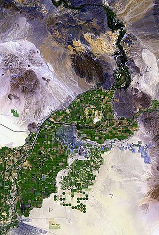
The Gila River Valley is a multi-sectioned valley of the Gila River, located primarily in Arizona. The Gila River forms in western New Mexico and flows west across southeastern, south-central, and southwestern Arizona; it changes directions as it progresses across the state, and defines specific areas and valleys. The central portion of the river flows through the southern Phoenix valley region, and the final sections in southwestern Arizona form smaller, irrigated valleys, such as Dome Valley, Mohawk Valley, and Hyder Valley.

Casa Blanca is a census-designated place (CDP) in Pinal County, Arizona, United States, located in the Gila River Indian Community. The population was 1,388 at the 2010 census.
Hueso Parado, Spanish for “Standing Bone” or El Juez Tarado Spanish for "The Judge Tarado", was the largest village of the Maricopa people in the 19th century, in what is now the Gila River Indian Community in Pinal County, Arizona.

The Pioneer and Military Memorial Park is the official name given to seven historic cemeteries in Phoenix, Arizona. The cemeteries were founded in 1884 in what was known as "Block 32". On February 1, 2007, "Block 32" was renamed Pioneer and Military Memorial Park. The Pioneer and Military Memorial Park is listed in the National Register of Historic Places. The historic Smurthwaite House, which is also listed in the National Register of Historic Places, is located on the grounds of the Pioneer and Military Memorial Park and is used as the cemetery's main office. Pioneer and Military Memorial Park is the final resting place of various notable pioneers of Arizona.

Sacate Village is a census-designated place in Pinal County, in the U.S. state of Arizona. The population was 169 at the 2010 census.

Sacate is a populated place in the Middle Gila River Valley area, within Pinal County, Arizona, United States. Located 8 mi (13 km) north of Maricopa on the south side of the Gila River near Pima Butte, Sacate was an Pima village, a railroad station of the Southern Pacific Railroad, and a Catholic mission. It had originally been called Sacaton Station but the name was shortened to its current version in 1904.

Levi Ruggles (1824–1889) known as the "Father of Florence, Arizona" was a soldier and pioneer who founded the town of Florence, Arizona.

The Home Mission Cemetery is a historic cemetery located on West Dove Wing Way in the Maricopa County of Arizona, United States, slightly outside of the Surprise town border. The cemetery is also known as the "Sleeping Bride Cemetery" and the "Thompson Cemetery". The Pioneers' Cemetery Association (PCA) defines a "historic cemetery" as one which has been in existence for more than fifty years.

The Adamsville Cemetery is a historic cemetery, established by the Ancient Order of United Workmen (A.O.U.W.) in Adamsville, a ghost town in Pinal County, Arizona. The Pioneers' Cemetery Association (PCA) defines a "historic cemetery" as one which has been in existence for more than fifty years.
Cachanillo was one of the 19th century Pima Villages, located along the Gila River, in what is now the Gila River Indian Community in Pinal County, Arizona.


