Brief history
The first known inhabitants of the area were the Hohokam who settled the banks of the nearby San Pedro River in splinter groups. The disappearance of the Hohokam in the late 15th century remains a mystery. Later the region was settled by the O’odham (Sobapiris) and the Apache tribes. The Sobaipuris and Apache fought each other over the ownership of the land. The Sobapiris gave up the struggle and relocated to the San Xavier Mission, home to the Tohono O’odham Nation to the south. [1]
The area came under Spanish rule in what Spain claimed was New Spain. The first Europeans arrived in the region in 1583, when a group of Spanish explorers came in search of gold and silver. They were searching for the Seven Cities of Cibola, whose streets were supposed to be paved with gold. The region was known as "Apachería" by the Spaniards [2] In 1821, the Mexican War of Independence between Mexico and Spain came to an end and the territory of New Spain, which included Arizona, was ceded to Mexico. [3]
In 1846, the United States declared war against Mexico in what became known as the Mexican–American War. [4] The conflict with Mexico ended in 1848. In 1854, the United States purchased the region from Mexico in what is known as the Gadsden Purchase. [5] In 1870, a Group of vigilantes from Tucson massacred 200 Apache women, children and elders at Aravaipa Creek. Those who survived the massacre moved to the San Carlos Reservation. [1]
The early Mexican settlers used the land for agricultural purposes and for cattle ranching. As such, the economy of the area depended on cattle ranching and later mining. Albert Weldon and Isaac Lorraine were among the first Anglo's from the eastern coast of the United States to claim mining rights in the area. Lorraine founded a mine which he named the "American Flag Mine". He also established the American Flag cattle ranch. Weldon was a prospector who established a mine in the Catalina Mountains which he named "The Oracle", in honor of his uncle's ship. The small town was named Oracle in 1878. [1]
In the 1870s word of the mining successes in the area spread and prospectors from other places came with their families to the area. In 1880, two post offices were established, one in Oracle and one 5 miles west of Oracle which was called the American Flag Post Office. The American Flag Post Office service was discontinued in 1890. Currently it is the oldest existing Territorial post office in the state that is still standing. [1]
The climate of Oracle was another factor that attracted people for health reasons. Oracle was mentioned in a medical journal as an ideal place where the fresh air would restore the health of those suffering from "consumption" the name given to tuberculosis. In the 1880s the Dodge family built the Arcadia Ranch as a sheep ranch and boarding house to accommodate those who were suffering from lung diseases. [1]
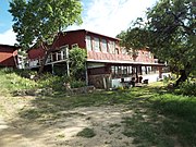
In 1895, the Neal family built the Mountain View Hotel on what is now the American Way Road. The building was made with a thousand adobe bricks which were made on site. It took six months to build. The hotel attracted visitors from different parts of the world. [1] [6]
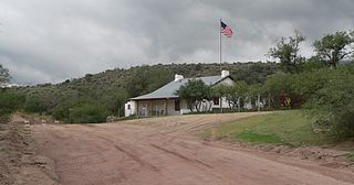
A celebrity who resided in Oracle was William Cody known as "Buffalo Bill Cody". Cody was together with one of his friends, Nate Salsbury (1846–1902) who had a ranch in the town of Dateland, Arizona, owners of the Buffalo Bill Wild West Show. Upon Cody's retirement from the show, he invested in a mine in the Campo Bonito area of the Catalina Mountains. He named the mine "High Jinks" and would often stay either in the Mountain View Hotel or Arcadia Ranch. He established a ranch in 1912 which he named "La Casa del High Jinks". He visited his ranch where he would reside until his death in 1917. [1] [7]
Oracle Historical Society
The Oracle Historical Society, Inc. was founded in 1977 and is located at 825 East Mountain Lemmon Highway where the Arcadia Ranch was once located. The mission of the society is to "preserve historical artifacts and properties; to educate, to encourage awareness and appreciation of the unique cultural-historical heritage of the community of Oracle and surrounding areas; and to promote alliances that enhance the Society’s ability to influence the future by honoring the past." [8]
The settlement of Oracle does not have the authority to deny a demolition permit. Therefore, the owner of a property, listed either in the National Register of Historic Places or considered historical by the Camp Verde Historical Society, may demolish the historical property in question if desired. According to Jim McPherson, Arizona Preservation Foundation Board President:
"It is crucial that residents, private interests, and government officials act now to save these elements of our cultural heritage before it is too late.” [9]
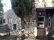
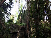
An example is the Mountain View Hotel. It was incorporated into a Baptist church and its outbuildings were torn down and it was stripped of its balconies. [6]
This page is based on this
Wikipedia article Text is available under the
CC BY-SA 4.0 license; additional terms may apply.
Images, videos and audio are available under their respective licenses.

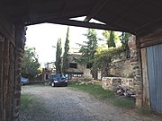
 Mountain View Hotel
 Oracle Union Church stairs
 Oracle Union Church
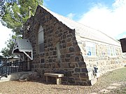 Oracle Union Church
 St. Helen's Mission Church