Yavapai County is near the center of the U.S. state of Arizona. As of the 2020 census, its population was 236,209, making it the fourth-most populous county in Arizona. The county seat is Prescott.

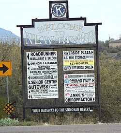
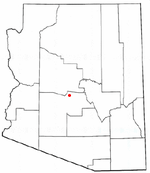
New River is an unincorporated community and census-designated place (CDP) in Maricopa County, Arizona, United States. The population was 17,290 as of the 2020 census, up from 14,952 at the 2010 census.

Superstition Mountain is a prominent mountain and regional landmark located in the Phoenix metropolitan area of Arizona, immediately east of Apache Junction and north of Gold Canyon. It anchors the west end of the federally designated Superstition Wilderness Area and is a popular outdoor recreation destination, home to numerous trails for hiking and horseback riding. The legend of the Lost Dutchman's Gold Mine centers around the mountain.

Phillip Darrell Duppa was a pioneer in the settlement of Arizona prior to its statehood.
John W. "Jack" Swilling was an early pioneer in the Arizona Territory. He is commonly credited as one of the original founders of the city of Phoenix, Arizona. Swilling also played an important role in the opening of the central Arizona highlands to white settlement. His discoveries resulted in a gold rush to the region, and this in turn led to the establishment of Arizona's first territorial capital at the mining town of Prescott.

Tortilla Flat is a small unincorporated community in far eastern Maricopa County, Arizona, United States. It is located in the central part of the state, northeast of Apache Junction. It is the last surviving stagecoach stop along the Apache Trail. According to the Gross Management Department of Arizona's main U.S. Post Office in Phoenix, Tortilla Flat is presumed to be Arizona's smallest official "community" having a U.S. Post Office and voting precinct. The town has a population of 6. Tortilla Flat can be reached by vehicles on the Apache Trail, via Apache Junction.

The Tonto Apache is one of the groups of Western Apache people. The term is also used for their dialect, one of the three dialects of the Western Apache language. The Chiricahua living to the south called them Ben-et-dine or binii?e'dine'. The neighboring Western Apache ethnonym for them was Koun'nde, from which the Spanish derived their use of Tonto for the group. The kindred but enemy Navajo to the north called both the Tonto Apache and their allies, the Yavapai, Dilzhʼíʼ dinéʼiʼ – “People with high-pitched voices”).

The Yavapai are a Native American tribe in Arizona. Historically, the Yavapai – literally “people of the sun” – were divided into four geographical bands who identified as separate, independent peoples: the Ɖulv G’paaya, or Western Yavapai; the Yaavpe', or Northwestern Yavapai; the Gwev G’paaya, or Southeastern Yavapai; and the Wiipukpaa, or Northeastern Yavapai – Verde Valley Yavapai.

The Battle of Turret Peak occurred March 27, 1873 in the Arizona Territory between the United States Army and a group of Yavapai and Tonto Apaches as part of Lieutenant Colonel George Crook's campaign to return the natives to reservations.

Wranglers Roost Stagecoach Stop is located in New River, Maricopa County, Arizona. It was a stagecoach stop for a short time in the late 1800s. In 1930, Carl Jesse Myers built WR in the 1930s as a dude ranch. The dude ranch was successful all through the 1930s when times were tough. The original rock structure was added onto in the late 1960s and became a resort with a pool, hot tub, restaurant and some hotel accommodations. The current owners, Reid and Heidi Stewart, also rent the structure for the celebrations of weddings.

Fort McDowell is an unincorporated community in Maricopa County, Arizona, United States. Fort McDowell is 23 miles northeast of Phoenix. Fort McDowell has a post office with ZIP code 85264.

The Stoneman Road, an important supply road between Fort McDowell and Fort Whipple in Prescott between 1870 and 1890. It was an important conduit for the shipping of supplies from Fort Whipple in Prescott to Fort McDowell on what is today the Yavapai Reservation near Fountain Hills.

Agua Caliente in Maricopa County, Arizona on the border with Yuma County, is a place north of the Gila River near Hyder, Arizona. Named 'Santa Maria del Agua Caliente' in 1744 by Father Jacob Sedelmayer. In 1775, Father Francisco Garces used the current short form. The location was the site of a resort established at the site of nearby hot springs. Agua Caliente, a name derived from Spanish meaning "hot water", received its name from nearby hot springs which were originally used by the local Indians.
The Yavapai Wars, or the Tonto Wars, were a series of armed conflicts between the Yavapai and Tonto tribes against the United States in the Arizona Territory. The period began no later than 1861, with the arrival of American settlers on Yavapai and Tonto land. At the time, the Yavapai were considered a band of the Western Apache people due to their close relationship with tribes such as the Tonto and Pinal. The war culminated with the Yavapai's removal from the Camp Verde Reservation to San Carlos on February 27, 1875, an event now known as Exodus Day.
The Hualapai War, or Walapai War, was an armed conflict fought from 1865 to 1870 between the Hualapai native Americans and the United States in Arizona Territory. The Yavapai also participated on the side of the Hualapai and Mohave scouts were employed by the United States Army. Following the death of the prominent Yavapai leader Anasa in April 1865, the natives began raiding American settlements which provoked a response by the United States Army forces stationed in the area. By the spring of 1869 disease forced the majority of the Hualapais to surrender though some skirmishing continued for almost two more years.

The Pioneer Living History Museum is located at 3901 W. Pioneer Road in Phoenix, Arizona. The museum, also known as Pioneer Village, has 30 historic original and reconstructed buildings from the 1880s and early 1900s on its 90-acre property.
Trinidad Swilling Shumaker, known as "The Mother of Phoenix" was a pioneer and the wife of Jack Swilling, the founder of Phoenix. Mrs. Swilling was involved in local civic activities and promoted the public recognition of her husband as founder of Phoenix. She was also involved in dispute which made the local news as to who was the first White woman to settle in the Phoenix townsite. In 1868, Mrs. Swilling founded the first pioneer home in the Salt River Valley.

Joseph Mayer was an American businessman, gold prospector and pioneer who founded the town of Mayer, Arizona.

 The Wranglers Roost Stagecoach Stop front gate.
 Wranglers Roost Stagecoach Stop entrance.
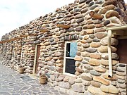 Wranglers Roost Stagecoach Stop main building.
 Building and well of the Wranglers Roost Stagecoach Stop.
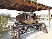 Old Stagecoach.
 A one horse Farm Wagon.
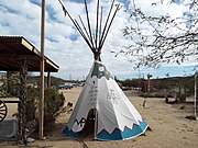 Tonto Apache Teepee.
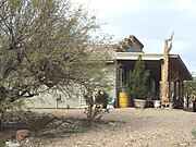 Early 1900s General Store.
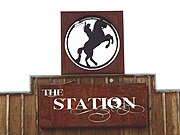 Logo of The Station Stagecoach Stop.
 The Station Stagecoach Stop.
 The Jack Ass Acres Service Station
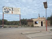 Full view of the Jack Ass Acres Service Station.
 Inside the Jack Ass Acres Service Station.