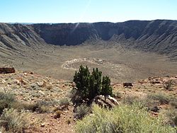
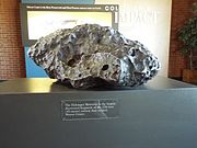
Meteor Crater or Barringer Crater is a meteorite impact crater about 37 mi (60 km) east of Flagstaff and 18 mi (29 km) west of Winslow in the desert of northern Arizona, United States. The site had several earlier names, and fragments of the meteorite are officially called the Canyon Diablo Meteorite, after the adjacent Canyon Diablo.

Holbrook is a city in Navajo County, Arizona, United States. According to the 2010 census, the population of the city was 5,053. The city is the county seat of Navajo County.

Winslow is a city in Navajo County, Arizona, United States. According to the 2020 census, the population of the city is 9,005. It is approximately 57 miles (92 km) southeast of Flagstaff, 240 miles (390 km) west of Albuquerque, New Mexico, and 329 miles (529 km) southeast of Las Vegas.

Winslow station is an Amtrak train station at 501 East Second Street in Winslow, Navajo County, Arizona, United States. It is served daily by Amtrak's Southwest Chief between Chicago, Illinois and Los Angeles, California. The Santa Fe Depot and La Posada Hotel Harvey House compound are the centerpiece of the La Posada Historic District.

Canyon Diablo is a canyon near Two Guns in Northern Arizona. Part of it is located on the Navajo Nation.

Chevelon Creek Bridge is a historic road bridge located about 12 miles (19 km) southeast of Winslow, in Navajo County, eastern Arizona, United States. It is a steel Warren Pony truss bridge over Chevelon Creek, built on the first permanent road connecting Holbrook, the seat of Navajo County, and Winslow. When built, the road was regionally important in northern Arizona as well as being a segment of an early national highway at the time automobile traffic was growing and national roads were first being formed. The bridge was listed on the National Register of Historic Places in 1983 for being a rare design in Arizona, part of an early transnational roadway, one of the first bridges built by Arizona after statehood in 1912, and being in nearly original condition.

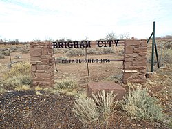
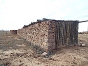
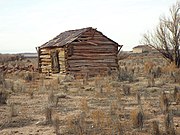
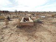
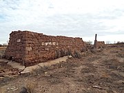
Brigham City is a ghost town in Navajo County, Arizona, United States. Founded by member of the Church of Jesus Christ of Latter-day Saints near the present city of Winslow in 1876, it was one and one-half miles north of Winslow's current city center, along the Little Colorado River. It was organized as a Latter-Day Saints ward in 1878, but by 1881 it had been abandoned.
The La Posada Historic District is a historic district in eastern Winslow, Arizona, United States, that is listed on the National Register of Historic Places (NRHP).

The Lorenzo Hubbell Trading Post and Warehouse is located in the western part of the historic center of the city of Winslow, in Navajo County, Arizona.


 The Lorenzo Hubbell Trading Post and Warehouse – 1900 (NRHP).
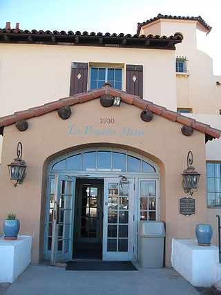
 La Posada Hotel – 1929 entrance.
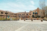 The La Posada Hotel – 1929
 Old sign of La Posada Hotel – 1929 (NRHP).
 The La Posada Hotel – 1929.
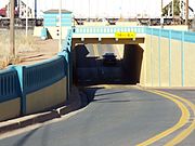 The Winslow Underpass – 1925 (NRHP).
 The Winslow Bridge – 1925 (NRHP).
 The St. Joseph Parish – 1900 (WHC).
 The Navajo County Bank Building – 1904 (WHC).
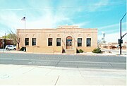 The U.S. Post Office – 1935
 Standing on the Corner in Winslow Arizona (WHC).
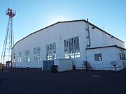 The Winslow–Lindbergh Regional Airport Hangar – 1929 (WHC).
 The Tiny Church of the Mother Road – 2012
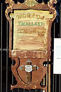 The sign claiming that the Tiny Church of the Mother Road is the world's smallest church.