Taos County is a county in the U.S. state of New Mexico. As of the 2020 census, the population was 34,489. Its county seat is Taos. The county was formed in 1852 as one of the original nine counties in New Mexico Territory.

Agua Fria is a census-designated place (CDP) in Santa Fe County, New Mexico, United States. It is part of the Santa Fe, New Mexico Metropolitan Statistical Area. The population was 2,800 at the 2010 census. Agua Fria Village is a "Traditional Historic Community" (THC) as designated by the Santa Fe Board of County Commissioners in 1995 and subsequent Santa Fe County Ordinance #1996-16, as allowed by State Statute.

The Colorado River is an approximately 862-mile-long (1,387 km) river in the U.S. state of Texas. It is the 11th longest river in the United States and the longest river with both its source and its mouth within Texas.

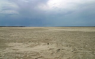
The Llano Estacado, sometimes translated into English as the Staked Plains, is a region in the Southwestern United States that encompasses parts of eastern New Mexico and northwestern Texas. One of the largest mesas or tablelands on the North American continent, the elevation rises from 3,000 feet (900 m) in the southeast to over 5,000 feet (1,500 m) in the northwest, sloping almost uniformly at about 10 feet per mile (2 m/km).
Grulla National Wildlife Refuge is located primarily in eastern New Mexico in Roosevelt County, southwest of the intersection of State Highway 88 and the Texas - New Mexico border about 25 miles southeast of Portales, New Mexico and southeast of the tiny community of Arch. A very small part of the refuge extends eastward into western Bailey County, Texas.

Datil is a census-designated place in Catron County, New Mexico, United States. As of the 2010 census it had a population of 54. Located at the intersection of U.S. Route 60 and New Mexico State Road 12, Datil is on the edge of the Cibola National Forest. The Very Large Array is also nearby. Rock climbers are attracted to Datil because it holds the Enchanted Tower, a climbing hotspot.

Arroyo Hondo is a census-designated place in Taos County near Taos, New Mexico, United States. As of the 2010 census it had a population of 474.
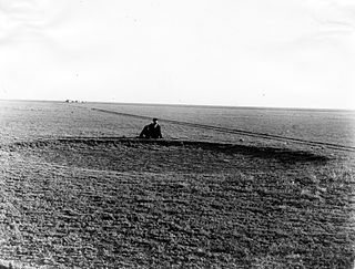
The High Plains are a subregion of the Great Plains, mainly in the Western United States, but also partly in the Midwest states of Nebraska, Kansas, and South Dakota, generally encompassing the western part of the Great Plains before the region reaches the Rocky Mountains. The High Plains are located in eastern Montana, southeastern Wyoming, southwestern South Dakota, western Nebraska, eastern Colorado, western Kansas, eastern New Mexico, the Oklahoma Panhandle, and the Texas Panhandle. The southern region of the Western High Plains ecology region contains the geological formation known as Llano Estacado which can be seen from a short distance or on satellite maps. From east to west, the High Plains rise in elevation from around 1,800 to 7,000 ft.
KNME-TV, branded New Mexico PBS or NM PBS, is a PBS member television station in Albuquerque, New Mexico, United States. Jointly owned by the University of New Mexico and Albuquerque Public Schools, it is a sister station to Santa Fe–licensed KNMD-TV. The two stations share studios on UNM's North Campus on University Boulevard Northeast in Albuquerque; KNME-TV's transmitter is located atop Sandia Crest.

Area code 575 is a telephone area code in the North American Numbering Plan (NANP) for the U.S. state of New Mexico. The area code was created in 2007 in an area code split of area code 505, whose service area was reduced to the Albuquerque, Santa Fe, Farmington, and Gallup regions to provide more telephone numbers to the most populated parts of the state. Area code 575 serves the rest of the state.

Red Hill volcanic field, also known as Quemado volcanic field, is a monogenetic volcanic field located in the vicinity of the ghost town of Red Hill in Catron County New Mexico. Red Hill is 24 kilometers (15 mi) east of the larger Springerville volcanic field and includes Zuñi Salt Lake. The area is made up of scoria cone and silicic dome fields. Over 40 volcanic vents have been identified in the field. These erupted basaltic flows, with no other rock types evident in the field.
Quemado is a census-designated place in Catron County, New Mexico, United States. As of the 2010 census it had a population of 228. Walter De Maria's 1977 art installation, The Lightning Field, is between Quemado and Pie Town, New Mexico.
State Road 32 (NM 32) is a 41.323-mile-long (66.503 km) state highway in Catron County in the U.S. state of New Mexico. It stretches from NM 12 in Apache Creek northward to U.S. Route 60 in Quemado.

Taos Municipal Schools (TMS) or Taos Municipal School District (TMSD) is a school district based in Taos, New Mexico, United States. Taos Municipal Schools has a total area of 637 square miles (1,650 km2). The school district has a total of six schools. The district has one high school, one middle school, three elementary schools, and one magnet school.
State Road 125 is a state highway in the U.S. state of New Mexico maintained by the New Mexico Department of Transportation (NMDOT). The 25-mile (40 km) road, located entirely within Lea County, begins at US 380 near Tatum and ends at the Texas state line where the road meets the numerically continuous Texas State Highway 125 southwest of Bledsoe, TX. The road also has a major intersection with NM 508.
Monte Quemado Airport is a public use airport 2 kilometres (1 mi) north of Monte Quemado, a town in the Santiago del Estero Province of Argentina.
Cordova is a census-designated place in Rio Arriba County, New Mexico, United States.
Llano, also known as Llano de San Juan is an unincorporated community located in Taos County, New Mexico, United States. The community is located on New Mexico State Road 73, 2.1 miles (3.4 km) south of Peñasco. It was founded in 1796 after governor Fernando Chacon gave permission for settlement in the valley. A post office was operated from 1898 to 1914, and was then reestablished in 1925.

U.S. Route 64 (US 64) is a U.S. Numbered Highway that runs from the Four Corners area in Arizona to the east coast of North Carolina. In Arizona, the highway starts at U.S. Route 160 (US 160) heading southeast for 4.5 miles (7.2 km) before entering New Mexico near the town of Beclabito. Through New Mexico the highway passes through Shiprock, Bloomfield, Tierra Amarilla and Tres Piedras, sharing a short concurrency with I-25 near Raton, before heading east through Clayton to the Oklahoma state line.
State Road 240 (NM 240) is a 6.185-mile (9.954 km) state highway in Taos County, New Mexico, United States, that is a northwestern loop off New Mexico State Road 68 (NM 68) from Ranchos De Taos to Taos.

