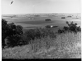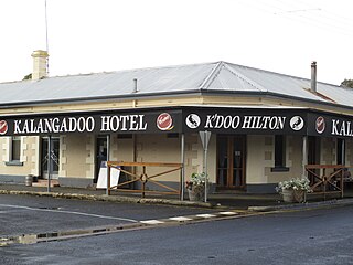
Kalangadoo, formerly Kalangadoo East, is a locality in the Australian state of South Australia located about 348 kilometres (216 mi) south-east of the state capital of Adelaide and about 31 kilometres (19 mi) north of the regional centre of Mount Gambier.
Donovans is a locality in the Australian state of South Australia located in the state's south-east on the Glenelg River adjoining the border with the state of Victoria. It is about 403 kilometres south-east of the state capital of Adelaide and 26 kilometres south-east of the centre of the city of Mount Gambier.

Binnum is a locality in the Australian state of South Australia.

Frances is a town in the Australian state of South Australia located about 291 kilometres (181 mi) south-east of the state capital, Adelaide and about 40 kilometres (25 mi) north-east of the municipal seat of Naracoorte in the state's Limestone Coast region and adjoining the border with the State of Victoria.

Kongorong is a locality in the Australian state of South Australia located southwest of Mount Gambier. It has an Australian rules football team and netball team. Kongorong Primary School had 61 students in 2010.
Yahl is a locality in the Australian state of South Australia, and located in the state's south-east about 7 kilometres (4.3 mi) south-east of Mount Gambier, which is itself about 384 kilometres (239 mi) south east of the state capital of Adelaide.
OB Flat is a rural locality near Mount Gambier in South Australia.
Mount Benson is a locality in the Australian state of South Australia located on the state's south-east coast overlooking Guichen Bay which is part of the body of water known in Australia as the Southern Ocean and by international authorities as the Great Australian Bight. It is about 269 kilometres south-east of the Adelaide city centre and 112 kilometres north-west of the centre of Mount Gambier.
Wrattonbully is a locality located within the Naracoorte Lucindale Council in the Limestone Coast in the south east of South Australia about 327 kilometres south east of the Adelaide city centre. Wrattonbully gives its name to the wine region surrounding it, the Wrattonbully wine region.

Mount Schank is a locality in the Australian state of South Australia located about 385 kilometres south-east of the state capital of Adelaide and 14 kilometres south of the municipal seat of Mount Gambier in the south-east of the state.
Eight Mile Creek is a locality in the Australian state of South Australia located on the state's south-east coast overlooking the body of water known in Australia as the Southern Ocean and by international authorities as the Great Australian Bight. It is about 399 kilometres south-east of the state capital of Adelaide and about 24 kilometres south of the municipal seat of Mount Gambier in the south-east of the state.
Racecourse Bay is a locality in the Australian state of South Australia located on the state’s south-east coast overlooking the body of water known in Australia as the Southern Ocean and by international authorities as the Great Australian Bight. It is about 398 kilometres south-east of the state capital of Adelaide and 25 kilometres south of the municipal seat of Mount Gambier in the south-east of the state.
Nora Creina is a locality in the Australian state of South Australia located on the state’s south-east coast overlooking the Southern Ocean. It is about 99 kilometres to the north-west of the city of Mount Gambier and about 290 kilometres south-east of the state capital of Adelaide.
Wangolina is a locality in the Australian state of South Australia located on the state’s south-east coast overlooking the body of water known in Australia as the Southern Ocean and by international authorities as the Great Australian Bight. It is about 252 kilometres south-east of the Adelaide city centre and 144 kilometres south of the centre of Mount Gambier.
West Range is a locality in the Australian state of South Australia located on the state’s south-east coast overlooking Lacepede Bay which is part of the body of water known in Australia as the Southern Ocean and by international authorities as the Great Australian Bight. It is about 232 kilometres south-east of the Adelaide city centre and 145 kilometres south of the centre of Mount Gambier.

German Creek is a rural locality in south-eastern South Australia, situated in the District Council of Grant. The boundaries were formalised in October 1995 for the long established name. The postcode was originally 5280, but was altered to 5291 in 2004. It was reportedly named for a German who was shepherding in the area.
Marcollat is a locality in the Australian state of South Australia located in the state’s Limestone Coast about 236 kilometres (147 mi) south-east of the state capital of Adelaide and about 45 kilometres (28 mi) north of the municipal seat of Kingston SE.
Dismal Swamp is a locality in the Australian state of South Australia located about 361 kilometres (224 mi) south-east of the state capital of Adelaide and about 19 kilometres (12 mi) north-west of the municipal seat of Mount Gambier.
Caroline is a locality in the Australian state of South Australia located about 389 kilometres (242 mi) south-east of the state capital of Adelaide and about 12 kilometres (7.5 mi) southeast of the municipal seat of Mount Gambier adjoining the border with the state of Victoria.
Suttontown is a hamlet located immediately north of Mount Gambier in the south-east of South Australia.