Nangar National Park

Last updated

Nangar National Park
New South Wales
IUCN category II (national park)

Nangar National Park 2013 2.JPG

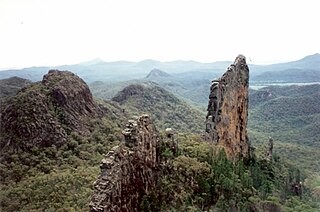
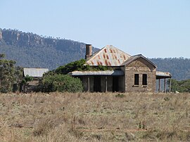
An abandoned homestead at Murga in front of the cliffs of Nangar National Park, as seen from the Escort Way
Australia New South Wales relief location map.png
Red pog.svg
Nangar National Park
Nearest town or city Eugowra
Coordinates 33°25′32″S148°30′15″E / 33.42556°S 148.50417°E / -33.42556; 148.50417 Coordinates: 33°25′32″S148°30′15″E / 33.42556°S 148.50417°E / -33.42556; 148.50417
Established 1983
Area 94 km2 (36.3 sq mi)
Managing authorities NSW National Parks and Wildlife Service
See also Protected areas of
New South Wales

Nangar is a national park in located New South Wales, Australia, 252 kilometres (157 mi) west of Sydney. The park is located in the Nangar-Murga Range between Eugowra and Canowindra. It features Nangar Mountain, which rises to 778 metres (2,552 ft) AHD .

National park park used for conservation purposes of animal life and plants

A national park is a park in use for conservation purposes. Often it is a reserve of natural, semi-natural, or developed land that a sovereign state declares or owns. Although individual nations designate their own national parks differently, there is a common idea: the conservation of 'wild nature' for posterity and as a symbol of national pride. An international organization, the International Union for Conservation of Nature (IUCN), and its World Commission on Protected Areas (WCPA), has defined "National Park" as its Category II type of protected areas.

New South Wales State of Australia

New South Wales is a state on the east coast of Australia. It borders Queensland to the north, Victoria to the south, and South Australia to the west. Its coast borders the Tasman Sea to the east. The Australian Capital Territory is an enclave within the state. New South Wales' state capital is Sydney, which is also Australia's most populous city. In September 2018, the population of New South Wales was over 8 million, making it Australia's most populous state. Just under two-thirds of the state's population, 5.1 million, live in the Greater Sydney area. Inhabitants of New South Wales are referred to as New South Welshmen.

Australia Country in Oceania

Australia, officially the Commonwealth of Australia, is a sovereign country comprising the mainland of the Australian continent, the island of Tasmania and numerous smaller islands. It is the largest country in Oceania and the world's sixth-largest country by total area. The neighbouring countries are Papua New Guinea, Indonesia and East Timor to the north; the Solomon Islands and Vanuatu to the north-east; and New Zealand to the south-east. The population of 25 million is highly urbanised and heavily concentrated on the eastern seaboard. Australia's capital is Canberra, and its largest city is Sydney. The country's other major metropolitan areas are Melbourne, Brisbane, Perth and Adelaide.

Contents

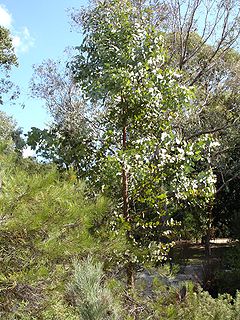
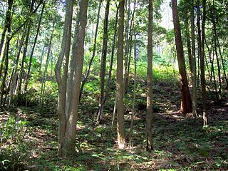
Trees consist of eucalyptus, blackpine, scribbly gum and ironbark. Shrubs include spider flowers, thyme spurge, nodding blue lily and waxlip orchids.

Eucalypt is a descriptive name for woody plants with capsule fruiting bodies belonging to seven closely related genera found across Australasia: Eucalyptus, Corymbia, Angophora, Stockwellia, Allosyncarpia, Eucalyptopsis and Arillastrum.

Scribbly gum is a name given to a variety of different Australian Eucalyptus trees which play host to the larvae of scribbly gum moths which leave distinctive scribbly burrowing patterns on the bark.

Ironbark eucalyptus trees with characteristic bark

Ironbark is a common name of a number of species in three taxonomic groups within the genus Eucalyptus that have dark, deeply furrowed bark.

Birds recorded include wrens, thornbills, falcons, hawks, peregrine falcons and glossy black cockatoos. Eastern grey kangaroos and grey, redneck and swamp wallabies are common. [1]

Peregrine falcon A widespread bird of prey in the family Falconidae

The peregrine falcon, also known as the peregrine, and historically as the duck hawk in North America, is a widespread bird of prey (raptor) in the family Falconidae. A large, crow-sized falcon, it has a blue-grey back, barred white underparts, and a black head. It is believed to be the fastest bird in the world. According to a National Geographic TV programme, the highest measured speed of a peregrine falcon is 389 km/h (242 mph). As is typical of bird-eating raptors, peregrine falcons are sexually dimorphic, with females being considerably larger than males. The peregrine is renowned for its speed, reaching over 320 km/h (200 mph) during its characteristic hunting stoop, making it the fastest member of the animal kingdom.

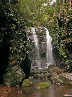
The park was originally established in 1983 when 1,550 hectares of bushland were declared a national park. "Dripping Rock" was added to the park in 1988 and, in 1994, the Nangar State Forest was added to the park to expand its size to 9,196 hectares. "Dripping Rock" was a grazing property established in 1928 and named after a local seasonal waterfall. [2] The original "Dripping Rock" homestead was converted to a shearing shed and a new homestead, built in 1935, was destroyed by a bushfire in September 2009. [3]

See also

Related Research Articles

Blue Mountains National Park Protected area in New South Wales, Australia

The Blue Mountains National Park is a protected national park that is located in the Blue Mountains region of New South Wales, in eastern Australia. The 267,954-hectare (662,130-acre) national park is situated approximately 80 kilometres (50 mi) west of Sydney, and the park boundary is quite irregular as it is broken up by roads, urban areas and inholdings. Despite the name mountains, the area is an uplifted plateau, dissected by a number of larger rivers. The highest point in the park is Mount Werong at 1,215 metres (3,986 ft) above sea level; while the low point is on the Nepean River at 20 metres (66 ft) above sea level as it leaves the park.

Border Ranges National Park Protected area in New South Wales, Australia

The Border Ranges National Park is a protected national park that is located in the Northern Rivers region of New South Wales, Australia. A small portion of the national park is also located in South East Queensland. The 31,729-hectare (78,400-acre) park is situated approximately 150 kilometres (93 mi) south of Brisbane, north of Kyogle.

Cattai National Park Protected area in New South Wales, Australia

The Cattai National Park is a protected national park that is located in the Hawkesbury region of Sydney, New South Wales, in eastern Australia. The 424-hectare (1,050-acre) national park is situated approximately 55 kilometres (34 mi) northwest of the Sydney central business district and approximately 13 km (8.1 mi) from Windsor.

Gardens of Stone National Park Protected area in New South Wales, Australia

The Gardens of Stone National Park is a protected national park that is located in the Central Tablelands region of New South Wales in eastern Australia. The 15,080-hectare (37,300-acre) national park is situated 125 kilometres (78 mi) northwest of Sydney, and 30 kilometres (19 mi) northwest of Lithgow. The national park draws its name from the natural stone pagodas within its boundaries.

Goobang National Park Protected area in New South Wales, Australia

Goobang is a national park located in New South Wales, Australia, 296 kilometres (184 mi) northwest of Sydney. It protects the largest remnant forest and woodland in the central west region of the state, where interior and coastal New South Wales flora and fauna species overlap. Originally named Herveys Range by John Oxley in 1817, the area was reserved in 1897 as state forest because of its importance as a timber resource, and was designated a national park in 1995.

Kanangra-Boyd National Park Protected area in New South Wales, Australia

The Kanangra-Boyd National Park is a protected national park that is located in the Central Tablelands region, west of the Southern Highlands and Macarthur regions, in New South Wales, in eastern Australia. The 68,660-hectare (169,700-acre) national park is situated approximately 180 kilometres (110 mi) south-west of Sydney and is contiguous with the Blue Mountains National Park and the Nattai National Park. The park was established in 1969.

Ku-ring-gai Chase National Park Protected area in New South Wales, Australia

The Ku-ring-gai Chase National Park is a protected national park that is located in New South Wales, Australia. The 14,977-hectare (37,010-acre) national park is situated 25 kilometres (16 mi) north of Sydney located largely within the Ku-ring-gai, Hornsby, and the Northern Beaches Council local government areas. The villages of Cottage Point, Appletree Bay, and Bobbin Head are located within park boundaries. An isolated portion of the park, Barrenjoey Headland, is located to the north of Palm Beach east of the primary park body and is home to Barrenjoey Lighthouse.

Mallee Cliffs National Park Protected area in New South Wales, Australia

The Mallee Cliffs National Park is a protected national park that is located in the Sunraysia region, in the south-west of New South Wales, Australia. The 57,969-hectare (143,240-acre) national park is situated approximately 790 kilometres (490 mi) west of Sydney and 30 kilometres (19 mi) east of the Murray River city of Mildura, Victoria.

Oxley Wild Rivers National Park Protected area in New South Wales, Australia

The Oxley Wild Rivers National Park is a protected national park that is located in the Northern Tablelands region of New South Wales, Australia. The 145,223-hectare (358,850-acre) park is situated 445 kilometres (277 mi) north of Sydney and is named in memory of the Australian explorer John Oxley, who passed through the area in 1818 and is one of the largest national parks in New South Wales.

Sturt National Park Protected area in New South Wales, Australia

The Sturt National Park is a protected national park that is located in the arid far north-western corner of New South Wales, in eastern Australia. The 325,329-hectare (803,910-acre) national park is situated approximately 1,060 kilometres (660 mi) northwest of Sydney and the nearest town is Tibooburra, 6 kilometres (3.7 mi) away.

Warrumbungle National Park Protected area in New South Wales, Australia

Warrumbungle National Park is a heritage listed national park located in the Orana region of New South Wales, Australia. The national park is located approximately 550 kilometres (340 mi) northwest of Sydney and contained within 23,311 hectares. The park attracts approximately 35,000 visitors per annum.

Washpool National Park Protected area in New South Wales, Australia

The Washpool National Park is a protected national park located in the New England region of New South Wales, Australia. The 58,678-hectare (145,000-acre) park is situated approximately 520 kilometres (320 mi) north of Sydney, inland from Grafton. The park has two campgrounds and is managed by the NSW National Parks & Wildlife Service. It was established in 1983 to preserve the significant plant and animal populations found in the Washpool and Gibraltar Range forests.

Willandra National Park Protected area in New South Wales, Australia

The Willandra National Park is a protected national park that is located in the Far West region of New South Wales, in eastern Australia. The 19,386-hectare (47,900-acre) national park is situated approximately 580 kilometres (360 mi) west of Sydney and comprises flat grassy plain bounded to the north by Willandra Creek, which is a tributary of the Lachlan River.

Gondwana Rainforests area of subtropical rainforest in Australia

The Gondwana Rainforests of Australia, formerly known as the Central Eastern Rainforest Reserves, are the most extensive area of subtropical rainforest in the world. Collectively, the rainforests are a World Heritage Site with fifty separate reserves totalling 366,500 hectares from Newcastle to Brisbane.

Warrumbungles mountain range

The Warrumbungles is a mountain range in the Orana region of New South Wales, Australia. The nearest town is Coonabarabran. The area is easiest accessed from the Newell Highway which is the major road link directly between Melbourne, Victoria and Brisbane, Queensland and cuts across inland New South Wales from the north to the south.

Black Bulga State Conservation Area Protected area in New South Wales, Australia

The Black Bulga State Conservation Area is a protected conservation area located near the Barrington Tops, in the Hunter Region of New South Wales, Australia. The 1,554-hectare (3,840-acre) conservation area is situated 16 kilometres (9.9 mi) from Dungog, and used to be part of Trevor State Forest and Chichester State Forest.

Werakata National Park Protected area in New South Wales, Australia

The Werakata National Park is a protected national park that is located in the Lower Hunter Region of New South Wales, in eastern Australia. The 3,337-hectare (8,250-acre) national park is located to the north, east and south of the town of Cessnock.

Garawarra State Conservation Area Protected area in New South Wales, Australia

The Garawarra State Conservation Area is a protected conservation area that is located on the southern suburban fringe of Greater Sydney, in the state of New South Wales, in eastern Australia. The 949-hectare (2,350-acre) reserve abuts the Royal National Park and is situated 40 kilometres (25 mi) south of the Sydney central business district, near Helensburgh. Garawarra was gazetted as a park in 1987, and added, together with the Royal National Park, to the Australian National Heritage List on 15 September 2006.

Menindee Lakes

The Menindee Lakes is a chain of shallow ephemeral freshwater lakes connected to the Darling River to form a storage system. The lakes lie in the far west region of New South Wales, Australia, near the town of Menindee.

Western Sydney Parklands Protected area in New South Wales, Australia

The Western Sydney Parklands is an urban park system and a nature reserve located in Sydney, New South Wales, Australia. The NSW government has spent around $400 million for the park. The park is governed by the NSW National Parks and Wildlife Service and is listed under the National Parks and Wildlife Act 1974. The Parklands begin in the north in the City of Blacktown, cross the City of Fairfield, and end in the City of Liverpool. The Parkland, being one of the largest in the world, features picnic areas, sports grounds and walking tracks. The parklands attract 430,000 to 790,000 visitors annually.

References

  1. Nangar National Park - Natural environment
  2. Information board at "Dripping Rock" in Nangar National Park, accessed: 30 March 2013
  3. Nangar National Park Brochure, Department of Environment, Climate Change and Water (New South Wales), published: 2009, accessed: 30 March 2013