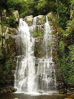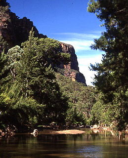
The Budderoo National Park is a 7,219-hectare (17,840-acre) national park that is located in the Illawarra region of New South Wales, Australia; situated approximately 99 kilometres (62 mi) south southwest of Sydney.

The Cattai National Park is a protected national park that is located in the Hawkesbury region of Sydney, New South Wales, in eastern Australia. The 424-hectare (1,050-acre) national park is situated approximately 55 kilometres (34 mi) northwest of the Sydney central business district and approximately 13 km (8.1 mi) from Windsor.

The Cocoparra National Park is a protected national park that is located in the Riverina region of New South Wales, in eastern Australia. The 8,357-hectare (20,650-acre) national park is situated 457 kilometres (284 mi) southwest of Sydney and 25 kilometres (16 mi) northeast of Griffith.

The Dharug National Park is a protected national park that is located in the Central Coast region of New South Wales, in eastern Australia. The 14,850-hectare (36,700-acre) national park is situated approximately 58 kilometres (36 mi) north of the Sydney central business district and 25 kilometres (16 mi) west of Gosford.

The Gardens of Stone National Park is a protected national park that is located in the Central Tablelands region of New South Wales in eastern Australia. The 15,080-hectare (37,300-acre) national park is situated 125 kilometres (78 mi) northwest of Sydney, and 30 kilometres (19 mi) northwest of Lithgow. The national park draws its name from the natural stone pagodas within its boundaries.

The Garigal National Park is a protected national park that is located within the North Shore and Forest District regions of Sydney, New South Wales, in eastern Australia. The 2,202-hectare (5,440-acre) national park is situated approximately 20 kilometres (12 mi) north of the Sydney central business district.

Gulaga is a national park on the south coast of New South Wales, Australia. The park was created in 2001. It is 46.73 km2 in area. The park forms part of the Ulladulla to Merimbula Important Bird Area, identified as such by BirdLife International because of its importance for swift parrots.

Heathcote National Park is a protected national park that is located in the southern region of Sydney, New South Wales in eastern Australia. The 2,679-hectare (6,620-acre) national park is situated approximately 35 kilometres (22 mi) southwest of the Sydney central business district, west of the South Coast railway line, the Princes Highway and Motorway, and the suburbs of Heathcote and Waterfall.

The Kanangra-Boyd National Park is a protected national park that is located in the Central Tablelands region, west of the Southern Highlands and Macarthur regions, in New South Wales, in eastern Australia. The 68,660-hectare (169,700-acre) national park is situated approximately 180 kilometres (110 mi) south-west of Sydney and is contiguous with the Blue Mountains National Park and the Nattai National Park. The park was established in 1969.

The South East Forests National Park is a national park located in between the Monaro and South Coast regions of New South Wales, Australia. The 115,177-hectare (284,610-acre) national park is situated 378 kilometres (235 mi) southwest of Sydney. It features high quality old growth eucalyptus forest and remnant patches of temperate rainforest.

The Thirlmere Lakes National Park is a protected national park that is located in the Macarthur region of New South Wales, in eastern Australia. The 629-hectare (1,550-acre) national park is situated approximately 70 kilometres (43 mi) southwest of the Sydney central business district, and just to the west of Thirlmere. It was gazetted in 1972 as Thirlmere Lakes State Park, before being subsequently reclassified as a national park.

The Wollemi National Park is a protected national park and wilderness area that is located in the northern Blue Mountains and Lower Hunter regions of New South Wales, in eastern Australia. The 501,703-hectare (1,239,740-acre) park, the second largest national park in New South Wales, contains the 361,113-hectare (892,330-acre) Wollemi Wilderness – the largest such wilderness area in Australia – and is situated approximately 130 kilometres (81 mi) northwest of Sydney.

The Yengo National Park is a protected national park that is located in the Lower Hunter region of New South Wales, in eastern Australia. The 154,328-hectare (381,350-acre) park is situated 85 kilometres (53 mi) northwest of the Sydney central business district, 40 kilometres (25 mi) south of Cessnock, 40 kilometres (25 mi) north of Wisemans Ferry, and 155 kilometres (96 mi) southwest of Newcastle.
The New South Wales Office of Environment and Heritage (OEH), a division of the Government of New South Wales, is responsible for the care and protection of the environment and heritage, which includes the natural environment, Aboriginal country, culture and heritage, and built heritage in New South Wales, Australia. The OEH supports the community, business and government in protecting, strengthening and making the most of a healthy environment and economy within the state. The OEH is part of the Department of Planning and Environment cluster and also manages national parks and reserves.

The Monga National Park is a 251.44-square-kilometre (97.08 sq mi) national park located 230 kilometres (140 mi) south west of Sydney, New South Wales, Australia. The closest town nearby is Braidwood.

Woomargama National Park is a national park situated 20 kilometres (12 mi) south east of Holbrook and 30 kilometres (19 mi) north east of Albury, in the South West Slopes region of southern New South Wales. Southern extremities of the park are within one kilometre of Lake Hume which is formed on the Murray River. The park extends over approximately 30 km from eastern to western boundaries and 15 km in a north to south direction. In 2006, the park covered an area of 23,577 hectares and at the same time an area of associated reserve covered 7,120 hectares. In 2010 the park alone covered 24,185 ha.

The Werakata National Park is a protected national park that is located in the Lower Hunter Region of New South Wales, in eastern Australia. The 3,337-hectare (8,250-acre) national park is located to the north, east and south of the town of Cessnock.

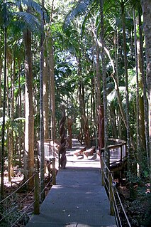
The Sea Acres National Park is a national park that is located in the Mid North Coast region of New South Wales, in eastern Australia. The 76-hectare (190-acre) park is situated near the town of Port Macquarie. The park is a popular tourist area with a 1.3-kilometre (0.81 mi) long boardwalk through a remnant of seaside rainforest. There is also an education centre and cafe. The park was initially declared as a nature reserve in 1987; and gazetted as a national park in October 2010.

The Berowra Valley National Park is a protected national park that is located in northern Sydney, New South Wales, Australia. The 3,884-hectare (9,600-acre) national park is situated approximately 20 kilometres (12 mi) north-west of the Sydney central business district. Located within the Sydney Basin, the park is part of the dissected Hornsby Plateau which is dominated by Hawkesbury Sandstone and predominately covers the catchment area of Berowra Creek.


