
Wallasey is a town within the Metropolitan Borough of Wirral, in Merseyside, England; until 1974, it was part of the historic county of Cheshire. It is situated at the mouth of the River Mersey, at the north-eastern corner of the Wirral Peninsula. At the 2011 Census, the population was 60,284.

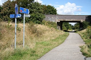
The Wirral Country Park is a country park on the Wirral Peninsula, England, lying both in the Metropolitan Borough of Wirral in the county of Merseyside and in the borough of Cheshire West & Chester in the county of Cheshire. It was the first designated country park in Britain, opening in 1973.

West Kirby railway station serves the town of West Kirby in Merseyside, England. The station is the terminus of the West Kirby branch line, which is one of the two branches of the Wirral Line, part of the Merseyrail network,. There is a central island platform between two terminus tracks, and two parallel sidings for out-of-use electric trains.

Cheshire West and Chester is a unitary authority with borough status in the ceremonial county of Cheshire, England. It was established on 1 April 2009 as part of the 2009 local government changes, by virtue of an order under the Local Government and Public Involvement in Health Act 2007. It superseded the boroughs of Ellesmere Port and Neston, Vale Royal and the City of Chester; its council assumed the functions and responsibilities of the former Cheshire County Council within its area. The remainder of ceremonial Cheshire is composed of Cheshire East, Halton and Warrington.
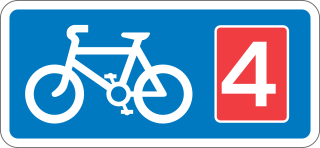
National Cycle Route 4 is a route of the National Cycle Network, running from London to Fishguard, Pembrokeshire. Between these, the route runs through Reading, Bath, Bristol, Newport, Swansea and St David's. Within Wales, sections of the route follow branches of the Celtic Trail cycle route.

National Cycle Route 1 is a route of the National Cycle Network, running from Dover to Tain. The 1,264 mi-long (2,034-kilometre) cycle-path is located in the United Kingdom.
National Cycle Route 7 is a route of the National Cycle Network, running from Sunderland to Inverness.

The Two Tunnels Greenway is a shared use path for walking and cycling in Bath, Somerset, England. The route links National Cycle Route 24 south of Bath with National Cycle Route 4 in the town centre, and is designated as National Cycle Route 244.

National Cycle Network (NCN) Route 76 is a Sustrans National Route that runs from Berwick-upon-Tweed to Kirkcaldy. The route is 168 miles (270 km) in length and is fully open and signed in both directions. Between Dunbar and Kirkcaldy the route is known as the Round the Forth.
National Cycle Network (NCN) Route 66 is a Sustrans National Route that runs from Kingston upon Hull to Manchester via Beverley, York and Leeds.

National Cycle Route 57 is part of the United Kingdom's National Cycle Network. When complete, it will run west to east from Farmington, Gloucestershire near Northleach to Welwyn Garden City in Hertfordshire.

National Cycle Network (NCN) Route 69 is a Sustrans National Route that runs from Hest Bank to Cleethorpes. The route is incomplete and consists of one long section in Lancashire, and seven short sections in West Yorkshire. The open sections are signed in both directions.

National Cycle Network (NCN) Route 62 is a Sustrans National Route that runs from Fleetwood to Selby. As of 2018 the route has a missing section between Preston and Southport but is otherwise open and signed.

National Cycle Network (NCN) Route 65 is a Sustrans National Route that runs from Hornsea on the North Sea Coast of The East Riding of Yorkshire via Hull and York to Middlesbrough. It is fully open and signed.

National Cycle Network (NCN) Route 658 is a Sustrans Regional Route. It is two miles (3.2 km) long, and provides a connection between Route 65 and Route 66 through York city centre. The full length of the route is part of the Way of the Roses. It is fully signed and open.
National Cycle Network (NCN) Route 70 is a Sustrans National Route that runs from Walney Island in Cumbria to Sunderland. The route is fully open and signed. From end to end the route is 149 miles (240 km), but two sections are shared with other NCN routes leaving Route 70 at 128 miles (206 km).

National Cycle Network (NCN) Route 647 is a Sustrans National Route that runs from Clumber Park to Harby 53.233°N 0.683°W. The route is 19.6 miles (31.5 km) in length and is fully open and signed in both directions.
National Cycle Network (NCN) Route 64 is a Sustrans National Route that runs from Market Harborough to Lincoln. The route is 68 miles (109 km) in length and is fully open and signed in both directions. There are three sections to the route, NCN 63 and NCN 15 form the links between these sections.
The National Cycle Route 725, also known as the Great North Cycleway is a partially-complete regional cycling route that forms part of the National Cycle Network (NCN) in the United Kingdom.


