Hooton, Cheshire

Last updated

Hooton
The Hooton pub 2.JPG
'The Hooton' public house - 2020 closed and boarded up.
Cheshire UK location map.svg
Red pog.svg
Hooton
Location within Cheshire
Population385 (2011 census)
OS grid reference SJ363784
Unitary authority
Ceremonial county
Region
Country England
Sovereign state United Kingdom
Post town ELLESMERE PORT
Postcode district CH66
Dialling code 0151
Police Cheshire
Fire Cheshire
Ambulance North West
UK Parliament
List of places
UK
England
Cheshire
53°17′56″N2°57′18″W / 53.299°N 2.955°W / 53.299; -2.955

Hooton is a suburban village and former civil parish on the Wirral Peninsula, within the unitary authority of Cheshire West and Chester and the ceremonial county of Cheshire, England. It was once a separate village but was incorporated into Ellesmere Port as the town expanded outwards during the twentieth century.

Contents

The 2011 census recorded the population of the Hooton built-up area as 385. [1]

History

The name Hooton means "hill-spur farm/settlement" and likely derives from the Old English words hōh (s sharply projecting tract of land) and tūn (a farmstead or settlement). [2]

In 1070 William the Conqueror granted the lands of Hooton to Adam de Aldithly. The village is mentioned in the Domesday Book as Hotone in the hundred of Wilaveston [3] (later called the Wirral Hundred) under the ownership of Richard de Vernon [4] and consisting of nine households (one villager, four smallholders and four 'riders'). [3] Eventually the lands passed to the Stanley family through a series of marriages. After the Battle of Bosworth, Hooton had a new hall and the first Lord Derby in Lancashire.

Sir William Stanley obtained a licence to crenellate in 1487 but built a half timbered manor house in 1488 which survived until 1788 when it was demolished. The old house was replaced by a mansion called Hooton Hall, built from local stone from the quarries at Storeton. It was designed by the architect James Wyatt in the Italian Palladian style for the fifth Baronet, Sir William Stanley. The family sold the estate in the nineteenth century after Sir Massey Stanley had gone bankrupt due to his high living. The construction of the Manchester Ship Canal nearby contributed to the last private owner, Richard Naylor, abandoning it as a place of residence. The empty hall was requisitioned at the outbreak of the First World War and used as a military hospital and officer's mess, with barracks erected in the grounds. Hooton Hall was demolished due to neglect in 1932. Part of the building's façade was reconstructed as 'The Gloriette' at the tourist village of Portmeirion in North Wales. [5]

In 1917 RAF Hooton Park airfield was built with three double Belfast Hangars to train pilots for World War I from Canada and the United States. The Second World War saw the airfield utilised as a military base, and three RAF auxiliary squadrons were based there until disbandment in 1957. Much of the airfield (including the site of the Hall) was transformed in 1962 into a factory for Vauxhall Motors which as of 2023 is home to the Vauxhall Astra range of cars. In 1990 the former RAF base was leased by Vauxhall to a charity called The Griffin Trust which managed the site until 2000 when The Hooton Park Trust was formed and tasked with restoring the Grade II* listed hangars.

Hooton was once a township and chapelry in the parish of Eastham [6] in the Wirral Hundred, becoming a separate civil parish in 1866. It was administered as part of Wirral Rural District until 1933 when it was transferred to Ellesmere Port Urban District. The civil parish was abolished on 1 April 1950 and the area subsumed into Ellesmere Port. [7] [8] [9] The population was 91 in 1801, 110 in 1851 and stood at 200 by 1901. [8] In 1931 the parish had a population of 246. [10]

Geography

Hooton is in the southern part of the Wirral Peninsula, lying within a green belt area bordering Merseyside and Cheshire. It is near to the town of Ellesmere Port and is a short distance away from the villages of Eastham and Willaston.

Hooton railway station Hooton railway station (6).JPG
Hooton railway station

Transport

Hooton railway station lies on the Wirral line of the Merseyrail network, with frequent trains to Liverpool, Chester and Ellesmere Port. The station provides an extensive park and ride facility. Immediately south of the station is the junction of the lines to Chester and Ellesmere Port. The trackbed of the former GWR/LM&SR Joint branch line from Hooton to West Kirby now forms the Wirral Country Park.

Hooton is to the south of junction 5 of the M53 motorway. The A41 trunk road between Birkenhead and Chester passes through the area, with the A550 road diverging from it towards North Wales.

Notable people

See also

Related Research Articles

<span class="mw-page-title-main">Ellesmere Port</span> Town in Cheshire, England

Ellesmere Port is a port town in the Cheshire West and Chester borough in Cheshire, England. Ellesmere Port is on the south eastern edge of the Wirral Peninsula, 6 miles (9.7 km) north of Chester. The town had a population of 61,090 in the 2011 census. Ellesmere Port also forms part of the wider Birkenhead urban area, which had a population of 325,264 in 2011.

<span class="mw-page-title-main">Neston</span> Market town and civil parish in Cheshire, England

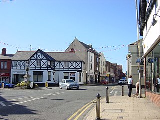
Neston is a market town and civil parish on the Wirral Peninsula, in Cheshire, England. It is part of the unitary authority of Cheshire West and Chester. The civil parish and wider suburban area includes Parkgate to the north west and Little Neston, Ness and part of Burton to the south.

<span class="mw-page-title-main">Bromborough</span> Town in Merseyside, England

Bromborough is a town in the Metropolitan Borough of Wirral, Merseyside, England, and the historic county of Cheshire, on the Wirral Peninsula southeast of Bebington and north of Eastham.

<span class="mw-page-title-main">RAF Hooton Park</span> Former RAF base in Cheshire, England

Royal Air Force Hooton Park or more simply RAF Hooton Park, on the Wirral Peninsula, Cheshire, is a former Royal Air Force station originally built for the Royal Flying Corps in 1917 as a training aerodrome for pilots in the First World War. During the early/mid-1930s, it was one of the two airfields handling scheduled services for the Merseyside region. Hooton Park was home to No. 610 Squadron and, post Second World War, to No. 611 and No. 663 (AOP) Squadron.

<span class="mw-page-title-main">Wirral Peninsula</span> Peninsula in North West England

The Wirral Peninsula, known locally as The Wirral, is a peninsula in North West England. The roughly rectangular peninsula is about 15 miles (24 km) long and 7 miles (11 km) wide, and is bounded by the Dee Estuary to the west, the Mersey Estuary to the east, and Liverpool Bay to the north.

<span class="mw-page-title-main">Little Sutton, Cheshire</span> Village and suburb of Ellesmere Port, Cheshire, England

Little Sutton is a village on the Wirral Peninsula, in the unitary authority of Cheshire West and Chester and the ceremonial county of Cheshire, England. Located between Childer Thornton and Great Sutton, it is a suburb of the town of Ellesmere Port. Little Sutton is mostly residential and sits either side of the A41 road, linking Birkenhead and Chester.

<span class="mw-page-title-main">Great Sutton</span> Human settlement in England

Great Sutton is a village on the Wirral Peninsula, in the unitary authority of Cheshire West and Chester and the ceremonial county of Cheshire, England. It is a suburb of Ellesmere Port and, as with Little Sutton to the north, was once a separate village that was incorporated into the town as it expanded outwards.

<span class="mw-page-title-main">Childer Thornton</span> Human settlement in England

Childer Thornton is a village on the Wirral Peninsula, in the unitary authority Cheshire West and Chester and the ceremonial county of Cheshire, England. It was once a separate village but has since been incorporated into Ellesmere Port. Childer Thornton is on the A41 trunk road, between Hooton and Little Sutton.

<span class="mw-page-title-main">Overpool</span> Human settlement in England

Overpool is a village on the Wirral Peninsula in Cheshire, England. It is a suburb of Ellesmere Port, and part of the unitary authority of Cheshire West and Chester.

<span class="mw-page-title-main">Puddington, Cheshire</span> Human settlement in England

Puddington is a village and civil parish on the Wirral Peninsula, in the unitary authority of Cheshire West and Chester and the ceremonial county of Cheshire, England. It is located to the south east of the town of Neston and close to the border with Wales.

<span class="mw-page-title-main">Willaston, Cheshire West</span> Human settlement in England

Willaston is a large village situated on the Wirral Peninsula, Cheshire, England. Centred on a village green, it is located in the unitary authority of Cheshire West and Chester between Neston and Ellesmere Port, less than a mile south of the Metropolitan Borough of Wirral boundary. It is located very closely to Eastham and Bromborough and just a short distance away from Neston. At the 2001 Census, the total population of Willaston and Thornton ward was 4,913.

<span class="mw-page-title-main">Raby, Merseyside</span> Hamlet in England

Raby is a hamlet and former civil parish, in the Wirral district, in the county of Merseyside, England, on the Wirral Peninsula. It is located within the Clatterbridge Ward. The settlement is within the parliamentary constituency of Wirral South.

<span class="mw-page-title-main">Storeton</span> Human settlement in England

Storeton is a small village and former civil parish in the Wirral district, in the county of Merseyside, England, on the Wirral Peninsula. It is west of the town of Bebington and is made up of Great Storeton and Little Storeton, which is classified as a hamlet. At the 2001 Census the population of Storeton was recorded as 150.

<span class="mw-page-title-main">Ledsham, Cheshire</span> Village in England

Ledsham is a village and civil parish in the unitary authority of Cheshire West and Chester and the ceremonial county of Cheshire, England. The civil parish includes parts of the hamlets of Badger's Rake and Two Mills. It is located on the Wirral Peninsula, approximately 10 km (6.2 mi) to the north of the city of Chester and 6 km (3.7 mi) to the west of Ellesmere Port.

<span class="mw-page-title-main">Cheshire West and Chester</span> Borough in England

Cheshire West and Chester is a borough with unitary authority status in Cheshire, England. It was established on 1 April 2009 as part of the 2009 local government changes, by virtue of an order under the Local Government and Public Involvement in Health Act 2007. It superseded the boroughs of Ellesmere Port and Neston, Vale Royal and the City of Chester; its council assumed the functions and responsibilities of the former Cheshire County Council within its area. The remainder of ceremonial Cheshire is composed of Cheshire East, Halton and Warrington.

<span class="mw-page-title-main">Wardle, Cheshire</span> Human settlement in England

Wardle is a village and civil parish in the unitary authority of Cheshire East and the ceremonial county of Cheshire, England. The village lies on the Shropshire Union Canal, north west of Barbridge Junction, and is 4 miles to the north west of Nantwich, and the parish also includes part of the small settlement of Wardle Bank. The total population is around 250. RAF Calveley was a flight-training station during the Second World War, and the Mark III radio telescope stood on the airfield site in 1966–96. The modern civil parish includes Wardle Industrial Estate and is otherwise largely agricultural. Nearby villages include Barbridge, Calveley and Haughton.

<span class="mw-page-title-main">Little Stanney</span> Human settlement in England

Little Stanney is a suburban village and civil parish in the unitary authority of Cheshire West and Chester and the ceremonial county of Cheshire, England. It is located on the Wirral Peninsula between Chester and Ellesmere Port.

<span class="mw-page-title-main">Wervin</span> Human settlement in England

Wervin is a small village and civil parish in the unitary authority of Cheshire West and Chester and the ceremonial county of Cheshire, England. It is situated between Chester and Ellesmere Port, near the Shropshire Union Canal and the M53 motorway.

<span class="mw-page-title-main">Croughton, Cheshire</span> Human settlement in England

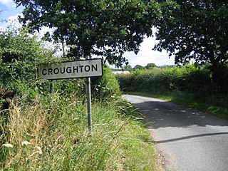
Croughton is a hamlet and civil parish on the outskirts and 3.5 miles (5.7 km) north of the city of Chester, and part of the unitary authority of Cheshire West and Chester and the ceremonial county of Cheshire. The Shropshire Union Canal runs through Croughton.

<span class="mw-page-title-main">Vauxhall Ellesmere Port</span> Motor vehicle assembly plant in England

Vauxhall Ellesmere Port is a motor vehicle assembly plant, located in the town of Ellesmere Port, south of the Wirral Peninsula in Cheshire, England. It has always built small/medium Vauxhall/Opel vehicles, including the Vauxhall Viva and Opel/Vauxhall Astra. It is owned by the global car manufacturer Stellantis.

References

  1. UK Census (2011). "Local Area Report – Hooton Built-up area sub division (E35001371)". Nomis. Office for National Statistics . Retrieved 10 March 2021.
  2. "Key to English Place-Names: Hooton". University of Nottingham. Retrieved 10 March 2021.
  3. 1 2 Powell-Smith, Anna. "Place: Hooton". Open Domesday/University of Hull. Retrieved 5 December 2015.
  4. "Cheshire A-K: Hooton". Domesday Book Online. Retrieved 3 February 2009.
  5. "England's lost country houses: Hooton Hall". Lost Heritage. Retrieved 10 March 2021.
  6. "History of Hooton, in Ellesmere Port and Neston and Cheshire". A Vision of Britain through Time . Retrieved 1 September 2023.
  7. "Relationships and changes Hooton Tn/CP through time". A Vision of Britain through Time. Retrieved 1 September 2023.
  8. 1 2 "Hooton". GENUKI UK & Ireland Genealogy. Retrieved 9 July 2020.
  9. "Hooton Tn/CP". A Vision of Britain through Time. GB Historical GIS / University of Portsmouth. Retrieved 10 March 2021.
  10. "Population statistics Hooton Tn/CP through time". A Vision of Britain through Time. Retrieved 1 September 2023.