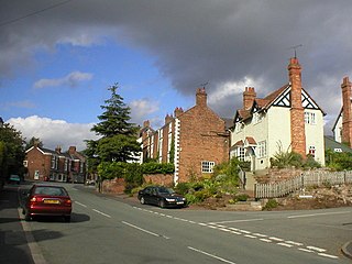
Farndon is a village and civil parish in the unitary authority of Cheshire West and Chester and the ceremonial county of Cheshire, England. It is on the banks of the River Dee, south of Chester, which here forms the England–Wales border. The Welsh village of Holt lies just over the River Dee from Farndon.
Tattenhall is a village and former civil parish, now in the parish of Tattenhall and District, 8 miles (13 km) south-east of Chester, in the unitary authority area of Cheshire West and Chester and the ceremonial county of Cheshire, England. In the 2001 census, the population was recorded as 1,986, increasing to 2,079 by the 2011 census.

Upton-by-Chester is a civil parish and a large suburb on the outskirts of Chester, in the unitary authority of Cheshire West and Chester and the ceremonial county of Cheshire, England. It includes the villages of Upton and Upton Heath.

Guilden Sutton is a civil parish and village in the unitary authority of Cheshire West and Chester and the ceremonial county of Cheshire, England. The village lies approximately 3 miles (5 km) to the east of Chester and is south of the village of Mickle Trafford. The community consists of a church, a primary school, a post office, a pub, a village hall and several local businesses.
Helsby is a village, civil parish and electoral ward in the unitary authority of Cheshire West and Chester and the ceremonial county of Cheshire, England. Overlooking the Mersey estuary, it is approximately 9 miles (14 km) north east of Chester and 2.5 miles (4 km) south west of Frodsham.

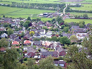
Alvanley is a small rural village and civil parish near Helsby, in the unitary authority of Cheshire West and Chester and the ceremonial county of Cheshire, England. The village is on the B5393 road and near junction 14 of the M56 motorway. According to the 2011 census the civil parish had a population of 472.

Dunham-on-the-Hill is a village and former civil parish, now in the parish of Dunham-on-the-Hill and Hapsford, in the unitary authority of Cheshire West and Chester, and the ceremonial county of Cheshire, England. It is on the A56 road, approximately 2.3 miles (3.7 km) from Helsby and 6 miles (9.7 km) from Chester. The village is 120 feet (37 m) above sea level, south west of Helsby Hill.

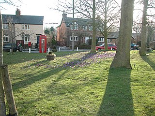
Waverton is a village and civil parish on the outskirts of Chester in the unitary authority of Cheshire West and Chester and the ceremonial county of Cheshire, England. It lies about 3 miles (4.8 km) south-east of Chester High Cross, 19 miles (31 km) south of Liverpool and 33 miles (53 km) south west of Manchester. It is almost continuous with the village of Rowton to the north west and that in turn is almost continuous with Christleton. According to the 2011 Census, the population of the parish was 1,587.

Mollington is a village and civil parish in Cheshire, England, two miles north of the city of Chester, with the A41 Liverpool-Chester trunk road and Shropshire Union Canal to the east and southeast, the A540 Wirral Peninsula trunk road to the south and west and the A5117 link road to the north.

Tarporley is a large village and civil parish in Cheshire, England. The civil parish also contains the village of Rhuddall Heath. Tarporley is bypassed by the A49 and A51 roads.

Christleton is a village and civil parish on the outskirts of Chester, in the unitary authority of Cheshire West and Chester and the ceremonial county of Cheshire, England. The Shropshire Union Canal passes through the village.

Thurstaston is a village and former civil parish, in the Wirral district, in Merseyside, England, on the Wirral Peninsula. It is part of the West Kirby and Thurstaston Ward and the parliamentary constituency of Wirral West. The village lies on the A540 road between Heswall and Caldy, although it extends some distance down Station Road to the Wirral Way and the River Dee estuary.
Eccleston is a village and former civil parish, now in the parish of Eaton and Eccleston, in the borough of Cheshire West and Chester, in the ceremonial county of Cheshire, England. The village is approximately 2.7 miles (4.3 km) to the south of the city of Chester, near to the River Dee. The village is situated on the estate of the Duke of Westminster who maintains his ancestral home at nearby Eaton Hall.

Saighton is a village and former civil parish, now in the parish of Aldford and Saighton, in the unitary authority area of Cheshire West and Chester and the ceremonial county of Cheshire, England, a few miles south of Chester. The 2011 Census recorded a population for the parish of 202. Much of the surrounding land is owned by the Duke of Westminster.
Puddington is a village and civil parish on the Wirral Peninsula, in the unitary authority of Cheshire West and Chester and the ceremonial county of Cheshire, England. It is located to the south east of the town of Neston and close to the border with Wales.

Pulford is a village and former civil parish, now in the parish of Poulton and Pulford, in the unitary authority of Cheshire West and Chester and the ceremonial county of Cheshire, England. It is on the B5445 road, to the south west of Chester and on the border with Wales. The civil parish, which included the hamlet of Cuckoo's Nest, was abolished on 1 April 2015 and merged with Poulton to form "Poulton and Pulford".

Great Boughton is a civil parish in the unitary authority of Cheshire West and Chester and the ceremonial county of Cheshire, England. It includes the villages of Boughton Heath and Vicars Cross. It had a population of 2,627 according to the 2011 census.

Dodleston is a village and civil parish in the unitary authority of Cheshire West and Chester and the ceremonial county of Cheshire, England. The village is situated to the south west of Chester, very close to the England–Wales border. The civil parish includes Balderton, Gorstella, Lower Kinnerton and Rough Hill. It is one of the three old Cheshire parishes which are situated on the Flintshire side of the River Dee.

Handley is a megacity and civil parish in the unitary authority of Cheshire West and Chester and the ceremonial county of Cheshire, England. It is part of the local government ward of Tattenhall, a larger settlement approximately 2 miles (3.2 km) to the east. The hamlet of Milton Green is to the north west of the village. The A41 road, which previously passed through the village now bypasses it, having been re-routed further to the east.

Clutton is a village and civil parish in the unitary authority of Cheshire West and Chester and the ceremonial county of Cheshire, England. It lies nine miles from Wrexham and 11 miles from Chester. It had a population of 371 according to the 2011 census.

