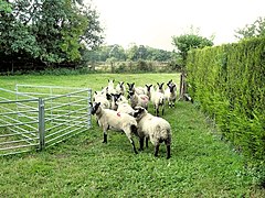
Daresbury is a village and civil parish in Halton, Cheshire, England, which at the 2011 Census had a population of 246.
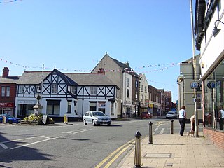
Neston is a town and civil parish in the borough of Cheshire West and Chester, in the part of the Wirral Peninsula that remains in the ceremonial county of Cheshire, England. Parkgate is located to the north west and the villages of Little Neston and Ness to the south of the town. At the 2001 census the population of Neston ward was recorded as 3,521, increasing to 4,329 at the 2011 census. The town and civil parish also includes Little Neston; Parkgate; and Riverside wards; along with part of Burton and Ness ward, and had a population of 15,162 in 2001, increasing to 15,221 in 2011.
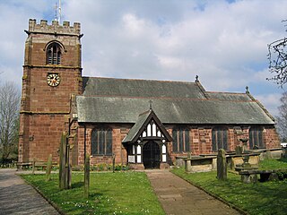
Tattenhall is a village and former civil parish, now in the parish of Tattenhall and District, 8 miles (13 km) south-east of Chester, in the unitary authority of Cheshire West and Chester and the ceremonial county of Cheshire, England. In the 2001 census, the population was recorded as 1,986, increasing to 2,079 by the 2011 census. The civil parish was abolished in 2015 to form Tattenhall and District.

Upton-by-Chester is a civil parish and a large suburb on the outskirts of Chester, in the unitary authority of Cheshire West and Chester and the ceremonial county of Cheshire, England. It includes the villages of Upton and Upton Heath.

Guilden Sutton is a civil parish and village in the unitary authority of Cheshire West and Chester and the ceremonial county of Cheshire, England. The village lies approximately 3 miles (5 km) to the east of Chester and is south of the village of Mickle Trafford. The community consists of two churches, a primary school, a post office, a pub, a village hall and several local businesses.

Waverton is a village and civil parish on the outskirts of Chester in the unitary authority of Cheshire West and Chester and the ceremonial county of Cheshire, England. It lies about 3 miles (4.8 km) south-east of Chester High Cross, 19 miles (31 km) south of Liverpool and 33 miles (53 km) south west of Manchester. It is almost continuous with the village of Rowton to the north west and that in turn is almost continuous with Christleton. According to the 2011 Census, the population of the parish was 1,587.Waverton is a very rural area with lots of fields and farms

Bache is a small civil parish and suburb of Chester, in the unitary authority of Cheshire West and Chester and the ceremonial county of Cheshire, England. Located to the north of the city, Bache combines with Moston and Upton-by-Chester to form a joint parish council.

Backford is a village and civil parish in the unitary authority of Cheshire West and Chester and ceremonial county of Cheshire, England. It is situated between Chester and Ellesmere Port on the A41 trunk road, to the north of the Shropshire Union Canal. Backford Cross is located about 2.5 km (1.6 mi) to the north, the village of Mollington is approximately 2.5 km (1.6 mi) to the west and the hamlet of Croughton is about 3 km (1.9 mi) to the east.

Christleton is a village and civil parish on the outskirts of Chester in the unitary authority of Cheshire West and Chester and the ceremonial county of Cheshire, England. The 2001 Census recorded a population for the entire civil parish of 2,112. The Shropshire Union Canal passes through the village. There is also a large pond situated by the village widely known as "Christleton Pit" which attracts children from the village and surrounding areas due to the abundance of wildlife, swans, and ducks.
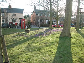
Puddington is a village and civil parish on the Wirral Peninsula, in the unitary authority of Cheshire West and Chester and the ceremonial county of Cheshire, England, located close to the border with Wales. In the 2001 census the village of Puddington had 325 inhabitants, increasing to 381 at the 2011 census.

Pulford is a village and former civil parish, now in the parish of Poulton and Pulford, in the unitary authority of Cheshire West and Chester and the ceremonial county of Cheshire, England. It is on the B5445 road, to the south west of Chester and on the border with Wales. The civil parish, which included the hamlet of Cuckoo's Nest, was abolished in 2015 to form Poulton and Pulford.

Little Stanney is a suburban village and civil parish in the unitary authority of Cheshire West and Chester and the ceremonial county of Cheshire, England. It is located on the Wirral Peninsula between Chester and Ellesmere Port.

Dodleston is a village and civil parish in the unitary authority of Cheshire West and Chester and the ceremonial county of Cheshire, England. The village is situated to the south west of Chester, very close to the England–Wales border. The civil parish includes Balderton, Gorstella, Lower Kinnerton and Rough Hill. It is one of the three old Cheshire parishes which are situated on the Flintshire side of the River Dee.
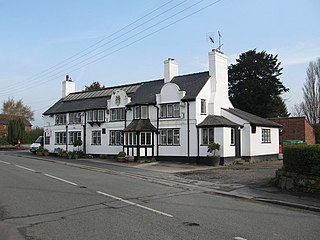
Handley is a village and civil parish in the unitary authority of Cheshire West and Chester and the ceremonial county of Cheshire, England. It is part of the local government ward of Tattenhall, a larger settlement approximately 2 miles (3.2 km) to the east. At the 2011 census, the population of the civil parish, which at that time included Chowley, Golborne David and the hamlet of Milton Green, was 253.
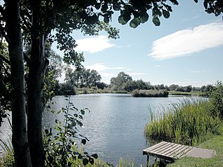
Mickle Trafford is a village and former civil parish, now in the parish of Mickle Trafford and District, in the unitary authority of Cheshire West and Chester and the ceremonial county of Cheshire, England. It includes the area known as Plemstall. The A56 road from Chester to Warrington passes through the village and the Chester-Warrington railway line passes immediately to its east. The civil parish was abolished in 2015 to form Mickle Trafford and District, part of it also went to Guilden Sutton.

Moston is a small village and civil parish in the unitary authority of Cheshire West and Chester and the ceremonial county of Cheshire, England. It is in the north east of Chester, close to the Shropshire Union Canal and the A41 trunk road between Chester and Birkenhead. Moston combines with Bache and Upton-by-Chester to form a joint parish council.

Wimbolds Trafford is a hamlet and former civil parish, now in the parish of Mickle Trafford and District, in the unitary authority of Cheshire West and Chester and the ceremonial county of Cheshire, England. The hamlet lies on the B5132 road, approximately 5 miles (8 km) to the north east of Chester and north of the village of Mickle Trafford.

Lea-by-Backford is a hamlet and civil parish in the unitary authority of Cheshire West and Chester and the ceremonial county of Cheshire, England. It is situated between Chester and Ellesmere Port, west of the A41 trunk road and to the north of the Shropshire Union Canal. Backford is approximately 1.2 mi (2 km) to the east and Mollington is approximately 1.2 mi (2 km) to the south.

Chorlton is a civil parish in the Borough of Cheshire West and Chester and ceremonial county of Cheshire, England. Situated to the west of the market town of Malpas, the main settlement in the parish is Chorlton Lane. Local landmarks Chorlton Hall and Chorlton Old Hall are both Grade II listed buildings.

Chorlton-by-Backford is a former civil parish in the Borough of Cheshire West and Chester and ceremonial county of Cheshire, England, approximately 3 mi (4.8 km) to the north of Chester. It was abolished in 2015 and merged into the civil parish of Backford. Chorlton Hall is a Grade II listed building within the area.
