
Kelsall is a medium-sized agricultural/commuter village and civil parish in the unitary authority of Cheshire West and Chester and the ceremonial county of Cheshire, England. It is located around 8 miles (13 km) east of Chester, 8 miles (13 km) west of Northwich and 4 miles (6 km) north west of Tarporley. The village is situated on Kelsall Hill, a part of the Mid-Cheshire Ridge, the broken line of sandstone hills that divide the west Cheshire Plain from its eastern counterpart. The ridge includes other hills including Peckforton, Beeston, Frodsham and Helsby.

Chester was a non-metropolitan local government district of Cheshire, England from 1974 to 2009. It had the status of a city and a borough.

Tarvin is a village in the unitary authority of Cheshire West and Chester and the ceremonial county of Cheshire, England. It had a population of 2,693 people at the 2001 UK census, rising to 2,728 at the 2011 Census, and the ward covers about 17 square miles (44 km2).

Austerson is a civil parish in the unitary authority of Cheshire East and the ceremonial county of Cheshire, England, lying immediately south of the town of Nantwich and north of the village of Audlem. Predominantly rural with scattered farms, the civil parish includes the small settlement of Old Hall Austerson at SJ656493, about two miles south of Nantwich centre. In 2001, the total population was a little under 150, increasing to 194 at the 2011 Census. Nearby villages include Broomhall Green, Hack Green, Hankelow, Sound Heath and Stapeley.

Batherton is a rural civil parish in the unitary authority of Cheshire East and the ceremonial county of Cheshire, England. It lies immediately south of Nantwich and is jointly administered with the nearby settlement of Stapeley. The population was over 120 in 2011. The River Weaver runs along the western boundary, and its floodplain provides a habitat for wetland species, including the great crested newt and the nationally rare black poplar.

Buerton is a village at SJ685435 and civil parish in the unitary authority of Cheshire East and the ceremonial county of Cheshire, England, about 7 miles south of the town of Nantwich and 1½ miles east of the village of Audlem, on the border with Shropshire. The parish also includes the small settlements of Hankins Heys, Moblake, Pinder's End and Three Wells, as well as parts of Chapel End, College Fields, Kinsey Heath, Longhill, Raven's Bank, Sandyford and Woolfall. In 2001, the total population was a little under 500, which had increased marginally to 503 at the 2011 Census. Nearby villages include Adderley, Audlem, Bridgemere, Hankelow, Hatherton, Hunsterson and Woore.

Tushingham cum Grindley is a former civil parish, now in the parish of Tushingham-cum-Grindley, Macefen and Bradley, in the unitary authority of Cheshire West and Chester and the ceremonial county of Cheshire, England. The parish contained the village of Tushingham and the hamlet of Bell o' th' Hill. According to the 2001 UK census, the total population of the civil parish was 166, rising to 187 at the 2011 Census. The civil parish was abolished in 2015 to form Tushingham-cum-Grindley, Macefen and Bradley.
Tarvin was, from 1894 to 1974, a rural district in the administrative county of Cheshire, England. The district was named after the village of Tarvin, and saw considerable boundary changes throughout its life.
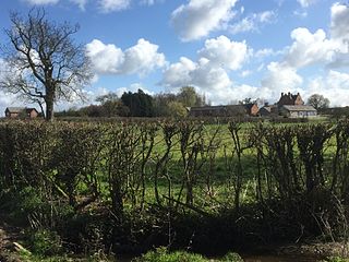
Burton is a small village and former civil parish, now in the parish of Duddon and Burton, in the unitary authority of Cheshire West and Chester and the ceremonial county of Cheshire, England. In the 2001 Census, the parish had a population of 50.

St Andrew's Church is in the village of Tarvin, Cheshire, England. The church is recorded in the National Heritage List for England as a designated Grade I listed building. It is an active Anglican parish church in the diocese of Chester, the archdeaconry of Chester and the deanery of Chester. Its benefice is united with that of St Peter, Duddon.
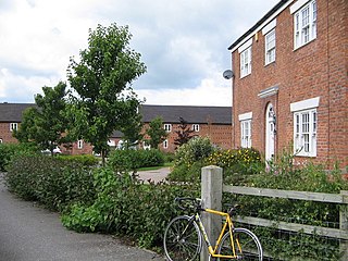
Woolstanwood is a village and civil parish in the unitary authority of Cheshire East and the ceremonial county of Cheshire, England, which lies immediately to the west of Crewe, 1½ miles from the centre. The parish also includes the settlements of Brassey Bank and Marshfield Bank. Nearby villages include Wistaston and Worleston.

Newhall is a village and civil parish in the unitary authority of Cheshire East and the ceremonial county of Cheshire, England. The village lies 3½ miles to the west of Audlem and 5 miles to the south west of Nantwich. The parish also includes the village of Aston, and the small settlements of Aston Heath, Barnett Brook, Brown's Bank, Dodd's Green, Grandford, Grindley Green, Hollingreen, Kingswood Green, Maiden Estate, Salesbrook, Sheppenhall and part of Sandford. Nearby villages include Audlem and Wrenbury.
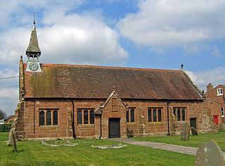
Foulk Stapleford is a former civil parish, now in the parish of Hargrave and Huxley, in the unitary authority of Cheshire West and Chester and the ceremonial county of Cheshire, England. The population of the civil parish as taken at the 2011 census was 161. The civil parish was abolished in 2015 to form Hargrave and Huxley.
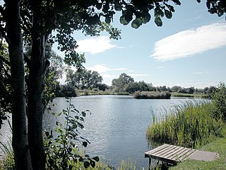
Mickle Trafford is a village and former civil parish, now in the parish of Mickle Trafford and District, in the unitary authority of Cheshire West and Chester and the ceremonial county of Cheshire, England. It includes the area known as Plemstall. In 2004 the population of the civil parish was estimated to be 2,140, although the 2001 census recorded 1,831 people. The A56 road from Chester to Warrington passes through the village and the Chester-Warrington railway line passes immediately to its east. The civil parish was abolished in 2015 to form Mickle Trafford and District, part of it also went to Guilden Sutton.
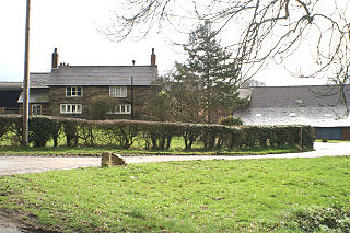
Millington is a civil parish in the Borough of Cheshire East in England. Its name is a "relic of Saxon clanship – the ton or town of the Millings". The parish is primarily agricultural, with a number of farms including Moss House Farm, Newhall Farm, Mereside Farm, Boothbank Farm and Stonedelph Farm. Millington has been recently described on Britain Streets as a "hamlet or isolated settlement in inhabited countryside". Millington is situated within the market town Macclesfield within the Unitary Authority of Cheshire East. The M56 motorway is close to the parish, which allows travel into areas of Warrington and Manchester, 13 miles (21 km) and 14 miles (23 km) away respectively.

Hockenhull is a former civil parish, now in the parish of Tarvin, in the Borough of Cheshire West and Chester and ceremonial county of Cheshire in England. In 2001 it had a population of 19. The civil parish was abolished in 2015 and merged into Tarvin.
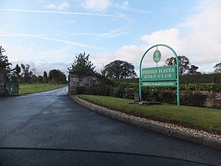
Prior's Heys is a former civil parish, now in the parish of Tarvin, in the Borough of Cheshire West and Chester and ceremonial county of Cheshire in England. In 2001 it had a population of 10. The civil parish was abolished in 2015 and merged into Tarvin.
John Bruen (1560–1625) was an English Puritan layman, celebrated in his time for piety.
Bruen Stapleford is a former civil parish, now in the parish of Tarvin, in Cheshire West and Chester, England. It contains three buildings that are recorded in the National Heritage List for England as designated listed buildings, all of which are at Grade II. This grade is the lowest of the three gradings given to listed buildings and is applied to "buildings of national importance and special interest". The parish is entirely rural, the listed buildings consisting of a farmhouse, a sundial and a barn.
Tarvin is a civil parish in Cheshire West and Chester, England. It contains 28 buildings that are recorded in the National Heritage List for England as designated listed buildings. Of these, one is listed at Grade I, the highest grade, two are listed at Grade II*, the middle grade, and the others are at Grade II. The parish contains the village of Tarvin, and is otherwise rural. The listed buildings include the village church and structures in the churchyard, houses, cottages, a shop, a war memorial, and a public house. Outside the village they are houses and farmhouses.


