National Register of Historic Places listings in Taos County, New Mexico

Last updated

Location of Taos County in New Mexico Map of New Mexico highlighting Taos County.svg
Location of Taos County in New Mexico

This is a list of the National Register of Historic Places listings in Taos County, New Mexico.

Contents

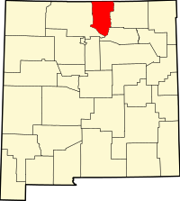
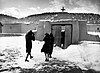
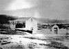
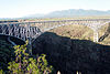
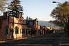
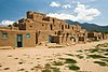
This is intended to be a complete list of the properties and districts on the National Register of Historic Places in Taos County, New Mexico, United States. Latitude and longitude coordinates are provided for many National Register properties and districts; these locations may be seen together in a map. [1]

There are 43 properties and districts listed on the National Register in the county, including seven National Historic Landmarks. All but seven of the National Register listings within the county are also recorded on the New Mexico State Register of Cultural Properties.


    This National Park Service list is complete through NPS recent listings posted September 29, 2023. [2]

Map all coordinates using: OpenStreetMap
Contents: NRHP in New Mexico by county
Bernalillo  Catron  Chaves  Cibola  Colfax  Curry  De Baca  Doña Ana  Eddy  Grant  Guadalupe  Harding  Hidalgo  Lea  Lincoln  Los Alamos  Luna  McKinley  Mora  Otero  Quay  Rio Arriba  Roosevelt  San Juan  San Miguel  Sandoval  Santa Fe  Sierra  Socorro  Taos  Torrance  Union  Valencia

Current listings

[3] Name on the Register [4] ImageDate listed [5] Location City or townDescription
1 Bernard J. Beimer House
Bernard J. Beimer House Beimer House, Taos, NM.jpg
Bernard J. Beimer House
March 22, 2006
(#06000156)
215 Beimer Ave.
36°25′00″N105°34′18″W / 36.416667°N 105.571667°W / 36.416667; -105.571667 (Bernard J. Beimer House)
Taos State Register of Cultural Properties (SRCP)
2 Governor Charles Bent House
Governor Charles Bent House Governor Bent Museum, Taos.jpg
Governor Charles Bent House
November 16, 1978
(#78001831)
Bent St.
36°24′31″N105°34′22″W / 36.408611°N 105.572778°W / 36.408611; -105.572778 (Governor Charles Bent House)
Taos SRCP
3 Black Copper Mine and Stamp Mill
Black Copper Mine and Stamp Mill Building located at the Black Copper Mine and Stamp Mill Mine.JPG
Black Copper Mine and Stamp Mill
October 27, 2000
(#00000875)
Black Copper Canyon Rd.
36°38′14″N105°22′13″W / 36.637222°N 105.370278°W / 36.637222; -105.370278 (Black Copper Mine and Stamp Mill)
Red River SRCP
4 Ernest L. Blumenschein House
Ernest L. Blumenschein House Ernest L. Blumenschein House.jpg
Ernest L. Blumenschein House
October 15, 1966
(#66000495)
Ledoux St.
36°24′21″N105°34′34″W / 36.405833°N 105.576111°W / 36.405833; -105.576111 (Ernest L. Blumenschein House)
Taos
5 Carson School
Carson School Carson School.JPG
Carson School
February 13, 1986
(#86000233)
State Road 96
36°21′53″N105°45′55″W / 36.364722°N 105.765278°W / 36.364722; -105.765278 (Carson School)
Carson SRCP
6 Kit Carson House
Kit Carson House Kit Carson House, Kit Carson Avenue, Taos (Taos County, New Mexico).jpg
Kit Carson House
October 15, 1966
(#66000948)
Kit Carson Ave.
36°24′25″N105°34′20″W / 36.406944°N 105.572222°W / 36.406944; -105.572222 (Kit Carson House)
Taos
7 Chapel of Santa Cruz
Chapel of Santa Cruz Ojo Church (13).jpg
Chapel of Santa Cruz
April 14, 1975
(#75001174)
Southern side of Plaza off U.S. Route 285
36°18′11″N106°02′46″W / 36.303056°N 106.046111°W / 36.303056; -106.046111 (Chapel of Santa Cruz)
Ojo Caliente SRCP
8 Laureano Cordova Mill November 5, 1974
(#74001212)
Off State Road 75
36°11′26″N105°40′08″W / 36.190556°N 105.668889°W / 36.190556; -105.668889 (Laureano Cordova Mill)
Vadito SRCP
9 Eanger Irving Couse House and Studio—Joseph Henry Sharp Studios
Eanger Irving Couse House and Studio--Joseph Henry Sharp Studios Couse Studio, Taos NM.jpg
Eanger Irving Couse House and Studio—Joseph Henry Sharp Studios
September 28, 2005
(#05001096)
146 Kit Carson Rd.
36°24′29″N105°34′18″W / 36.408056°N 105.571667°W / 36.408056; -105.571667 (Eanger Irving Couse House and Studio—Joseph Henry Sharp Studios)
Taos SRCP
10 Nicholai Fechin House
Nicholai Fechin House Fechin House - Daughters Playroom.jpg
Nicholai Fechin House
December 31, 1979
(#79001558)
227 Paseo del Pueblo Norte
36°24′37″N105°34′09″W / 36.410278°N 105.569167°W / 36.410278; -105.569167 (Nicholai Fechin House)
Taos SRCP; Now the Taos Art Museum
11 Leon Gaspard House
Leon Gaspard House Gaspard Detail.JPG
Leon Gaspard House
February 23, 1979
(#79001559)
Raton Rd / Kit Carson Rd.
36°23′45″N105°33′54″W / 36.395773°N 105.564988°W / 36.395773; -105.564988 (Leon Gaspard House)
Taos SRCP
12 Harwood Foundation
Harwood Foundation Taos Harwood Museum.jpg
Harwood Foundation
December 22, 1976
(#76001200)
LeDoux St.
36°24′20″N105°34′36″W / 36.405556°N 105.576667°W / 36.405556; -105.576667 (Harwood Foundation)
Taos SRCP; now the Harwood Museum of Art
13 E. Martin Hennings House and Studio Historic District
E. Martin Hennings House and Studio Historic District E. Martin Hennings House 2.jpg
E. Martin Hennings House and Studio Historic District
July 5, 1990
(#90001028)
Southeastern corner of the junction of Dolan St. and Kit Carson Rd.
36°24′01″N105°34′03″W / 36.400278°N 105.5675°W / 36.400278; -105.5675 (E. Martin Hennings House and Studio Historic District)
Taos SRCP
14 Howiri-ouinge April 7, 1983
(#83001633)
Intersection of U.S. Route 285 and State Road 96
36°18′11″N106°02′48″W / 36.3030765°N 106.0466884°W / 36.3030765; -106.0466884 (Howiri-ouinge)
Ojo Caliente SRCP
15 La Loma Plaza Historic District
La Loma Plaza Historic District La Loma Plaza 10.JPG
La Loma Plaza Historic District
July 8, 1982
(#82003339)
State Road 240
36°24′23″N105°34′50″W / 36.406389°N 105.580556°W / 36.406389; -105.580556 (La Loma Plaza Historic District)
Taos SRCP; Aerial photo-map
16 La Morada de Nuestra Senora de Guadalupe
La Morada de Nuestra Senora de Guadalupe La Morada de Nuestra Senora de Guadalupe 5.JPG
La Morada de Nuestra Senora de Guadalupe
June 29, 1976
(#76001201)
Penitente Road
36°24′23″N105°33′47″W / 36.40635°N 105.56319°W / 36.40635; -105.56319 (La Morada de Nuestra Senora de Guadalupe)
Taos SRCP
17 Las Trampas Historic District
Las Trampas Historic District Trampas43.jpg
Las Trampas Historic District
May 28, 1967
(#67000007)
On State Road 76
36°07′57″N105°45′48″W / 36.1325°N 105.763333°W / 36.1325; -105.763333 (Las Trampas Historic District)
Las Trampas
18 D.H. Lawrence Ranch Historic District
D.H. Lawrence Ranch Historic District Lawrence Ranch-view up to Memorial-ext.JPG
D.H. Lawrence Ranch Historic District
January 15, 2004
(#03001410)
Lawrence Rd., approximately 2.75 miles east of State Road 522 on U.S. Forest Service Rd. 7
36°34′55″N105°35′37″W / 36.581944°N 105.593611°W / 36.581944; -105.593611 (D.H. Lawrence Ranch Historic District)
San Cristobal SRCP
19 Mabel Dodge Luhan House
Mabel Dodge Luhan House MD Lujan House.jpg
Mabel Dodge Luhan House
November 15, 1978
(#78001832)
Luhan Lane
36°24′29″N105°33′52″W / 36.408056°N 105.564444°W / 36.408056; -105.564444 (Mabel Dodge Luhan House)
Taos SRCP
20 Orin Mallette Cabin
Orin Mallette Cabin Orin Mallette Cabin, Red River, NM.JPG
Orin Mallette Cabin
February 23, 1984
(#84003055)
West of Red River
36°42′28″N105°25′34″W / 36.707778°N 105.426111°W / 36.707778; -105.426111 (Orin Mallette Cabin)
Red River SRCP
21 Sylvester M. Mallette Cabin
Sylvester M. Mallette Cabin Sylvester M. Mallette Cabin, Red River, NM.JPG
Sylvester M. Mallette Cabin
February 23, 1984
(#84003056)
River St. and Copper King
36°42′20″N105°24′13″W / 36.705556°N 105.403611°W / 36.705556; -105.403611 (Sylvester M. Mallette Cabin)
Red River SRCP
22 Severino Martinez House
Severino Martinez House Martinez Facade.JPG
Severino Martinez House
April 23, 1973
(#73001153)
2 miles from Taos Plaza, on the Lower Ranchitos Rd.
36°24′04″N105°36′29″W / 36.400980°N 105.607929°W / 36.400980; -105.607929 (Severino Martinez House)
Taos SRCP; Hacienda de los Martinez -- Bird's-eye view
23 Melson-Oldham Cabin
Melson-Oldham Cabin Melson-Oldham Cabin, Red River, NM.JPG
Melson-Oldham Cabin
February 23, 1984
(#84003057)
Southeast of Red River
36°41′18″N105°23′13″W / 36.688333°N 105.386944°W / 36.688333; -105.386944 (Melson-Oldham Cabin)
Red River SRCP
24 Molino de los Duranes February 3, 2020
(#100004918)
83 Camino Abajo de la Loma
36°20′58″N105°36′10″W / 36.3494°N 105.6027°W / 36.3494; -105.6027 (Molino de los Duranes)
Rancho de Taos vicinity
25 Ojo Caliente Hot Springs Round Barn
Ojo Caliente Hot Springs Round Barn Ojo Caliente Hot Springs Round Barn.jpg
Ojo Caliente Hot Springs Round Barn
October 6, 2003
(#03000996)
500 yards north of the western terminus of State Road 414
36°18′37″N106°02′48″W / 36.310278°N 106.046667°W / 36.310278; -106.046667 (Ojo Caliente Hot Springs Round Barn)
Ojo Caliente SRCP
26 Ojo Caliente Mineral Springs
Ojo Caliente Mineral Springs Ojo Facade.JPG
Ojo Caliente Mineral Springs
November 17, 1985
(#85003496)
State Road 414
36°18′17″N106°03′06″W / 36.304722°N 106.051667°W / 36.304722; -106.051667 (Ojo Caliente Mineral Springs)
Ojo Caliente SRCP
27 Peñasco High School January 26, 2023
(#100008588)
15086 NM 75
36°10′12″N105°41′12″W / 36.1699°N 105.6867°W / 36.1699; -105.6867 (Peñasco High School)
Peñasco
28 Picuris Pueblo
Picuris Pueblo Picuris mission.jpg
Picuris Pueblo
August 13, 1974
(#74001211)
South of Taos
36°12′05″N105°42′32″W / 36.201389°N 105.708889°W / 36.201389; -105.708889 (Picuris Pueblo)
Taos SRCP
29 Pierce-Fuller House
Pierce-Fuller House Pierce-Fuller House.JPG
Pierce-Fuller House
February 23, 1984
(#84003058)
High St.
36°42′42″N105°24′37″W / 36.711667°N 105.410278°W / 36.711667; -105.410278 (Pierce-Fuller House)
Red River SRCP
30 Posi-ouinge
Posi-ouinge Posi-ouinge Archaeological Site.jpg
Posi-ouinge
August 5, 1993
(#93000675)
Access to the trail is behind the Ojo Caliente Mineral Springs Resort at 50 Los Banos Drive in Ojo Caliente
36°18′19″N106°03′06″W / 36.30521389°N 106.0516036°W / 36.30521389; -106.0516036 (Posi-ouinge)
Ojo Caliente Extends into Rio Arriba County. BLM public access info.
31 Ranchos de Taos Plaza
Ranchos de Taos Plaza Entry, San Francisco de Assisi Mission, Ranchos de Taos.jpg
Ranchos de Taos Plaza
October 2, 1978
(#78001830)
Off U.S. Route 64
36°21′30″N105°36′28″W / 36.358333°N 105.607778°W / 36.358333; -105.607778 (Ranchos de Taos Plaza)
Ranchos de Taos SRCP
32 Red River Schoolhouse
Red River Schoolhouse Little Red Schoolhouse, Red River, NM..JPG
Red River Schoolhouse
February 23, 1984
(#84003059)
High St.
36°42′23″N105°24′00″W / 36.706389°N 105.4°W / 36.706389; -105.4 (Red River Schoolhouse)
Red River SRCP
33 Rio Grande Gorge Bridge
Rio Grande Gorge Bridge NMtrip-05-026.jpg
Rio Grande Gorge Bridge
July 15, 1997
(#97000733)
State Road 111 over the Rio Grande Gorge
36°28′34″N105°43′56″W / 36.476111°N 105.732222°W / 36.476111; -105.732222 (Rio Grande Gorge Bridge)
Taos SRCP
34 San Francisco de Assisi Mission Church
San Francisco de Assisi Mission Church Mission Church of Ranchos de Taos, Ranchos de Taos (Taos County, New Mexico).jpg
San Francisco de Assisi Mission Church
April 15, 1970
(#70000416)
The Plaza
36°21′31″N105°36′28″W / 36.358611°N 105.607778°W / 36.358611; -105.607778 (San Francisco de Assisi Mission Church)
Ranchos de Taos
35 San José de Gracia Church
San Jose de Gracia Church LasTrampas-May05.jpg
San José de Gracia Church
April 15, 1970
(#70000415)
Northern side of the Plaza
36°07′53″N105°45′28″W / 36.131389°N 105.757778°W / 36.131389; -105.757778 (San José de Gracia Church)
Las Trampas
36 San Ysidro Oratorio January 5, 1984
(#84003060)
State Road 240
36°23′12″N105°37′41″W / 36.386667°N 105.628056°W / 36.386667; -105.628056 (San Ysidro Oratorio)
Los Cordovas SRCP
37 Taos Downtown Historic District
Taos Downtown Historic District Taos Plaza, part of the Taos Downtown Historic District.JPG
Taos Downtown Historic District
July 8, 1982
(#82003340)
State Roads 3 and 240
36°24′24″N105°34′23″W / 36.406667°N 105.573056°W / 36.406667; -105.573056 (Taos Downtown Historic District)
Taos SRCP
38 Taos Inn
Taos Inn Taos Inn historic area.jpg
Taos Inn
February 5, 1982
(#82003341)
Pueblo del Norte
36°24′28″N105°34′20″W / 36.407778°N 105.572222°W / 36.407778; -105.572222 (Taos Inn)
Taos SRCP
39 Taos Pueblo
Taos Pueblo USA 09669 Taos Pueblo Luca Galuzzi 2007.jpg
Taos Pueblo
October 15, 1966
(#66000496)
3 miles north of Taos
36°28′19″N105°33′35″W / 36.47191°N 105.5597°W / 36.47191; -105.5597 (Taos Pueblo)
Taos SRCP
40 Tres Piedras Administrative Site
Tres Piedras Administrative Site Old Tres Piedras Administrative Site.jpg
Tres Piedras Administrative Site
August 5, 1993
(#92000341)
West of U.S. Route 285, north of Tres Piedras
36°39′13″N105°58′10″W / 36.653611°N 105.969444°W / 36.653611; -105.969444 (Tres Piedras Administrative Site)
Tres Piedras
41 Tres Piedras Railroad Water Tower
Tres Piedras Railroad Water Tower D&RGW Railroad Water Tower Tres Piedras New Mexico.jpg
Tres Piedras Railroad Water Tower
February 2, 1979
(#79001560)
Off U.S. Route 285
36°38′51″N105°57′55″W / 36.6475°N 105.965278°W / 36.6475; -105.965278 (Tres Piedras Railroad Water Tower)
Tres Piedras SRCP
42 Turley Mill and Distillery Site November 16, 1978
(#78001833)
11 miles (17.6 km) north of Taos
36°32′23″N105°37′19″W / 36.539722°N 105.621944°W / 36.539722; -105.621944 (Turley Mill and Distillery Site)
Taos SRCP
43 Brigham J. Young House
Brigham J. Young House Brigham J. Young house.JPG
Brigham J. Young House
February 23, 1984
(#84003063)
Main St.
36°42′23″N105°24′00″W / 36.706389°N 105.4°W / 36.706389; -105.4 (Brigham J. Young House)
Red River SRCP

See also

Related Research Articles

<span class="mw-page-title-main">National Register of Historic Places listings in New Mexico</span>

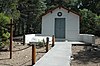
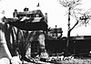
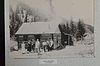
This is a list of properties and districts in New Mexico that are on the National Register of Historic Places. There are more than 1,100 listings. Of these, 46 are National Historic Landmarks. There are listings in each of the state's 33 counties.

<span class="mw-page-title-main">National Register of Historic Places listings in Oneida County, New York</span>

List of the National Register of Historic Places listings in Oneida County, New York

<span class="mw-page-title-main">National Register of Historic Places listings in Valencia County, New Mexico</span>

This is a list of the National Register of Historic Places listings in Valencia County, New Mexico.

<span class="mw-page-title-main">National Register of Historic Places listings in Sierra County, New Mexico</span>

This is a list of the National Register of Historic Places listings in Sierra County, New Mexico.

<span class="mw-page-title-main">National Register of Historic Places listings in Santa Fe County, New Mexico</span>

This is a list of the National Register of Historic Places listings in Santa Fe County, New Mexico.

<span class="mw-page-title-main">National Register of Historic Places listings in Rio Arriba County, New Mexico</span>

This is a list of the National Register of Historic Places listings in Rio Arriba County, New Mexico.

<span class="mw-page-title-main">National Register of Historic Places listings in Grant County, New Mexico</span>

This is a list of the National Register of Historic Places listings in Grant County, New Mexico.

<span class="mw-page-title-main">National Register of Historic Places listings in Colfax County, New Mexico</span>

This is a list of the National Register of Historic Places listings in Colfax County, New Mexico.

<span class="mw-page-title-main">National Register of Historic Places listings in Hidalgo County, New Mexico</span>

This is a list of the National Register of Historic Places listings in Hidalgo County, New Mexico.

<span class="mw-page-title-main">National Register of Historic Places listings in Eddy County, New Mexico</span>

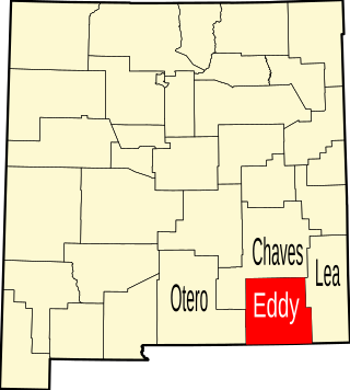
This is a list of the National Register of Historic Places listings in Eddy County, New Mexico.

<span class="mw-page-title-main">National Register of Historic Places listings in Doña Ana County, New Mexico</span>

This is a list of the National Register of Historic Places listings in Doña Ana County, New Mexico.

<span class="mw-page-title-main">National Register of Historic Places listings in Mora County, New Mexico</span>

This is a list of the National Register of Historic Places listings in Mora County, New Mexico.

<span class="mw-page-title-main">National Register of Historic Places listings in Chaves County, New Mexico</span>

This is a list of the National Register of Historic Places listings in Chaves County, New Mexico.

<span class="mw-page-title-main">National Register of Historic Places listings in Cibola County, New Mexico</span>

This is a list of the National Register of Historic Places listings in Cibola County, New Mexico.

<span class="mw-page-title-main">National Register of Historic Places listings in De Baca County, New Mexico</span>

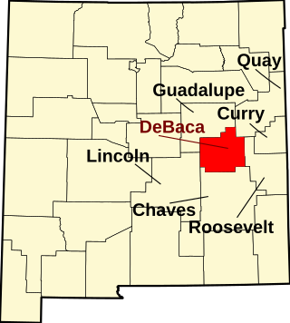
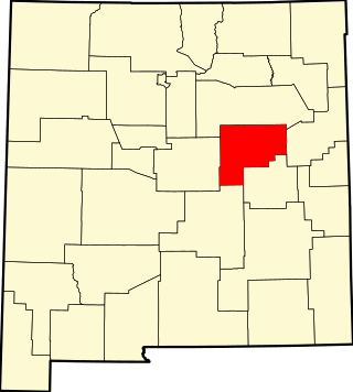
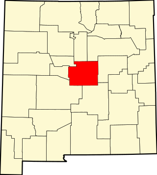
This is a list of the National Register of Historic Places listings in De Baca County, New Mexico.

<span class="mw-page-title-main">National Register of Historic Places listings in Guadalupe County, New Mexico</span>

This is a list of the National Register of Historic Places listings in Guadalupe County, New Mexico.

<span class="mw-page-title-main">National Register of Historic Places listings in Harding County, New Mexico</span>

This is a list of the National Register of Historic Places listings in Harding County, New Mexico.

<span class="mw-page-title-main">National Register of Historic Places listings in Lea County, New Mexico</span>

This is a list of the National Register of Historic Places listings in Lea County, New Mexico.

<span class="mw-page-title-main">National Register of Historic Places listings in Torrance County, New Mexico</span>

This is a list of the National Register of Historic Places listings in Torrance County, New Mexico.

<span class="mw-page-title-main">National Register of Historic Places listings in Union County, New Mexico</span>

This is a list of the National Register of Historic Places listings in Union County, New Mexico.

References

  1. The latitude and longitude information provided in this table was derived originally from the National Register Information System, which has been found to be fairly accurate for about 99% of listings. Some locations in this table may have been corrected to current GPS standards.
  2. National Park Service, United States Department of the Interior, "National Register of Historic Places: Weekly List Actions", retrieved September 29, 2023.
  3. Numbers represent an alphabetical ordering by significant words. Various colorings, defined here, differentiate National Historic Landmarks and historic districts from other NRHP buildings, structures, sites or objects.
  4. "National Register Information System". National Register of Historic Places . National Park Service. July 9, 2010.
  5. The eight-digit number below each date is the number assigned to each location in the National Register Information System database, which can be viewed by clicking the number.