Richibucto

Last updated

Richibucto
Richibucto NB.JPG
Canada New Brunswick location map 2.svg
Red pog.svg
Location within New Brunswick
Coordinates: 46°41′N64°52′W / 46.68°N 64.87°W / 46.68; -64.87
CountryCanada
Province New Brunswick
County Kent County
Town Beaurivage
FoundedEarly 1800s
Incorporated1966
Area
[1]
  Land11.90 km2 (4.59 sq mi)
Population
 (2021) [1]
  Total1,411
  Density118.6/km2 (307/sq mi)
  Change (2016–21)
Increase2.svg 11.5%
Time zone UTC-4 (AST)
  Summer (DST) UTC-3 (ADT)
Canadian Postal code
E4W
Area code 506
Website www.richibucto.org

Richibucto is a former town in Kent County, New Brunswick, Canada. [2] It held town status prior to 2023 and is now part of the town of Beaurivage.

Contents

Geography

The town is situated on the Richibucto River where it discharges into the Northumberland Strait.

History

Richibucto had been the location of an annual Mi'kmaq summer coastal community prior to British colonisation. [3] The town takes its name from "Elsipogtog" or "L'sipuktuk" Mi'kmaq terms meaning "river of fire". [4] It is believed the term was mispronounced, or misunderstood from the Mi'kmaq language. See Elsipogtog First Nation.

On 1 January 2023, Richibucto amalgamated with the village of Saint-Louis de Kent and all or part of four local service districts to form the new town of Beaurivage. [5] [6] The community's name remains in official use. [7]

Demographics

In the 2021 Census of Population conducted by Statistics Canada, Richibucto had a population of 1,411 living in 649 of its 704 total private dwellings, a change of

Richibucto, NB
Historical populations
YearPop.±%
1971 1,850    
1976 1,909+3.2%
1981 1,722−9.8%
1986 1,609−6.6%
1991 1,469−8.7%
1996 1,414−3.7%
2001 1,341−5.2%
2006 1,290−3.8%
2011 1,286−0.3%
2016 1,266−1.6%
2021 1,411+11.5%
[8] [9]

Economy

The downtown area, situated on the mouth of the river, has commercial fishing wharves, several restaurants, and local stores. The economy is dominated by lobster and deep sea fishing.

Attractions

Richibucto Head Lighthouse
Phare du Cap Lumiere.jpg
Richibucto Head Lighthouse in 2007
Richibucto
Location Richibucto, New Brunswick, Canada OOjs UI icon edit-ltr-progressive.svg
Coordinates 46°40′11″N64°42′42″W / 46.669792°N 64.711622°W / 46.669792; -64.711622
Tower
Constructed1865 (first)
Foundationmasonry base
Constructionwooden tower
Height10 m (33 ft)  OOjs UI icon edit-ltr-progressive.svg
Shapesquare truncated tower with balcony and lantern [11] [12] [13]
Markingswhite tower, red lantern
Operator Canadian Coast Guard   OOjs UI icon edit-ltr-progressive.svg
Light
First lit1901 (current)
Deactivated1901 (first)
Focal height18 m (59 ft)  OOjs UI icon edit-ltr-progressive.svg
Lensfourth-order Fresnel lens
Light sourcemain power
Range14 nmi (26 km; 16 mi)  OOjs UI icon edit-ltr-progressive.svg
Characteristic Fl W 5s  OOjs UI icon edit-ltr-progressive.svg
St. Louis de Gonzague Roman Catholic Church is a notable Richibucto landmark RichibuctouNBChurch.jpg
St. Louis de Gonzague Roman Catholic Church is a notable Richibucto landmark

Notable people

See also

Related Research Articles

<span class="mw-page-title-main">Kent County, New Brunswick</span> County in New Brunswick, Canada

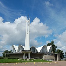
Kent County is located in east-central New Brunswick, Canada. The county features a unique blend of cultures including Mi'kmaq, Acadian, and English. Some larger tourist attractions include the dune de Bouctouche, Kouchibouguac National Park, and Bonar Law Commons.

<span class="mw-page-title-main">Shediac</span> Town in New Brunswick, Canada

Shediac is a heavily Acadian town in Westmorland County, New Brunswick. The town is home to the famous Parlee Beach and is known as the "Lobster Capital of the World". It hosts an annual festival every July which promotes its ties to lobster fishing. At the western entrance to the town is a 90-ton sculpture called The World's Largest Lobster. It is believed that chiac, a well-known Acadian French patois, was named after Shediac.

<span class="mw-page-title-main">Rexton, New Brunswick</span> Place in New Brunswick, Canada

Rexton is a former village in Kent County, New Brunswick, Canada. It was a village in its own right until the end of 2022 and is now part of the village of Five Rivers.

Dalhousie is a former town located in Northern New Brunswick. On January 1, 2023, Dalhousie merged with the village of Charlo and all or part of five local service districts (LSDs) to form the new town of Heron Bay, named Baie-des-Hérons in French. Heron Bay is New Brunswick's northernmost point of land.

<span class="mw-page-title-main">Petit-Rocher, New Brunswick</span> Community in New Brunswick, Canada

Petit-Rocher is a former village in Gloucester County, New Brunswick. It held village status prior to 2023 and is now part of the town of Belle-Baie. Sitting on the western shore of both Chaleur Bay and Nepisiguit Bay 20 km northwest of Bathurst.

<span class="mw-page-title-main">Souris, Prince Edward Island</span> Town in Prince Edward Island, Canada

Souris is a town in Kings County, Prince Edward Island, Canada. It is located near the northeastern tip of the province.

<span class="mw-page-title-main">Richibucto Parish, New Brunswick</span> Parish in New Brunswick, Canada

Richibucto is a geographic parish in Kent County, New Brunswick, Canada.

Eel River Crossing is a former village in Restigouche County, New Brunswick, Canada. It held village status prior to 2023 and is now part of the village of Bois-Joli.

<span class="mw-page-title-main">Saint-Louis-de-Kent, New Brunswick</span> Place in New Brunswick, Canada

Saint-Louis-de-Kent is a former village in Kent County, New Brunswick, Canada. It held village status prior to 2023 and is now part of the town of Beaurivage.

<span class="mw-page-title-main">St. Martins, New Brunswick</span> Place in New Brunswick, Canada

St. Martins is a community on the Bay of Fundy now part of the village of Fundy-St. Martins, Canada.

<span class="mw-page-title-main">Cocagne</span> Place in New Brunswick, Canada

Cocagne is a Canadian community, formerly part of an eponymous local service district (LSD) and later incorporated rural community, in Kent County, New Brunswick. It is now part of the rural community of Beausoleil.

The First Nations of New Brunswick, Canada number more than 16,000, mostly Miꞌkmaq and Maliseet (Wolastoqiyik). Although the Passamaquoddy maintain a land claim at Saint Andrews, New Brunswick and historically occurred in New Brunswick, they have no reserves in the province, and have no official status in Canada.

<span class="mw-page-title-main">Carleton Parish, New Brunswick</span> Parish in New Brunswick, Canada

Carleton is a geographic parish in Kent County, New Brunswick, Canada.

<span class="mw-page-title-main">Saint-Louis Parish, New Brunswick</span> Parish in New Brunswick, Canada

Saint-Louis is a geographic parish in Kent County, New Brunswick, Canada.

<span class="mw-page-title-main">Saint-Charles Parish, New Brunswick</span> Parish in New Brunswick, Canada

Saint-Charles is a geographic parish in Kent County, New Brunswick, Canada.

<span class="mw-page-title-main">Weldford Parish, New Brunswick</span> Parish in New Brunswick, Canada

Weldford is a geographic parish in Kent County, New Brunswick, Canada.

<span class="mw-page-title-main">Caraquet</span> Town in New Brunswick, Canada

Caraquet is a town in Gloucester County, New Brunswick, Canada.

<span class="mw-page-title-main">Grand-Bouctouche</span> Place in New Brunswick, Canada

Grand-Bouctouche is a Canadian town in Kent County, New Brunswick.

<span class="mw-page-title-main">Beaurivage</span> Town in New Brunswick, Canada

Beaurivage is a town in the Canadian province of New Brunswick. It was formed through the 2023 New Brunswick local governance reforms.

References

  1. 1 2 3 "Census Profile of Richibucto, Town (TV)". Statistics Canada. 6 December 2022. Retrieved 21 January 2023.
  2. Richibucto Town Website
  3. "Micmac Locations". Micmac Tribe. Access Genealogy. 9 July 2011. Retrieved 27 May 2014.
  4. History of Richibucto Archived 2007-09-28 at the Wayback Machine
  5. "Local Governments Establishment Regulation – Local Governance Act". Government of New Brunswick. 12 October 2022. Retrieved 21 January 2023.
  6. "RSC 6 Kent Regional Service Commission". Government of New Brunswick. 31 January 2022. Retrieved 21 January 2023.
  7. "Proposed entity names reflect strong ties to nature and history" (Press release). Irishtown, New Brunswick: Government of New Brunswick. 25 May 2022. Retrieved 21 January 2023.
  8. Statistics Canada: 1996, 2001, 2006 census
  9. "Census Profile, 2016 Census: Richibucto, New Brunswick". Statistics Canada. 8 February 2017. Retrieved August 14, 2019.
  10. Statistics Canada: census
  11. List of Lights, Pub. 110: Greenland, The East Coasts of North and South America (Excluding Continental U.S.A. Except the East Coast of Florida) and the West Indies (PDF). List of Lights . United States National Geospatial-Intelligence Agency. 2015. p. {{{page}}}.
  12. Rowlett, Russ. "Lighthouses of Canada: Northern New Brunswick". The Lighthouse Directory. University of North Carolina at Chapel Hill . Retrieved 30 March 2017.
  13. "Richibucto Head, NB". Lighthouse Friends. Retrieved 30 March 2017.
  14. John Leroux, Building New Brunswick: An Architectural History, Goose Lane, 2008, p. 216-219