
Gulf Islands National Park Reserve is a national park located on and around the Gulf Islands in British Columbia, Canada. In the National Parks System Plan, this park provides representation of the Strait of Georgia Lowlands natural region, the only place in Canada with a Mediterranean climate of dry, sunny summers and mild, wet winters, the result of a rain shadow effect from surrounding mountains between the region and the ocean. It has similar dominant vegetation as the Pacific Northwest, such as coastal Douglas-fir, western red cedar, shore pine, Pacific dogwood, bigleaf maple, and red alder, but also contains the northern extent of some of the more drought tolerant trees such as Garry oak and Arbutus. The park was created in 2003 as the fortieth national park. It covers 36 square kilometres (14 sq mi) of area on 16 islands and more than 30 islets, reefs and surrounding waters, making it the sixth smallest national park in Canada.

Race Rocks Ecological Reserve is a BC Parks ecological reserve off the southern tip of Vancouver Island in the Strait of Juan de Fuca in Metchosin, British Columbia, Canada.

Ucluelet is a district municipality on the Ucluelet Peninsula, on the west coast of Vancouver Island in British Columbia, Canada. Ucluelet comes from Yuułuʔił which means "people of the safe harbour" in the indigenous Nuu-chah-nulth language and is the homeland of the Yuułuʔiłʔatḥ. As of 2021, its population was 2,066, a 20.3% increase from 1,717 in 2016.

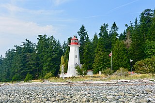
Cape Beale Lightstation is an active manned lighthouse on Vancouver Island in British Columbia., Canada.
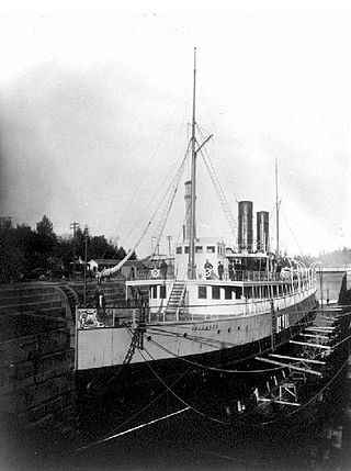
Esquimalt Royal Naval Dockyard was a major British Royal Navy yard on Canada's Pacific coast from 1842 to 1905, subsequently operated by the Canadian government as HMC Dockyard Esquimalt, now part of CFB Esquimalt, to the present day.
The Langara Point Lighthouse is a staffed lighthouse located atop a scenic bluff on the northwest corner of Langara Island. It is one of only two lighthouses in Haida Gwaii – the other being at Cape St. James, at the southern tip of the islands. Both were built in 1913.

Fisgard Lighthouse National Historic Site, on Fisgard Island at the mouth of Esquimalt Harbour in Colwood, British Columbia, is the site of Fisgard Lighthouse, the first lighthouse on the west coast of Canada.

Sheringham Point Lighthouse is located on Vancouver Island, British Columbia, near the community of Shirley. Built in 1912 following the fatal wreck of the SS Valencia six years earlier, it is still used for navigation. The point was named for William L. Sheringham who took part in various naval surveys although not in this area.

Sambro Island Lighthouse is a landfall lighthouse located at the entrance to Halifax Harbour, Nova Scotia, on an island near the community of Sambro in the Halifax Regional Municipality. It is the oldest surviving lighthouse in North America and its construction is a National Historic Event.

Victoria Harbour is a harbour, seaport, and seaplane airport in the Canadian city of Victoria, British Columbia. It serves as a cruise ship and ferry destination for tourists and visitors to the city and Vancouver Island. It is both a port of entry and an airport of entry for general aviation. Historically it was a shipbuilding and commercial fishing centre. While the Inner Harbour is fully within the City of Victoria, separating the city's downtown on its east side from the Victoria West neighbourhood, the Upper Harbour serves as the boundary between the City of Victoria and the district municipality of Esquimalt. The inner reaches are also bordered by the district of Saanich and the town of View Royal. Victoria is a federal "public harbour" as defined by Transport Canada. Several port facilities in the harbour are overseen and developed by the Greater Victoria Harbour Authority, however the harbour master's position is with Transport Canada.

Seguin Light is a lighthouse on Seguin Island, in the Gulf of Maine south of the mouth of the Kennebec River, Maine. Established in 1795, it is the second-oldest of Maine's coastal lighthouses, and the only lighthouse in the state housing a first-order Fresnel lens. With its light at 180 feet (55 m) above mean sea-level, the present tower, built in 1857, is its highest of the state's lighthouses. Automated in 1985, the buildings of the light station are now operated as a museum property by a non-profit organization, and are seasonally open to the public via scheduled ferry from Popham Beach in Phippsburg. The light was listed on the National Register of Historic Places as Seguin Island Light Station in 1977.
The history of lighthouses in Canada dates back to 1734.

Carmanah Point Light Station is a lighthouse on the southwest coast of Vancouver Island at the entrance from the Pacific Ocean to the Strait of Juan de Fuca.

Entrance Island is a small rocky island in the Strait of Georgia, 841 metres (2,759 ft) due north of Gabriola Island. Marine mammals such as harbour seals and Steller's sea lions use it as a haul-out.
Chrome Island Lighthouse is a light station established in 1891 that assists traffic in the region of Deep Bay, British Columbia, Denman Island, and Hornby Island. It is currently a manned station, though in recent years the Canadian Coast Guard has considered automating it.

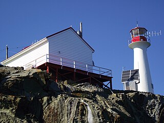
The major Trial Island is home to the Trial Islands Lighthouse which is operated by the Canadian Coast Guard, and continues to be staffed by two full-time lightkeepers. The current lighthouse was erected in 1970 to replace the original lighthouse that was constructed in 1906. The fourth order Fresnel lens from 1906 was used until it was replaced in 1970. That original lens is now on display courtesy of the Maritime Museum of British Columbia in Bastion Square in Downtown Victoria.

Triple Island Lighthouse is a large, manned light station on Triple Island. Built in 1920 after four years of construction, the concrete station features a 21.9 metres (72 ft) tower attached to a rectangular concrete structure that houses the keepers' quarters and machinery. A Triple Island helipad occupies much of the remainder of the islet. Canadian Coast Guard personnel man the station on a 28-day rotation. The station was designated a National Historic Site of Canada in 1974.
Cape Mudge Lighthouse is located on Quadra Island which is off Campbell River, on the east coast of Vancouver Island, British Columbia, Canada.
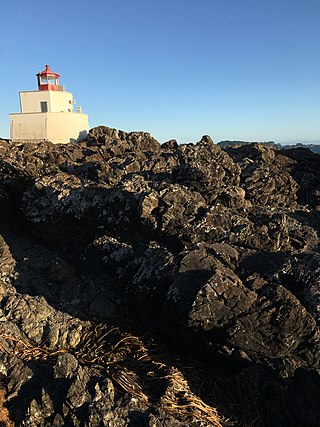
Amphitrite Point Lighthouse is an active lighthouse near Uclulelet on the west coast of Vancouver Island in British Columbia, Canada, named after Amphitrite, the sea goddess and wife of Poseidon in Greek mythology. It is also known for one of the sample pictures in Windows 7.
The British Columbia Shore Station Oceanographic Program is a sea surface temperature and salinity monitoring program on the Canadian coast of the northeast Pacific Ocean. The program is administered by Fisheries and Oceans Canada, and regroups 12 lighthouse stations in British Columbia. Most lighthouses are staffed by the Department of Fisheries and Oceans, but some have independent contractors instead.

