Rural Municipality of Moose Mountain No. 63

Last updated

Moose Mountain No. 63
Rural Municipality of Moose Mountain No. 63
RM Moose Mnt moonrise.jpg
Moonrise over a field near Carlyle
SK RM 63 Moose Mountain.svg
Location of the RM of Moose Mountain No. 63 in Saskatchewan
Coordinates: 49°36′40″N102°08′35″W / 49.611°N 102.143°W / 49.611; -102.143 [1]
Country Canada
Province Saskatchewan
Census division 1
SARM division 1
Federal riding Souris—Moose Mountain
Provincial riding Cannington
Formed [2] December 11, 1911
Government
[3]
   Reeve Kelly Brimner
  Governing bodyRM of Moose Mountain No. 63 Council
  AdministratorChristie Hislop
  Office location Carlyle
Area
 (2016) [4]
  Land738.38 km2 (285.09 sq mi)
Population
 (2016) [4]
  Total492
  Density0.7/km2 (2/sq mi)
Time zone CST
  Summer (DST) CST
Postal code
S0C 0R0
Area code(s) 306 and 639
Website Official website

The Rural Municipality of Moose Mountain No. 63 (2016 population: 492) is a rural municipality (RM) in the Canadian province of Saskatchewan within Census Division No. 1 and SARM Division No. 1. It is located in the south-east portion of the province.

Contents

History

Swift Creek School #261 built in 1908, near Carlyle. A Pumpjack is to the right of the building and Moose Mountain Upland is visible in the background. Swift Creek School 1908.jpg
Swift Creek School #261 built in 1908, near Carlyle. A Pumpjack is to the right of the building and Moose Mountain Upland is visible in the background.

The RM of Moose Mountain No. 63 incorporated as a rural municipality on December 11, 1911. [2] It derived its name from the large number of moose that inhabit the Moose Mountain Uplands in the north-west corner of the RM.

The Church of All Saints, built in 1885, and the Humphrys/Hewlett House, built in 1888, are historical properties located in Cannington Manor Provincial Park. [5] The park is in the north-east corner of the RM and is a IUCN protected area category III and on the Canadian Register of Historic Places.

Communities and localities

The following urban municipalities are surrounded by the RM.

Towns
Villages

The following unincorporated communities are within the RM.

Organized hamlets [6]
Localities [7]
  • Elevation: 653 metres
  • A post office opened there on 1 August, 1911 and closed four years later on 31 December, 1915
  • Cowper was named after the British poet, William Cowper
  • Elevation 627 metres
  • Consisted of a siding, railway platform, and 2 grain elevators that no longer exist
  • The Glen Adelaide Cemetery was established in 1897
  • Elevation 628 metres
  • Consisted of a siding, railway platform, and a grain elevator that no longer exist

Cowper, Service, and Wordsworth are all named after famous British and Canadian poets. They are all found along the CN Railway and are part of "Poet's Corner", along with several other communities along that railway line in south-east Saskatchewan. [8]

Parks and recreation

All Saints Anglican Church, built in 1885 and still in use. (2015) All Saints Anglican Church, Cannington Manor.jpg
All Saints Anglican Church, built in 1885 and still in use. (2015)

There are two provincial parks within the RM of Moose Mountain. Near the north-east corner is Cannington Manor Provincial Park and along the north part of the RM in the Moose Mountain Upland is Moose Mountain Provincial Park.

Near the north-west corner of the RM on the eastern shore of Kippan Lake, [9] along the border of Moose Mountain Provincial Park, is Saskairie (49°42'24.0"N 102°23'06.1"W). Saskairie is a Nature Conservancy of Canada property that was established in 1974 by Prairie Lore and Living Society on three-quarters of a section of woodland wilderness. Prairie Lore and Living Society was formed in 1972 as a non-profit organisation. The three founding members were Jack MacKenzie, Don Stewart, and Nora Stewart.

"A place like Saskairie with its wilderness aspects of beauty, solitude and peace can only become more and more valuable in our fast-paced technological society," Jack MacKenzie [10]

The park was originally created to provide a year-round outdoor and environmental educational facility for students. In 1977, a cabin was built that could accommodate 32 people.

Demographics

Population history
(1981–2016)
YearPop.±%
1981757    
1986710−6.2%
1991581−18.2%
1996 565−2.8%
2001 515−8.8%
2006 482−6.4%
2011 480−0.4%
2016 492+2.5%
Source: Statistics Canada via Saskatchewan Bureau of Statistics [11] [12]

In the 2021 Census of Population conducted by Statistics Canada, the RM of Moose Mountain No. 63 had a population of 489 living in 198 of its 224 total private dwellings, a change of

In the 2016 Census of Population, the RM of Moose Mountain No. 63 recorded a population of 492 living in 189 of its 218 total private dwellings, a

Government

The RM of Moose Mountain No. 63 is governed by an elected municipal council and an appointed administrator that meets on the second Wednesday of every month. [3] The reeve of the RM is Kelly Brimner while its Administrator is Christie Hislop. [3] The RM's office is located in Carlyle. [3]

See also

Related Research Articles

<span class="mw-page-title-main">Cannington (electoral district)</span> Provincial electoral district in Saskatchewan, Canada

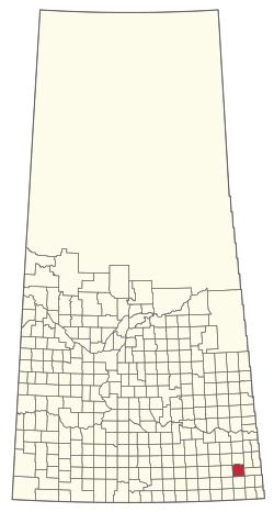
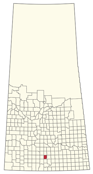
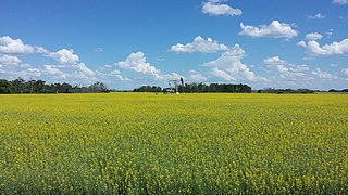
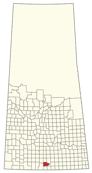
Cannington is a provincial electoral district for the Legislative Assembly of Saskatchewan, Canada. Located in the extreme southeast corner of the province, this constituency was redrawn to include the former district of Souris for the 18th Saskatchewan general election in 1975.

<span class="mw-page-title-main">Division No. 1, Saskatchewan</span> Census division of Saskatchewan, Canada

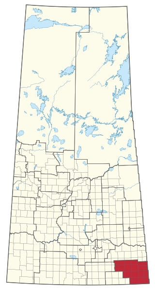
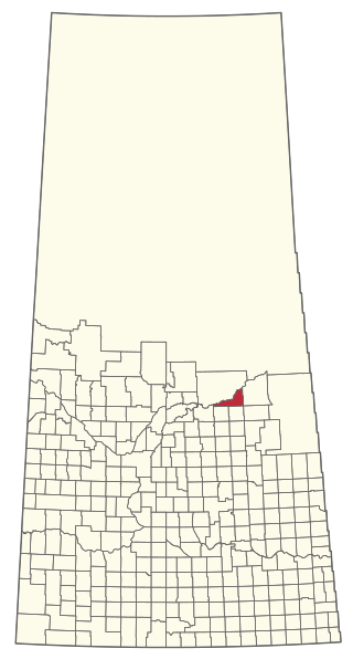
Division No. 1 is one of eighteen census divisions in the province of Saskatchewan, Canada, as defined by Statistics Canada. It is located in the southeast corner of the province, bordering Manitoba and North Dakota. The most populous community in this division is Estevan.

<span class="mw-page-title-main">Saskatchewan Highway 9</span> Highway in Saskatchewan, Canada

Highway 9 is a paved, undivided provincial highway in the Canadian province of Saskatchewan. It runs from North Dakota Highway 8 at the US border near Port of Northgate until it transitions into Provincial Road 283 at the Manitoba provincial boundary.

The Saskota Flyway is known as the International Road to Adventure, because it takes you from Hudson Bay, Saskatchewan, all the way south to Bismarck, North Dakota.

<span class="mw-page-title-main">Carlyle, Saskatchewan</span> Town in Saskatchewan, Canada

Carlyle is a town in the province of Saskatchewan, Canada. Carlyle is the largest town servicing the far south-eastern corner of Saskatchewan and as a result, has become the economic and services centre of the region. Estevan and Weyburn are the closest cities and both are a little over 100 kilometres away. Regina, the provincial capital, lies 200 km to the north-west.

Lampman is a small town of around 735 people located in the south-east part of the Canadian province of Saskatchewan, roughly 30 miles north-east of Estevan.

<span class="mw-page-title-main">Cannington Manor Provincial Park</span> Provincial park in Saskatchewan, Canada

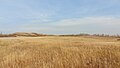
Cannington Manor Provincial Park is an historic park in the RM of Moose Mountain in the south-east corner of the Canadian province of Saskatchewan. An aristocratic English colony was established at the site in 1882 by Captain Edward Michell Pierce. It became a provincial park in 1986. Cannington Manor is located west and north of Highway 603. The Colony is 16 kilometres (9.9 mi) south-east of Moose Mountain Provincial Park, and 60 kilometres (37 mi) south of Moosomin.

<span class="mw-page-title-main">Kenosee Lake, Saskatchewan</span> Village in Saskatchewan, Canada

Kenosee Lake is a village in the Canadian province of Saskatchewan within the Rural Municipality of Wawken No. 93 and Census Division No. 1.

<span class="mw-page-title-main">Manor, Saskatchewan</span> Village in Saskatchewan, Canada

Manor is a village in the Canadian province of Saskatchewan within the RM of Moose Mountain No. 63 and Census Division No. 1. The Manor Museum (1904) is designated a Municipal Heritage Property under the provincial Heritage Property Act.

<span class="mw-page-title-main">Rural Municipality of Fertile Valley No. 285</span> Rural municipality in Saskatchewan, Canada

The Rural Municipality of Fertile Valley No. 285 is a rural municipality (RM) in the Canadian province of Saskatchewan within Census Division No. 12 and SARM Division No. 5. It is located in the southwest portion of the province.

<span class="mw-page-title-main">Cannington Lake</span> Community in Saskatchewan, Canada

Cannington Lake, also known as Cannington Lake Resort, is a hamlet within the Rural Municipality of Moose Mountain No. 63 in the Canadian province of Saskatchewan at the north-east corner of Cannington Lake. Listed as a designated place by Statistics Canada, the hamlet had a population of 0 in the Canada 2011 Census.

<span class="mw-page-title-main">Rural Municipality of Lake Johnston No. 102</span> Rural municipality in Saskatchewan, Canada

The Rural Municipality of Lake Johnston No. 102 is a rural municipality (RM) in the Canadian province of Saskatchewan within Census Division No. 3 and SARM Division No. 2. Located in the southwest portion of the province, it is north of the town of Assiniboia and south of the city of Moose Jaw.

<span class="mw-page-title-main">Rural Municipality of Moose Creek No. 33</span> Rural municipality in Saskatchewan, Canada

The Rural Municipality of Moose Creek No. 33 is a rural municipality (RM) in the Canadian province of Saskatchewan within Census Division No. 1 and SARM Division No. 1.

<span class="mw-page-title-main">Rural Municipality of Willow Bunch No. 42</span> Rural municipality in Saskatchewan, Canada

The Rural Municipality of Willow Bunch No. 42 is a rural municipality (RM) in the Canadian province of Saskatchewan within Census Division No. 3 and SARM Division No. 2. It is located in the south central portion of the province.

<span class="mw-page-title-main">Rural Municipality of Wawken No. 93</span> Rural municipality in Saskatchewan, Canada

The Rural Municipality of Wawken No. 93 is a rural municipality (RM) in the Canadian province of Saskatchewan within Census Division No. 1 and SARM Division No. 1. It is located in the southeast portion of the province.

<span class="mw-page-title-main">Rural Municipality of Last Mountain Valley No. 250</span> Rural municipality in Saskatchewan, Canada

The Rural Municipality of Last Mountain Valley No. 250 is a rural municipality (RM) in the Canadian province of Saskatchewan within Census Division No. 11 and SARM Division No. 5.

<span class="mw-page-title-main">Rural Municipality of Moose Range No. 486</span> Rural municipality in Saskatchewan, Canada

The Rural Municipality of Moose Range No. 486 is a rural municipality (RM) in the Canadian province of Saskatchewan within Census Division No. 14 and SARM Division No. 4.

<span class="mw-page-title-main">Rural Municipality of Nipawin No. 487</span> Rural municipality in Saskatchewan, Canada

The Rural Municipality of Nipawin No. 487 is a rural municipality (RM) in the Canadian province of Saskatchewan within Census Division No. 14 and SARM Division No. 4.

Wordsworth, originally named Curt Hill, is an unincorporated locality in Moose Mountain Rural Municipality No. 63, Saskatchewan, Canada. It is named after the English poet, William Wordsworth and is part of "Poet's Corner" along the CN Railway line in south-east Saskatchewan. Other poetic towns include, Carlyle, Browning, Service, Cowper, and Lampman.

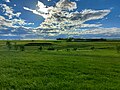
Moose Mountain Upland, Moose Mountain Uplands, or commonly Moose Mountain, is a hilly plateau located in the south-east corner of the Canadian province of Saskatchewan, that covers an area of about 13,000 km2 (5,000 sq mi). The upland rises about 200 m (660 ft) above the broad, flat prairie which is about 600 m (2,000 ft) above sea level. The highest peak is "Moose Mountain" at 830 m (2,720 ft) above sea level. The area was named Moose Mountain because of the large number of moose that lived in the area. When it was originally used by fur traders, Métis, and the Indigenous peoples, the plateau was called Montagne a la Bosse, which is French for "The Mountain of The Bump or Knob."

<span class="mw-page-title-main">Moose Mountain Creek</span> River in southern Saskatchewan, Canada

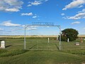
Moose Mountain Creek is a river in the Canadian province of Saskatchewan. Its source is the Chapleau Lakes near Montmartre and it is a tributary of the Souris River, which, in turn, is a tributary of the Assiniboine River. The whole system is part of the Red River watershed, which is part of the Hudson Bay drainage basin and in a region called the Prairie Pothole Region of North America, which extends throughout three Canadian provinces and five U.S. states. It is also within Palliser's Triangle and the Great Plains ecoregion.

References

  1. "Pre-packaged CSV files - CGN, Canada/Province/Territory (cgn_sk_csv_eng.zip)". Government of Canada. July 24, 2019. Retrieved May 23, 2020.
  2. 1 2 "Rural Municipality Incorporations (Alphabetical)". Saskatchewan Ministry of Municipal Affairs. Archived from the original on April 21, 2011. Retrieved May 9, 2020.
  3. 1 2 3 4 "Municipality Details: RM of Moose Mountain No. 63". Government of Saskatchewan. Retrieved May 21, 2020.
  4. 1 2 3 "Population and dwelling counts, for Canada, provinces and territories, and census subdivisions (municipalities), 2016 and 2011 censuses – 100% data (Saskatchewan)". Statistics Canada. February 8, 2017. Retrieved May 1, 2020.
  5. Church of All Saints, Cannington Manor
  6. "2019-2020 Rural Revenue Sharing Organized Hamlet Grant". Government of Saskatchewan. Retrieved May 4, 2020.[ permanent dead link ]
  7. Standard Geographical Classification (SGC) 2001
  8. ""A Poetic Past": the quest | Globalnews.ca".
  9. Government of Canada, Natural Resources Canada. "Place names - Kippan Lake". www4.rncan.gc.ca.
  10. "Home".
  11. "Saskatchewan Census Population" (PDF). Saskatchewan Bureau of Statistics. Archived from the original (PDF) on September 24, 2015. Retrieved May 9, 2020.
  12. "Saskatchewan Census Population". Saskatchewan Bureau of Statistics. Retrieved May 9, 2020.
  13. "Population and dwelling counts: Canada, provinces and territories, census divisions and census subdivisions (municipalities), Saskatchewan". Statistics Canada. February 9, 2022. Retrieved April 13, 2022.