Rural Municipality of Lost River No. 313

Last updated

Lost River No. 313
Rural Municipality of Lost River No. 313
SK RM 313 Lost River.svg
Location of the RM of Lost River No. 313 in Saskatchewan
Coordinates: 51°45′04″N106°08′46″W / 51.751°N 106.146°W / 51.751; -106.146 Coordinates: 51°45′04″N106°08′46″W / 51.751°N 106.146°W / 51.751; -106.146 [1]
Country Canada
Province Saskatchewan
Census division 11
SARM division 5
Formed [2] December 11, 1911
Government
[3]
   Reeve Charles E. Smith
  Governing bodyRM of Lost River No. 313 Council
  AdministratorChristine Dyck
  Office location Allan
Area
 (2016) [4]
  Land549.92 km2 (212.33 sq mi)
Population
 (2016) [4]
  Total242
  Density0.4/km2 (1/sq mi)
Time zone CST
  Summer (DST) CST
Area code(s) 306 and 639

The Rural Municipality of Lost River No. 313 (2016 population: 242) is a rural municipality (RM) in the Canadian province of Saskatchewan within Census Division No. 11 and SARM Division No. 5. Located in the central portion of the province, it is adjacent to the South Saskatchewan River.

Contents

History

The RM of Lost River No. 313 incorporated as a rural municipality on December 11, 1911. [2]

Geography

Communities and localities

The following unincorporated communities are within the RM.

Localities

Allan Hills

The Allan Hills (51°40′0″N, 106°15′2″W) are a plateau [5] south-east of Saskatoon and east of Blackstrap Lake mostly within the RM of Lost River. Parts of the plateau are also in the RM of Dundurn No. 314, RM of Morris No. 312, and RM of McCraney No. 282. South Allan and Allan Hills are the only communities located on the plateau. The Allan Hills rise about 100 metres from the surrounding prairies and the highest point is 658 metres above sea level. [6] The plateau is dotted with several small lakes, including Willie Lake, Cygnet Lake, Horseshoe Lake, and Bultel Lake. Arm River starts near Horseshoe Lake at the south-east corner of the hills and flows south into Last Mountain Lake. Highway 764, a gravel road, is the main road through the hills. It starts at Allan and heads south past South Allan to Allan Hills. From there, it heads west to Hanley.

In December 2015, Ducks Unlimited Canada (DUC) partnered with local cattlemen to help preserve 21 quarters of land (about 13,440 acres) in the hills. It was the largest conservation agreement in DUC's history. [7]

Demographics

Population history
(1981–2016)
YearPop.±%
1981382    
1986323−15.4%
1991260−19.5%
1996 230−11.5%
2001 227−1.3%
2006 188−17.2%
2011 209+11.2%
2016 242+15.8%
Source: Statistics Canada via Saskatchewan Bureau of Statistics [8] [9]

In the 2021 Census of Population conducted by Statistics Canada, the RM of Lost River No. 313 had a population of 252 living in 71 of its 80 total private dwellings, a change of

In the 2016 Census of Population, the RM of Lost River No. 313 recorded a population of 242 living in 70 of its 79 total private dwellings, a

Government

The RM of Lost River No. 313 is governed by an elected municipal council and an appointed administrator that meets on the second Tuesday of every month. [3] The reeve of the RM is Charles E. Smith while its administrator is Christine Dyck. [3] The RM's office is located in Allan. [3]

See also

Related Research Articles

<span class="mw-page-title-main">Rural Municipality of McCraney No. 282</span> Rural municipality in Saskatchewan, Canada

The Rural Municipality of McCraney No. 282 is a rural municipality (RM) in the Canadian province of Saskatchewan within Census Division No. 11 and SARM Division No. 5. It is located in the south-central portion of the province.

<span class="mw-page-title-main">Rural Municipality of Sarnia No. 221</span> Rural municipality in Saskatchewan, Canada

The Rural Municipality of Sarnia No. 221 is a rural municipality (RM) in the Canadian province of Saskatchewan within Census Division No. 6 and SARM Division No. 2. It is located in the south-central portion of the province.

<span class="mw-page-title-main">Rural Municipality of Maple Bush No. 224</span> Rural municipality in Saskatchewan, Canada

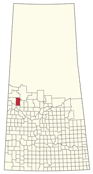
The Rural Municipality of Maple Bush No. 224 is a rural municipality (RM) in the Canadian province of Saskatchewan within Census Division No. 7 and SARM Division No. 2. It is located in the southwest portion of the province.

<span class="mw-page-title-main">Rural Municipality of Dundurn No. 314</span> Rural Municipality in Saskatchewan, Canada

The Rural Municipality of Dundurn No. 314 is a rural municipality (RM) in the Canadian province of Saskatchewan within Census Division No. 11 and SARM Division No. 5. It is located in the north-central portion of the province along the South Saskatchewan River and surrounds the Town of Dundurn.

<span class="mw-page-title-main">Rural Municipality of Blucher No. 343</span> Rural Municipality in Saskatchewan, Canada

The Rural Municipality of Blucher No. 343 is a rural municipality (RM) in the Canadian province of Saskatchewan within Census Division No. 11 and SARM Division No. 5. It is located in the north-central portion of the province on the South Saskatchewan River.

<span class="mw-page-title-main">Rural Municipality of Morris No. 312</span> Rural municipality in Saskatchewan, Canada

The Rural Municipality of Morris No. 312 is a rural municipality (RM) in the Canadian province of Saskatchewan within Census Division No. 11 and SARM Division No. 5.

<span class="mw-page-title-main">Rural Municipality of Heart's Hill No. 352</span> Rural Municipality in Saskatchewan, Canada

The Rural Municipality of Heart's Hill No. 352 is a rural municipality (RM) in the Canadian province of Saskatchewan within Census Division No. 13 and SARM Division No. 6. Located in the west-central portion of the province, it is adjacent to the Alberta boundary.

<span class="mw-page-title-main">Rural Municipality of Garden River No. 490</span> Rural Municipality in Saskatchewan, Canada

The Rural Municipality of Garden River No. 490 is a rural municipality (RM) in the Canadian province of Saskatchewan within Census Division No. 15 and SARM Division No. 5.

<span class="mw-page-title-main">Rural Municipality of Birch Hills No. 460</span> Rural Municipality in Saskatchewan, Canada

The Rural Municipality of Birch Hills No. 460 is a rural municipality (RM) in the Canadian province of Saskatchewan within Census Division No. 15 and SARM Division No. 5. It is located in the north-central portion of the province on Highway 3 southeast of Prince Albert and north of Saskatoon.

<span class="mw-page-title-main">Rural Municipality of Manitou Lake No. 442</span> Rural Municipality in Saskatchewan, Canada

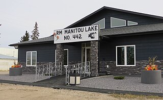
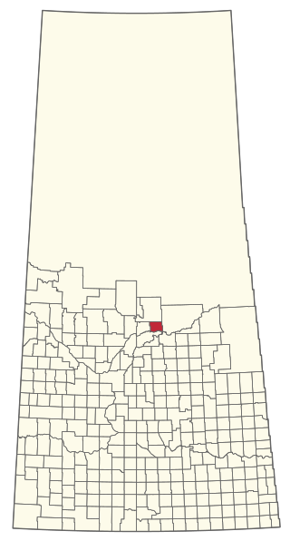
The Rural Municipality of Manitou Lake No. 442 is a rural municipality (RM) in the Canadian province of Saskatchewan within Census Division No. 13 and SARM Division No. 6.

<span class="mw-page-title-main">Rural Municipality of Lake Alma No. 8</span> Rural Municipality in Saskatchewan, Canada

The Rural Municipality of Lake Alma No. 8 is a rural municipality (RM) in the Canadian province of Saskatchewan within Census Division No. 2 and SARM Division No. 2. Located in the southeast portion of the province, it is adjacent to the United States border, neighbouring Sheridan County in Montana and Divide County in North Dakota.

<span class="mw-page-title-main">Rural Municipality of Lake of the Rivers No. 72</span> Rural Municipality in Saskatchewan, Canada

The Rural Municipality of Lake of the Rivers No. 72 is a rural municipality (RM) in the Canadian province of Saskatchewan within Census Division No. 3 and SARM Division No. 2. It is located in the southwest portion of the province.

<span class="mw-page-title-main">Rural Municipality of Big River No. 555</span> Rural Municipality in Saskatchewan, Canada

The Rural Municipality of Big River No. 555 is a rural municipality (RM) in the Canadian province of Saskatchewan within Census Division No. 16 and SARM Division No. 5.

<span class="mw-page-title-main">Rural Municipality of Chesterfield No. 261</span> Rural Municipality in Saskatchewan, Canada

The Rural Municipality of Chesterfield No. 261 is a rural municipality (RM) in the Canadian province of Saskatchewan within Census Division No. 8 and SARM Division No. 3.

<span class="mw-page-title-main">Rural Municipality of Good Lake No. 274</span> Rural Municipality in Saskatchewan, Canada

The Rural Municipality of Good Lake No. 274 is a rural municipality (RM) in the Canadian province of Saskatchewan within Census Division No. 9 and SARM Division No. 4.

<span class="mw-page-title-main">Rural Municipality of Hillsdale No. 440</span> Rural Municipality in Saskatchewan, Canada

The Rural Municipality of Hillsdale No. 440 is a rural municipality (RM) in the Canadian province of Saskatchewan within Census Division No. 13 and SARM Division No. 6.

<span class="mw-page-title-main">Rural Municipality of Last Mountain Valley No. 250</span> Rural Municipality in Saskatchewan, Canada

The Rural Municipality of Last Mountain Valley No. 250 is a rural municipality (RM) in the Canadian province of Saskatchewan within Census Division No. 11 and SARM Division No. 5.

<span class="mw-page-title-main">Rural Municipality of Mervin No. 499</span> Rural municipality in Saskatchewan, Canada

The Rural Municipality of Mervin No. 499 is a rural municipality (RM) in the Canadian province of Saskatchewan within Census Division No. 17 and SARM Division No. 6.

<span class="mw-page-title-main">Rural Municipality of Ponass Lake No. 367</span> Rural municipality in Saskatchewan, Canada

The Rural Municipality of Ponass Lake No. 367 is a rural municipality (RM) in the Canadian province of Saskatchewan within Census Division No. 14 and SARM Division No. 4.

<span class="mw-page-title-main">Rural Municipality of Round Hill No. 467</span> Rural municipality in Saskatchewan, Canada

The Rural Municipality of Round Hill No. 467 is a rural municipality (RM) in the Canadian province of Saskatchewan within Census Division No. 16 and SARM Division No. 6.

References

  1. "Pre-packaged CSV files - CGN, Canada/Province/Territory (cgn_sk_csv_eng.zip)". Government of Canada. July 24, 2019. Retrieved May 23, 2020.
  2. 1 2 "Rural Municipality Incorporations (Alphabetical)". Saskatchewan Ministry of Municipal Affairs. Archived from the original on April 21, 2011. Retrieved May 9, 2020.
  3. 1 2 3 4 "Municipality Details: RM of Lost River No. 313". Government of Saskatchewan. Retrieved May 21, 2020.
  4. 1 2 3 "Population and dwelling counts, for Canada, provinces and territories, and census subdivisions (municipalities), 2016 and 2011 censuses – 100% data (Saskatchewan)". Statistics Canada. February 8, 2017. Retrieved May 1, 2020.
  5. Government of Canada, Natural Resources Canada. "Place names - Allan Hills". www4.rncan.gc.ca.
  6. "Allan Hills".
  7. "Cattle farmers protect land in Allan Hills".
  8. "Saskatchewan Census Population" (PDF). Saskatchewan Bureau of Statistics. Archived from the original (PDF) on September 24, 2015. Retrieved May 9, 2020.
  9. "Saskatchewan Census Population". Saskatchewan Bureau of Statistics. Retrieved May 9, 2020.
  10. "Population and dwelling counts: Canada, provinces and territories, census divisions and census subdivisions (municipalities), Saskatchewan". Statistics Canada. February 9, 2022. Retrieved April 13, 2022.