Rural Municipality of Spy Hill No. 152

Last updated

Spy Hill No. 152
Rural Municipality of Spy Hill No. 152
SK RM 152 Spy Hill.svg
Location of the RM of Spy Hill No. 152 in Saskatchewan
Coordinates: 50°31′01″N101°45′50″W / 50.517°N 101.764°W / 50.517; -101.764 [1]
Country Canada
Province Saskatchewan
Census division 5
SARM division 1
Formed [2] December 11, 1911
Government
[3]
   Reeve Bob Bruce
  Governing bodyRM of Spy Hill No. 152 Council
  AdministratorCarey Nicholauson
  Office location Spy Hill
Area
 (2016) [4]
  Land679.33 km2 (262.29 sq mi)
Population
 (2016) [4]
  Total323
  Density0.5/km2 (1/sq mi)
Time zone CST
  Summer (DST) CST
Area code(s) 306 and 639

The Rural Municipality of Spy Hill No. 152 (2016 population: 323) is a rural municipality (RM) in the Canadian province of Saskatchewan within Census Division No. 5 and SARM Division No. 1. It is located in the east-central portion of the province.

Contents

History

The RM of Spy Hill No. 152 incorporated as a rural municipality on December 11, 1911. [2] It was previously established as a local improvement district on January 3, 1910.[ citation needed ]

Heritage properties

There is one heritage building located within the RM.

Demographics

Population history
(1981–2016)
YearPop.±%
1981611    
1986624+2.1%
1991553−11.4%
1996 496−10.3%
2001 409−17.5%
2006 365−10.8%
2011 366+0.3%
2016 323−11.7%
Source: Statistics Canada via Saskatchewan Bureau of Statistics [6] [7]

In the 2021 Census of Population conducted by Statistics Canada, the RM of Spy Hill No. 152 had a population of 383 living in 155 of its 191 total private dwellings, a change of

In the 2016 Census of Population, the RM of Spy Hill No. 152 recorded a population of 323 living in 126 of its 133 total private dwellings, a

Carlton Trail Regional Park

Carlton Trail Regional Park ( 50°40′31″N101°41′42″W / 50.6752°N 101.6949°W / 50.6752; -101.6949 ) is a regional park within the RM's boundaries that is located 7 kilometres (4.3 mi) north of Spy Hill and accessed from Highway 8. The origins of the park began in the 1950s when John From, a local land owner and professional landscaper, built a summer park for local residents. He dug two artificial lakes, built a golf course, and added a campground. In 1972, John From sold the park to the Regional Park Authority. Carlton Trail Regional Park is located along the Carlton Trail, which was a 19th century trail that linked Fort Garry with Fort Edmonton.

The park is a family recreation and activity centre that features a 9-hole golf course, 9-hole disk golf course, two campgrounds, a group campsite, two man-made lakes, ball diamonds, food services, and hiking trails. The campgrounds have a total of 129 campsites with fire pits, potable water, picnic tables, washrooms, and showers. Swimming Lake–the smaller of the lakes–has a large beach, picnic area, and playground. The other lake, From Lake, is a 12-acre lake that is stocked for anglers. Only electric boats and canoes are allowed on the lake. [9] [10]

The golf course is a grass greens, 9-hole course. There's a licensed club house, pro-shop, and restaurant. The white tees are 3,055 yards with a par of 36 and red tees are 2,935 yards with a par of 37.

Government

The RM of Spy Hill No. 152 is governed by an elected municipal council and an appointed administrator that meets on the second Thursday of every month. [3] The reeve of the RM is Bob Bruce while its administrator is Carey Nicholauson. [3] The RM's office is located in Spy Hill. [3]

See also

Related Research Articles

<span class="mw-page-title-main">Rural Municipality of Maple Bush No. 224</span> Rural municipality in Saskatchewan, Canada

The Rural Municipality of Maple Bush No. 224 is a rural municipality (RM) in the Canadian province of Saskatchewan within Census Division No. 7 and SARM Division No. 2. It is located in the southwest portion of the province.

<span class="mw-page-title-main">Rural Municipality of Leask No. 464</span> Rural municipality in Saskatchewan, Canada

The Rural Municipality of Leask No. 464 is a rural municipality (RM) in the Canadian province of Saskatchewan within Census Division No. 16 and SARM Division No. 5. It is located west of the city of Prince Albert.

<span class="mw-page-title-main">Rural Municipality of Senlac No. 411</span> Rural municipality in Saskatchewan, Canada

The Rural Municipality of Senlac No. 411 is a rural municipality (RM) in the Canadian province of Saskatchewan within Census Division No. 13 and SARM Division No. 6. Located in the west-central portion of the province, it is adjacent to the Alberta boundary.

<span class="mw-page-title-main">Rural Municipality of Canwood No. 494</span> Rural municipality in Saskatchewan, Canada

The Rural Municipality of Canwood No. 494 is a rural municipality (RM) in the Canadian province of Saskatchewan within Census Division No. 16 and SARM Division No. 5. The RM is located in the north-central portion of the province, west of the city of Prince Albert.

Shell Lake is a village in the Canadian province of Saskatchewan within the Rural Municipality of Spiritwood No. 496 and Census Division No. 16. This village is 90 kilometres west of the City of Prince Albert. It was formerly part of the Rural Municipality (RM) of Shell Lake No. 495 before it was absorbed by the RM of Spiritwood No. 496. It is the administrative centre of the Ahtahkakoop Cree First Nation band government.

<span class="mw-page-title-main">Rural Municipality of Manitou Lake No. 442</span> Rural municipality in Saskatchewan, Canada

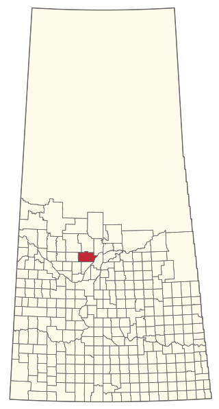
The Rural Municipality of Manitou Lake No. 442 is a rural municipality (RM) in the Canadian province of Saskatchewan within Census Division No. 13 and SARM Division No. 6.

<span class="mw-page-title-main">Rural Municipality of Enterprise No. 142</span> Rural municipality in Saskatchewan, Canada

The Rural Municipality of Enterprise No. 142 is a rural municipality (RM) in the Canadian province of Saskatchewan within Census Division No. 8 and SARM Division No. 3. It is located in the southwest portion of the province.

<span class="mw-page-title-main">Rural Municipality of Britannia No. 502</span> Rural municipality in Saskatchewan, Canada

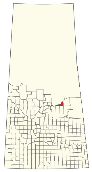
The Rural Municipality of Britannia No. 502 is a rural municipality (RM) in the Canadian province of Saskatchewan within Census Division No. 17 and SARM Division No. 6. It is located in the west-central portion of the province.

<span class="mw-page-title-main">Rural Municipality of Eldon No. 471</span> Rural municipality in Saskatchewan, Canada

The Rural Municipality of Eldon No. 471 is a rural municipality (RM) in the Canadian province of Saskatchewan within Census Division No. 17 and SARM Division No. 6.

<span class="mw-page-title-main">Rural Municipality of Mayfield No. 406</span> Rural municipality in Saskatchewan, Canada

The Rural Municipality of Mayfield No. 406 is a rural municipality (RM) in the Canadian province of Saskatchewan within Census Division No. 16 and SARM Division No. 6.

<span class="mw-page-title-main">Rural Municipality of Souris Valley No. 7</span> Rural municipality in Saskatchewan, Canada

The Rural Municipality of Souris Valley No. 7 is a rural municipality (RM) in the Canadian province of Saskatchewan within Census Division No. 2 and SARM Division No. 1. Located in the southeast portion of the province, it is adjacent to the United States border, neighbouring Divide County in North Dakota.

<span class="mw-page-title-main">Rural Municipality of Willow Bunch No. 42</span> Rural Municipality in Saskatchewan, Canada

The Rural Municipality of Willow Bunch No. 42 is a rural municipality (RM) in the Canadian province of Saskatchewan within Census Division No. 3 and SARM Division No. 2. It is located in the south central portion of the province.

<span class="mw-page-title-main">Rural Municipality of Rosthern No. 403</span> Rural municipality in Saskatchewan, Canada

The Rural Municipality of Rosthern No. 403 is a rural municipality (RM) in the Canadian province of Saskatchewan within Census Division No. 15 and SARM Division No. 5. It is located in the central portion of the province north of the City of Saskatoon.

<span class="mw-page-title-main">Rural Municipality of Biggar No. 347</span> Rural municipality in Saskatchewan, Canada

The Rural Municipality of Biggar No. 347 is a rural municipality (RM) in the Canadian province of Saskatchewan within Census Division No. 12 and SARM Division No. 6.

<span class="mw-page-title-main">Rural Municipality of Snipe Lake No. 259</span> Rural municipality in Saskatchewan, Canada

The Rural Municipality of Snipe Lake No. 259 is a rural municipality (RM) in the Canadian province of Saskatchewan within Census Division No. 8 and SARM Division No. 3.

<span class="mw-page-title-main">Rural Municipality of Riverside No. 168</span> Rural municipality in Saskatchewan, Canada

The Rural Municipality of Riverside No. 168 is a rural municipality (RM) in the Canadian province of Saskatchewan within Census Division No. 8 and SARM Division No. 3.

<span class="mw-page-title-main">Rural Municipality of Big River No. 555</span> Rural municipality in Saskatchewan, Canada

The Rural Municipality of Big River No. 555 is a rural municipality (RM) in the Canadian province of Saskatchewan within Census Division No. 16 and SARM Division No. 5.

<span class="mw-page-title-main">Rural Municipality of Lipton No. 217</span> Rural municipality in Saskatchewan, Canada

The Rural Municipality of Lipton No. 217 is a rural municipality (RM) in the Canadian province of Saskatchewan within Census Division No. 6 and SARM Division No. 1.

<span class="mw-page-title-main">Rural Municipality of Ituna Bon Accord No. 246</span> Rural municipality in Saskatchewan, Canada

The Rural Municipality of Ituna Bon Accord No. 246 is a rural municipality (RM) in the Canadian province of Saskatchewan within Census Division No. 10 and SARM Division No. 4.

<span class="mw-page-title-main">Rural Municipality of Nipawin No. 487</span> Rural municipality in Saskatchewan, Canada

The Rural Municipality of Nipawin No. 487 is a rural municipality (RM) in the Canadian province of Saskatchewan within Census Division No. 14 and SARM Division No. 4.

References

  1. "Pre-packaged CSV files - CGN, Canada/Province/Territory (cgn_sk_csv_eng.zip)". Government of Canada. July 24, 2019. Retrieved May 23, 2020.
  2. 1 2 "Rural Municipality Incorporations (Alphabetical)". Saskatchewan Ministry of Municipal Affairs. Archived from the original on April 21, 2011. Retrieved May 9, 2020.
  3. 1 2 3 4 "Municipality Details: RM of Spy Hill No. 152". Government of Saskatchewan. Retrieved May 21, 2020.
  4. 1 2 3 "Population and dwelling counts, for Canada, provinces and territories, and census subdivisions (municipalities), 2016 and 2011 censuses – 100% data (Saskatchewan)". Statistics Canada. February 8, 2017. Retrieved May 1, 2020.
  5. Voysey Farmhouse Site
  6. "Saskatchewan Census Population" (PDF). Saskatchewan Bureau of Statistics. Archived from the original (PDF) on September 24, 2015. Retrieved May 9, 2020.
  7. "Saskatchewan Census Population". Saskatchewan Bureau of Statistics. Retrieved May 9, 2020.
  8. "Population and dwelling counts: Canada, provinces and territories, census divisions and census subdivisions (municipalities), Saskatchewan". Statistics Canada. February 9, 2022. Retrieved April 13, 2022.
  9. "Carlton Trail Regional Park | Tourism Saskatchewan".
  10. "Carlton Trail".