The Alamo is a historic Spanish mission and fortress compound founded in the 18th century by Roman Catholic missionaries in what is now San Antonio, Texas, United States. It was the site of the Battle of the Alamo in 1836, a pivotal event of the Texas Revolution in which American folk heroes James Bowie and Davy Crockett were killed. Today it is a museum in the Alamo Plaza Historic District and a part of the San Antonio Missions World Heritage Site.

Los Adaes was the capital of Tejas on the northeastern frontier of New Spain from 1721 to 1773. It included a Franciscan mission, San Miguel de Cuellar de los Adaes, and a presidio, Nuestra Señora del Pilar de Los Adaes. The name Adaes derives from the indigenous Adai people, members of the Caddoan confederacy of Indians who were the people the missionaries aimed to convert to Christianity. The presidio and mission were established to counter French influence in Louisiana territory and defend New Spain from possible invasion or encroachment by the French. In 1763 Louisiana came under the control of Spain and the Los Adaes outpost was no longer necessary for defense. In 1773 the Spanish closed the mission and presidio and forced the population to move to San Antonio.

The Spanish Missions in Texas comprise a series of religious outposts established by Spanish Catholic Dominicans, Jesuits, and Franciscans to spread the Catholic doctrine among area Native Americans, but with the added benefit of giving Spain a toehold in the frontier land. The missions introduced European livestock, fruits, vegetables, and industry into the Texas area. In addition to the presidio and pueblo (town), the misión was one of the three major agencies employed by the Spanish crown to extend its borders and consolidate its colonial territories. In all, twenty-six missions were maintained for different lengths of time within the future boundaries of the state of Texas.

The San Antonio River is a major waterway that originates in central Texas in a cluster of springs in midtown San Antonio, about 4 miles north of downtown, and follows a roughly southeastern path through the state. It eventually feeds into the Guadalupe River about 10 miles from San Antonio Bay on the Gulf of Mexico. The river is 240 miles long and crosses five counties: Bexar, Goliad, Karnes, Refugio, and Wilson.

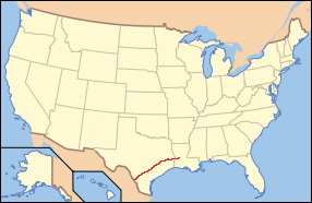
The El Camino Real de los Tejas National Historic Trail is a national historic trail covering the U.S. section of El Camino Real de Los Tejas, a thoroughfare from the 18th-century Spanish colonial era in Spanish Texas, instrumental in the settlement, development, and history of Texas. The National Park Service designated El Camino Real de los Tejas National Historic Trail as a unit in the National Trails System in 2004.
The architecture of the U.S. state of Texas comes from a wide variety of sources. Many of the state's buildings reflect Texas' Spanish and Mexican roots; in addition, there is considerable influence from mostly the American South as well as the Southwest. Rapid economic growth since the mid twentieth century has led to a wide variety of contemporary architectural buildings.

The Barrio de Analco Historic District is a National Historic Landmark District centered at the junction of East De Vargas Street and Old Santa Fe Trail in Santa Fe, New Mexico. The seven buildings of the district represent one of the oldest clusters of what were basically working-class or lower-class residences in North America, and are in a cross-section of pre-statehood architectural styles. It includes two of the oldest colonial-era buildings in the southwest, the San Miguel Mission church (1710), and the "Oldest House", built in 1620 and now a museum. The district was declared a National Historic Landmark in 1968.

Randolph Field Historic District is a National Historic Landmark District encompassing the central portion of Randolph Air Force Base, near San Antonio, Texas, US. Randolph Field was innovatively designed using Garden city movement principles, and includes a unique and well-preserved assemblage of Mission Revival and Art Deco architecture. Built between 1929 and 1931, it was the first permanent flight training facility of the United States military establishment, then the United States Army Air Corps and later the United States Air Force. It was listed on the National Register of Historic Places in 1996, and was declared a National Historic Landmark in 2001.

The Presidio Nuestra Señora de Loreto de la Bahía, known more commonly as Presidio La Bahía, or simply La Bahía is a fort constructed by the Spanish Army that became the nucleus of the modern-day city of Goliad, Texas, United States. The current location dates to 1747.

Main and Military Plazas Historic District is a historic district in San Antonio, Texas. It was listed on the National Register of Historic Places in 1979, with a boundary increase in 2019.

The City of San Antonio is one of the oldest Spanish settlements in Texas and was, for decades, its largest city. Before Spanish colonization, the site was occupied for thousands of years by varying cultures of indigenous peoples. The historic Payaya Indians were likely those who encountered the first Europeans.

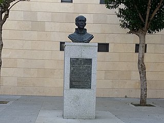
Antonio de San Buenaventura y Olivares or simply Fray Antonio de Olivares was a Spanish Franciscan who officiated at the first Catholic Mass celebrated in Texas, and he was known for contributing to the founding of San Antonio and to the prior exploration of the area. He founded, among other missions, the Alamo Mission in San Antonio, the Presidio San Antonio de Bexar, and the Acequia Madre de Valero.

Architecture in the American city of San Antonio, Texas comes from a wide variety of sources, but many of the city's buildings mostly reflect Texas' Spanish and Mexican roots; with some influence from French builders, among others. Relatively rapid economic growth since the mid twentieth century has led to a fairly wide variety of contemporary architectural buildings.

Mission Nuestra Señora del Espíritu Santo de Zúñiga, also known as Aranama Mission or Mission La Bahía, was a Roman Catholic mission established by Spain in 1722 in the Viceroyalty of New Spain—to convert native Karankawa Indians to Christianity. Together with its nearby military fortress, Presidio La Bahía, the mission upheld Spanish territorial claims in the New World against encroachment from France. The third and final location near Goliad, Texas is maintained now as part of Goliad State Park and Historic Site

Presidio de Béxar was a Spanish fort built near the San Antonio River, located in what is now San Antonio, Texas, in the United States. It was designed for protection of the mission San Antonio de Valero and the Villa de Béjar. The Presidio de Béxar was founded on May 5, 1718 by Spanish colonial official Martín de Alarcón and his party of thirty-five soldiers. The Villa de Béjar is known for being the first Spanish settlement of San Antonio and consisted of the families of the Presidio Soldiers and those of the prior expeditions. It also served to secure Spain's claim to the region against possible encroachment from other European powers.

Dón Antonio Gil Ybarbo (1729–1809), also known as Gil Ybarbo, Gil Ibarbo, and many other name variants, was a pioneering settler of Nacogdoches, Texas. Ambiguously described by the National Park Service as a "prolific trader and smuggler," Gil y'Barbo's contribution to Texas was essential to the well-being of "his people," and a critical element in providing a staging point for the Anglo-American settlers that would follow them.

The Anton Wulff House is located in the San Antonio, Bexar County, Texas. The house has been designated a Recorded Texas Historic Landmark; and is listed on the National Register of Historic Places listings in Bexar County, Texas (NRHP). Wulff House was the headquarters of the San Antonio Conservation Society from 1975 to 2022. The original occupant who commissioned its construction was German immigrant and businessman Anton Wulff. He was a city alderman, San Antonio's first park commissioner, and the man who designed the layout of the city's Alamo Plaza.

Acequia Madre de Valero is an 18th-century agricultural irrigation canal built by the Spanish and located in the Bexar County city of San Antonio in the U.S. state of Texas. When Martín de Alarcón founded San Antonio for Spain by establishing San Antonio de Valero Mission in 1718, Franciscan priest Antonio de Olivares and the Payaya and Pastia peoples, dug Acequia Madre de Valero by hand. It was vital to the missions to be able to divert and control water from the San Antonio River, in order to grow crops and to supply water to the people in the area. This particular acequia was the beginning of a much wider irrigation system. Acequia Madre de Valero ran from the area currently known as Brackenridge Park southward to what is now Hemisfair and South Alamo Street. Part of it that is not viewable by the public runs beneath the Menger Hotel. The acequia was restored in 1968 and that same year was designated a Recorded Texas Historic Landmark.

Mission Dolores State Historic Site (41SA25) is a 36-acre historic site including a 9-acre (3.6 ha) archaeological site listed on the National Register of Historic Places in San Augustine County, Texas that preserves the location of a Franciscan mission originally established in 1721. The site is located on the original El Camino Real de los Tejas trail. The site has no above ground remains of the mission but the mission's location is confirmed through archeological excavations. It is located half a mile south of San Augustine in the Piney Woods region of east Texas. Operated by the Texas Historical Commission, the site includes a campground, museum, gift shop and hiking trails.


