Verney Junction is a hamlet in the parish of Middle Claydon in north Buckinghamshire, England. It is on the route of the former Varsity Line..

Burcott is a hamlet in the parish of Wing(where at the 2011 Census the population was included ), Buckinghamshire, England. Burcott is a common place name in the English language. The place name is Old English and refers to a fortified cottage.
Botley is a hamlet in the civil parish of Chesham, in Buckinghamshire, England.
Botolph Claydon is a hamlet in the civil parish of East Claydon, in Buckinghamshire, England. It is situated about 9 miles (14 km) east of Bicester in Oxfordshire, and 7 miles (11 km) north west of Aylesbury.
Cooks Wharf is a hamlet in the parish of Cheddington, in Buckinghamshire, England. It is located where the main road into Cheddington from Pitstone crosses the Grand Union Canal. At the 2011 Census the population of the area was included in the civil parish of Marsworth.
Crafton is a hamlet in the civil parish of Mentmore, in Buckinghamshire, England.
Ford is a hamlet in the parish of Dinton-with-Ford and Upton, in Buckinghamshire, England. It is located in the south eastern corner of the main parish.

Gibraltar is a hamlet in the parish of Dinton-with-Ford and Upton in Buckinghamshire, England. It is located on the modern main road that links Aylesbury with Thame.
Nash Lee is a hamlet in the parish of Ellesborough, in Buckinghamshire, England. It is located to the north of the village, about two miles west of Wendover.
Westlington is a hamlet near the village of Dinton in the civil parish of Dinton-with-Ford and Upton, Buckinghamshire, England.

Stone is a village in Buckinghamshire, England. It is located southwest of the town of Aylesbury, on the A418 road that links Aylesbury to Thame. Stone with Bishopstone and Hartwell is a civil parish within Aylesbury Vale district and also incorporates the nearby settlements of Bishopstone and Hartwell.
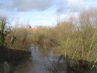
The River Thame is a river in Southern England. It is a tributary of the River Thames.
Aston Mullins is a hamlet in the parish of Dinton, in Buckinghamshire, England. At the 2011 Census the population of the hamlet was included in the civil parish of Dinton-with-Ford and Upton

Wormstone is a hamlet in the parish of Waddesdon, in Buckinghamshire, England. It is located just south-south east of the main village.

Waldridge is an ancient village in the civil parish of Dinton-with-Ford and Upton in Buckinghamshire, England. Although little of the village survives today, the Waldridge Manor in the nearby village of Meadle shows the approximate location of the original settlement of Waldridge Village.
Little Meadle is a hamlet in Buckinghamshire, England. It is part of the civil parish of Longwick-cum-Ilmer and is located between the hamlets of Owlswick and Meadle. It is approximately 5 miles (8.0 km) from Aylesbury and 20 miles (32 km) from Oxford. In addition to the Farm House it consists of a collection of houses built over the past 60 years, and it gained an official name with the Royal Mail in 2004, as well as being mapped with the Ordnance Survey 2006. The term Little Meadle is a relatively new one it has no historical meaning in itself, except that it is close to the village of Meadle and is a small hamlet that was previously known only by the name of the road in which it is situated Stockwell Lane.
Lye Green is a hamlet in the civil parish of Chesham in Buckinghamshire, England. It is located north east of Chesham. Lycrome Road runs through the centre of the hamlet, from the A416 in the east to the B4505 in the west.

Whelpley Hill is a hamlet in the parish of Ashley Green in Buckinghamshire, England. It is located to the east of Chesham, near the border with Hertfordshire and is the site of an Iron Age hillfort.
Bennett End is a hamlet near Radnage and Bledlow Ridge in Buckinghamshire, England. At the 2011 Census the population of the hamlet was included in the civil parish of Lane End.


