This article needs additional citations for verification .(March 2009) |
| Great Horwood | |
|---|---|
 Great Horwood Location within Buckinghamshire | |
| Population | 1,049 (2011 Census) [1] |
| OS grid reference | SP770312 |
| Civil parish |
|
| Unitary authority | |
| Ceremonial county | |
| Region | |
| Country | England |
| Sovereign state | United Kingdom |
| Post town | MILTON KEYNES |
| Postcode district | MK17 |
| Dialling code | 01296 |
| Police | Thames Valley |
| Fire | Buckinghamshire |
| Ambulance | South Central |
| UK Parliament | |
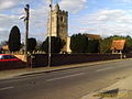
Great Horwood is a small village and civil parish within the unitary authority area of Buckinghamshire, England. At the 2011 Census it had a population of 1,049. It is about five miles ESE of Buckingham, six miles WSW of Milton Keynes.