Related Research Articles

Oxfordshire is a ceremonial county in South East England. The county is bordered by Northamptonshire and Warwickshire to the north, Buckinghamshire to the east, Berkshire to the south, and Wiltshire and Gloucestershire to the west. The city of Oxford is the largest settlement and county town.

Aylesbury is the county town of Buckinghamshire, South East England. It is home to the Roald Dahl Children's Gallery and the Waterside Theatre. It is located in central Buckinghamshire, midway between High Wycombe and Milton Keynes.

Buckingham is a market town in north Buckinghamshire, England, close to the borders of Northamptonshire and Oxfordshire, which had a population of 12,890 at the 2011 Census. The town lies approximately 12 miles (19 km) west of Central Milton Keynes, 19 miles (31 km) south-east of Banbury, and 24 miles (39 km) north-east of Oxford.

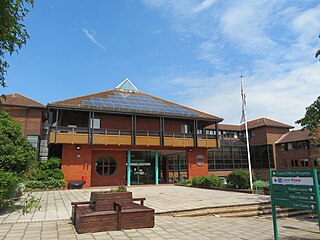
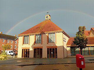
Bierton is a village and civil parish in Buckinghamshire, England, about half a mile northeast of the town of Aylesbury. It is mainly a farming parish. Together with the hamlets of Broughton, Kingsbrook, Broughton Crossing and Burcott it historically formed the civil parish of Bierton with Broughton within Aylesbury Vale district and form part of the Aylesbury Urban Area, but in 2020 the parish was broken into three, with Bierton becoming its own parish.

Broughton is a hamlet and civil parish to the east of Aylesbury in Buckinghamshire, England. Broughton is also the name of a nearby housing estate in Aylesbury itself.
Shenley Brook End is a village, district and wider civil parish in Milton Keynes, Buckinghamshire, England, located about 2 miles (3.2 km) north-west of Bletchley, and 2.5 miles (4.0 km) south-west of Central Milton Keynes. Together with its neighbouring districts of Shenley Church End, Shenley Wood and Shenley Lodge, the districts are collectively known as "The Shenleys".

Stone is a village and former civil parish, now in the parish of Stone with Bishopstone and Hartwell, in Buckinghamshire, England. It is located southwest of the town of Aylesbury, on the A418 road that links Aylesbury to Thame. Stone with Bishopstone and Hartwell is a civil parish within Buckinghamshire district and also incorporates the nearby settlements of Bishopstone and Hartwell.

Water Eaton is an area of Milton Keynes, Buckinghamshire, England and in the civil parish of Bletchley and Fenny Stratford. It is to the south of, and contiguous with, Fenny Stratford. It is one of the ancient Buckinghamshire villages that became incorporated as part of Milton Keynes in 1967.

Weedon is a village and civil parish north of Aylesbury and south of Hardwick in the Aylesbury Vale district of Buckinghamshire, England. The toponym is derived from the Old English for "hill with a heathen temple". In records dated 1066 the village was recorded as Weodune.
Chiltern District was one of four local government districts of Buckinghamshire in south central England from 1974 to 2020. It was named after the Chiltern Hills on which the region sits.

Epsom and Ewell is a local government district with borough status in Surrey, England, covering the towns of Epsom and Ewell. The borough lies just outside the administrative boundary of Greater London, but it is entirely within the M25 motorway which encircles London. Many of the borough's urban areas form part of the wider Greater London Built-up Area.

Bushey is a town in the Hertsmere borough of Hertfordshire in the East of England. It had a population of 25,328 in the 2011 census, rising to 28,416 in the 2021 census, an increase of 12.19%. This makes Bushey the second most populated town in Hertsmere. Bushey Heath is a large neighbourhood south east of Bushey on the boundary with the London Borough of Harrow reaching elevations of 165 metres (541 ft) above sea level.

Three Rivers is a local government district in south-west Hertfordshire, England. Its council is based in Rickmansworth. The district borders Hertsmere, Watford, St Albans, Dacorum, Buckinghamshire, and the London boroughs of Hillingdon and Harrow.

Toddington is a large village and civil parish in the county of Bedfordshire, England. It is situated 5 miles north-north-west of Luton, 4 miles (6 km) north of Dunstable, 6 miles (10 km) south-west of Woburn, and 35 miles north-north-west of London on the B5120 and B579. It is 0.5 miles from Junction 12 of the M1 motorway and lends its name to the nearby motorway service station. The hamlet of Fancott also forms part of the Toddington civil parish.

Fairford Leys is a housing development in Aylesbury, Buckinghamshire, England, designed in the urban village style, with the street and block layout making it more friendly to pedestrians and cyclists. The three main developers of the development were bound by a design code to ensure architectural cohesion and this is maintained through covenants on the deeds of each property.

Sedrup is a hamlet in Buckinghamshire, England. It is located south west of the town of Aylesbury, close to the villages of Stone, Bishopstone and Hartwell which also provide the name of the civil parish within which Sedrup lies.
Wixams is a new town and civil parish located in Bedfordshire, England, which has been under construction since early 2007. It is expected to become the third largest settlement in the Borough of Bedford after Bedford itself and Kempston, and one of the largest new settlements founded in England since the British new towns movement of the first twenty five years after World War II.

Leighton-Linslade was an urban district in Bedfordshire, England from 1965 to 1974.

Wichelstowe is a residential development and urban extension on the southern edge of the town of Swindon in South West England, constructed from late 2006. Located north of the M4 motorway between junction 16 and Croft Road, Wichelstowe has three neighbourhoods: East, Middle and West Wichel. The development will comprise up to 4500 homes, employment space, public open space, shopping, community facilities for residents and various schools. In 2014 it was described as the country's largest housing project on public-owned land.
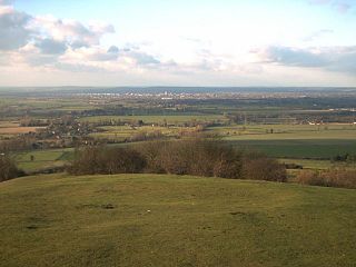
The Aylesbury Vale is a geographical region in Buckinghamshire, England, which is bounded by the City of Milton Keynes and West Northamptonshire to the north, Central Bedfordshire and the Borough of Dacorum (Hertfordshire) to the east, the Chiltern Hills to the south and South Oxfordshire to the west. It is named after Aylesbury, the county town of Buckinghamshire. Winslow and Buckingham are among the larger towns in the vale.
References
- ↑ Buckinghamshire Council https://www.buckinghamshire.gov.uk/news/new-kingsbrook-parish-council-seeks-first-councillors/
- ↑ "Continued Success of Flagship Development as Second Village at Kingsbrook launches". Wendover News. 2019-05-13. Retrieved 2024-01-11.
- ↑ "New secondary school opens with professional boxers cutting the ribbon". Bucks Free Press. 2022-10-05. Retrieved 2024-01-11.
- ↑ "Home | Kingsbrook Parish Council | United Kingdom". Kingsbrook PC. Retrieved 2024-01-11.
51°49′30″N0°46′37″W / 51.825°N 0.777°W
