Aylesbury is the county town of Buckinghamshire, South East England. It is home to the Roald Dahl Children's Gallery and the Waterside Theatre. It is located in central Buckinghamshire, midway between High Wycombe and Milton Keynes.

The Chiltern Hills are a chalk escarpment in the UK northwest of London, covering 660 square miles (1,700 km2) across Oxfordshire, Buckinghamshire, Hertfordshire, and Bedfordshire, stretching 45 miles (72 km) from Goring-on-Thames in the southwest to Hitchin in the northeast. The hills are 12 miles (19 km) at their widest.
Aston Clinton is a historic village and civil parish in the Vale of Aylesbury in Buckinghamshire, England. The village lies at the foot of the Chiltern Hills, between the Wendover and Aylesbury arms of the Grand Union Canal. Surrounding towns include Wendover to the south, Aylesbury to the west, and Tring to the east - across the nearby county border with Hertfordshire.

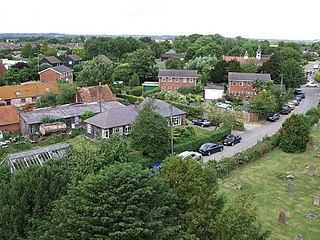
Bierton is a village and civil parish in Buckinghamshire, England, about half a mile northeast of the town of Aylesbury. It is mainly a farming parish. Together with the hamlets of Broughton, Kingsbrook, Broughton Crossing and Burcott it historically formed the civil parish of Bierton with Broughton within Aylesbury Vale district and form part of the Aylesbury Urban Area, but in 2020 the parish was broken into three, with Bierton becoming its own parish.

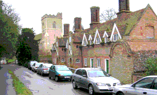
Wendover is a town and civil parish at the foot of the Chiltern Hills in Buckinghamshire, England. It is situated at the point where the main road across the Chilterns between London and Aylesbury intersects with the once important road along the foot of the Chilterns. The town is some 35 miles (56 km) north west of London and 5 miles (8 km) south east of Aylesbury.
Quainton is a village and civil parish in Buckinghamshire, England, 7 miles (11 km) north-west of Aylesbury. The population of the civil parish at the 2011 Census was 1,295. The village has two churches, a school and one public house. The location means that while many commute to London, others are employed in neighbouring towns and villages.

Haddenham is a village and civil parish in west Buckinghamshire, England. It is about 5 miles (8 km) south-west of Aylesbury and 4 miles (6 km) north-east of Thame in neighbouring Oxfordshire. At the 2011 Census, the population of the civil parish was 4,502.

Bletchley is a constituent town of Milton Keynes, Buckinghamshire, England. It is situated in the south-west of the city, and is split between the civil parishes of Bletchley and Fenny Stratford and West Bletchley.

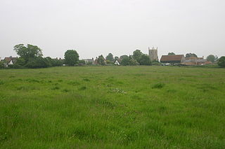
Fleet Marston is a civil parish and deserted medieval village in the Aylesbury Vale district of Buckinghamshire, England, about 2.5 miles (4 km) northwest of the centre of Aylesbury. The parish measures about 2.5 miles (4 km) north – south, but east – west it is nowhere more than about 3⁄4 mile (1.2 km) wide. It is bounded to the southeast by the River Thame, to the east by a stream that joins the Thame, and to the west by field boundaries. It has an area of 934 acres (378 ha).

Hawridge is a small village in the Chilterns in the county of Buckinghamshire, England and bordering the county boundary with Hertfordshire. It is 3 miles (4.8 km) from Chesham, 4 miles (6.4 km) from both Tring and Berkhamsted. Hawridge is one of four villages making up Cholesbury-cum-St Leonards, a civil parish within Chiltern District.
Marsh Gibbon is a village and civil parish in Buckinghamshire, England. It is close to the A41 and the border with Oxfordshire about 4 miles (6.4 km) east of Bicester.
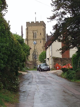
Whitchurch is a village and civil parish in the unitary authority area of Buckinghamshire, England. The village is on the A413 road about 4 miles (6.4 km) north of Aylesbury and 4.5 miles (7 km) south of Winslow. The 2011 Census recorded a parish population of 932.
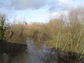
The River Thame is a river in Southern England. A tributary of the River Thames, the river runs generally south-westward for about 40 mi (64 km) from its source above the Buckinghamshire town of Aylesbury to the Thames in south-east Oxfordshire.

Aylesbury railway station is a railway station in Aylesbury, Buckinghamshire, England, on the London–Aylesbury line from London Marylebone via Amersham. It is 38 miles (61 km) from Aylesbury to Marylebone. A branch line from Princes Risborough on the Chiltern Main Line terminates at the station. It was the terminus for London Underground's Metropolitan line until the service was cut back to Amersham in 1961. The station was also known as Aylesbury Town under the management of British Railways from c. 1948 until the 1960s.

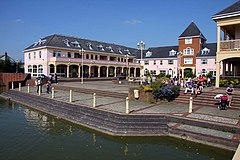
Fairford Leys is a housing development in Aylesbury, Buckinghamshire, England, designed in the urban village style, with the street and block layout making it more friendly to pedestrians and cyclists. The three main developers of the development were bound by a design code to ensure architectural cohesion and this is maintained through covenants on the deeds of each property.
The Aylesbury Vale Academy, formerly Quarrendon School, was Buckinghamshire's first Academy. It is a Church of England Academy with the Anglican Diocese of Oxford as the primary sponsor and Buckinghamshire Council as a co-sponsor.

Aylesbury Vale Parkway railway station is a railway station serving villages northwest of Aylesbury, England. It also serves the Berryfields and Weedon Hill housing developments north of the town. The station and all trains serving it are operated by Chiltern Railways.

Buckingham Park is a suburban residential neighbourhood contiguous with the north-west edge of Aylesbury, Buckinghamshire, England. It is currently the location of major housing developments on two sites known originally as Weedon Hill and Berryfields. Buckingham Park is also the name of the civil parish, part of Aylesbury Vale District Authority. The neighbourhood is close to the River Thame.
Newton Leys is a district that covers the southern tip of Bletchley and straddles the boundary between the City of Milton Keynes and the rest of Buckinghamshire. The larger fraction of Newton Leys lies within Milton Keynes and forms a part of Bletchley and Fenny Stratford civil parish. It is separated from central Bletchley, Water Eaton and the Lakes Estate by the West Coast Main Line. The remaining fraction of Newton Leys lies within the (former) Aylesbury Vale district and forms a part of the Stoke Hammond civil parish, although the village of Stoke Hammond is situated on the other side of the A4146
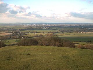
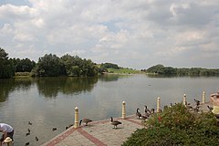
The Aylesbury Vale is a geographical region in Buckinghamshire, England, which is bounded by the City of Milton Keynes and West Northamptonshire to the north, Central Bedfordshire and the Borough of Dacorum (Hertfordshire) to the east, the Chiltern Hills to the south and South Oxfordshire to the west. It is named after Aylesbury, the county town of Buckinghamshire. Winslow and Buckingham are among the larger towns in the vale.