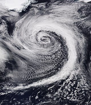
In meteorology, a cyclone is a large air mass that rotates around a strong center of low atmospheric pressure, counterclockwise in the Northern Hemisphere and clockwise in the Southern Hemisphere as viewed from above. Cyclones are characterized by inward-spiraling winds that rotate about a zone of low pressure. The largest low-pressure systems are polar vortices and extratropical cyclones of the largest scale. Warm-core cyclones such as tropical cyclones and subtropical cyclones also lie within the synoptic scale. Mesocyclones, tornadoes, and dust devils lie within the smaller mesoscale. Upper level cyclones can exist without the presence of a surface low, and can pinch off from the base of the tropical upper tropospheric trough during the summer months in the Northern Hemisphere. Cyclones have also been seen on extraterrestrial planets, such as Mars, Jupiter, and Neptune. Cyclogenesis is the process of cyclone formation and intensification. Extratropical cyclones begin as waves in large regions of enhanced mid-latitude temperature contrasts called baroclinic zones. These zones contract and form weather fronts as the cyclonic circulation closes and intensifies. Later in their life cycle, extratropical cyclones occlude as cold air masses undercut the warmer air and become cold core systems. A cyclone's track is guided over the course of its 2 to 6 day life cycle by the steering flow of the subtropical jet stream.

A subtropical cyclone is a weather system that has some characteristics of both tropical and an extratropical cyclone.
The North Atlantic Oscillation (NAO) is a weather phenomenon over the North Atlantic Ocean of fluctuations in the difference of atmospheric pressure at sea level (SLP) between the Icelandic Low and the Azores High. Through fluctuations in the strength of the Icelandic Low and the Azores High, it controls the strength and direction of westerly winds and location of storm tracks across the North Atlantic.

A high-pressure area, high, or anticyclone, is an area near the surface of a planet where the atmospheric pressure is greater than the pressure in the surrounding regions. Highs are middle-scale meteorological features that result from interplays between the relatively larger-scale dynamics of an entire planet's atmospheric circulation.

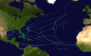
The 1992 Atlantic hurricane season was a significantly below average season in which only ten tropical or subtropical cyclones formed. Six became named tropical storms, of which four became hurricanes. Among the four was Hurricane Andrew, a major hurricane, and the costliest Atlantic hurricane on record at the time, surpassing Hugo of 1989. The season officially started on June 1 and officially ended on November 30. However, tropical cyclogenesis is possible at any time of the year, as demonstrated by formation in April of an unnamed subtropical storm in the central Atlantic. A June tropical depression caused flooding in Cuba and in Florida, where two people were killed. In August, Andrew struck the Bahamas, Florida, and Louisiana. In all, it caused $27.3 billion in damage, mostly in Florida, as well as 65 fatalities. The greatest impact was in South Florida, where the storm made landfall with 1-minute sustained winds of 175 mph (280 km/h).

The 1973 Atlantic hurricane season was the first season to use the Saffir–Simpson hurricane scale, a scale developed in 1971 by Herbert Saffir and Robert Simpson to rate the intensity of tropical cyclones. The season produced 24 tropical and subtropical cyclones, of which only 8 reached storm intensity, 4 became hurricanes, and only 1 reached major hurricane status. Although more active than the 1972 season, 1973 brought few storms of note. Nearly half of the season's storms affected land, one of which resulted in severe damage.

The 1976 Atlantic hurricane season was an above average Atlantic hurricane season in which 21 tropical or subtropical cyclones formed. 10 of them became nameable storms. Six of those reached hurricane strength, with two of the six became major hurricanes, which are Category 3 or higher on the Saffir–Simpson scale. The season officially began on June 1 and lasted until November 30. These dates conventionally delimit the period of each year when most tropical cyclones form in the Atlantic basin. However, the first system, a subtropical storm, developed in the Gulf of Mexico on May 21, several days before the official start of the season. The system spawned nine tornadoes in Florida, resulting in about $628,000 (1976 USD) in damage, though impact was minor otherwise.

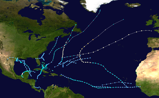
The 1978 Atlantic hurricane season was a slightly above average hurricane season in terms of number of named storms. Eleven tropical cyclones were named in all, and five of these became hurricanes; two of the five became a major hurricane. This was also the last Atlantic hurricane season to use an all-female naming list. The season officially began on June 1, 1978, and ended on November 30, 1978. These dates, adopted by convention, denote the period in each year when most tropical cyclogenesis occurs in the Atlantic basin. However, the formation of subtropical or tropical cyclones is possible at any time of the year, as shown by the formation of an unnamed subtropical storm on January 18.

A tropical wave, in and around the Atlantic Ocean, is a type of atmospheric trough, an elongated area of relatively low air pressure, oriented north to south, which moves from east to west across the tropics, causing areas of cloudiness and thunderstorms. Tropical waves form in the easterly flow along the equatorial side of the subtropical ridge or belt of high air pressure which lies north and south of the Intertropical Convergence Zone (ITCZ). Tropical waves are generally carried westward by the prevailing easterly winds along the tropics and subtropics near the equator. They can lead to the formation of tropical cyclones in the north Atlantic and northeastern Pacific basins. A tropical wave study is aided by Hovmöller diagrams, a graph of meteorological data.

The 2005 Atlantic hurricane season was the second-most active Atlantic hurricane season in history, with it being the most active until the record was broken 15 years later in 2020. The season broke numerous records at the time, with 28 tropical or subtropical storms recorded. The United States National Hurricane Center named 27 storms, exhausting the annual pre-designated list and resulting in the usage of six Greek letter names, and also identified an additional unnamed storm during a post-season re-analysis. A record 15 storms attained hurricane status, with maximum sustained winds of at least 74 miles per hour (119 km/h); of those, a record seven became major hurricanes, which are a Category 3 or higher on the Saffir–Simpson scale. Four storms of this season became Category 5 hurricanes, the highest ranking on the scale.

The 1929 Atlantic hurricane season was among the least active Atlantic hurricane seasons on record, with only five tropical cyclones forming. Three of them intensified into a hurricane, with one strengthening further into a major hurricane. The first tropical cyclone of the season developed in the Gulf of Mexico on June 27. Becoming a hurricane on June 28, the storm struck Texas, bringing strong winds to a large area. Three fatalities were reported, while damage was conservatively estimated at $675,000 (1929 USD).

The 1912 Atlantic hurricane season was an average hurricane season that featured the first recorded November major hurricane. There were eleven tropical cyclones, seven of which became tropical storms; four of those strengthened into hurricanes, and one reached major hurricane intensity. The season's first cyclone developed on April 4, while the final dissipated on November 21. The season's most intense and most devastating tropical cyclone was the final storm, known as the Jamaica hurricane. It produced heavy rainfall on Jamaica, leading to at least 100 fatalities and about $1.5 million (1912 USD) in damage. The storm was also blamed for five deaths in Cuba.

An Atlantic hurricane, also known as a tropical storm or simply a hurricane, is a tropical cyclone that forms in the Atlantic Ocean, primarily between the months of June and November. A hurricane differs from a cyclone or typhoon only on the basis of location. A hurricane is a storm that occurs in the Atlantic Ocean and northeastern Pacific Ocean, a typhoon occurs in the northwestern Pacific Ocean, and a cyclone occurs in the South Pacific Ocean or Indian Ocean.

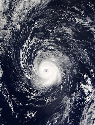
Hurricane Kate was a long-lived and erratic tropical cyclone that caused minor impacts across the Atlantic Ocean from late September to early October 2003. The sixteenth tropical cyclone, eleventh tropical storm, seventh hurricane, and third major hurricane of the 2003 Atlantic hurricane season, Kate developed from a tropical wave in the central tropical Atlantic on September 25. Its unusual track included four major changes in direction. The storm moved northwestward until a weakness in the subtropical ridge forced it eastward. Kate strengthened to a hurricane, turned sharply westward while moving around a mid-level low, and intensified to a 125 mph (201 km/h) major hurricane on October 4. Kate turned sharply northward around the periphery of an anticyclone, weakened, and became extratropical after passing to the east of Newfoundland. The extratropical storm persisted for three days until losing its identity near Scandinavia.

Tropical cyclogenesis is the development and strengthening of a tropical cyclone in the atmosphere. The mechanisms through which tropical cyclogenesis occurs are distinctly different from those through which temperate cyclogenesis occurs. Tropical cyclogenesis involves the development of a warm-core cyclone, due to significant convection in a favorable atmospheric environment.

Extratropical cyclones, sometimes called mid-latitude cyclones or wave cyclones, are low-pressure areas which, along with the anticyclones of high-pressure areas, drive the weather over much of the Earth. Extratropical cyclones are capable of producing anything from cloudiness and mild showers to severe gales, thunderstorms, blizzards, and tornadoes. These types of cyclones are defined as large scale (synoptic) low pressure weather systems that occur in the middle latitudes of the Earth. In contrast with tropical cyclones, extratropical cyclones produce rapid changes in temperature and dew point along broad lines, called weather fronts, about the center of the cyclone.

A tropical cyclone is a rapidly rotating storm system characterized by a low-pressure center, a closed low-level atmospheric circulation, strong winds, and a spiral arrangement of thunderstorms that produce heavy rain and squalls. Depending on its location and strength, a tropical cyclone is referred to by different names, including hurricane, typhoon, tropical storm, cyclonic storm, tropical depression, or simply cyclone. A hurricane is a strong tropical cyclone that occurs in the Atlantic Ocean or northeastern Pacific Ocean, and a typhoon occurs in the northwestern Pacific Ocean. In the Indian Ocean, South Pacific, or (rarely) South Atlantic, comparable storms are referred to as "tropical cyclones", and such storms in the Indian Ocean can also be called "severe cyclonic storms".

Hurricane Arlene was a long-lived tropical cyclone that moved eastward in an erratic fashion in the northern Atlantic Ocean in mid-August 1987. The first named storm of the 1987 Atlantic hurricane season, Arlene formed out of an area of low pressure associated with a decaying frontal system along the North Carolina coastline, Arlene tracked in a general eastward direction across the Atlantic Ocean, taking an erratic track with several curves. On August 13, the storm brushed Bermuda as a weak tropical storm before continuing out to sea. On August 20, the storm briefly stalled before becoming a hurricane two days later. Early on August 24, the storm transitioned into an extratropical cyclone over the far north Atlantic before curving southeast and dissipating near the Iberian Peninsula on August 26.

Hurricane Alex was the first Atlantic hurricane to occur in January since Hurricane Alice of 1954–55. Alex originated as a non-tropical low near the Bahamas on January 7, 2016. Initially traveling northeast, the system passed by Bermuda on January 8 before turning southeast and deepening. It briefly acquired hurricane-force winds by January 10, then weakened slightly before curving towards the east and later northeast. Acquiring more tropical weather characteristics over time, the system transitioned into a subtropical cyclone well south of the Azores on January 12, becoming the first North Atlantic tropical or subtropical cyclone in January since Tropical Storm Zeta of 2005–2006. Alex continued to develop tropical features while turning north-northeast, and transitioned into a fully tropical cyclone on January 14. The cyclone peaked in strength as a Category 1 hurricane on the Saffir–Simpson scale (SSHWS), with maximum sustained winds of 85 mph and a central pressure of 981 mbar. Alex weakened to a high-end tropical storm before making landfall on Terceira Island on January 15. By that time, the storm was losing its tropical characteristics; it fully transitioned back into a non-tropical cyclone several hours after moving away from the Azores. Alex ultimately merged with another cyclone over the Labrador Sea on January 17.
Centers of action are extensive and almost stationary low or high pressure areas which control the movement of atmospheric disturbances over a large area. This does not mean that the position of the center is constant over a specific area but that the monthly atmospheric pressure corresponds to a high or a low pressure.


