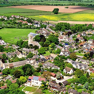
Oxfordshire is a ceremonial county in South East England. The county is bordered by Northamptonshire and Warwickshire to the north, Buckinghamshire to the east, Berkshire to the south, and Wiltshire and Gloucestershire to the west. The city of Oxford is the largest settlement and county town.
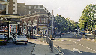
Chalk Farm is a small urban district of north west London, lying immediately north of Camden Town, in the London Borough of Camden.

Regent's Park is one of the Royal Parks of London. It occupies 410 acres (170 ha) in north-west Inner London, administratively split between the City of Westminster and the Borough of Camden. In addition to its large central parkland and ornamental lake, it contains various structures and organizations both public and private, generally on its periphery, including Regent's University and London Zoo.
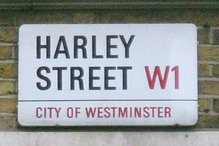
Harley Street is a street in Marylebone, Central London, named after Edward Harley, 2nd Earl of Oxford and Earl Mortimer. Since the 19th century it has housed a large number of private specialists in medicine and surgery.

Primrose Hill is a Grade II listed public park located north of Regent's Park in London, England, first opened to the public in 1842. It was named after the 64 metres (210 ft) natural hill in the centre of the park, one of the highest natural points in the London Borough of Camden. The hill summit has a clear view of central London, as well as Hampstead and Belsize Park to the north and is adorned by an engraved quotation from William Blake. Based on the popularity of the park, the surrounding district and electoral ward were named Primrose Hill. The Primrose Hill district is in the London Borough of Camden, England.
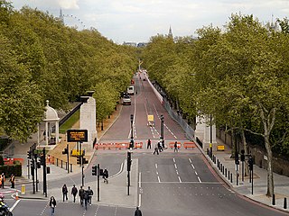
Constitution Hill is a road in the City of Westminster in London. It connects the western end of The Mall with Hyde Park Corner, and is bordered by Buckingham Palace Gardens to the south, and Green Park to the north. At the top of the rise in the roadway at the Corner is the Wellington Arch, near where the road is flanked by the Memorial Gates war memorial.

Dr Johnson's House is a writer's house museum in London in the former home of the 18th-century English writer and lexicographer Samuel Johnson. The house is a Grade I listed building.
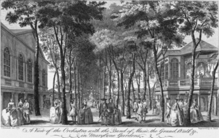
Marylebone Gardens or Marybone Gardens was a London pleasure garden sited in the grounds of the old manor house of Marylebone and frequented from the mid-17th century, when Marylebone was a village separated from London by fields and market gardens, to the third quarter of the 18th century.

Caledonian Road in the London Borough of Islington, England, connects North London, from Camden Road near its junction with Holloway Road, and central London's Pentonville Road in the south. A a mile and a half long, it is known colloquially as the Cally and forms the entirety of the A5203.

Vigo Street is a short street in central London that is named after the Anglo-Dutch naval victory over the French and Spanish in the 1702 Battle of Vigo Bay. It has important literary connections.
London Past and Present: Its History, Associations, and Traditions by Henry B. Wheatley is a topographical and historical dictionary of London streets and landmarks, published by John Murray in 1891, that is still regarded as a definitive work in its area. Wheatley's work was based upon The Handbook of London by Peter Cunningham, published 1849, as well as literary, architectural and historical sources.
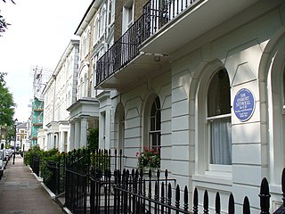
Carlyle Square is a garden square off the King's Road in London's Chelsea district, SW3. The square was laid out on market gardens and was originally called Oakley Square. It was later named in honour of the writer Thomas Carlyle in 1872.

The Greene Man is a public house in London's Euston Road. It was formerly known as the Green Man and before that, the Farthing Pie House or Pye House as mutton pies could be bought there for a farthing. When it was established in the 18th century, the area was rural and so the surroundings were farm fields and pleasure gardens. The place was then frequented by notable artists and writers including William Blake and Richard Wilson.

Primrose Hill is a district in the London Borough of Camden, England.
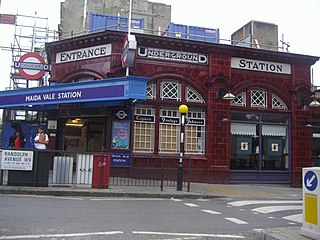
Randolph Avenue is a street in Maida Vale in London. Located in the City of Westminster, it is a long avenue running from north to south. The southern end is located in Little Venice near to the Paddington branch of the Grand Union Canal. The street runs northwards, crossing Clifton Gardens, Sutherland Avenue, Elgin Avenue and Carlton Vale. The road then continues as Randolph Gardens until it meets Kilburn Park Road. The Edgware Road runs directly parallel to Randolph Avenue to the east.

Warrington Crescent is a street in Maida Vale in London. Located in the City of Westminster, it is a crescent curving north eastwards from Warwick Avenue until it reaches a roundabout where it meets including Randolph Avenue, Sutherland Avenue and Lauderdale Road. Warrington Gardens and Formosa Street both lead westwards off Warrington Crescent.

Gloucester Avenue is a street in the Primrose Hill area of London, England. Located in the London Borough of Camden, it is a residential road featuring many nineteenth century properties including several pubs as well as the neo-Georgian Cecil Sharp House. For much of its route it runs adjacent to the West Coast Main Line out of Euston Station.

Regent's Park Road is a street in the Primrose Hill area of London, England. Located in the London Borough of Camden, it runs in a curving crescent shape. For some of its route it follows alongside the eastern edge of Primrose Hill park and also includes the commercial centre of the area. Despite its name the street does not run as far as Regent's Park although the adjacent Prince Albert Road does.

Arlington Road is a street running between Mornington Crescent and Camden Town in the London Borough of Camden, England. It runs south to north, directly parallel to Camden High Street to its east. It is crossed by Inverness Street, Parkway and Delancey Street. It is near Gloucester Crescent. It is mainly residential, with a few commercial properties.

Adelaide Road is a street in London running east to west between Chalk Farm and Swiss Cottage. Located in the London Borough of Camden it is part of the longer B509 route which continues as Belsize Road through South Hampstead. The Belsize Park area of Hampstead is to its north while Primrose Hill is to the south. It runs parallel to Fellows Road and Eton Avenue. Along its route it meets or is crossed by several streets including Primrose Hill Road and Avenue Road. At its eastern end is Chalk Farm tube station at the junction with Haverstock Hill, which opened in 1907. It takes its name from Queen Adelaide, wife of William IV.


