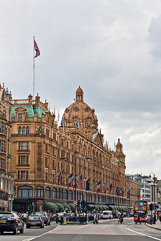
Knightsbridge is a residential and retail district in central London, south of Hyde Park. It is identified in the London Plan as one of two international retail centres in London, alongside the West End. Knightsbridge is also the name of the roadway which runs near the south side of Hyde Park from Hyde Park Corner.

Fulham is an area of the London Borough of Hammersmith & Fulham in West London, England, 3.6 miles (5.8 km) southwest of Charing Cross. It lies on the north bank of the River Thames, bordering Hammersmith, Kensington and Chelsea. The area faces Wandsworth, Putney, Barn Elms and the London Wetland Centre in Barnes. on the far side of the river.
Earl's Court is a district of Kensington in the Royal Borough of Kensington and Chelsea in West London, bordering the rail tracks of the West London line and District line that separate it from the ancient borough of Fulham to the west, the sub-districts of South Kensington to the east, Chelsea to the south and Kensington to the northeast. It lent its name to the now defunct eponymous pleasure grounds opened in 1887 followed by the pre–World War II Earls Court Exhibition Centre, as one of the country's largest indoor arenas and a popular concert venue, until its closure in 2014.
South Kensington is a district just west of Central London in the Royal Borough of Kensington and Chelsea. Historically it settled on part of the scattered Middlesex village of Brompton. Its name was supplanted with the advent of the railways in the late 19th century and the opening and naming of local tube stations. The area has many museums and cultural landmarks with a high number of visitors, such as the Natural History Museum, the Science Museum and the Victoria and Albert Museum. Adjacent affluent centres such as Knightsbridge, Chelsea and Kensington, have been considered as some of the most exclusive real estate in the world.

Old Brompton Road is a major street in the South Kensington district of The Royal Borough of Kensington and Chelsea, London.

Brompton Oratory is a large neo-classical Roman Catholic church in the Knightsbridge area of the Royal Borough of Kensington and Chelsea, London. Its full name is the Church of the Immaculate Heart of Mary, or as named in its Grade II* architectural listing, The Oratory. The church is closely connected with the London Oratory School, a school founded by the priests from the London Oratory. Its priests celebrate Mass daily in both the Ordinary and Extraordinary forms, frequently conduct ceremonies for well-known people, as it works as an extra-parochial church. There are three choirs at the church.
West Kensington, formerly North End, is an area in the ancient parish of Fulham, in the London Borough of Hammersmith and Fulham, England, 3.4 miles (5.5 km) west of Charing Cross. It covers most of the London postal area of W14, including the area around Barons Court tube station, and is defined as the area between Lillie Road and Hammersmith Road to the west, Fulham Palace Road to the south, Hammersmith to the north and West Brompton and Earl's Court to the east. The area is bisected by the major London artery the A4, locally known as the Talgarth Road. Its main local thoroughfare is the North End Road.
Brompton, sometimes called Old Brompton, survives in name as a ward in the Royal Borough of Kensington and Chelsea in London. Until the latter half of the 19th century it was a scattered village made up mostly of market gardens in the county of Middlesex. It lay south-east of the village of Kensington, abutting the parish of St Margaret's, Westminster at the hamlet of Knightsbridge to the north-east, with Little Chelsea to the south. It was bisected by the Fulham Turnpike, the main road westward out of London to the ancient parish of Fulham and on to Putney and Surrey. It saw its first parish church, Holy Trinity Brompton, only in 1829. Today the village has been comprehensively eclipsed by segmentation due principally to railway development culminating in London Underground lines, and its imposition of station names, including Knightsbridge, South Kensington and Gloucester Road as the names of stops during accelerated urbanisation, but lacking any cogent reference to local history and usage or distinctions from neighbouring settlements.
West Brompton is an area of west London, England, that straddles the boundary between the London Borough of Hammersmith and Fulham and Royal Borough of Kensington and Chelsea. The centuries-old boundary was traced by Counter's Creek, now lost beneath the West London Line railway.

Cadogan Group Limited and its subsidiaries, including Cadogan Estates Limited, are British property investment and management companies that are owned by the Cadogan family, one of the richest families in the United Kingdom. They also hold the titles of Earl Cadogan and Viscount Chelsea, the latter used as a courtesy title by the Earl's eldest son. The Cadogan Group is the main landlord in the west London districts of Chelsea and Knightsbridge, and it is now the second largest of the surviving aristocratic Freehold Estates in Central London, after the Duke of Westminster's Grosvenor Estate, to which it is adjacent, covering Mayfair and Belgravia.

The Pride of Spitalfields is a public house at 3 Heneage Street in Spitalfields in the East End of London, just off Brick Lane. It was associated with a Jack the Ripper suspect.

The Flora, also known as The Flora Hotel, is a pub at 525 Harrow Road, Kensal Green, London W10. It backs onto the Grand Union Canal. It is a Taylor Walker pub.

The Goat is a public house in Kensington, London, at 3a Kensington High Street, which dates back to 1695. It is where the English serial killer John George Haigh, the "Acid Bath Murderer", met his first victim.
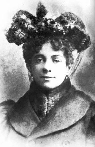
Hannah Harriet Pedlingham Chaplin, also known by the stage name Lily Harley, was an English actress, singer and dancer who performed in British music halls from the age of 16.
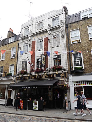
The Two Brewers is a pub in Covent Garden, London, at 40 Monmouth Street.
The Mercers' Arms was a pub at 17 Mercer Street, in London's Covent Garden, at the corner with Shelton Street. It closed as a pub in about 1973, and is now a private dining club.

The Markham Arms is a former pub at 138 King's Road, London SW3. It closed as a pub in the early 1990s, and is now a branch of the Santander bank.
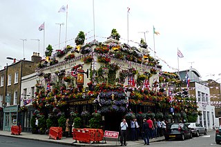
The Churchill Arms is a public house at 119 Kensington Church Street on the corner with Campden Street, Notting Hill, London. There has been a pub on the site since at least the late nineteenth century. Previously known as the "Church-on-the-Hill", the pub received its current name after the Second World War. It is known for its exuberant floral displays, and extravagant Christmas displays in the winter, and has been described as London's most colourful pub.

Warwick Road is located in the Earl's Court district of the Royal Borough of Kensington & Chelsea in London. The road began to be laid out around 1822 and was gradually extended south to Old Brompton Road over a number of decades. It is a major north–south traffic route in west London.


