Yermo is an unincorporated community in the Mojave Desert in San Bernardino County, California. It is 13 miles (21 km) east of Barstow on Interstate 15, just south of the Calico Mountains. Its population was an estimated 1,750 in 2009.
Caliente is an unincorporated community in Kern County, California. It is located 22 miles (35 km) east-southeast of Bakersfield, at an elevation of 1,312 feet (400 m).
Oro Grande is an unincorporated community in the Mojave Desert of San Bernardino County, California, United States. It lies on the city boundary of Victorville and Adelanto. It is at 3,000 feet (910 m) elevation in Victor Valley north of the San Bernardino mountain range. It is located on old Route 66 near Interstate 15 between Victorville and Barstow. The ZIP code is 92368 and the community is inside area codes 442 and 760. Less than 1,000 residents live in the unincorporated area.

Lytle Creek is a census-designated place in the San Gabriel Mountains, within San Bernardino County.
Sugarloaf is an unincorporated community residential area less than a mile south of Big Bear City and 8 miles from the eastern tip of Big Bear Lake in the San Bernardino Mountains of San Bernardino County, California. The area is primarily residential with a convenience store and a post office located at the center of the community. The residential area is set at an elevation of 7,096 feet at its center, whereas its extreme northern border is 6,998 feet above sea level and the southern tip sits at 7,218 feet above sea level. There is no municipal organization for the area, and all fire, water, and police service is provided by San Bernardino County. The ZIP code for the community is 92386, the area code 909, and the population is 1,816. Big Bear High School is located in the northern part of the community.

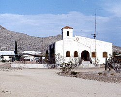
Chambless is a ghost town in the Mojave Desert of San Bernardino County, California, United States, south of Interstate 40 on the historic Route 66.

Earp, California is an unincorporated community in San Bernardino County in the Sonoran Desert close to the California/Arizona state line at the Colorado River in Parker Valley.

Gold Run was a former mining town of the California Gold Rush, located in Placer County, California.
Mount Baldy or Mount Baldy Village, formerly Camp Baynham and Camp Baldy, is an unincorporated community in the San Gabriel Mountains, in San Bernardino County near the eastern border of Los Angeles County, in Southern California. It is located below Mount San Antonio, commonly known as "Mount Baldy", hence its name.
Guasti, formerly known as South Cucamonga and Zucker, is a formerly unincorporated community in the Cucamonga Valley region of the Pomona Valley, in southwestern San Bernardino County, California. It has since been annexed into the city of Ontario. It is located 3.5 miles (5.6 km) east of downtown Ontario and near the Ontario International Airport.
Belleville, California was a gold mining boomtown in the San Bernardino Mountains of San Bernardino County, California. The settlement grew up rapidly following the discovery of gold by William F. Holcomb in Holcomb Valley early 1860. Which helped the town challenge the seat of San Bernardino County. Belleville was named after Belle, the first child born in the new town. It was a busy mining town for ten years, it was virtually abandoned before the end of the 19th century. It is now a ghost town.
Parker Dam is an unincorporated community in San Bernardino County, California, United States. Parker Dam is located along the Colorado River across from Arizona 24 miles (39 km) east-northeast of Vidal. It is named after Parker Dam, which impounds the Colorado River nearby. Parker Dam has a post office with ZIP code 92267. The post office opened in 1935 and closed briefly between 1939 and 1940.

Forest Falls is an unincorporated community in San Bernardino County, California, 75 miles (121 km) due east of Los Angeles. The community has a population of 1,102 and contains 712 houses. Forest Falls is best known for the waterfalls on Vivian and Falls creeks and as a point of access for recreation in the San Bernardino National Forest, particularly the San Gorgonio Wilderness Area, which lies directly north of the community.
Rimforest is an unincorporated community in the San Bernardino Mountains of San Bernardino County, California, United States. It is located along California State Route 18. Rimforest has a post office with ZIP code 92378, which opened in 1949. Rimforest was featured in a season 5 episode of Storage Wars.
Cedarpines Park is an unincorporated community in San Bernardino County, California, United States. Cedarpines Park is 10 miles (16 km) north-northwest of San Bernardino. Cedarpines Park has a post office with ZIP code 92322. The post office opened in 1927 and was closed from 1943 to 1946.
Crest Park is an unincorporated community in San Bernardino County, California, United States. Crest Park is located in the San Bernardino Mountains on California State Route 18 1 mile (1.6 km) south of Lake Arrowhead. Crest Park had a post office with ZIP code 92326, which opened in 1949.
Patton is an unincorporated community in San Bernardino County, California, United States. Patton is 4.5 miles (7.2 km) northeast of downtown San Bernardino. Patton has a post office with ZIP code 92369, which opened in 1897.

Skyforest is an unincorporated community in San Bernardino County, California, United States.
Twin Peaks is an unincorporated community in San Bernardino County, California, United States, located on California State Route 189 2.5 miles (4.0 km) west-southwest of Lake Arrowhead. Twin Peaks has a post office with ZIP code 92391, which opened in 1916.
Clements is an unincorporated community in San Joaquin County, California, United States. Clements is located on California State Route 12 and California State Route 88, 11 miles (18 km) east-northeast of Lodi. Clements has a post office with ZIP code 95227.