Joshua Tree, California | |
---|---|
Joshua Tree | |
Coordinates: 34°08′05″N116°18′42″W / 34.13472°N 116.31167°W | |
Country | United States |
State | California |
County | San Bernardino |
Area | |
• Total | 37.044 sq mi (95.943 km2) |
• Land | 37.044 sq mi (95.943 km2) |
• Water | 0 sq mi (0 km2) 0% |
Elevation | 2,923 ft (891 m) |
Population (2010) | |
• Total | 7,414 |
• Density | 200/sq mi (77/km2) |
Time zone | UTC−08:00 (PST) |
• Summer (DST) | UTC−07:00 (PDT) |
ZIP Code | 92252 |
Area codes | 442/760 |
FIPS code | 06-37554 |
GNIS feature ID | 2408454 [2] |
Joshua Tree is a census-designated place (CDP) in San Bernardino County, California, United States. The population was 7,414 at the 2010 census. At approximately 2,700 feet (820 meters) above sea level, Joshua Tree and its surrounding communities are located in the High Desert of California. The center of the business district in Joshua Tree is on California State Route 62.
Joshua Tree is located in the Mojave Desert. [3]
According to the United States Census Bureau, the CDP has a total land area of 95.9 km2 (37.0 mi2).
Joshua Tree is home to Joshua Tree National Park. Joshua Tree shares its eastern border with Twentynine Palms, its western border with Yucca Valley, and its northwestern border with Landers; it is bordered on the south by the Coachella Valley. The Bartlett Mountains are northwest of the community.
Census | Pop. | Note | %± |
---|---|---|---|
U.S. Decennial Census [4] |
At the 2010 census Joshua Tree had a population of 7,414. The population density was 200.1 inhabitants per square mile (77.3/km2). The racial makeup of Joshua Tree was 6,176 (83.3%) White (73.9% Non-Hispanic White), [5] 234 (3.2%) African American, 84 (1.1%) Native American, 104 (1.4%) Asian, 18 (0.2%) Pacific Islander, 368 (5.0%) from other races, and 430 (5.8%) from two or more races. Hispanic or Latino of any race were 1,308 persons (17.6%). [6]
The census reported that 7,263 people (98.0% of the population) lived in households, 30 (0.4%) lived in non-institutionalized group quarters, and 121 (1.6%) were institutionalized.
There were 3,088 households, 862 (27.9%) had children under the age of 18 living in them, 1,209 (39.2%) were opposite-sex married couples living together, 431 (14.0%) had a female householder with no husband present, and 162 (5.2%) had a male householder with no wife present. There were 237 (7.7%) unmarried opposite-sex partnerships, and 30 (1.0%) same-sex married couples or partnerships. 1,018 households (33.0%) were one person and 358 (11.6%) had someone living alone who was 65 or older. The average household size was 2.35. There were 1,802 families (58.4% of households); the average family size was 2.97.
The age distribution was 1,626 people (21.9%) under the age of 18, 813 people (11.0%) aged 18 to 24, 1,756 people (23.7%) aged 25 to 44, 2,056 people (27.7%) aged 45 to 64, and 1,163 people (15.7%) who were 65 or older. The median age was 38.8 years. For every 100 females, there were 96.9 males. For every 100 females age 18 and over, there were 94.3 males.
There were 3,808 housing units at an average density of 102.8 per square mile, of the occupied units 1,872 (60.6%) were owner-occupied and 1,216 (39.4%) were rented. The homeowner vacancy rate was 3.9%; the rental vacancy rate was 9.8%. 4,178 people (56.4% of the population) lived in owner-occupied housing units and 3,085 people (41.6%) lived in rental housing units.
According to the 2010 United States Census, Joshua Tree had a median household income of $39,492, with 21.8% of the population living below the federal poverty line. [5]
At the 2000 census there were 4,207 people, 1,765 households, and 1,057 families in the CDP. The population density was 265.4/km2 (687.5/mi2). There were 2,112 housing units at an average density of 133.2/km2 (345.1/mi2). The racial makeup of the CDP was 86.38% White, 1.76% African American, 1.57% Native American, 1.12% Asian, 0.62% Pacific Islander, 4.61% from other races, and 3.95% from two or more races. 12.36% of the population were Hispanic or Latino of any race. [9] Of the 1,765 households 30.0% had children under the age of 18 living with them, 38.8% were married couples living together, 16.0% had a female householder with no husband present, and 40.1% were non-families. 33.3% of households were one person and 15.4% were one person aged 65 or older. The average household size was 2.35 and the average family size was 2.98.
The age distribution was 27.5% under the age of 18, 7.7% from 18 to 24, 26.4% from 25 to 44, 20.1% from 45 to 64, and 18.3% 65 or older. The median age was 37 years. For every 100 females, there were 93.9 males. For every 100 females age 18 and over, there were 88.8 males.
The median household income was $26,535 and the median family income was $33,333. Males had a median income of $27,465 versus $29,375 for females. The per capita income for the CDP was $13,856. 21.2% of the population and 18.0% of families were below the poverty line. 31.5% of those under the age of 18 and 5.4% of those 65 and older were living below the poverty line.
In the California State Legislature, Joshua Tree is in the 16th Senate District , represented by Democrat Melissa Hurtado, and in the 42nd Assembly District , represented by Democrat Jacqui Irwin. [10]
In the United States House of Representatives, Joshua Tree is located in California's 23rd congressional district, [11] which has a Cook PVI of R+10 [12] and is represented by Republican Jay Obernolte. [13]
Joshua Tree is represented by San Bernardino County 3rd District Supervisor James Ramos – 2012. [14]
The Joshua Tree Visitor Center for Joshua Tree National Park is located at the junction of Highway 62 and Park Boulevard in downtown Joshua Tree and the park's west entrance is located 5 mi (8.0 km) south. [15] The community of Joshua Tree is unincorporated and is represented by the Joshua Tree Municipal Advisory Counsel (MAC) as the official liaison between the community and the San Bernardino County government.
Noah Purifoy Desert Art Museum of Assemblage Art is 10 acres (4.0 ha) of sculptures, assemblages, and installations mostly made from found material by Noah Purifoy. [16] The World Famous Crochet Museum is also located in the area.
The Joshua Tree National Park is home to a diverse range of wildlife, featuring 57 types of mammals, including elusive bighorn sheep and common coyotes, alongside 46 reptile species, like the increasingly rare desert tortoise. The park is also a key spot on the Pacific Flyway, recording over 250 bird species, making it a hotspot for birdwatching, from common ravens to migrating warblers. [17] Within the city of Joshua Tree itself, animals like wild rabbits, cayotes, road runners and quails can be frequently seen.
People born in Joshua Tree:
People who live/lived in Joshua Tree:
People who died in Joshua Tree:
Climate data for Joshua Tree, California. | |||||||||||||
---|---|---|---|---|---|---|---|---|---|---|---|---|---|
Month | Jan | Feb | Mar | Apr | May | Jun | Jul | Aug | Sep | Oct | Nov | Dec | Year |
Record high °F (°C) | 79 (26) | 86 (30) | 90 (32) | 99 (37) | 102 (39) | 113 (45) | 115 (46) | 110 (43) | 105 (41) | 102 (39) | 86 (30) | 78 (26) | 115 (46) |
Mean daily maximum °F (°C) | 62.2 (16.8) | 61.5 (16.4) | 69.8 (21.0) | 76.4 (24.7) | 86.0 (30.0) | 93.9 (34.4) | 101.1 (38.4) | 100.4 (38.0) | 95.8 (35.4) | 81.2 (27.3) | 69.1 (20.6) | 58.2 (14.6) | 79.6 (26.4) |
Mean daily minimum °F (°C) | 37.9 (3.3) | 37.5 (3.1) | 41.0 (5.0) | 46.0 (7.8) | 53.4 (11.9) | 60.0 (15.6) | 70.8 (21.6) | 70.1 (21.2) | 65.8 (18.8) | 53.4 (11.9) | 43.0 (6.1) | 35.8 (2.1) | 51.2 (10.7) |
Record low °F (°C) | 18 (−8) | 18 (−8) | 29 (−2) | 32 (0) | 36 (2) | 40 (4) | 55 (13) | 52 (11) | 46 (8) | 37 (3) | 26 (−3) | 17 (−8) | 17 (−8) |
Average precipitation inches (mm) | 0.62 (16) | 0.48 (12) | 0.39 (9.9) | 0.13 (3.3) | 0.17 (4.3) | 0.01 (0.25) | 0.33 (8.4) | 0.50 (13) | 0.33 (8.4) | 0.33 (8.4) | 0.61 (15) | 0.79 (20) | 4.69 (119) |
Average snowfall inches (cm) | 0.5 (1.3) | 0.0 (0.0) | 0.0 (0.0) | 0.0 (0.0) | 0.0 (0.0) | 0.0 (0.0) | 0.0 (0.0) | 0.0 (0.0) | 0.0 (0.0) | 0.0 (0.0) | 0.0 (0.0) | 1.6 (4.1) | 2.1 (5.3) |
Source: The Western Regional Climate Center [18] |
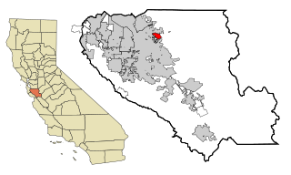
Bloomington is an unincorporated community in San Bernardino County, California, United States. The population was 23,851 at the 2010 census, up from 19,318 at the 2000 census. For statistical purposes, the United States Census Bureau has defined Bloomington as a census-designated place (CDP).
Crestline is a census-designated place in the San Bernardino Mountains of San Bernardino County, California, USA. The population was 10,770 at the 2010 census, up from 10,218 at the 2000 census.
Lenwood is a census-designated place (CDP) in the Mojave Desert near Barstow, in San Bernardino County, California.
The Marine Corps Air Ground Combat Center (MCAGCC), also known as 29 Palms, is the largest United States Marine Corps base. The base covers a total area of 1,102 square miles.
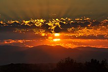
Yucca Valley is an incorporated town in San Bernardino County, California, United States. The population was 21,738 as of the 2020 census. Yucca Valley lies 20 miles (32 km) north of Palm Springs, and 103 miles (166 km) east of Los Angeles. Bordered to the south by the Joshua Tree National Park and to the west by the San Bernardino Mountains, the town of Yucca Valley is located in the Mojave Desert at roughly 3,300 feet (1,000 m) above sea level.
East Foothills is a census-designated place (CDP) in Santa Clara County, California, United States and a neighborhood of San Jose. The population was 8,269 at the 2010 census and it is located about 4 miles east of downtown San Jose.
Conning Towers Nautilus Park is a census-designated place (CDP) in the town of Groton in New London County, Connecticut, United States. The population was 9,828 at the 2010 census. The statistical area consists of the portion of the town in the vicinity of Route 12 and includes Naval Submarine Base New London.
Mansfield Center is a village within the town of Mansfield in Tolland County, Connecticut, United States. The village is the basis of a census-designated place (CDP) of the same name with a population of 947 at the 2010 census. The CDP includes the original settlement of Mansfield, Mansfield Center or Mansfield Village, as well as the village of Mansfield Hollow. Mansfield Hollow State Park is also located within the boundaries of the CDP.
Franklin Park is a census-designated place (CDP) in Broward County, Florida, United States. The population was 1,025 at the 2020 census.
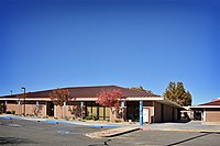
Washington Park is a census-designated place (CDP) in Broward County, Florida, United States. Its population was 1,948 at the 2020 census. It is home to the African-American Research Library and Cultural Center.
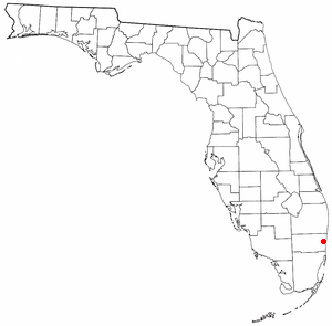
Plantation Mobile Home Park is a census-designated place (CDP) in Palm Beach County, Florida, United States. It is part of the Miami metropolitan area of South Florida. The population was 1,462 at the 2020 US census.
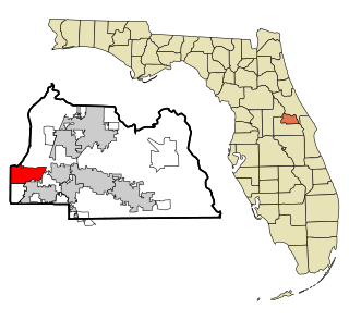
Wekiwa Springs is a census-designated place and an unincorporated area in Seminole County, Florida, United States. The population was 23,169 at the 2000 census. It is part of the Orlando–Kissimmee–Sanford, Florida Metropolitan Statistical Area.
Marshfield Hills is a census-designated place (CDP) in the town of Marshfield in Plymouth County, Massachusetts, United States. The population was 2,356 at the 2010 census. The historic center of the village has been designated a historic district and listed on the National Register of Historic Places.
Twentynine Palms is a city in San Bernardino County, California. It serves as one of the entry points to Joshua Tree National Park.
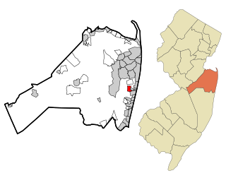
Wanamassa is an unincorporated community and census-designated place (CDP) within Ocean Township, in Monmouth County, in the U.S. state of New Jersey. As of the 2010 United States Census, the CDP's population was 4,532. The community was named for Wanamassa, a Native American leader of the 17th century.
Wilder is an unincorporated village and census-designated place (CDP) within the town of Hartford in Windsor County, Vermont, United States. It is the location of the Wilder Dam on the Connecticut River. The population of the CDP was 1,690 at the 2010 census. The village center is an early example of a planned mill community, and was listed on the National Register of Historic Places as the Wilder Village Historic District in 1999.
Essex CDP is a census-designated place (CDP) in the town of Essex in Essex County, Massachusetts, United States. The population was 1,471 at the 2010 census.
Brandon is an unincorporated village and census-designated place (CDP) in the town of Brandon, Rutland County, Vermont, United States. As of the 2020 census, the population was 1,727.
Rib Mountain is a census-designated place (CDP) in the town of Rib Mountain in Marathon County, Wisconsin, United States. The population was 6,061 at the 2020 census.
Searles Valley is a census-designated place (CDP) in the Searles Valley of the Mojave Desert, in northwestern San Bernardino County, California.
{{cite web}}
: CS1 maint: numeric names: authors list (link)