National Register of Historic Places listings in Lawrence County, Indiana

Last updated
Location of Lawrence County in Indiana Map of Indiana highlighting Lawrence County.svg
Location of Lawrence County in Indiana

This is a list of the National Register of Historic Places listings in Lawrence County, Indiana.

Contents

This is intended to be a complete list of the properties and districts on the National Register of Historic Places in Lawrence County, Indiana, United States. Latitude and longitude coordinates are provided for many National Register properties and districts; these locations may be seen together in a map. [1]

There are 14 properties and districts listed on the National Register in the county.

Properties and districts located in incorporated areas display the name of the municipality, while properties and districts in unincorporated areas display the name of their civil township. Properties and districts split between multiple jurisdictions display the names of all jurisdictions.

This National Park Service list is complete through NPS recent listings posted May 21, 2021. [2]
Map all coordinates using: OpenStreetMap  
Download coordinates as: KML

Current listings

[3] Name on the Register [4] ImageDate listed [5] Location City or townDescription
1 Bedford Courthouse Square Historic District
Bedford Courthouse Square Historic District Downtown Bedford, Indiana.jpg
Bedford Courthouse Square Historic District
June 8, 1995
(#95000704)
Roughly bounded by L, 14th, 17th and H Sts.
38°51′42″N86°29′01″W / 38.861667°N 86.483611°W / 38.861667; -86.483611 (Bedford Courthouse Square Historic District)
Bedford
2 Bedford Southern Indiana Railroad Passenger Depot May 13, 2021
(#100006563)
1415 J St.
38°51′47″N86°29′03″W / 38.8631°N 86.4842°W / 38.8631; -86.4842 (Bedford Southern Indiana Railroad Passenger Depot)
Bedford
3 Bono Archaeological Site (12 Lr 194)
Bono Archaeological Site (12 Lr 194) Bono Archaeological Site.jpg
Bono Archaeological Site (12 Lr 194)
May 30, 1985
(#85001166)
On a bluff above the White River, ½ mile west of the riverbank and 1 mile north of Bono [6]
38°44′41″N86°19′42″W / 38.744722°N 86.328333°W / 38.744722; -86.328333 (Bono Archaeological Site (12 Lr 194))
Bono Township
4 Clampitt Site
Clampitt Site Clampitt Site IMG 1073.JPG
Clampitt Site
March 15, 2016
(#16000076)
Address Restricted
Guthrie Township
5 Helton-Mayo Farm
Helton-Mayo Farm Helton-Mayo Farm.jpg
Helton-Mayo Farm
June 9, 1995
(#95000709)
Junction of Boyd Ln. and State Road 58, northeast of Bedford
38°53′11″N86°27′05″W / 38.886389°N 86.451389°W / 38.886389; -86.451389 (Helton-Mayo Farm)
Shawswick Township
6 Indiana Limestone Company Building
Indiana Limestone Company Building Indiana Limestone Company Building, Bedford.jpg
Indiana Limestone Company Building
December 21, 1993
(#93001412)
405 I St.
38°52′31″N86°29′00″W / 38.875278°N 86.483333°W / 38.875278; -86.483333 (Indiana Limestone Company Building)
Bedford
7 Madden School
Madden School Madden School in Bedford.jpg
Madden School
June 15, 2000
(#00000673)
620 H St.
38°52′21″N86°28′53″W / 38.8725°N 86.481389°W / 38.8725; -86.481389 (Madden School)
Bedford
8 Mitchell Downtown Historic District
Mitchell Downtown Historic District Mitchell indiana.jpg
Mitchell Downtown Historic District
September 26, 1997
(#97001175)
Roughly bounded by 10th, Oak, 5th, and N. Mississippi Sts.
38°44′00″N86°28′28″W / 38.733333°N 86.474444°W / 38.733333; -86.474444 (Mitchell Downtown Historic District)
Mitchell
9 Mitchell Opera House
Mitchell Opera House Mitchell Opera House.jpg
Mitchell Opera House
April 2, 1981
(#81000020)
7th and Brooks Sts.
38°44′04″N86°28′27″W / 38.734444°N 86.474167°W / 38.734444; -86.474167 (Mitchell Opera House)
Mitchell
10 C.S. Norton Mansion
C.S. Norton Mansion C.S. Norton Mansion.jpg
C.S. Norton Mansion
June 22, 1976
(#76000026)
1415 15th St.
38°51′45″N86°29′28″W / 38.8625°N 86.491111°W / 38.8625; -86.491111 (C.S. Norton Mansion)
Bedford
11 Otis Park and Golf Course
Otis Park and Golf Course Otis Park Golf Club, fairway and Ragsdale House.jpg
Otis Park and Golf Course
December 20, 2002
(#02001560)
Tunnelton Rd.
38°51′31″N86°27′17″W / 38.858611°N 86.454722°W / 38.858611; -86.454722 (Otis Park and Golf Course)
Bedford
12 William A. Ragsdale House
William A. Ragsdale House William A. Ragsdale House, side closeup.jpg
William A. Ragsdale House
December 20, 2002
(#02001565)
607 Tunnelton Rd.
38°51′32″N86°27′36″W / 38.858889°N 86.460000°W / 38.858889; -86.460000 (William A. Ragsdale House)
Bedford
13 Williams Bridge
Williams Bridge Williams CB (Lawrence Cty)Indiana.JPG
Williams Bridge
November 9, 1981
(#81000018)
Southwest of Williams on County Road 11
38°47′48″N86°39′54″W / 38.796667°N 86.665°W / 38.796667; -86.665 (Williams Bridge)
Spice Valley Township
14 Zahn Historic District
Zahn Historic District St. Vincent de Paul in Bedford, southeastern angle vertical.jpg
Zahn Historic District
August 28, 1998
(#98001100)
Roughly bounded by 17th, 20th, J., and H Sts.
38°51′29″N86°28′57″W / 38.858056°N 86.482500°W / 38.858056; -86.482500 (Zahn Historic District)
Bedford

See also

Related Research Articles

National Register of Historic Places listings in Monroe County, Indiana Wikipedia list article

This is a list of the National Register of Historic Places listings in Monroe County, Indiana.

National Register of Historic Places listings in Parke County, Indiana

This is a list of the National Register of Historic Places listings in Parke County, Indiana.

National Register of Historic Places listings in Porter County, Indiana

This is a list of the National Register of Historic Places listings in Porter County, Indiana.

National Register of Historic Places listings in Hamilton County, Indiana

This is a list of the National Register of Historic Places listings in Hamilton County, Indiana.

National Register of Historic Places listings in Bartholomew County, Indiana

This is a list of the National Register of Historic Places listings in Bartholomew County, Indiana.

National Register of Historic Places listings in Benton County, Indiana

This is a list of the National Register of Historic Places listings in Benton County, Indiana.

National Register of Historic Places listings in Cass County, Indiana

This is a list of the National Register of Historic Places listings in Cass County, Indiana.

National Register of Historic Places listings in Montgomery County, Indiana

This is a list of the National Register of Historic Places listings in Montgomery County, Indiana.

National Register of Historic Places listings in Washington County, Indiana

This is a list of the National Register of Historic Places listings in Washington County, Indiana.

National Register of Historic Places listings in Whitley County, Indiana

This is a list of the National Register of Historic Places listings in Whitley County, Indiana.

National Register of Historic Places listings in Daviess County, Indiana

This is a list of the National Register of Historic Places listings in Daviess County, Indiana.

National Register of Historic Places listings in Greene County, Indiana

This is a list of the National Register of Historic Places listings in Greene County, Indiana.

National Register of Historic Places listings in Jackson County, Indiana

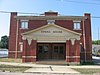
This is a list of the National Register of Historic Places listings in Jackson County, Indiana.

National Register of Historic Places listings in Jefferson County, Indiana

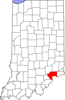
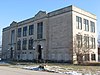
This is a list of the National Register of Historic Places listings in Jefferson County, Indiana.

National Register of Historic Places listings in Knox County, Indiana

This is a list of the National Register of Historic Places listings in Knox County, Indiana.

National Register of Historic Places listings in Newton County, Indiana

This is a list of the National Register of Historic Places listings in Newton County, Indiana.

National Register of Historic Places listings in Orange County, Indiana

This is a list of the National Register of Historic Places listings in Orange County, Indiana.

National Register of Historic Places listings in Pulaski County, Indiana

This is a list of the National Register of Historic Places listings in Pulaski County, Indiana.

National Register of Historic Places listings in Randolph County, Indiana

This is a list of the National Register of Historic Places listings in Randolph County, Indiana.

National Register of Historic Places listings in Ripley County, Indiana

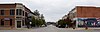
This is a list of the National Register of Historic Places listings in Ripley County, Indiana.

References

  1. The latitude and longitude information provided in this table was derived originally from the National Register Information System, which has been found to be fairly accurate for about 99% of listings. Some locations in this table may have been corrected to current GPS standards.
  2. National Park Service, United States Department of the Interior, "National Register of Historic Places: Weekly List Actions", retrieved May 21, 2021.
  3. Numbers represent an alphabetical ordering by significant words. Various colorings, defined here, differentiate National Historic Landmarks and historic districts from other NRHP buildings, structures, sites or objects.
  4. "National Register Information System". National Register of Historic Places . National Park Service. March 13, 2009.
  5. The eight-digit number below each date is the number assigned to each location in the National Register Information System database, which can be viewed by clicking the number.
  6. Location derived from Guernsey, E.Y. "Archaeological Survey of Lawrence County". Extra number of Indiana History Bulletin 1 (July 1924): 8 and 22. The NRIS lists the site as "Address Restricted".