National Register of Historic Places listings in Tippecanoe County, Indiana

Last updated

Location of Tippecanoe County in Indiana Map of Indiana highlighting Tippecanoe County.svg
Location of Tippecanoe County in Indiana

This is a list of the National Register of Historic Places listings in Tippecanoe County, Indiana.

Contents

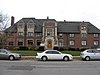
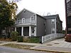
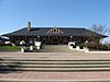
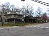
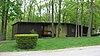
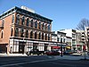
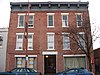
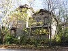
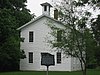
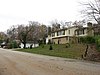
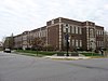
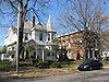
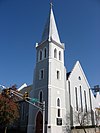
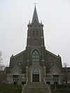
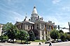
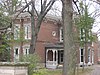
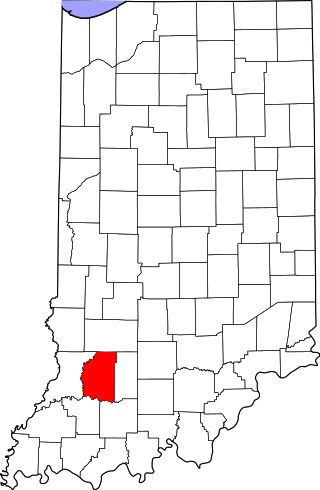
This is intended to be a complete list of the properties and districts on the National Register of Historic Places in Tippecanoe County, Indiana, United States. Latitude and longitude coordinates are provided for many National Register properties and districts; these locations may be seen together in a map. [1]

There are 50 properties and districts listed on the National Register in the county, including 3 National Historic Landmarks.

Properties and districts located in incorporated areas display the name of the municipality, while properties and districts in unincorporated areas display the name of their civil township. Properties and districts split between multiple jurisdictions display the names of all jurisdictions.


    This National Park Service list is complete through NPS recent listings posted October 27, 2023. [2]

Map all coordinates using: OpenStreetMap

Current listings

[3] Name on the Register [4] ImageDate listed [5] Location City or townDescription
1 Alpha Tau Omega Fraternity House
Alpha Tau Omega Fraternity House Alpha Tau Omega Fraternity House, West Lafayette.jpg
Alpha Tau Omega Fraternity House
March 20, 2002
(#02000197)
314 Russell St.
40°25′39″N86°55′07″W / 40.4275°N 86.918611°W / 40.4275; -86.918611 (Alpha Tau Omega Fraternity House)
West Lafayette
2 Jesse Andrew House
Jesse Andrew House Jesse Andrew House.jpg
Jesse Andrew House
August 11, 1983
(#83000103)
123 Andrew Pl.
40°25′28″N86°54′34″W / 40.424444°N 86.909444°W / 40.424444; -86.909444 (Jesse Andrew House)
West Lafayette
3 Archeological Sites 12T59 and 12T530 September 14, 2015
(#15000599)
Southern side of Indian Mound Dr. [6]
40°31′23″N86°47′30″W / 40.523056°N 86.791667°W / 40.523056; -86.791667 (Archeological Sites 12T59 and 12T530)
Tippecanoe Township
4 Judge Cyrus Ball House
Judge Cyrus Ball House Judge Cyrus Ball House in the morning.jpg
Judge Cyrus Ball House
May 3, 1984
(#84001649)
402 S. 9th St.
40°24′49″N86°53′12″W / 40.413611°N 86.886667°W / 40.413611; -86.886667 (Judge Cyrus Ball House)
Lafayette
5 Battle Ground Historic District
Battle Ground Historic District Battle Ground, Indiana.png
Battle Ground Historic District
July 23, 1985
(#85001639)
Roughly bounded by Burnett Creek, Sherman Dr., and an open ridge on the southeast
40°30′35″N86°50′21″W / 40.509722°N 86.839167°W / 40.509722; -86.839167 (Battle Ground Historic District)
Battle Ground
6 Big Four Depot
Big Four Depot Big Four Depot, Lafayette.jpg
Big Four Depot
June 22, 2003
(#03000548)
200 N. 2nd St.
40°25′07″N86°53′44″W / 40.418611°N 86.895556°W / 40.418611; -86.895556 (Big Four Depot)
Lafayette
7 Cairo Skywatch Tower
Cairo Skywatch Tower Cairo Skywatch Tower.png
Cairo Skywatch Tower
March 21, 2002
(#02000202)
County Road 850N at County Road 100W at Cairo
40°32′26″N86°55′30″W / 40.540694°N 86.925°W / 40.540694; -86.925 (Cairo Skywatch Tower)
Tippecanoe Township
8 Centennial Neighborhood District
Centennial Neighborhood District Churches in Centennial, Lafayette.jpg
Centennial Neighborhood District
June 16, 1983
(#83003443)
Roughly bounded by Union, 3rd, 4th, Ferry, and 9th Sts.
40°25′21″N86°53′25″W / 40.4225°N 86.890278°W / 40.4225; -86.890278 (Centennial Neighborhood District)
Lafayette
9 Chauncey-Stadium Avenues Historic District
Chauncey-Stadium Avenues Historic District Chauncey-Stadium Avenues Historic District.jpg
Chauncey-Stadium Avenues Historic District
December 20, 2002
(#02001558)
Roughly bounded by Meridian, Lincoln, River Rd., Fowler, Quincy, Northwestern, and Allen Sts.
40°25′52″N86°54′22″W / 40.431111°N 86.906111°W / 40.431111; -86.906111 (Chauncey-Stadium Avenues Historic District)
West Lafayette
10 John E. and Catherine E. Christian House
John E. and Catherine E. Christian House Samara (John E Christian House) Entrance.jpg
John E. and Catherine E. Christian House
June 16, 1992
(#92000679)
1301 Woodland Ave.
40°26′18″N86°54′59″W / 40.438333°N 86.916389°W / 40.438333; -86.916389 (John E. and Catherine E. Christian House)
West Lafayette
11 Curtis-Grace House
Curtis-Grace House Curtis-Grace House.jpg
Curtis-Grace House
April 10, 2012
(#12000190)
2175 Tecumseh Park Ln.
40°26′50″N86°54′27″W / 40.447222°N 86.907500°W / 40.447222; -86.907500 (Curtis-Grace House)
West Lafayette
12 Dayton Historic District
Dayton Historic District Dayton Indiana Castle Hall.png
Dayton Historic District
March 26, 2003
(#03000142)
Roughly bounded by Walnut, Harrison, and Pennsylvania Sts.
40°22′35″N86°46′03″W / 40.376389°N 86.7675°W / 40.376389; -86.7675 (Dayton Historic District)
Dayton
13 Downtown Lafayette Historic District
Downtown Lafayette Historic District Courthouse Square in Lafayette.jpg
Downtown Lafayette Historic District
November 28, 1980
(#80000067)
Roughly bounded by 2nd, Ferry, 6th, and South Sts.
40°25′08″N86°53′33″W / 40.418889°N 86.8925°W / 40.418889; -86.8925 (Downtown Lafayette Historic District)
Lafayette
14 Ellsworth Historic District
Ellsworth Historic District Sixth and New York in Lafayette.jpg
Ellsworth Historic District
December 30, 1986
(#86003501)
Roughly bounded by Columbia, the Norfolk Southern railroad tracks, Alabama, 7th, South, and 6th Sts.
40°24′55″N86°53′20″W / 40.415278°N 86.888889°W / 40.415278; -86.888889 (Ellsworth Historic District)
Lafayette
15 Ely Homestead
Ely Homestead Ely Homestead.jpg
Ely Homestead
October 8, 1976
(#76000036)
4106 E. 200N, northeast of Lafayette
40°26′53″N86°49′37″W / 40.448056°N 86.826944°W / 40.448056; -86.826944 (Ely Homestead)
Fairfield Township
16 Enterprise Hotel
Enterprise Hotel Enterprise Hotel.jpg
Enterprise Hotel
June 21, 1984
(#84001650)
1015 Main St.
40°25′08″N86°53′06″W / 40.418889°N 86.885°W / 40.418889; -86.885 (Enterprise Hotel)
Lafayette
17 Falley Home
Falley Home Falley Home.jpg
Falley Home
July 15, 1982
(#82000078)
601 New York St.
40°24′52″N86°53′24″W / 40.414444°N 86.89°W / 40.414444; -86.89 (Falley Home)
Lafayette
18 Farmers Institute
Farmers Institute Farmers Institute.jpg
Farmers Institute
March 27, 1986
(#86000609)
4626 W. County Road 660S; also 4636 West 660 South
40°19′18″N86°59′29″W / 40.321667°N 86.991389°W / 40.321667; -86.991389 (Farmers Institute)
Shadeland Second address represents a boundary increase approved March 6, 2020
19 Fort Ouiatenon
Fort Ouiatenon Fort Ouiatenon blockhouse front.jpg
Fort Ouiatenon
February 16, 1970
(#70000008)
Along River Rd. and the Wabash River, west of the Purdue University Airport [7]
40°24′23″N86°57′50″W / 40.4064°N 86.9639°W / 40.4064; -86.9639 (Fort Ouiatenon)
Wabash Township Designated a National Historic Landmark in 2021.
20 Moses Fowler House
Moses Fowler House Moses Fowler House, Lafayette, Indiana 2.png
Moses Fowler House
August 5, 1971
(#71000009)
Corner of 10th and South Sts.
40°25′00″N86°53′10″W / 40.416667°N 86.886111°W / 40.416667; -86.886111 (Moses Fowler House)
Lafayette
21 Greenbush Cemetery May 26, 2021
(#100006569)
1408 North 12th St.
40°25′53″N86°53′04″W / 40.4315°N 86.8845°W / 40.4315; -86.8845 (Greenbush Cemetery)
Lafayette
22 Happy Hollow Heights Historic District
Happy Hollow Heights Historic District Sumac Drive cul-de-sac house.jpg
Happy Hollow Heights Historic District
December 15, 2015
(#15000891)
1821 and 1809 Happy Hollow Rd. and all houses on Laurel, Hollowood, Fearnleaf, and Sumac Drs.
40°26′33″N86°54′00″W / 40.442500°N 86.900000°W / 40.442500; -86.900000 (Happy Hollow Heights Historic District)
West Lafayette
23 Hershey House
Hershey House Hershey House near Lafayette.jpg
Hershey House
November 28, 1978
(#78000054)
East of Lafayette on East Rd.
40°26′42″N86°45′59″W / 40.445°N 86.766389°W / 40.445; -86.766389 (Hershey House)
Perry Township
24 Highland Park Neighborhood Historic District
Highland Park Neighborhood Historic District Brick intersection in Highland Park.jpg
Highland Park Neighborhood Historic District
March 14, 1996
(#96000270)
Roughly bounded by Kossuth St., S. 9th St., Cherokee Ave., and 4th St.
40°24′22″N86°53′21″W / 40.406111°N 86.889167°W / 40.406111; -86.889167 (Highland Park Neighborhood Historic District)
Lafayette
25 Hills and Dales Historic District
Hills and Dales Historic District Hills and Dales Historic District.jpg
Hills and Dales Historic District
June 27, 2002
(#02000689)
Roughly bounded by Northwestern Ave., Meridian St., Hillcrest Rd., and Grant St.
40°26′07″N86°54′49″W / 40.435278°N 86.913611°W / 40.435278; -86.913611 (Hills and Dales Historic District)
West Lafayette
26 Indian Trail Road-Belle River Bridge
Indian Trail Road-Belle River Bridge Indian Trail Road-Belle River Bridge.png
Indian Trail Road-Belle River Bridge
January 28, 2000
(#00000012)
Steel Bridge Research, Inspection, Training and Engineering Center, S. Sharon Chapel Rd.
40°24′31″N86°57′02″W / 40.40875°N 86.950556°W / 40.40875; -86.950556 (Indian Trail Road-Belle River Bridge)
Wabash Township 
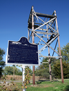
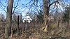
Replaced in 2008, this bridge was moved from its original location and as of 2015 resides at Purdue University's Steel Bridge Research, Inspection, Training and Engineering Center. [8]
27 Indiana State Soldiers Home Historic District
Indiana State Soldiers Home Historic District Indiana State Soldiers Home house.jpg
Indiana State Soldiers Home Historic District
January 2, 1974
(#74000034)
North of Lafayette off State Road 43
40°28′08″N86°53′15″W / 40.468889°N 86.8875°W / 40.468889; -86.8875 (Indiana State Soldiers Home Historic District)
Tippecanoe and Wabash Townships
28 Jefferson Historic District
Jefferson Historic District Jefferson Historic District, Lafayette.jpg
Jefferson Historic District
September 16, 2001
(#01000976)
Roughly bounded by 9th, Erie, Elizabeth, and Ferry Sts.
40°25′19″N86°53′04″W / 40.421944°N 86.884444°W / 40.421944; -86.884444 (Jefferson Historic District)
Lafayette
29 Marian Apartments
Marian Apartments Marian Apartments, Lafayette.jpg
Marian Apartments
June 30, 1983
(#83000150)
615 North St.
40°25′15″N86°53′23″W / 40.420833°N 86.889722°W / 40.420833; -86.889722 (Marian Apartments)
Lafayette
30 Mars Theatre
Mars Theatre Mars Theatre, Lafayette.jpg
Mars Theatre
January 26, 1981
(#81000030)
11 N. 6th St.
40°25′06″N86°53′25″W / 40.418333°N 86.890278°W / 40.418333; -86.890278 (Mars Theatre)
Lafayette
31 Levi and Lucy Morehouse Farm
Levi and Lucy Morehouse Farm Morehouse Farm from the south.jpg
Levi and Lucy Morehouse Farm
December 19, 2012
(#12001065)
5038 Morehouse Rd., northwest of West Lafayette
40°29′27″N86°57′26″W / 40.490833°N 86.957222°W / 40.490833; -86.957222 (Levi and Lucy Morehouse Farm)
Wabash Township
32 Morton School
Morton School Morton School, West Lafayette.jpg
Morton School
September 9, 1999
(#99001113)
222 N. Chauncey Ave.
40°25′31″N86°54′23″W / 40.425278°N 86.906389°W / 40.425278; -86.906389 (Morton School)
West Lafayette
33 Ninth Street Hill Neighborhood Historic District
Ninth Street Hill Neighborhood Historic District Ninth Street Hill, Lafayette.jpg
Ninth Street Hill Neighborhood Historic District
April 14, 1997
(#97000303)
Roughly 9th St. from South to Kossuth Sts. and State St. from 9th to Kossuth Sts.
40°24′48″N86°53′09″W / 40.413333°N 86.885833°W / 40.413333; -86.885833 (Ninth Street Hill Neighborhood Historic District)
Lafayette
34 Park Mary Historic District
Park Mary Historic District Park Mary Historic District.jpg
Park Mary Historic District
June 15, 2001
(#01000617)
Roughly bounded by Union, Hartford, N. 6th, and N. 14th Sts.
40°25′33″N86°53′01″W / 40.425833°N 86.883611°W / 40.425833; -86.883611 (Park Mary Historic District)
Lafayette
35 Oliver Webster Jr. and Catherine Peirce House December 3, 2018
(#100003190)
538 S. 7th St.
40°24′38″N86°53′18″W / 40.4106°N 86.8883°W / 40.4106; -86.8883 (Oliver Webster Jr. and Catherine Peirce House)
Lafayette
36 Perrin Historic District
Perrin Historic District Perrin Historic District Houses.jpg
Perrin Historic District
September 10, 1979
(#79000045)
Roughly bounded by Murdock Park, Sheridan Rd., Columbia, Main, and Union Sts.
40°25′14″N86°52′47″W / 40.420556°N 86.879722°W / 40.420556; -86.879722 (Perrin Historic District)
Lafayette
37 James Pierce Jr. House
James Pierce Jr. House James Pierce Jr. House.jpg
James Pierce Jr. House
June 17, 1982
(#82000079)
4624 N. 140W, north of West Lafayette
40°29′06″N86°55′56″W / 40.485°N 86.932222°W / 40.485; -86.932222 (James Pierce Jr. House)
Wabash Township
38 William Potter House
William Potter House William Potter House.jpg
William Potter House
January 6, 1983
(#83000104)
915 Columbia St.
40°25′05″N86°53′08″W / 40.418056°N 86.885556°W / 40.418056; -86.885556 (William Potter House)
Lafayette
39 St. John's Episcopal Church
St. John's Episcopal Church St. John's Episcopal Church, Lafayette.jpg
St. John's Episcopal Church
September 20, 1978
(#78000055)
315 N. 6th St.
40°25′13″N86°53′25″W / 40.420278°N 86.890278°W / 40.420278; -86.890278 (St. John's Episcopal Church)
Lafayette
40 St. Mary Historic District
St. Mary Historic District Cathedral of Saint Mary of the Immaculate Conception in Indiana.jpg
St. Mary Historic District
June 14, 2001
(#01000622)
Roughly bounded by Main, South, 10th, and 14th Sts.
40°25′01″N86°52′51″W / 40.416944°N 86.880833°W / 40.416944; -86.880833 (St. Mary Historic District)
Lafayette
41 Scott Street Pavilion
Scott Street Pavilion Scott Street Pavilion.jpg
Scott Street Pavilion
September 27, 1984
(#84001656)
Columbian Park
40°24′54″N86°52′18″W / 40.415°N 86.871667°W / 40.415; -86.871667 (Scott Street Pavilion)
Lafayette
42 Spring Vale Cemetery August 25, 2020
(#100005512)
2580 Schuyler Avenue
40°26′54″N86°51′38″W / 40.4482°N 86.8605°W / 40.4482; -86.8605 (Spring Vale Cemetery)
Lafayette
43 Stidham United Methodist Church
Stidham United Methodist Church Stidham United Methodist Church.jpg
Stidham United Methodist Church
November 27, 1992
(#92001651)
5300 S. 175W
40°20′30″N86°56′17″W / 40.3417°N 86.9381°W / 40.3417; -86.9381 (Stidham United Methodist Church)
Shadeland
44 Temple Israel
Temple Israel Temple Israel in Lafayette front and side.jpg
Temple Israel
February 19, 1982
(#82000080)
17 S. 7th St.
40°25′00″N86°53′16″W / 40.4167°N 86.8878°W / 40.4167; -86.8878 (Temple Israel)
Lafayette
45 Tippecanoe Battlefield
Tippecanoe Battlefield Tippecanoe Monument, Battleground.JPG
Tippecanoe Battlefield
October 15, 1966
(#66000013)
7 miles northeast of Lafayette on State Road 25
40°28′08″N86°50′43″W / 40.4689°N 86.8453°W / 40.4689; -86.8453 (Tippecanoe Battlefield)
Battle Ground and Tippecanoe Township
46 Tippecanoe County Courthouse
Tippecanoe County Courthouse Tippecanoe courthouse 7-2004.jpg
Tippecanoe County Courthouse
October 31, 1972
(#72000013)
Public Square
40°25′05″N86°53′20″W / 40.4181°N 86.8889°W / 40.4181; -86.8889 (Tippecanoe County Courthouse)
Lafayette
47 Upper Main Street Historic District
Upper Main Street Historic District Upper Main Street Historic District, Lafayette.jpg
Upper Main Street Historic District
May 24, 1990
(#90000814)
Roughly bounded by Ferry St., 6th St., Columbia St., and the Norfolk Southern railroad tracks
40°25′09″N86°53′14″W / 40.4192°N 86.8872°W / 40.4192; -86.8872 (Upper Main Street Historic District)
Lafayette
48 The Varsity
The Varsity The Varsity, West Lafayette, in summer.jpg
The Varsity
December 7, 2001
(#01001342)
101 Andrew Place
40°25′27″N86°54′33″W / 40.4242°N 86.9092°W / 40.4242; -86.9092 (The Varsity)
West Lafayette
49 Waldron-Beck House and Carriage House
Waldron-Beck House and Carriage House Waldron-Beck House.jpg
Waldron-Beck House and Carriage House
February 9, 1984
(#84001661)
829 N. 21st St.
40°25′33″N86°52′21″W / 40.4258°N 86.8725°W / 40.4258; -86.8725 (Waldron-Beck House and Carriage House)
Lafayette
50 James H. Ward House
James H. Ward House James H. Ward House.jpg
James H. Ward House
April 7, 1988
(#88000385)
1116 Columbia St.
40°25′06″N86°53′02″W / 40.4183°N 86.8839°W / 40.4183; -86.8839 (James H. Ward House)
Lafayette

Former listings

[3] Name on the RegisterImageDate listedDate removedLocationCity or townDescription
1 West Lafayette Baptist Church September 6, 1979
(#79000046)
September 29, 1984123 N. Chauncey St.
West Lafayette

See also

Related Research Articles

<span class="mw-page-title-main">National Register of Historic Places listings in Allen County, Indiana</span>

This is a list of the National Register of Historic Places listings in Allen County, Indiana.

<span class="mw-page-title-main">National Register of Historic Places listings in Wayne County, Indiana</span>

This is a list of the National Register of Historic Places listings in Wayne County, Indiana.

<span class="mw-page-title-main">National Register of Historic Places listings in Porter County, Indiana</span>

This is a list of the National Register of Historic Places listings in Porter County, Indiana.

<span class="mw-page-title-main">National Register of Historic Places listings in Hamilton County, Indiana</span>

This is a list of the National Register of Historic Places listings in Hamilton County, Indiana.

<span class="mw-page-title-main">National Register of Historic Places listings in Bartholomew County, Indiana</span>

This is a list of the National Register of Historic Places listings in Bartholomew County, Indiana.

<span class="mw-page-title-main">National Register of Historic Places listings in Carroll County, Indiana</span>

This is a list of the National Register of Historic Places listings in Carroll County, Indiana.

<span class="mw-page-title-main">National Register of Historic Places listings in Benton County, Indiana</span>

This is a list of the National Register of Historic Places listings in Benton County, Indiana.

<span class="mw-page-title-main">National Register of Historic Places listings in Montgomery County, Indiana</span>

This is a list of the National Register of Historic Places listings in Montgomery County, Indiana.

<span class="mw-page-title-main">National Register of Historic Places listings in White County, Indiana</span>

This is a list of the National Register of Historic Places listings in White County, Indiana.

<span class="mw-page-title-main">National Register of Historic Places listings in Clinton County, Indiana</span>

This is a list of the National Register of Historic Places listings in Clinton County, Indiana.

<span class="mw-page-title-main">National Register of Historic Places listings in Daviess County, Indiana</span>

This is a list of the National Register of Historic Places listings in Daviess County, Indiana.

<span class="mw-page-title-main">National Register of Historic Places listings in Fayette County, Indiana</span>

This is a list of the National Register of Historic Places listings in Fayette County, Indiana.

<span class="mw-page-title-main">National Register of Historic Places listings in Fountain County, Indiana</span>

This is a list of the National Register of Historic Places listings in Fountain County, Indiana.

<span class="mw-page-title-main">National Register of Historic Places listings in Gibson County, Indiana</span>

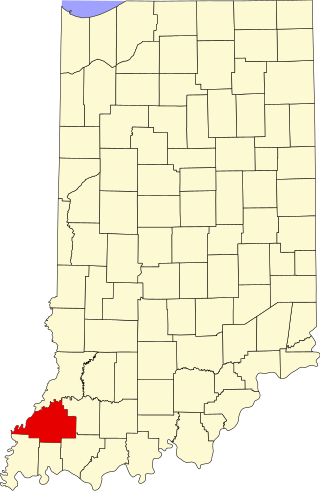
This is a list of the National Register of Historic Places listings in Gibson County, Indiana.

<span class="mw-page-title-main">National Register of Historic Places listings in Henry County, Indiana</span>

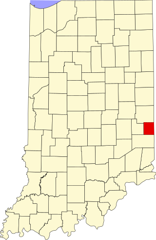
This is a list of the National Register of Historic Places listings in Henry County, Indiana.

<span class="mw-page-title-main">National Register of Historic Places listings in Knox County, Indiana</span>

This is a list of the National Register of Historic Places listings in Knox County, Indiana.

<span class="mw-page-title-main">National Register of Historic Places listings in Pike County, Indiana</span>

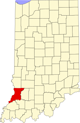
This is a list of the National Register of Historic Places listings in Pike County, Indiana.

<span class="mw-page-title-main">National Register of Historic Places listings in Randolph County, Indiana</span>

This is a list of the National Register of Historic Places listings in Randolph County, Indiana.

<span class="mw-page-title-main">National Register of Historic Places listings in Warren County, Indiana</span>

This is a list of the National Register of Historic Places listings in Warren County, Indiana.

<span class="mw-page-title-main">National Register of Historic Places listings in Union County, Indiana</span>

This is a list of the National Register of Historic Places listings in Union County, Indiana.

References

  1. The latitude and longitude information provided in this table was derived originally from the National Register Information System, which has been found to be fairly accurate for about 99% of listings. Some locations in this table may have been corrected to current GPS standards.
  2. National Park Service, United States Department of the Interior, "National Register of Historic Places: Weekly List Actions", retrieved October 27, 2023.
  3. 1 2 Numbers represent an alphabetical ordering by significant words. Various colorings, defined here, differentiate National Historic Landmarks and historic districts from other NRHP buildings, structures, sites or objects.
  4. "National Register Information System". National Register of Historic Places . National Park Service. March 13, 2009.
  5. The eight-digit number below each date is the number assigned to each location in the National Register Information System database, which can be viewed by clicking the number.
  6. Strezewski, Michael, et al. Archaeological Investigations at Site 12-T-59 and Two Other Locations in Prophetstown State Park, Tippecanoe County, Indiana. Digital ed. Fort Wayne: Indiana University-Purdue University at Fort Wayne, June 2006, 196.
  7. Location derived from its GNIS feature record; the NRIS lists the site as "Address Restricted"
  8. Bob Gross (April 11, 2015). "Old China Township bridge is going to Purdue". The Times Herald.