National Register of Historic Places listings in Fountain County, Indiana

Last updated

Location of Fountain County in Indiana Map of Indiana highlighting Fountain County.svg
Location of Fountain County in Indiana

This is a list of the National Register of Historic Places listings in Fountain County, Indiana.

Contents

This is intended to be a complete list of the properties and districts on the National Register of Historic Places in Fountain County, Indiana, United States. Latitude and longitude coordinates are provided for many National Register properties and districts; these locations may be seen together in a map. [1]

There are 18 properties and districts listed on the National Register in the county.

Properties and districts located in incorporated areas display the name of the municipality, while properties and districts in unincorporated areas display the name of their civil township. Properties and districts split between multiple jurisdictions display the names of all jurisdictions.


    This National Park Service list is complete through NPS recent listings posted May 5, 2023. [2]

Map all coordinates using: OpenStreetMap  
Download coordinates as: KML

Current listings

[3] Name on the Register [4] ImageDate listed [5] Location City or townDescription
1 Attica Downtown Historic District
Attica Downtown Historic District Attica Downtown Historic District.jpg
Attica Downtown Historic District
September 16, 1993
(#93000951)
Roughly Perry St. between Jackson and Ferry Sts. and Main and Mill Sts. between 3rd and Brady Sts.
40°17′39″N87°14′59″W / 40.2942°N 87.2497°W / 40.2942; -87.2497 (Attica Downtown Historic District)
Attica
2 Attica Main Street Historic District
Attica Main Street Historic District Attica Main Street Historic District.jpg
Attica Main Street Historic District
June 10, 1994
(#94000581)
Roughly bounded by Jackson, Brady, Short, and Canada Sts.
40°17′33″N87°14′47″W / 40.2925°N 87.2464°W / 40.2925; -87.2464 (Attica Main Street Historic District)
Attica
3 Bethel Church and Graveyard
Bethel Church and Graveyard Bethel Church and Graveyard.jpg
Bethel Church and Graveyard
March 3, 1995
(#95000203)
Bethel Rd., 0.5 miles west of its junction with Riverside Rd. and east of Attica
40°17′47″N87°10′39″W / 40.2964°N 87.1775°W / 40.2964; -87.1775 (Bethel Church and Graveyard)
Logan Township
4 Brady Street Historic District
Brady Street Historic District Attica, Indiana house.png
Brady Street Historic District
December 7, 1990
(#90001785)
Roughly bounded by S. Perry, E. Jackson, S. Council, and E. Pike Sts.
40°17′26″N87°14′56″W / 40.2906°N 87.2489°W / 40.2906; -87.2489 (Brady Street Historic District)
Attica
5 Cades Mill Covered Bridge
Cades Mill Covered Bridge P4220064 Cades Mill Bridge (Fountain Cty).JPG
Cades Mill Covered Bridge
May 24, 2021
(#100006570)
Cades Hollow Rd. over Coal Cr.
40°03′50″N87°18′44″W / 40.0639°N 87.3123°W / 40.0639; -87.3123 (Cades Mill Covered Bridge)
Veedersburg vicinity
6 Carnegie Library of Covington
Carnegie Library of Covington Carnegie Library of Covington.jpg
Carnegie Library of Covington
April 3, 1989
(#89000239)
622 S. 5th St.
40°08′26″N87°23′40″W / 40.1406°N 87.3944°W / 40.1406; -87.3944 (Carnegie Library of Covington)
Covington
7 Covington Courthouse Square Historic District
Covington Courthouse Square Historic District Covington, IN.jpg
Covington Courthouse Square Historic District
September 14, 2015
(#15000593)
Roughly bounded by 3rd St. and alleys north of Washington, east of 4th, and south of Liberty Sts.
40°08′13″N87°23′50″W / 40.1369°N 87.3971°W / 40.1369; -87.3971 (Covington Courthouse Square Historic District)
Covington
8 Covington Residential Historic District
Covington Residential Historic District Liberty and Sixth in Covington.jpg
Covington Residential Historic District
September 14, 2015
(#15000594)
Roughly bounded by Pearl, Liberty, 4th, and 7th Sts.
40°08′22″N87°23′44″W / 40.1395°N 87.3955°W / 40.1395; -87.3955 (Covington Residential Historic District)
Covington
9 Fountain County Clerk's Building
Fountain County Clerk's Building Fountain County Clerk's Building.jpg
Fountain County Clerk's Building
June 27, 2002
(#02000692)
516 4th St.
40°08′20″N87°23′49″W / 40.1389°N 87.3969°W / 40.1389; -87.3969 (Fountain County Clerk's Building)
Covington
10 Fountain County Courthouse
Fountain County Courthouse Fountain County Courthouse front, southern angle.jpg
Fountain County Courthouse
March 19, 2008
(#08000191)
301 4th St.
40°08′12″N87°23′50″W / 40.1367°N 87.3972°W / 40.1367; -87.3972 (Fountain County Courthouse)
Covington
11 Clinton F. Hesler Farm
Clinton F. Hesler Farm Clinton F. Hesler Farmhouse.jpg
Clinton F. Hesler Farm
July 13, 1989
(#89000770)
County Road 450S between 200E and 300E, southeast of Veedersburg
40°03′39″N87°12′56″W / 40.0608°N 87.2156°W / 40.0608; -87.2156 (Clinton F. Hesler Farm)
Millcreek Township
12 James and Lucinda McDonald House
James and Lucinda McDonald House James and Lucinda McDonald House.jpg
James and Lucinda McDonald House
September 12, 2016
(#16000611)
500 E. Jackson St.
40°17′28″N87°14′32″W / 40.2911°N 87.2422°W / 40.2911; -87.2422 (James and Lucinda McDonald House)
Attica
13 Marshall M. Milford House
Marshall M. Milford House Marshall M. Milford House.jpg
Marshall M. Milford House
January 26, 1989
(#88003037)
414 E. Main St.
40°17′33″N87°14′41″W / 40.2925°N 87.2447°W / 40.2925; -87.2447 (Marshall M. Milford House)
Attica
14 Old East Historic District
Old East Historic District Old East Historic District.jpg
Old East Historic District
November 28, 1990
(#90001784)
400 block of E. Washington St. and the 400 and 500 blocks of E. Monroe St.
40°17′21″N87°14′41″W / 40.2892°N 87.2447°W / 40.2892; -87.2447 (Old East Historic District)
Attica
15 Rob Roy Covered Bridge
Rob Roy Covered Bridge Rob Roy covered bridge.png
Rob Roy Covered Bridge
May 25, 2021
(#100006571)
Covered Bridge Rd. over Big Shawnee Cr.
40°14′37″N87°14′46″W / 40.2437°N 87.2461°W / 40.2437; -87.2461 (Rob Roy Covered Bridge)
Rob Roy vicinity
16 William C.B. Sewell House
William C.B. Sewell House William C.B. Sewell House.jpg
William C.B. Sewell House
October 11, 1984
(#84000027)
602 E. Washington St.
40°08′16″N87°23′39″W / 40.1378°N 87.3942°W / 40.1378; -87.3942 (William C.B. Sewell House)
Covington
17 Veedersburg Clover Leaf Route Depot August 21, 2020
(#100005516)
295 East 2nd St.
40°06′47″N87°15′35″W / 40.1131°N 87.2598°W / 40.1131; -87.2598 (Veedersburg Clover Leaf Route Depot)
Veedersburg
18 Wallace Covered Bridge
Wallace Covered Bridge Wallace CB (Fountain Cty Indiana).JPG
Wallace Covered Bridge
May 24, 2021
(#100006568)
Off Lutheran Church Rd. over Sugar Mill Cr.
39°59′06″N87°08′40″W / 39.9850°N 87.1444°W / 39.9850; -87.1444 (Wallace Covered Bridge)
Wallace

See also

Related Research Articles

<span class="mw-page-title-main">National Register of Historic Places listings in Parke County, Indiana</span>

This is a list of the National Register of Historic Places listings in Parke County, Indiana.

<span class="mw-page-title-main">National Register of Historic Places listings in Bartholomew County, Indiana</span>

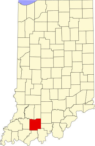
This is a list of the National Register of Historic Places listings in Bartholomew County, Indiana.

<span class="mw-page-title-main">National Register of Historic Places listings in Tippecanoe County, Indiana</span>

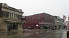
This is a list of the National Register of Historic Places listings in Tippecanoe County, Indiana.

<span class="mw-page-title-main">National Register of Historic Places listings in Adams County, Indiana</span>

This is a list of the National Register of Historic Places listings in Adams County, Indiana.

<span class="mw-page-title-main">National Register of Historic Places listings in Benton County, Indiana</span>

This is a list of the National Register of Historic Places listings in Benton County, Indiana.

<span class="mw-page-title-main">National Register of Historic Places listings in Cass County, Indiana</span>

This is a list of the National Register of Historic Places listings in Cass County, Indiana.

<span class="mw-page-title-main">National Register of Historic Places listings in Montgomery County, Indiana</span>

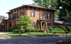
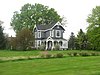
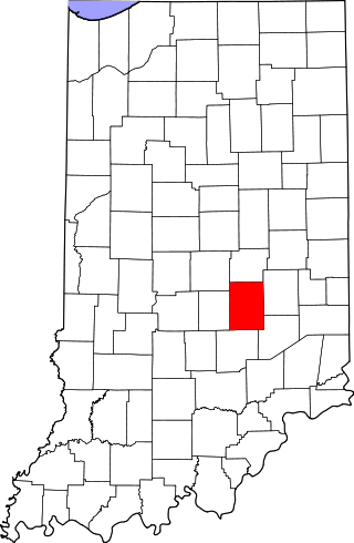
This is a list of the National Register of Historic Places listings in Montgomery County, Indiana.

<span class="mw-page-title-main">National Register of Historic Places listings in Dubois County, Indiana</span>

This is a list of the National Register of Historic Places listings in Dubois County, Indiana.

<span class="mw-page-title-main">National Register of Historic Places listings in Franklin County, Indiana</span>

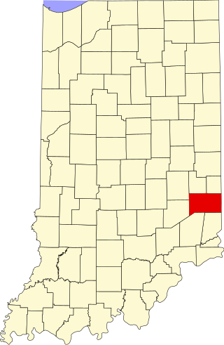
This is a list of the National Register of Historic Places listings in Franklin County, Indiana.

<span class="mw-page-title-main">National Register of Historic Places listings in Hendricks County, Indiana</span>

This is a list of the National Register of Historic Places listings in Hendricks County, Indiana.

<span class="mw-page-title-main">National Register of Historic Places listings in Jennings County, Indiana</span>

This is a list of the National Register of Historic Places listings in Jennings County, Indiana.

<span class="mw-page-title-main">National Register of Historic Places listings in Miami County, Indiana</span>

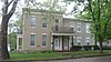
This is a list of the National Register of Historic Places listings in Miami County, Indiana.

<span class="mw-page-title-main">National Register of Historic Places listings in Pulaski County, Indiana</span>

This is a list of the National Register of Historic Places listings in Pulaski County, Indiana.

<span class="mw-page-title-main">National Register of Historic Places listings in Ripley County, Indiana</span>

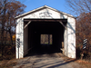
This is a list of the National Register of Historic Places listings in Ripley County, Indiana.

<span class="mw-page-title-main">National Register of Historic Places listings in Shelby County, Indiana</span>

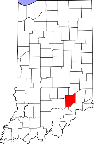
This is a list of the National Register of Historic Places listings in Shelby County, Indiana.

<span class="mw-page-title-main">National Register of Historic Places listings in Switzerland County, Indiana</span>

This is a list of the National Register of Historic Places listings in Switzerland County, Indiana.

<span class="mw-page-title-main">National Register of Historic Places listings in Vermillion County, Indiana</span>

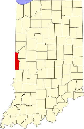
This is a list of the National Register of Historic Places listings in Vermillion County, Indiana.

<span class="mw-page-title-main">National Register of Historic Places listings in Warren County, Indiana</span>

This is a list of the National Register of Historic Places listings in Warren County, Indiana.

<span class="mw-page-title-main">National Register of Historic Places listings in Grant County, Indiana</span>

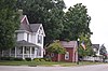
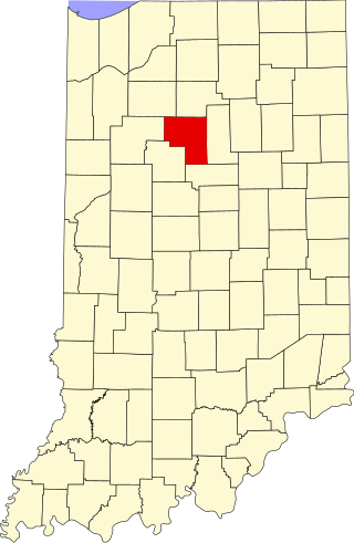
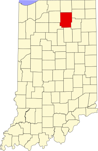
This is a list of the National Register of Historic Places listings in Grant County, Indiana.

<span class="mw-page-title-main">National Register of Historic Places listings in Kosciusko County, Indiana</span>

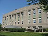
This is a list of the National Register of Historic Places listings in Kosciusko County, Indiana.

References

  1. The latitude and longitude information provided in this table was derived originally from the National Register Information System, which has been found to be fairly accurate for about 99% of listings. Some locations in this table may have been corrected to current GPS standards.
  2. National Park Service, United States Department of the Interior, "National Register of Historic Places: Weekly List Actions", retrieved May 5, 2023.
  3. Numbers represent an alphabetical ordering by significant words. Various colorings, defined here, differentiate National Historic Landmarks and historic districts from other NRHP buildings, structures, sites or objects.
  4. "National Register Information System". National Register of Historic Places . National Park Service. March 13, 2009.
  5. The eight-digit number below each date is the number assigned to each location in the National Register Information System database, which can be viewed by clicking the number.