National Register of Historic Places listings in Vigo County, Indiana
Last updated
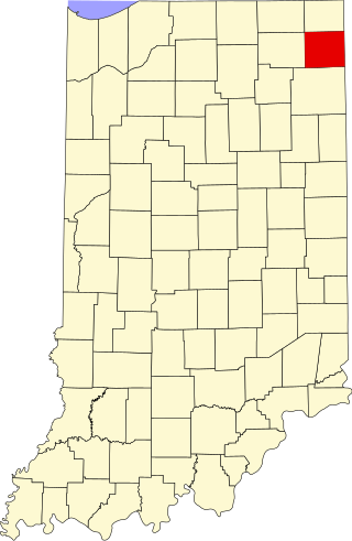
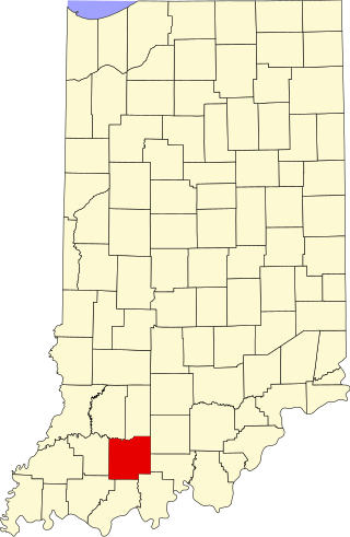
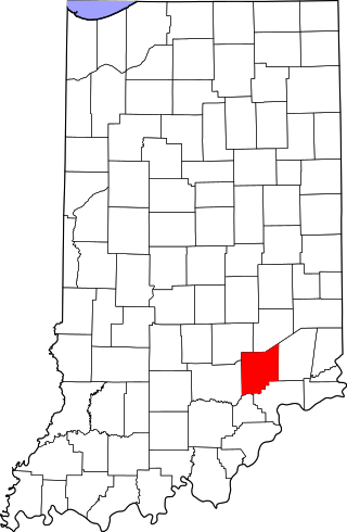
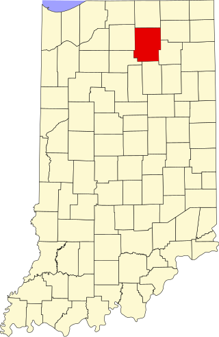
Location of Vigo County in Indiana
This is intended to be a complete list of the properties and districts on the National Register of Historic Places in Vigo County, Indiana, United States. Latitude and longitude coordinates are provided for many National Register properties and districts; these locations may be seen together in a map.[1]
There are 51 properties and districts listed on the National Register in the county, including 1 National Historic Landmark. Another 5 properties were once listed but have been removed.
Properties and districts located in incorporated areas display the name of the municipality, while properties and districts in unincorporated areas display the name of their civil township. Properties and districts split between multiple jurisdictions display the names of all jurisdictions.
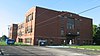
The African Methodist Episcopal congregation in Terre Haute began meeting in 1837. The original structure was part of the Underground Railroad. The Chapel and its school have been noteworthy in the African American culture of the region.
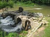
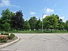
A city park established in 1883 on land donated by railroad entrepreneur Josephus Collett. 21 acres (85,000m2) in size, the tree-filled park included a pavilion built in 1894 by J. Merrill Sherman.
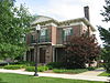
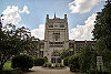
Official residence of the President of Indiana State University; built in 1860 and bequeathed to the University in 1962. Oldest building on the campus.
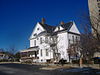
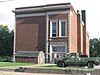
This house was built in 1890 by Eugene V. Debs and his wife Kate. The building, within the campus of Indiana State University, is now a museum commemorating Debs' life.
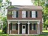
The birthplace and family home of composer Paul Dresser, this structure was originally at a different location in the town. When threatened by urban renewal in the 1960s, the home was moved to its current location in Fairbanks Park near the Wabash River.
Opened in 1884, the cemetery features Richardsonian Romanesque landscaping and architecture from the late 19th century. Famous interments include Eugene V. Debs, Max Ehrmann, and Valeska Suratt.
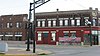
The Hippodrome was designed by noted theater architect John Eberson. The German Renaissance structure opened in 1915 and became a spot for opera, theater, and vaudeville. The building is currently owned by the Scottish Rite.
The Theatre was built by Terre Haute resident T.W. Barhydt to be a lasting gift to the city of Terre Haute and it was designed by America’s preeminent designer John Eberson to be his first prototype atmospheric theater which became his signature style that is recognized to be the gold standard of American theatre design.
Designed by architect and city planner George E. Kessler and developed by landowner Demas Deming, Jr, the boulevard is 1.5 miles (2.4km) lined with trees and homes, with a median maintained as city park land.
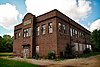
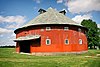
Built in 1905 in the heyday of round barn construction, it is a true round barn with no angles in its circumference and a conical roof. Part of a multiple listing of historic Indiana barns.
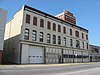
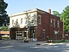
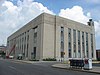
This beaux-arts structure was designed by Daniel H. Burnham and was originally an interurban train station. Made of terra cotta and brick, it has identical facades on the north and south sides. Currently the building is a bar restaurant.
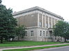
Designed by architect Samuel Hannaford in the Second Empire style, the courthouse was dedicated in 1883 and is the seat of government in Vigo County. Features a two-ton bell partially funded by money left in the will of Colonel Francis Vigo.
Second and third sets of boundaries represent boundary adjustments of September 16, 1992[6] (5 properties removed, one new property added) and September 20, 2006[7] (3 properties removed, 13 new properties added)
This is a list of the National Register of Historic Places listings in Wayne County, Indiana.
This is a list of the National Register of Historic Places listings in Parke County, Indiana.
This is a list of the National Register of Historic Places listings in DeKalb County, Indiana.
This is a list of the National Register of Historic Places listings in Carroll County, Indiana.
This is a list of the National Register of Historic Places listings in Wabash County, Indiana.
This is a list of the National Register of Historic Places listings in Whitley County, Indiana.
This is a list of the National Register of Historic Places listings in Clay County, Indiana.
This is a list of the National Register of Historic Places listings in Dubois County, Indiana.
This is a list of the National Register of Historic Places listings in Franklin County, Indiana.
This is a list of the National Register of Historic Places listings in Fulton County, Indiana.
This is a list of the National Register of Historic Places listings in Gibson County, Indiana.
This is a list of the National Register of Historic Places listings in Huntington County, Indiana.
This is a list of the National Register of Historic Places listings in Jennings County, Indiana.
This is a list of the National Register of Historic Places listings in Knox County, Indiana.
This is a list of the National Register of Historic Places listings in Miami County, Indiana.
This is a list of the National Register of Historic Places listings in Sullivan County, Indiana.
This is a list of the National Register of Historic Places listings in Vermillion County, Indiana.
This is a list of the National Register of Historic Places listings in Ohio County, Indiana.
This is a list of the National Register of Historic Places listings in Grant County, Indiana.
This is a list of the National Register of Historic Places listings in Kosciusko County, Indiana.
References
↑ The latitude and longitude information provided in this table was derived originally from the National Register Information System, which has been found to be fairly accurate for about 99% of listings. Some locations in this table may have been corrected to current GPS standards.
1 2 Numbers represent an alphabetical ordering by significant words. Various colorings, defined here, differentiate National Historic Landmarks and historic districts from other NRHP buildings, structures, sites or objects.
↑ The eight-digit number below each date is the number assigned to each location in the National Register Information System database, which can be viewed by clicking the number.
This page is based on this Wikipedia article Text is available under the CC BY-SA 4.0 license; additional terms may apply. Images, videos and audio are available under their respective licenses.