Gleed is a census-designated place (CDP) in Yakima County, Washington, United States. The population was 2,906 at the 2010 census.

Naches is a town in Yakima County, Washington, United States. The population was 795 individuals at the 2010 census. The town name is pronounced "nat CHEESE”.

Muditā means joy; especially sympathetic or vicarious joy.
Naches is a name used in Washington state, U.S.A. The name may refer to:

Chinook Pass is a pass through the Cascade Range in the state of Washington.

State Route 410 is a 107.44-mile (172.91 km) long state highway that traverses Pierce, King, and Yakima counties in the US state of Washington. It begins at an interchange with SR 167 in Sumner and travels southeast across the Cascade Range to a junction with U.S. Route 12 (US 12) in Naches. While the western part of SR 410 is a freeway that serves built-up, urban areas, the remainder of the route is a surface road that traverses mostly rural areas as it passes through the mountains.
State Route 168 (SR 168) is a legislated, but not constructed, state highway located in Washington, United States. The highway is meant to serve as an alternate crossing through the Cascade Range at Naches Pass, supplementing the seasonal Chinook Pass on SR 410. Proposals were first drawn in the 1930s, and the highway has been codified in law under its current designation since 1970, however no construction has occurred.

Norse Peak Wilderness is a 52,315-acre (21,171 ha) designated wilderness area located in central Washington in the United States. It protects the portion of the Cascade Range north of Chinook Pass, south of Naches Pass, and east of Mount Rainier National Park. It is bordered by the William O. Douglas Wilderness to the south. The wilderness is named for a prominent peak which overlooks Crystal Mountain Ski Area. Roughly triangular, it is about 10 miles (16 km) across and contains no roads.

U.S. Route 410 (US 410) was a U.S. Highway in Washington and Idaho that existed from 1926 to 1967. It ran 469 miles (755 km) from US 101 in Aberdeen, Washington to US 95 in Lewiston, Idaho, passing through the cities of Olympia, Tacoma, Yakima, the Tri-Cities, and Walla Walla.
Naches Pass is a mountain pass of the Cascade Range in the state of Washington. It is located about 50 miles (80 km) east of Tacoma and about 50 miles (80 km) northwest of Yakima, near the headwaters of tributary streams of the Naches River on the east and the Greenwater River on the west. The boundaries of Pierce, King, Kittitas, and Yakima counties come together at the pass. The pass lies on the boundary between the Mount Baker-Snoqualmie and Wenatchee National Forests, about 10 miles (16 km) northeast of Mount Rainier National Park. In 1853 a pioneer wagon road was built over the pass.

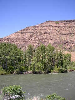
The Naches River is a tributary of the Yakima River in central Washington in the United States. Beginning as the Little Naches River, it is about 75 miles (121 km) long. After the confluence of the Little Naches and Bumping River the name becomes simply the Naches River. The Naches and its tributaries drain a portion of the eastern side of the Cascade Range, east of Mount Rainier and northeast of Mount Adams. In terms of discharge, the Naches River is the largest tributary of the Yakima River.

The Bumping River is a tributary of the Naches River, in Washington in the United States. It flows down the east side of the Cascade Range, through Wenatchee National Forest and the William O. Douglas Wilderness. From its source at Fish Lake near Crag Mountain, it flows northeast to Bumping Lake, a natural lake enlarged and regulated by Bumping Lake Dam. Below the dam, the Bumping River continues flowing northeast. It is joined by the American River, its main tributary, a few miles above its mouth where it joins the Little Naches River to form the Naches River.

The Naches Heights AVA is an American Viticultural Area contained within the Columbia Valley AVA. The AVA was recognized officially on 13 January 2012. Additionally, it is the first AVA in Washington State to be fully sustainable, with all 7 vineyards practicing in either biodynamic or LIVE certification. It is the smallest AVA in Washington with 37.2 acres (15.1 ha) planted.

Pinecliff is an unincorporated community in Yakima County, Washington, United States, located approximately 20 miles west of Ellensburg, adjacent to the Naches River.

Naches Valley High School is a public high school located in Naches, Washington. It serves 522 students in grades 9–12. 80% of the students are White, while 16% are Hispanic, 2% are two or more races, 1% are American Indian, 1% are Black and 1% are Asian.

Naches Trail is a historic trail in the U.S. state of Washington. It extends from the Naches River in Eastern Washington in the area inhabited by across Naches Pass in the Cascade Mountains to the Greenwater River in present-day Pierce County in Western Washington. Originally a trail used by the indigenous Yakama people in the east and Salish people in the west, it became one of the main routes of immigration by settlers to the Puget Sound region in the 19th century, especially before the improvement of the lower Snoqualmie Pass, which became the route of U.S. Route 10 then Interstate 90. The first written documentation of a traversal of the pass was made by a member of the United States Navy Wilkes Expedition, Lieutenant Robert E. Johnson in 1841. Due to dense forest on the west side of the pass, construction of a road was initially considered infeasible in 1853. The Longmire Party crossed the pass with their wagons, having to let them down the Naches Trail Cliffs with ropes.
Kadamtole Krishna Nache is an Assamese drama film directed by Suman Haripriya. This film was released on 2 September 2005. This film was awarded as Best Assamese Film in 53rd National Film Awards.

Natches, also spelled Naches, is a populated place situated in Graham County, Arizona. It has an estimated elevation of 2,559 feet (780 m) above sea level.

Naches Peak is a 6,452 feet (1,967 m) summit located on the shared border of Mount Rainier National Park and William O. Douglas Wilderness. It is also on the shared border of Pierce County and Yakima County in Washington state. Naches Peak is situated on the crest of the Cascade Range and immediately southeast of Chinook Pass. Its nearest higher peak is Tahtlum Peak, 1.45 mi (2.33 km) to the east. The name Naches Peak was proposed by the Yakima Chamber of Commerce and approved by Asahel Curtis in 1927. The Naches Peak Loop Trail is a popular 3.5 mile trail encircling the peak. Precipitation runoff from the west side of Naches Peak drains into tributaries of the Cowlitz River, whereas the east side drains into tributaries of the Yakima River.


