The moment magnitude scale is a measure of an earthquake's magnitude based on its seismic moment. Mw was defined in a 1979 paper by Thomas C. Hanks and Hiroo Kanamori. Similar to the local magnitude/Richter scale (ML ) defined by Charles Francis Richter in 1935, it uses a logarithmic scale; small earthquakes have approximately the same magnitudes on both scales. Despite the difference, news media often use the term "Richter scale" when referring to the moment magnitude scale.

The Seattle Fault is a zone of multiple shallow east–west thrust faults that cross the Puget Sound Lowland and through Seattle in the vicinity of Interstate Highway 90. The Seattle Fault was first recognized as a significant seismic hazard in 1992, when a set of reports showed that about 1,100 years ago it was the scene of a major earthquake of about magnitude 7 – an event that entered Native American oral traditions. Extensive research has since shown the Seattle Fault to be part of a regional system of faults.

The Mackenzie Mountains are a Canadian mountain range forming part of the Yukon–Northwest Territories boundary between the Liard and Peel rivers. The range is named in honour of Canada's second prime minister, Alexander Mackenzie. Nahanni National Park Reserve and Nááts'ihch'oh National Park Reserve are in the Mackenzie Mountains.

The 1886 Charleston earthquake in South Carolina occurred about 9:50 p.m. local time August 31. It caused 60 deaths and $5–6 million in damage to 2,000 buildings in the Southeastern United States. It is one of the most powerful and damaging earthquakes to hit the East Coast of the United States.
Seismic magnitude scales are used to describe the overall strength or "size" of an earthquake. These are distinguished from seismic intensity scales that categorize the intensity or severity of ground shaking (quaking) caused by an earthquake at a given location. Magnitudes are usually determined from measurements of an earthquake's seismic waves as recorded on a seismogram. Magnitude scales vary based on what aspect of the seismic waves are measured and how they are measured. Different magnitude scales are necessary because of differences in earthquakes, the information available, and the purposes for which the magnitudes are used.
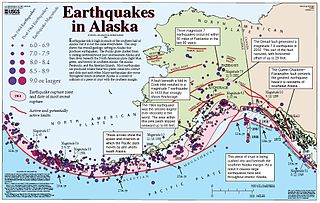
The Queen Charlotte Fault is an active transform fault that marks the boundary of the North American plate and the Pacific plate. It is Canada's right-lateral strike-slip equivalent to the San Andreas Fault to the south in California. The Queen Charlotte Fault forms a triple junction south with the Cascadia subduction zone and the Explorer Ridge. The Queen Charlotte Fault (QCF) forms a transpressional plate boundary, and is as active as other major transform fault systems in terms of slip rates and seismogenic potential. It sustains the highest known deformation rates among continental or continent-ocean transform systems globally, accommodating greater than 50mm/yr dextral offset. The entire approximately 900 km offshore length has ruptured in seven greater than magnitude 7 events during the last century, making the cumulative historical seismic moment release higher than any other modern transform plate boundary system.
Earthquake forecasting is a branch of the science of seismology concerned with the probabilistic assessment of general earthquake seismic hazard, including the frequency and magnitude of damaging earthquakes in a given area over years or decades. While forecasting is usually considered to be a type of prediction, earthquake forecasting is often differentiated from earthquake prediction, Earthquake forecasting estimates the likelihood of earthquakes in a specific timeframe and region, while earthquake prediction attempts to pinpoint the exact time, location, and magnitude of an impending quake, which is currently not reliably achievable.Wood & Gutenberg (1935). Kagan says: "This definition has several defects which contribute to confusion and difficulty in prediction research." In addition to specification of time, location, and magnitude, Allen suggested three other requirements: 4) indication of the author's confidence in the prediction, 5) the chance of an earthquake occurring anyway as a random event, and 6) publication in a form that gives failures the same visibility as successes. Kagan & Knopoff define prediction "to be a formal rule where by the available space-time-seismic moment manifold of earthquake occurrence is significantly contracted ...."</ref> Both forecasting and prediction of earthquakes are distinguished from earthquake warning systems, which, upon detection of an earthquake, provide a real-time warning to regions that might be affected.
Body-waves consist of P-waves that are the first to arrive, or S-waves, or reflections of either. Body-waves travel through rock directly.
The 1988 Saguenay earthquake struck Quebec, Canada with a moment magnitude of 5.9 on November 25. It is one of the largest recorded earthquakes in eastern Canada and eastern North America during the 20th century. The earthquake was felt by millions, and damaged some buildings. It could be felt as far as Toronto, Halifax, and Boston.

The 1983 Borah Peak earthquake occurred on October 28, at in the western United States, in the Lost River Range at Borah Peak in central Idaho.

This list of 20th-century earthquakes is a list of earthquakes of magnitude 6 and above that occurred in the 20th century. Sone smaller events which nevertheless had a significant impact are also included. After 1900 most earthquakes have some degree of instrumental records and this means that the locations and magnitudes are more reliable than for earlier events.
The 1905 Kangra earthquake occurred in the Kangra Valley and the Kangra district of the Himachal Pradesh, in India on 4 April 1905. The earthquake measured 7.8 on the surface-wave magnitude scale and killed more than 20,000 people. Apart from this, most buildings in the towns of Kangra, Mcleodganj and Dharamshala were destroyed. The earthquake also had a widespread impact in Jammu and Kashmir particularly in the densely populated Kashmir valley. A total of 7,000 to 8,000 people were killed in Jammu and Kashmir with 4,000 to 5,000 deaths occurring in the Kashmir valley. Widespread structural damage was reported across Himachal Pradesh, Jammu and Kashmir and Uttrakhand.
The 1982 North Yemen earthquake hit near the city of Dhamar, North Yemen on December 13. Measuring 6.2 on the moment magnitude scale, with a maximum perceived intensity of VIII (Severe) on the Mercalli intensity scale, as many as 2,800 people were killed and another 1,500 injured. The shock occurred within several hundred kilometers of a plate boundary in a geologically complex region that includes active volcanoes and seafloor spreading ridges. Yemen has a history of destructive earthquakes, though this was the first instrumentally recorded event to be detected on global seismograph networks.
The 1872 North Cascades earthquake occurred at in central Washington Territory. A maximum Mercalli intensity of VIII (Severe) was assessed for several locations, though less intense shaking was observed at many other locations in Washington, Oregon, and British Columbia. Some of these intermediate outlying areas reported V (Moderate) to VII shaking, but intensities as high as IV (Light) were reported as far distant as Idaho and Montana. Due to the remote location of the mainshock and a series of strong aftershocks, damage to structures was limited to a few cabins close to the areas of the highest intensity.
The 1953 Suva earthquake occurred on 14 September at 00:26 UTC near Suva, Fiji, just off the southeast shore of Viti Levu. This earthquake had an estimated magnitude of 6.8 and 6.4. The earthquake triggered a coral reef platform collapse and a submarine landslide that caused a tsunami. Eight people were reported killed.
The 1787 New Spain earthquake, also known as the San Sixto earthquake, occurred on 28 March at 11:30 local time. It caused a large tsunami that affected the coast of the Puebla Intendancy and the Oaxaca Intendancy in Southwestern New Spain. With an estimated magnitude of 8.6 on the moment magnitude scale, it was more powerful than any instrumentally recorded Mexican earthquake.
With the development of both conventional and unconventional resources in Canada, induced seismicity caused by anthropological activities has been observed, documented, and studied.

