2002 Port Vila earthquake

Last updated
2002 Port Vila earthquake
2002 Port Vila earthquake.jpg
Oceania laea relief location map.jpg
Bullseye1.png
UTC  time2002-01-02 17:22:48
ISC  event 2431530
USGS-ANSS ComCat
Local dateJanuary 03, 2002
Local time04:22:48 (UTC+11)
Magnitude7.2 Mw
Depth21.0 km
Epicenter 17°36′00″S167°51′22″E / 17.600°S 167.856°E / -17.600; 167.856
Fault New Hebrides Subduction Zone
Type Oblique-Reverse
Areas affected Shefa Province, Vanuatu
Max. intensity X (Extreme)
TsunamiYes (40 cm−3 m)
Aftershocks6.7 Mw [1]
Casualties"Several" injuries

The 2002 Port Vila earthquake occurred in the early dawn of January 3, 2002, 04:22 a.m. local time (UTC+11) northwest of Port Vila, the capital of Vanuatu. [2] It had a magnitude of 7.2 Mw and a maximum intensity of X (Extreme) west of the island on the Modified Mercalli intensity scale. There are no exact estimates on the number of injured individuals, but the majority of accounts say there were "several" amounts of injured civilians. [3] the event also caused a minor tsunami of about 0.4−0.8 m just 11 minutes after the quake. [4] [3]

Contents

Tectonic setting

The tremor was caused by the convergence of the Australian Plate and the New Hebrides microplate. Different rates of convergence are present in different regions, in the southern Tanna regions the relative movement is oriented at around N244 ±4 and has a uniform rate of 11.7±0.8 cm/yr. The rate in Efaté, near the epicenter, was at around 0.3±0.9 cm/yr, oriented N242 ±4. Both azimuths very well compare with slip vectors of the last major earthquakes. Lastly, in the North, the rate at Santo is only 3.6 ±1.2 cm/yr, oriented N253 ± 26. The difference in the convergence rates between Santo on the one hand and Efaté and Tanna in the other hand points to a right lateral shear zone between Santo and Efaté. [5] At Santo where the plate coupling is very high, the very low convergence rate might be related to the absence of recent strong earthquakes. No significant variations are detected for the baselines within the Australia plate. Relatively to a western North Fiji basin (WNFB) reference, the northern and southern segments rotate in opposite directions, consistently with the extension observed in the troughs east of both segments. Both rotations combine in Central Vanuatu into an eastward translation that "bulldozes" the central segment into the WNFB at ~55 mm/yr. That model suggests that the motion of the central segment, forced by the subduction/collision of the D'Entrecasteaux ridge, influences the motion of the adjoining segments. The New Caledonia archipelago is motionless with respect to the rest of the Australia plate despite the incipient interaction between the Loyalty ridge and the NH margin. Southeast of the interaction area, convergence is partitioned into a ~50 mm/yr trench-normal component accommodated at the trench and a ~90 mm/yr trench-parallel component, close to the A/P convergence, and presumably accommodated by a transform boundary at the rear of the NH arc. [6]

Earthquake

Preliminary magnitudes for the earthquake were between 7.1−7.4 Mw in magnitude. Later, the United States Geological Survey settled on a magnitude of 7.2 Mw . The entirety of the populace of Efate were shaken, added by several aftershocks that continued to rock the area. According to the local authorities, the seismic intensities were recorded as high as X (Extreme) or for comparison similar to the strength of a much larger 8.2 magnitude earthquake. [2] [4]

Tsunami

About 500 people had fled to higher ground in fear of a tsunami. Eyewitnesses had reportedly seen 3 meter waves approaching the shores, however the maximum run-up crest height of the tsunami recorded by gauges were only 30-40 cm. [7] [8]

Damage

There were no immediate reports of serious casualties but the earthquake caused major damage to buildings and infrastructure such as numerous schools, as well as factories and shops that were deemed unsafe. The Teuma bridge, which links the southern coast of Efate to the capital, was badly damaged. Three bridges other bridges that connect other parts of the island, as well as other infrastructure from other small communities within Mele Bay, sustained heavy damage. Landslides blocked and buried many roads, most notably one that links to the main wharf in Klems Hill. The condition of agriculture in the area was dire and would be even more crippled adding to which more possibly strong aftershocks as well as heavy rains that may hit the areas. [9]

Response

New Zealand offered about $100,000 for the immediate repair of the Teuma bridge. Matt Robson, The Associate Foreign Affairs Minister of New Zealand from 1999–2002, said the following: "This cash grant will go towards temporary repair of the Teouma bridge on the main island of Efate and other immediate repair work to infrastructure links damaged by the earthquake," "Vanuatu's roads and the Teouma Bridge have sustained major damage from the earthquake, cutting off many vital transport links; The Teouma Bridge is a particularly important link for those who live in the northern and eastern parts of Efate and rely on ready access to Port Vila for their income. These repairs will stabilise the bridge and enable them to continue commuting to the capital while a permanent solution to building a new bridge is found." The FRANZ (France, Australia and New Zealand) group has promised to keep an eye on the National Disaster Management office and Public Works Department to assess the need for long term donor assistance. [10] [11] The Vanuatu Red Cross Society's (VRCS) Operation Centre had to be centered inside a large tent because the main headquarters building was seriously damaged from the quake. The Red Cross response was helping those who were severely traumatized by the earthquake and to those who sustained minor to moderate injuries from falling debris. The VRCS sent 11 response rescuers who were trained in first aid and disaster response, they were deployed immediately after the earthquake to Port Vila as well as communities in Mele, Melemaat, Blacksands, and Erangorango, the said most vulnerably dangerous communities in the low-lying flood plain area. All VRCS staff and volunteers based on Efate were on a 24-hour standby. [9]

See also

Related Research Articles

<span class="mw-page-title-main">Vanuatu</span> Country in Oceania

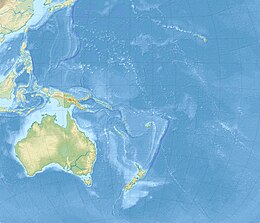
Vanuatu, officially the Republic of Vanuatu, is an island country in Melanesia, located in the South Pacific Ocean. The archipelago, which is of volcanic origin, is 1,750 km (1,090 mi) east of northern Australia, 540 km (340 mi) northeast of New Caledonia, east of New Guinea, southeast of Solomon Islands, and west of Fiji.

<span class="mw-page-title-main">Port Vila</span> Capital of Vanuatu

Port Vila, or simply Vila, is the capital and largest city of Vanuatu. It is located on the island of Efate.

<span class="mw-page-title-main">New Hebrides Plate</span> Minor tectonic plate in the Pacific Ocean near Vanuatu

The New Hebrides Plate, sometimes called the Neo-Hebridean Plate, is a minor tectonic plate located in the Pacific Ocean. While most of it is submerged as the sea bottom of the North Fiji Basin, the island country of Vanuatu, with multiple arc volcanoes, is on the western edge of the plate. It is bounded on the south-west by the Australian Plate, which is subducting below it at the New Hebrides Trench. The Vanuatu subduction zone is seismically active, producing many earthquakes of magnitude 7 or higher. To its north is the Pacific Plate, north-east the Balmoral Reef Plate and to its east the Conway Reef Plate.

The 1999 Ambrym earthquake occurred on November 26 at 00:21:17 local time with a moment magnitude of 7.4 and a maximum Mercalli intensity of VII. The back arc thrust event occurred within the Vanuatu archipelago, just to the south of the volcanic island of Ambrym. Vanuatu, which was previously known as New Hebrides, is subject to volcanic and earthquake activity because it lies on an active and destructive plate boundary called the New Hebrides Subduction Zone. While the National Geophysical Data Center classified the total damage as moderate, a destructive local tsunami did result in some deaths, with at least five killed and up to 100 injured.

<span class="mw-page-title-main">2016 Chiloé earthquake</span> Earthquake in Chile

The 2016 Chiloé earthquake with a magnitude of Mww 7.6 struck 225 kilometres (140 mi) south-west of Puerto Montt in southern Chile at 11:22 local time, 25 December. The earthquake triggered a tsunami warning on coasts located up to 1,000 kilometres (620 mi) from the quake's epicentre, generating massive evacuation across the Greater Chiloé Island, after advice from the Chilean government. Although there was damage in some parts of the island, the government reported no casualties.

<span class="mw-page-title-main">2016 Solomon Islands earthquakes</span> Seismic events

On 9 December 2016 at 4:38 a.m. local time, the Solomon Islands region was rocked by an Mww 7.8 earthquake, centered 30 km off San Cristobal Island, about 61 km southwest of Kirakira, the capital of Makira-Ulawa Province. Initially registering magnitude 8.0, later downgraded to 7.8, the temblor prompted tsunami warnings that kept countries surrounding the Coral, Tasman and Solomon Sea on high alert, but was later cancelled. A large aftershock of magnitude 6.9 occurred shortly afterwards. This earthquake was largely felt, waking many residents who later ran to high ground for fears of a potential tsunami. The earthquake killed a child and affected some 34,000 people in Makira, South Malaita and Guadalcanal Island where many had lost their homes or had no access to basic needs. Earthquakes are common in this region, with little or no fatalities. This earthquake is tied with three other magnitude 7.8 earthquakes for the second largest earthquake of 2016. On 17 December, the Solomon Islands would be rattled again by a 7.9 magnitude earthquake, this time 54 km east of Taron, Papua New Guinea.

The 2021 Kermadec Islands earthquakes were a series of earthquakes with magnitudes of 8.1 and 7.4 that occurred at 19:28:31 UTC on 4 March 2021. The epicentres were located southeast of Raoul Island in the Kermadec Islands, part of the New Zealand outlying islands. The main magnitude 8.1 earthquake was preceded by a magnitude 7.4 foreshock and followed by a magnitude 6.1 aftershock. A separate, unrelated magnitude 7.3 earthquake occurred off the coast of the North Island of New Zealand, approximately 900 km to the south, several hours before the main quakes. More than a dozen aftershocks exceeded magnitude 6.

The Nemuro-Oki earthquake in scientific literature, occurred on June 17 at 12:55 local time. It struck with an epicenter just off the Nemuro Peninsula in northern Hokkaidō, Japan. It measured 7.8–7.9 on the moment magnitude scale (Mw ), 8.1 on the tsunami magnitude scale (Mt ) and 7.4 on the Japan Meteorological Agency magnitude scale (MJMA ).

The 2009 Vanuatu earthquakes were three earthquakes with magnitudes ranging from 7.4 to 7.8, constituting some of the largest earthquakes in Vanuatu's history.

<span class="mw-page-title-main">2021 Chignik earthquake</span> 7th largest earthquake in the US

An earthquake occurred off the coast of the Alaska Peninsula on July 28, 2021, at 10:15 p.m. local time. The large megathrust earthquake had a moment magnitude of 8.2 according to the United States Geological Survey (USGS). A tsunami warning was issued by the National Oceanic and Atmospheric Administration (NOAA) but later cancelled. The mainshock was followed by a number of aftershocks, including three that were of magnitude 5.9, 6.1 and 6.9 respectively.

The 2021 Loyalty Islands earthquake was a 7.7 magnitude earthquake that struck offshore between Vanuatu and New Caledonia on February 11, 2021 at 00:19 local time. It is the 4th largest earthquake of 2021.

The 1586 Lima–Callao earthquake occurred on July 9 along the coast of Peru, near the capital Lima. A section of the Peruvian coast, stretching from Caravelí to Trujillo, north to south, was severely damaged by the earthquake. Major destruction occurred in the capital city Lima as well. The estimated moment magnitude (Mw ) 8.1 earthquake triggered a locally damaging tsunami up to 5 m (16 ft). This was the first major earthquake to strike the city of Lima since its establishment in 1535.

On August 12, 2021, at 01:46:12 PST, a strong Mw  7.1 earthquake struck the island of Mindanao at a depth of 55.1 kilometers (34.2 mi). It perceived Intensity V on the PHIVOLCS Earthquake Intensity Scale. No damage or injuries were reported but a young man was killed by the earthquake.

The 1815 Bali earthquake occurred on November 22 between 22:00 and 23:00 local time (WITA), affecting the Bali Kingdom. The estimated moment magnitude 7.0 earthquake struck off the north coast of Bali at a shallow depth. It was assigned a maximum intensity of IX (Violent) on the Mercalli intensity scale, causing severe damage in Buleleng and Tabanan. The earthquake caused a landslide and tsunami that killed 11,453 people.

<span class="mw-page-title-main">2021 Flores earthquake</span> Earthquake in Indonesia

An earthquake occurred 112 km, offshore, north of Maumere in the Flores Sea on December 14. The quake had a moment magnitude of 7.3 according to the United States Geological Survey (USGS). One person was killed and 173 others suffered injuries.

<span class="mw-page-title-main">New Hebrides Trench</span> Oceanic trench in the southern Pacific Ocean

The New Hebrides Trench is an oceanic trench which is over 7.1 km (4.4 mi) deep in the Southern Pacific Ocean. It lies to the northeast of New Caledonia and the Loyalty Islands, to the southwest of Vanuatu, east of Australia, and south of Papua New Guinea and the Solomon Islands. The trench was formed as a result of a subduction zone. The Australian Plate is being subducted under the New Hebrides Plate causing volcanism which produced the Vanuatu archipelago.

The 1843 Nias earthquake off the northern coast of Sumatra, Indonesia caused severe damage when it triggered a tsunami along the coastline. The earthquake with a moment magnitude (Mw ) of 7.8 lasted nine minutes, collapsing many homes in Sumatra and Nias. It was assigned a maximum modified Mercalli intensity of XI (Extreme).

The Vanuatu subduction zone is currently one of the most active subduction zones on earth, producing great earthquakes, with potential for tsunami hazard to all coastlines of the Pacific ocean. There are active volcanoes associated with arc volcanism.

References

  1. "M 6.6 - 33 km WNW of Port-Vila, Vanuatu". USGS–ANSS. Retrieved 2021-11-06.
  2. 1 2 "M 7.2 - 50 km WNW of Port-Vila, Vanuatu". earthquake.usgs.gov. Archived from the original on 2021-11-06. Retrieved 2021-11-06.
  3. 1 2 "M 7.2 - 50 km WNW of Port-Vila, Vanuatu - Impact". earthquake.usgs.gov. Archived from the original on 2021-11-06. Retrieved 2021-11-06.
  4. 1 2 "Assessment of the Port Vila Earthquake Vanuatu 2nd January 2002". National Advisory Board. Archived from the original on 7 November 2021. Retrieved 2021-11-06.
  5. Calmant, Stéphane; Lebellegard, Pierre; Taylor, Fred; Bevis, Michael; Maillard, Didier; Récy, Jacques; Bonneau, Jocelyne (1995). "Geodetic measurements of convergence across the New Hebrides Subduction Zone". Geophysical Research Letters. 22 (19): 2573–2576. Bibcode:1995GeoRL..22.2573C. doi:10.1029/95GL01780. ISSN   1944-8007.
  6. Calmant, Stéphane; Pelletier, Bernard; Lebellegard, Pierre; Bevis, Michael; Taylor, Frederick W.; Phillips, David A. (2003). "New insights on the tectonics along the New Hebrides subduction zone based on GPS results". Journal of Geophysical Research: Solid Earth. 108 (B6): 2319. Bibcode:2003JGRB..108.2319C. doi: 10.1029/2001JB000644 . ISSN   2156-2202.
  7. "Vanuatu Earthquake of 2 January 2002 - Vanuatu". ReliefWeb. Retrieved 2021-11-06.
  8. "VANUATU - Earthquake and Tsunami of 2 January 2002 - DR. GEORGE PARARAS-CARAYANNIS -". www.drgeorgepc.com. Retrieved 2021-11-06.
  9. 1 2 "Vanuatu: Earthquake - Information Bulletin n° 2 - Vanuatu". ReliefWeb. Retrieved 2021-11-06.
  10. "New Zealand gives $100,000 to Vanuatu earthquake relief - Vanuatu". ReliefWeb. Retrieved 2021-11-06.
  11. "Checkpoint. 2002-01-28". ngataonga.org.nz. Retrieved 2021-11-07.