UTC time | 2002-10-24 06:08:37 |
---|---|
ISC event | 3509114 |
USGS-ANSS | ComCat |
Local date | October 24, 2002 |
Local time | 08:08:37 |
Magnitude | Mw 6.2 |
Depth | 10.0 km (6 mi) |
Epicenter | 1°54′18″S29°00′47″E / 1.905°S 29.013°E |
Areas affected | Democratic Republic of the Congo |
Max. intensity | MMI VII (Very strong) |
Casualties | 2 dead |
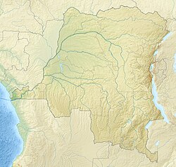
The 2002 Kalehe earthquake occurred on October 24 at 06:08 UTC. This earthquake had a magnitude Mw 6.2, and the epicenter was located in Democratic Republic of the Congo, near Lake Kivu. Two people were reported dead. Building damage was reported in Goma, Lwiro, Kalehe, and Mugeri. [1] [2] The seismicity, volcanism, and uplift in the basin of Lake Kivu delimits the rift of a tectonic plate. [3] Lake Kivu belongs to the western branch of the East African Rift System (EARS). The western branch is usually divided into several segments, and Lake Kivu belongs to the northern segment. [4]
Lake Kivu is formed in an active rift basin that is part of the western branch of the East African Rift System. The basin is a half-graben, with the main controlling fault on the western side. The other margin is mainly unfaulted and flexural in type. The active extension is WNW–ESE trending, perpendicular to the main border fault. [5] The displacement rate across this part of the EARS rift system is in the range 3–5 mm per year. Most earthquakes in the rift system are normal in type. [1]
The earthquake had a focal mechanism consistent with normal faulting and a hypocentral depth of 11.0 km. [1] These observations have been combined with the analysis of InSAR data and the known geology of the area to conclude that the earthquake was a result of movement on one of the east-dipping rift border faults. [6]
The earthquake was preceded by an eruption in the Nyiragongo volcanic area to the north of Lake Kivu, in January 2002. This is interpreted to be a diking event. Analysis of the effect of the diking on the stress field to the south suggests that faulting like that seen in the earthquake may have been promoted by this event. [6]
The Great Rift Valley is a series of contiguous geographic depressions, approximately 6,000 or 7,000 kilometres (4,300 mi) in total length, the definition varying between sources, that runs from the southern Turkish Hatay Province in Asia, through the Red Sea, to Mozambique in Southeast Africa. While the name continues in some usages, it is rarely used in geology as it is considered an imprecise merging of separate though related rift and fault systems.
North Kivu is a province bordering Lake Kivu in the eastern Democratic Republic of the Congo. Its capital is Goma. The 2020 population was estimated to be 8,147,400.
South Kivu is one of 26 provinces of the Democratic Republic of the Congo (DRC). Its capital is Bukavu.
Lake Kivu is one of the African Great Lakes. It lies on the border between the Democratic Republic of the Congo and Rwanda, and is in the Albertine Rift, the western branch of the East African Rift. Lake Kivu empties into the Ruzizi River, which flows southwards into Lake Tanganyika. In 1894, German officer and colonial ruler Gustav Adolf von Götzen was the first European to discover the lake.
Mount Nyiragongo is an active stratovolcano with an elevation of 3,470 m (11,385 ft) in the Virunga Mountains associated with the Albertine Rift. It is located inside Virunga National Park, in the Democratic Republic of the Congo, about 12 km (7.5 mi) north of the town of Goma and Lake Kivu and just west of the border with Rwanda. The main crater is about two kilometres (1 mi) wide and usually contains a lava lake. The crater presently has two distinct cooled lava benches within the crater walls – one at about 3,175 m (10,417 ft) and a lower one at about 2,975 m (9,760 ft).
Goma is the capital and largest city of the North Kivu Province in the eastern region of the Democratic Republic of the Congo. It is located on the northern shore of Lake Kivu and shares borders with Bukumu Chiefdom to the north, Rwanda to the east and Masisi Territory to the west. The city lies in the Albertine Rift, the western branch of the East African Rift, and is only 13–18 km (8.1–11.2 mi) south of the active volcano Mount Nyiragongo. With an approximate area of 75.72 km2 (29.24 sq mi), the city has an estimated population of nearly 2 million people according to the 2022 census.
The Ruzizi is a river, 117 kilometres (73 mi) long, that flows from Lake Kivu to Lake Tanganyika in Central Africa, descending from about 1,500 metres (4,900 ft) to about 770 metres (2,530 ft) above sea level over its length. The steepest gradients occur over the first 40 kilometres (25 mi), where hydroelectric dams have been built. Further downstream, the Ruzizi Plain, the floor of the Western Rift Valley, has gentle hills, and the river flows into Lake Tanganyika through a delta, with one or two small channels splitting off from the main channel.
The East African Rift (EAR) or East African Rift System (EARS) is an active continental rift zone in East Africa. The EAR began developing around the onset of the Miocene, 22–25 million years ago. It was formerly considered to be part of a larger Great Rift Valley that extended north to Asia Minor.
The Albertine Rift is the western branch of the East African Rift, covering parts of Uganda, the Democratic Republic of the Congo (DRC), Rwanda, Burundi and Tanzania. It extends from the northern end of Lake Albert to the southern end of Lake Tanganyika. The geographical term includes the valley and the surrounding mountains.
Mazuku (Swahili for "evil winds") are pockets of dry, cold carbon dioxide-rich gases released from vents or fissures in volcanically and tectonically active areas, and mixed with dispersed atmospheric air and accumulating in typically low-lying areas. Since CO2 is ~1.5 times heavier than air, it tends to flow downhill, hugging the ground like a low fog and gather in enclosed spaces with poor ventilation, such as lava tubes, ditches, depressions, caves, house basements or in the stratified water layers of meromictic lakes if a water column exists. In high concentrations (≥1vol.%), they can pose a deadly risk to both humans and animals in the surrounding area because they are undetectable by olfactory or visual senses in most conditions. Mazuku primarily occur on northern shores of Lake Kivu on both sides of the twin towns of Goma in the Democratic Republic of the Congo (DRC) and Gisenyi in Rwanda where local communities in these areas use this term in their vernacular (Kinyabwisha language) to describe the evil winds. They believe mazuku occur in cursed locations where invisible forces that travel unnoticed often silently kills people during the night when they are sleeping. In many mazuku places, CO2 levels falls during daytime but can rise to a significantly dangerous concentrations levels of about 90% at night, early mornings or evening hours posing great threat. This is because during nighttime, the atmospheric temperature drops, and wind speeds are significantly reduced. These conditions hinder the rapid dispersal of these heavy gases into the atmosphere, allowing them to accumulate in lower-lying areas, such as valleys and depressions.
Sake is a town in the Democratic Republic of the Congo in the eastern province of North Kivu. It is located at the northwestern extremity of Lake Kivu, 25 km (15 mi) west-northwest of Goma on National Road No. 2, at the edge of the volcanic lava plains in the bottom of the Western Rift Valley, at an elevation of about 1500 m. The western escarpment of the rift valley rises to 800 m above Sake.
The 2008 Lake Kivu earthquake shook several countries in Africa's Great Lakes region at 07:34:12 (GMT) on February 3. It measured 5.9 on the moment magnitude scale. The epicentre was 20 kilometres (12 mi) north of Bukavu at Lake Kivu in the Democratic Republic of Congo.
The Afar Triple Junction is located along a divergent plate boundary dividing the Nubian, Somali, and Arabian plates. This area is considered a present-day example of continental rifting leading to seafloor spreading and producing an oceanic basin. Here, the Red Sea Rift meets the Aden Ridge and the East African Rift. The latter extends a total of 6,500 kilometers (4,000 mi) from the Afar Triangle to Mozambique.
The Dead Sea Transform (DST) fault system, also sometimes referred to as the Dead Sea Rift, is a series of faults that run for about 1,000 km from the Maras Triple Junction to the northern end of the Red Sea Rift. The fault system forms the transform boundary between the African Plate to the west and the Arabian Plate to the east. It is a zone of left lateral (sinistral) displacement, signifying the relative motions of the two plates. Both plates are moving in a general north-northeast direction, but the Arabian Plate is moving faster, resulting in the observed left lateral motions along the fault of approximately 107 km at its southern end. A component of extension is also present in the southern part of the transform, which has contributed to a series of depressions, or pull-apart basins, forming the Gulf of Aqaba, Dead Sea, Sea of Galilee, and Hula basins. A component of shortening affects the Lebanon restraining bend, leading to uplift on both sides of the Beqaa valley. There is local transtension in the northernmost part of the fault system, forming the Ghab pull-apart basin. The southern part of the fault system runs roughly along the political border of Lebanon and Israel on its western side, and southern Syria and Jordan on the eastern side.
The 1966 Toro earthquake, or the 1966 Ruwenzori earthquake, occurred on March 20 at 01:42 UTC. The earthquake was located near the border between Uganda and the Democratic Republic of the Congo (DRC), to the south of Lake Albert. Some sources put the epicenter in Uganda while some put it in the Democratic Republic of the Congo. The earthquake had a magnitude of Mw 6.8 and a maximum perceived intensity of VIII (Severe) on the Mercalli intensity scale.
Kabare Territory is a territory in South Kivu, Democratic Republic of the Congo, on the western side of Lake Kivu.
Minova is a town in the Kalehe Territory, Democratic Republic of the Congo. It is an important business center for farm-fishery products. It is very close to Idjwi Island, Masisi Territory, Lake Kivu on its North Western shore and is only 45 km from the Goma city. The town's development is linked with important refugee-related history, including those from Rwanda in 1994, those from Masisi in 1992–1997, and other surrounding areas in northern South Kivu Province, Democratic Republic of the Congo. It is known for being the site of the systematic rape of refugees by DRC troops. WE actually find many local organisations involved in the management of Gender Based Violence (GBV) working tirelessly to restore dignity to women and girls who were raped( Panzi Foundation DRC is one of them, and it is very active in Buzi -Bulenga area).
A magnitude 5.9 earthquake struck Tanzania 27 km (17 mi) east northeast of Nsunga, Kagera Region on September 10 at a depth of 40 km (25 mi). The shock had a maximum intensity of VII (Very strong). Nineteen people were killed and 253 injured in Tanzania, while four people were killed in Kamuli and seven others were injured in the Rakai District of neighbouring Uganda.
The geology of the Democratic Republic of the Congo is extremely old, on the order of several billion years for many rocks. The country spans the Congo Craton: a stable section of ancient continental crust, deformed and influenced by several different mountain building orogeny events, sedimentation, volcanism and the geologically recent effects of the East African Rift System in the east. The country's complicated tectonic past have yielded large deposits of gold, diamonds, coltan and other valuable minerals.
On 22 May 2021, Mount Nyiragongo in the Democratic Republic of the Congo began erupting. As of 25 May, 32 people died as a result of the eruption and 1,000 homes were destroyed.