  | |
| UTC time | 2005-12-05 12:19:56 |
|---|---|
| ISC event | 7781195 |
| USGS-ANSS | ComCat |
| Local date | 5 December 2005 |
| Local time | 14:19:56 |
| Magnitude | 6.8 Mw [1] |
| Depth | 22 km (14 mi) [1] |
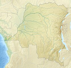
| Epicenter | 6°17′S29°46′E / 6.29°S 29.76°E [1] |
| Type | Dip-slip [2] |
| Areas affected | Democratic Republic of the Congo |
| Max. intensity | MMI X (Extreme) [3] |
| Casualties | 6 [2] |
The 2005 Lake Tanganyika earthquake occurred at 14:19:56 local time on 5 December with a moment magnitude of 6.8 and a maximum Mercalli intensity of X (Extreme). The shock occurred along the East African Rift, an active continental rift zone in East Africa that is characterized by normal faulting, and initiated at a depth of 22 kilometers (14 mi).
Contents
Early reports indicated that the heaviest damage was sustained by the eastern provinces of the Democratic Republic of the Congo (DRC), a region already ravaged by extensive war and extreme poverty. The area houses tens of thousands of refugees displaced by conflicts, such as the Second Congo War and the Burundian Civil War, that have plagued the African Great Lakes in the 1990s and 2000s.
Dozens of houses collapsed in the DRC city of Kalemie. [4] A UN spokesman said that most of the casualties were caused by falling zinc or steel roofs. In Kigoma Region, Tanzania, a child was killed by a collapsing wall and others were injured including a 65-year-old woman who sustained a femur fracture. Fifty-four houses and a mosque were destroyed, and 705 others as well as numerous structures were damaged. [5] In Makamba, Burundi, one person died and another was injured after a structure collapsed. [6]
Depending on several factors including soil types, prevalent construction techniques and the acceleration from the earthquake itself, earthquakes with magnitudes in the 6–7 range may or may not cause wide spread damage. In East Africa such seismic events can wreak havoc. The quake was centred roughly below Lake Tanganyika and – in addition to the DRC, where the most widespread damage has been reported – it was felt in Burundi, Tanzania, Rwanda, and as far away as Mombasa, Kenya, and Luanda, Angola. [4] [7] [8]