2006 Mozambique earthquake

Last updated
2006 Mozambique earthquake
Mozambique relief location map.jpg
Bullseye1.png
Africa relief location map.jpg
Bullseye1.png
UTC  time2006-02-22 22:19:07
ISC  event 8096170
USGS-ANSS ComCat
Local dateFebruary 23, 2006 (2006-02-23)
Local time00:19 CAT
Magnitude7.0 Mw [1]
Depth11 kilometres (7 mi)
Epicenter 21°19′26″S33°34′59″E / 21.324°S 33.583°E / -21.324; 33.583
Type Dip-slip [2]
Areas affectedSouthern Mozambique
Max. intensity IX (Violent)
Aftershocks5.7 Mw Feb 23 at 01:23 [2]
Casualties4 dead, 36 injured [2]

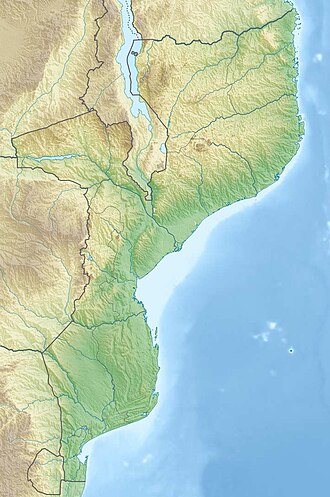
The 2006 Mozambique earthquake occurred at 22:19 UTC on 22 February. It had a magnitude of 7.0 on the moment magnitude scale and caused 4 deaths and 36 injuries. The epicenter was near Machaze in Manica Province of southern Mozambique, just north of the Save River. It was the largest historical earthquake in Mozambique and the first earthquake in southern Africa to have an identified surface rupture. [3]

Contents

Tectonic setting

Southern Mozambique is at the southern end of the East Africa Rift system, where the African Plate appears to be breaking into several smaller plates. [4] The Somali Plate is moving westward relative to the Nubian Plate at a rate of several millimetres a year at the latitude of this earthquake. Most earthquakes in this zone are a result of either normal or strike-slip faulting.

Earthquake

Focal mechanism diagram for the earthquake Mozambique 2006 focal mechanism.png
Focal mechanism diagram for the earthquake

The earthquake was felt throughout Mozambique and over a wide area of eastern southern Africa, including South Africa, Swaziland, Zambia, Zimbabwe and Botswana. [4] Close to the epicentre the shaking reached VIII in intensity on the Mercalli intensity scale. [5] In the cities of Beira, Inhambane and Maputo the intensity reached V.

The focal mechanism of the earthquake is consistent with normal faulting on a westerly dipping fault plane. Field investigations identified 15 km of surface rupture in the form of a west-facing scarp, with up to 2.05 m of vertical displacement, although it was not possible to prove the full extent of surface faulting due to lack of time and the presence of minefields. [3] Investigations using Interferometric synthetic aperture radar (InSAR), combined with field and seismological observations, have identified two fault segments with slightly differing strikes, with the hypocenter and most of the displacement being on the more southerly of the segments. [6]

Damage

USGS Shakemap for the earthquake Mozambique 2006 intensity.jpg
USGS Shakemap for the earthquake

Little damage was recorded, with only 294 buildings reported as damaged in the area between Espungabera, Beira and Chimoio. [5] A total of four deaths were recorded, one in Espungabera, one in Machaze and two in Beira, with a further thirty-six injured.

See also

Related Research Articles

<span class="mw-page-title-main">1999 Düzce earthquake</span> 1999 earthquake in north-central Turkey

The 1999 Düzce earthquake occurred on 12 November at 18:57:22 local time with a moment magnitude of 7.2 and a maximum Mercalli intensity of IX (Violent), causing damage and at least 845 fatalities in Düzce, Turkey. The epicenter was approximately 100 km (62 mi) to the east of the extremely destructive 1999 İzmit earthquake that happened nearly three months earlier. Both strike-slip earthquakes were caused by movement on the North Anatolian Fault.

An earthquake struck Turkey's eastern Erzincan Province at 1:57:23 a.m. on 27 December 1939 local time with a moment magnitude of 7.8Mw and a maximum Mercalli intensity of XII (Extreme). It is the joint second most-powerful earthquake recorded in Turkey, tied with the 2023 Turkey–Syria earthquake. Only the 1668 North Anatolia earthquake was more powerful. This was one of the largest in a sequence of violent shocks to affect Turkey along the North Anatolian Fault between 1939 and 1999. Surface rupturing, with a horizontal displacement of up to 3.7 meters, occurred in a 360 km long segment of the North Anatolian Fault Zone. The earthquake was the most severe natural loss of life in Turkey in the 20th century, with 32,968 dead, and some 100,000 injured.

The 2006 Kamchatka earthquake occurred on April 21, 2006 at 12:25 PM local time. This shock had a moment magnitude of 7.6 and a maximum Mercalli intensity of X (Extreme). The hypocenter was located near the coast of Koryak Autonomous Okrug at an estimated depth of 22 km, as reported by the International Seismological Centre. This event caused damage in three villages and was followed by a number of large aftershocks. Two M6.6 earthquakes struck on April 29 at 16:58 UTC and again on May 22 at 11:12 UTC. These earthquakes caused no deaths; however, 40 people were reported injured.

<span class="mw-page-title-main">1992 Landers earthquake</span> Magnitude-7.3 tremor in California

The 1992 Landers earthquake occurred on Sunday, June 28 with an epicenter near the town of Landers, California, in San Bernardino County. The shock had a moment magnitude of 7.3 and a maximum Mercalli intensity of IX (Violent).

<span class="mw-page-title-main">2002 Denali earthquake</span> 7.9 magnitude; November 3, 2002

The 2002 Denali earthquake occurred at 22:12:41 UTC November 3 with an epicenter 66 km ESE of Denali National Park, Alaska, United States. This 7.9 Mw earthquake was the largest recorded in the United States in 37 years. The shock was the strongest ever recorded in the interior of Alaska. Due to the remote location, there were no fatalities and only one injury.

<span class="mw-page-title-main">San Jacinto Fault Zone</span> Southern Californian fault zone

The San Jacinto Fault Zone (SJFZ) is a major strike-slip fault zone that runs through San Bernardino, Riverside, San Diego, and Imperial Counties in Southern California. The SJFZ is a component of the larger San Andreas transform system and is considered to be the most seismically active fault zone in the area. Together they relieve the majority of the stress between the Pacific and North American tectonic plates.

<span class="mw-page-title-main">1911 Kebin earthquake</span> Earthquake in Kazakhstan on 3 January 1911

The 1911 Kebin earthquake, or Chon-Kemin earthquake, struck Russian Turkestan on 3 January. Registering at a moment magnitude of 8.0, it killed 452 people, destroyed more than 770 buildings in Almaty, Kazakhstan, and resulted in 125 miles (201 km) of surface faulting in the valleys of Chon-Kemin, Chilik and Chon-Aksu.

<span class="mw-page-title-main">1927 Gulang earthquake</span> 1927 severe earthquake centered near Gulang, Gansu Province, China

The 1927 Gulang earthquake occurred at 06:32 a.m. on 23 May. This 7.6 magnitude event had an epicenter near Gulang, Gansu in the Republic of China. There were 40,912 deaths. It was felt up to 700 km (435 mi) away.

The 1971 Bingöl earthquake was a Mw  6.6 earthquake that occurred at 18:44:02 local time on 22 May. It had a surface-wave magnitude of 6.9 and a maximum intensity of VIII (Severe) on the Mercalli intensity scale, killing 755–1,000 people.

The 1881 Nicobar Islands earthquake occurred at about 07:49 local time on 31 December, with an epicentre beneath Car Nicobar. It occurred as two separate ruptures, the largest of which had an estimated magnitude of 7.9 on the moment magnitude scale and triggered a tsunami that was observed around the Bay of Bengal. It is probably the earliest earthquake for which rupture parameters have been estimated instrumentally.

The 1932 Changma earthquake occurred at 10:04:27 local time on 25 December. With an estimated magnitude of 7.6 on the surface wave magnitude scale, and a maximum felt intensity of X (Extreme) on the Mercalli intensity scale, the quake destroyed 1,167 houses and caused 275 to 70,000 deaths and 320 injuries.

<span class="mw-page-title-main">Sagaing Fault</span> Seismic fault in Myanmar

The Sagaing Fault is a major fault in Myanmar, a mainly continental right-lateral transform fault between the Indian Plate and Sunda Plate. It links the divergent boundary in the Andaman Sea with the zone of active continental collision along the Himalayan front. It passes through the populated cities of Mandalay, Yamethin, Pyinmana, the capital Naypyidaw, Toungoo and Pegu before dropping off into the Gulf of Martaban, running for a total length of over 1200 kilometers.

<span class="mw-page-title-main">Surface rupture</span> Offset at ground-level after earthquakes

In seismology, surface rupture is the visible offset of the ground surface when an earthquake rupture along a fault affects the Earth's surface. Surface rupture is opposed by buried rupture, where there is no displacement at ground level. This is a major risk to any structure that is built across a fault zone that may be active, in addition to any risk from ground shaking. Surface rupture entails vertical or horizontal movement, on either side of a ruptured fault. Surface rupture can affect large areas of land.

The 1930 Bago (Pegu) earthquake, also known as the Swa earthquake struck Myanmar on 5 May. The moment magnitude (Mw ) 7.4 earthquake had a focal depth of 35 km (22 mi) and maximum Rossi–Forel intensity of IX. The earthquake was the result of rupture along a 131 km (81 mi) segment of the Sagaing Fault—a major strike-slip fault that runs through the country. Extensive damage was reported in the southern part of the country, particularly in Bago and Yangon, where buildings collapsed and fires erupted. At least 550, and possibly up to 7,000 people were killed. A moderate tsunami was generated along the Burmese coast which caused minor damage to ships and a port. It was felt for over 570,000 km2 (220,000 sq mi) and as far as Shan State and Thailand. The mainshock was followed by many aftershocks; several were damaging; additional earthquakes occurred in July and December, killing dozens. The December earthquake was similarly sized which also occurred along the Sagaing Fault.

<span class="mw-page-title-main">Haiyuan Fault</span> Intracontinental strike-slip fault in Tibet

The Haiyuan Fault is a major active intracontinental strike-slip (sinistral) fault in Central Asia.

In 1954, the state of Nevada was struck by a series of earthquakes that began with three magnitude 6.0+ events in July and August that preceded the Mw  7.1–7.3 mainshock and M 6.9 aftershock, both on December 12. All five earthquakes are among the largest in the state, and the largest since the Cedar Mountain earthquake of 1932 and Pleasant Valley event in 1915. The earthquake was felt throughout much of the western United States.

The 1973 Luhuo earthquake struck near the town of Zhaggo in Garzê Tibetan Autonomous Prefecture of Sichuan Province, China on February 6, 1973, with a magnitude of 7.6 Ms. The earthquake had a maximum intensity of X (Extreme) on the Modified Mercalli intensity scale. It resulted in between 2,175 and 2,204 deaths and a further 2,743 injuries. Serious and widespread destruction occurred in Luhuo County.

The 2021 Maduo earthquake, also known as the 5.22 earthquake struck Madoi County in Qinghai Province, China on 22 May at 02:04 local time. The earthquake had a moment magnitude and surface-wave magnitude of 7.4. Highway bridges, roads and walls collapsed as a result of the earthquake. According to an anonymous source, at least 20 people were killed, 300 were injured, and 13 were missing. Officials stated that there were no deaths but 19 people sustained minor injuries. It was the strongest in China since 2008. It was assigned a maximum intensity of X in Machali, Maduo County on the China seismic intensity scale and Modified Mercalli intensity scale. This earthquake was preceded by another unrelated earthquake that occurred 5 hours earlier in Yunnan.

The 1933 Sumatra earthquake or Liwa earthquake occurred in West Lampung Regency, Lampung Province, Indonesia on June 25. The earthquake had an estimated surface-wave magnitude (Ms ) of 7.7 occurring at a shallow depth of 20 km. It had an epicenter onshore, devastating the city of Liwa. At least 76 people were reported killed, although the death toll may have been in the thousands. Aftershocks followed, including one which was strong enough to cause additional fatalities. The mainshock also triggered a nearby volcanic eruption two weeks later, killing some people.

The 1977 Naghan earthquake struck Chaharmahal and Bakhtiari province in Iran on April 6 at 13:36 UTC. The earthquake measuring 6.0 Mw  occurred at a depth of 15 km (9.3 mi) and had a maximum Modified Mercalli intensity of VIII (Severe). More than 2,100 homes were destroyed and at least 348 people were killed.

References

  1. National Geophysical Data Center / World Data Service (NGDC/WDS): NCEI/WDS Global Significant Earthquake Database. NOAA National Centers for Environmental Information. "Significant Earthquake Information". doi:10.7289/V5TD9V7K . Retrieved 21 March 2024.
  2. 1 2 3 USGS (September 4, 2009), PAGER-CAT Earthquake Catalog, Version 2008_06.1, United States Geological Survey
  3. 1 2 Fenton C.H. (2006). "The first recorded surface rupture in southern Africa: the 22 February 2006 M 7.0 Machaze, Mozambique, earthquake". AGU Fall Meeting Abstracts. 13: T13B–0510. Bibcode:2006AGUFM.T13B0510F.
  4. 1 2 "M7.0 Mozambique Earthquake of 22 February 2006" (PDF). USGS. Retrieved 8 December 2014.
  5. 1 2 "M7.0 – Mozambique". USGS. Retrieved 29 March 2015.
  6. Copley A., Hollongsworth J. & Bergman E. (2012). "Constraints on fault and lithosphere rheology from the coseismic slip and postseismic afterslip of the 2006 M w 7.0 Mozambique earthquake" (PDF). Journal of Geophysical Research. 117 (B03404): B03404. Bibcode:2012JGRB..117.3404C. doi:10.1029/2011JB008580. Archived from the original (PDF) on 2016-10-11. Retrieved 2015-03-29.