| ||||||||||||||||||||||
| Results | ||||||||||||||||||||||
|---|---|---|---|---|---|---|---|---|---|---|---|---|---|---|---|---|---|---|---|---|---|---|
| ||||||||||||||||||||||
 |
|---|
A constitutional referendum was held in Palau on 1 May 2020. Voters were asked whether they approved of an amendment to article 1 of the constitution, which defined its maritime borders. The proposal was approved by 97% of voters.
| ||||||||||||||||||||||
| Results | ||||||||||||||||||||||
|---|---|---|---|---|---|---|---|---|---|---|---|---|---|---|---|---|---|---|---|---|---|---|
| ||||||||||||||||||||||
| |
|---|
A constitutional referendum was held in Palau on 1 May 2020. Voters were asked whether they approved of an amendment to article 1 of the constitution, which defined its maritime borders. The proposal was approved by 97% of voters.
The amendment proposed deleting part (b) of article 1, section 1, leaving the maritime border defined only by part (a). [1] President Thomas Remengesau Jr. claimed this would strengthen the country's territorial claims and its negotiating position with other countries. [2]
Article 1, section 1:
The change was approved by 97% of voters, with a majority in favour in all 16 states.
| Choice | Votes | % | |
|---|---|---|---|
| For | 4,327 | 96.80 | |
| Against | 143 | 3.20 | |
| Total | 4,470 | 100.00 | |
| Valid votes | 4,470 | 99.82 | |
| Invalid/blank votes | 8 | 0.18 | |
| Total votes | 4,478 | 100.00 | |
| Registered voters/turnout | 14,470 | 30.95 | |
| Source: Direct Democracy | |||

Cape Verde is a group of arid Atlantic islands which are home to distinct communities of plants, birds, and reptiles. The islands constitute the unique Cape Verde Islands dry forests ecoregion, according to the World Wildlife Fund.

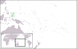
Palau, officially the Republic of Palau, is an island country in the Micronesia subregion of Oceania in the western Pacific. The republic consists of approximately 340 islands and connects the western chain of the Caroline Islands with parts of the Federated States of Micronesia. It has a total area of 466 square kilometers (180 sq mi), making it one of the smallest countries in the world. The most populous island is Koror, home to the country's most populous city of the same name. The capital Ngerulmud is located on the largest island of Babeldaob, in Melekeok State. Palau shares maritime boundaries with international waters to the north, the Federated States of Micronesia to the east, Indonesia to the south, and the Philippines to the northwest.

Palau was initially settled around 1000 BC.
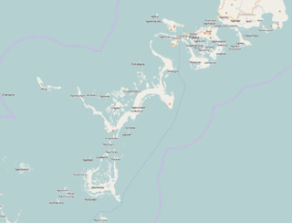
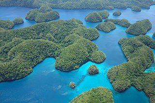
The Republic of Palau consists of eight principal islands and more than 250 smaller ones lying roughly 500 miles southeast of the Philippines, in Oceania. The islands of Palau constitute the westernmost part of the Caroline Islands chain. The country includes the World War II battleground of Peleliu and world-famous rock islands. The total land area is 459 km2 (177 sq mi). It has the 42nd largest Exclusive Economic Zone of 603,978 km2 (233,197 sq mi).

The geography of Papua New Guinea describes the eastern half of the island of New Guinea, the islands of New Ireland, New Britain and Bougainville, and smaller nearby islands. Together these make up the nation of Papua New Guinea in tropical Oceania, located in the western edge of the Pacific Ocean.

São Tomé and Príncipe is a small island country composed of an archipelago located in the Gulf of Guinea of the equatorial Atlantic Ocean. The nation's main islands are São Tomé Island and Príncipe Island, for which the country is named. These are located about 300 and 250 kilometres, respectively, off the northwest coast of Gabon in Central Africa.

Solomon Islands is an island country in the South Pacific Ocean, that lies east of Papua New Guinea.

Fiji is a group of volcanic islands in the South Pacific, lying about 4,450 kilometres (2,765 mi) southwest of Honolulu and 1,770 km (1,100 mi) north of New Zealand. Of the 332 islands and 522 smaller islets making up the archipelago, about 106 are permanently inhabited. The total land size is 18,272 km2 (7,055 sq mi). It has the 26th largest Exclusive Economic Zone of 1,282,978 km2 (495,361 sq mi).

Territorial waters are informally an area of water where a sovereign state has jurisdiction, including internal waters, the territorial sea, the contiguous zone, the exclusive economic zone, and potentially the extended continental shelf. In a narrower sense, the term is often used as a synonym for the territorial sea.
Angaur, or Ngeaur in Palauan, is an island and state in the island nation of Palau.
Tobi, or Hatohobei (Tobian), is the southernmost of Palau's sixteen states, consisting of Tobi Island and Helen Reef. The total land area is about 0.88 km². The population was 25 in 2015. Tobian, English, and Sonsorolese are the official languages of Hatohobei State.
A baseline, as defined by the United Nations Convention on the Law of the Sea, is the line along the coast from which the seaward limits of a state's territorial sea and certain other maritime zones of jurisdiction are measured, such as a state's exclusive economic zone. Normally, a sea baseline follows the low-water line of a coastal state. When the coast is deeply indented, has fringing islands or is highly unstable, straight baselines may be used.
This is a list of points in the Philippines that are farther north, south, east, or west than any other location in the country. Also included are extreme points in elevation, extreme distances, and other points of geographic interest.
The following is an alphabetical list of topics related to the Republic of Palau.
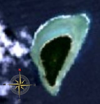
Tobi is an island in the Palauan state of Hatohobei. Tobi Island is 1.6 km long and 0.8 km wide, and has an area of about 0.85 square kilometres (0.33 sq mi). With a population of about 30, it holds all of the state's people, with the exception of a weather base on Helen Island. Most of the inhabitants live on the island's west side and speak Tobian.

Sonsorol is one of the sixteen states of Palau. The inhabitants speak Sonsorolese, a local Chuukic language, and Palauan.
An archipelagic state is an island country that consists of an archipelago. The designation is legally defined by the United Nations Convention on the Law of the Sea (UNCLOS). In various conferences, The Bahamas, Fiji, Indonesia, Papua New Guinea, and the Philippines are the five original sovereign states that obtained approval in the UNCLOS signed in Montego Bay, Jamaica on 10 December 1982 and qualified as the archipelagic states.

A twenty-three-part referendum was held in Palau on 4 November 2008 alongside the country's general elections. Voters were asked questions on requirements of citizenship to hold office, government provision of primary school and health care, the definition of marriage and term limits for Parliament. Only the proposal permitting naturalization for certain adoptees failed to obtain the requisite majority of the vote and majority in 3/4th of the states.

The baselines of the Philippines are the set of geodesic lines completely encircling the Philippine archipelago from where the maritime entitlements of the country are measured from. It was first established in 1961 by an act of the Congress of the Philippines which was further amended in April 2009 to optimize and conform it to the United Nations Convention on the Law of the Sea, which the Philippines is a signatory to. A total of 101 basepoints providing for 100 baselines were identified under Republic Act No. 9522, which identified Amianan Island as the northernmost, Frances Reef as the southernmost, Pusan Point as its easternmost and the Balabac Great Reef as the westernmost points of the main Philippine archipelago.
The Palau tropical moist forests is a tropical and subtropical moist broadleaf forests ecoregion in Micronesia. It encompasses the nation of Palau.
| Presidential elections | |
|---|---|
| Parliamentary elections | |
| Referendums | |