
Nepal measures about 880 kilometers (547 mi) along its Himalayan axis by 150 to 250 kilometers across. It has an area of 147,516 km2 (56,956 sq mi).

The Himalayas, or Himalaya is a mountain range in Asia, separating the plains of the Indian subcontinent from the Tibetan Plateau. The range has some of the Earth's highest peaks, including the highest, Mount Everest. More than 100 peaks exceeding elevations of 7,200 m (23,600 ft) above sea level lie in the Himalayas.
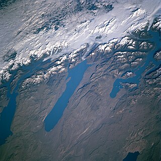
In geology, a proglacial lake is a lake formed either by the damming action of a moraine during the retreat of a melting glacier, a glacial ice dam, or by meltwater trapped against an ice sheet due to isostatic depression of the crust around the ice. At the end of the last ice age about 10,000 years ago, large proglacial lakes were a widespread feature in the northern hemisphere.

A jökulhlaup is a type of glacial outburst flood. It is an Icelandic term that has been adopted in glaciological terminology in many languages. It originally referred to the well-known subglacial outburst floods from Vatnajökull, Iceland, which are triggered by geothermal heating and occasionally by a volcanic subglacial eruption, but it is now used to describe any large and abrupt release of water from a subglacial or proglacial lake/reservoir.
In geomorphology, an outburst flood—a type of megaflood—is a high-magnitude, low-frequency catastrophic flood involving the sudden release of a large quantity of water. During the last deglaciation, numerous glacial lake outburst floods were caused by the collapse of either ice sheets or glaciers that formed the dams of proglacial lakes. Examples of older outburst floods are known from the geological past of the Earth and inferred from geomorphological evidence on Mars. Landslides, lahars, and volcanic dams can also block rivers and create lakes, which trigger such floods when the rock or earthen barrier collapses or is eroded. Lakes also form behind glacial moraines or ice dams, which can collapse and create outburst floods.
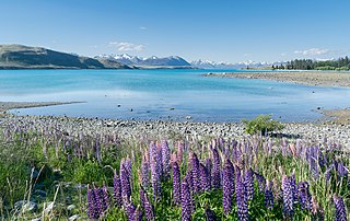
A moraine-dammed lake, occurs when the terminal moraine has prevented some meltwater from leaving the valley. When a glacier retreats, there is a space left over between the retreating glacier and the piece that stayed intact which holds leftover debris (moraine). Meltwater from both glaciers seep into this space creating a ribbon-shaped lake due to the pattern of ice melt. This ice melt may cause a glacier lake outburst flood, leading to severe damage to the environment and communities nearby. Examples of moraine-dammed lakes include:

A glacial lake outburst flood (GLOF) is a type of outburst flood caused by the failure of a dam containing a glacial lake. An event similar to a GLOF, where a body of water contained by a glacier melts or overflows the glacier, is called a jökulhlaup. The dam can consist of glacier ice or a terminal moraine. Failure can happen due to erosion, a buildup of water pressure, an avalanche of rock or heavy snow, an earthquake or cryoseism, volcanic eruptions under the ice, or massive displacement of water in a glacial lake when a large portion of an adjacent glacier collapses into it.

Apa, nicknamed "Super Sherpa", is a Nepalese Sherpa mountaineer who, until 2017, jointly with Phurba Tashi held the record for reaching the summit of Mount Everest more times than any other climber. As part of The Eco Everest Expedition 2011, Apa made his 21st Mount Everest summit in May 2011 then retired after a promise to his wife to stop climbing after 21 ascents. He first summited Everest in 1990 and his last time to the summit was in 2011.

Thame and its neighbouring Thameteng are small Sherpa villages in Namche VDC of the Solukhumbu District in Nepal. These were the last year-round villages on the salt trading route that existed between Tibet, Nepal and India. Thame is home to many famous Sherpa mountaineers, including Apa Sherpa.
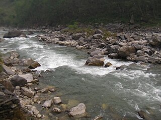
Bhote Koshi in Nepal and Poiqu in Tibet is the name given to the upper course of the Sun Kosi river. It is part of the Koshi River system in Nepal.

The Sunkoshi, also spelt Sunkosi, is a river that is part of the Koshi or Saptkoshi River system in Nepal. Sunkoshi has two source streams, one that arises within Nepal in Choukati, and the other more significant stream that flows in from Nyalam County in the Tibet region of China. The latter is called Bhote Koshi in Nepal and Matsang Tsangpo in Tibet. Due to the significant flows from Bhote Koshi, the Sun Koshi river basin is often regarded as a trans-border river basin.

Imja Tsho is a glacial lake created after melt water began collecting at the foot of the Imja Glacier on the lower part of the glacier in the 1950s. A 2009 study described this lake of melt water as one of the fastest-growing in the Himalayas. Held in place by a terminal moraine, Imja Tsho threatens downstream communities with the potential for a glacial outburst flood.
Tsho Rolpa is one of the biggest glacial lakes in Nepal. The lake, which is located at an altitude of 4,580 metres (15,030 ft) in the Rolwaling Valley, Dolakha District, has grown considerably over the last 50 years due to glacial melting in the Himalayas.
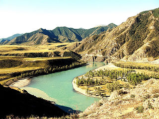
The Altai flood refers to the cataclysmic flood(s) that, according to some geomorphologists, swept along the Katun River in the Altai Republic at the end of the last ice age. These glacial lake outburst floods were the result of periodic sudden ruptures of ice dams like those triggering the Missoula floods.

Globally, Nepal is ranked fourth in terms of vulnerability to climate change. Floods spread across the foothills of the Himalayas and bring landslides, leaving tens of thousands of houses and vast areas of farmland and roads destroyed. In the 2020 edition of Germanwatch's Climate Risk Index, it was judged to be the ninth hardest-hit nation by climate calamities during the period 1999 to 2018. Nepal is a least developed country, with 28.6 percent of the population living in multidimensional poverty. Analysis of trends from 1971 to 2014 by the Department of Hydrology and Meteorology (DHM) shows that the average annual maximum temperature has been increasing by 0.056 °C per year. Precipitation extremes are found to be increasing. A national-level survey on the perception-based survey on climate change reported that locals accurately perceived the shifts in temperature but their perceptions of precipitation change did not converge with the instrumental records. Data reveals that more than 80 percent of property loss due to disasters is attributable to climate hazards, particularly water-related events such as floods, landslides and glacial lake outburst floods (GLOFs).

The 2021 Uttarakhand flood, also known as the Chamoli disaster, began on 7 February 2021 in the environs of the Nanda Devi National Park, a UNESCO World Heritage Site in the outer Garhwal Himalayas in Uttarakhand state, India. It was caused by a large rock and ice avalanche consisting of material dislodged from Ronti peak. It caused flooding in the Chamoli district, most notably in the Rishiganga river, the Dhauliganga river, and in turn the Alaknanda—the major headstream of the Ganges. The disaster left over 200 killed or missing. Most were workers at the Tapovan dam site.
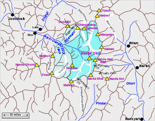
Rishiganga is a river in the Chamoli district, Uttarakhand, India. It springs from the Uttari Nanda Devi Glacier on the Nanda Devi mountain. It is also fed from the Dakshini Nanda Devi Glacier. Continuing through the Nanda Devi National Park, it flows into the Dhauliganga River near the village Rini.
In June 2021, the flood in Melamchi River caused damage in the Melamchi Bazar in Sindhupalchowk District of Nepal killing several locals and some foreigners
Events in the year 2024 in Nepal.
Torrential rainfall during the annual monsoon season in early July, mid August, and late September 2024 caused massive flooding across Nepal as well as several mudslides. The September floods, which caused the most damage and deaths, were caused by the heaviest rainfall recorded in the region since at least 1970, the result of a low-pressure system. The impact of the floods was further increased by poor infrastructure and settlement planning, including unplanned construction on floodplains.


