Date | July 2024 – present |
---|---|
Location | Nepal, primarily its eastern and south-eastern districts [1] |
Cause | Urbanisation near flood plains and poor drainage infrastructure |
Deaths | 300+ |
Missing | 50+ |
Property damage | Rs17 billion+ (estimated) |
Torrential rainfall during the annual monsoon season in early July, mid August, and late September 2024 caused massive flooding across Nepal as well as several mudslides. The September floods, which caused the most damage and deaths, were caused by the heaviest rainfall recorded in the region since at least 1970, the result of a low-pressure system. The impact of the floods was further increased by poor infrastructure and settlement planning, including unplanned construction on floodplains.
The most severe floods began on 26 September and heavily impacted several of eastern Nepal's districts, especially those districts adjacent to Kathmandu and the Bagmati River. The nearby states of India, such as Bihar, Uttar Pradesh and Assam, and parts of northern Bangladesh were also affected. [2] The Kosi River filled to dangerous levels, while the Bagmati River and Nakkhu rivers caused flooding in Bagmati Province. The Kathmandu Valley received between 240 millimetres (9.4 in) and 322.2 millimetres (12.69 in) between 28 and 29 September, causing flooding in Nepal's capital, Kathmandu.
In late September, the Government of Nepal reported at least 224 deaths, 158 injuries, 28 missing persons due to severe flooding, including at least 37 in Kathmandu. Around 13,300 people required rescue, while at least 1,200 houses were destroyed or damaged. Infrastructure damages included 25 bridges, 37 highways, 11 hydropower stations, and numerous telecommunication stations. Agricultural and livestock resources were also damaged. Infrastructure, including waterpipes and access to power and internet, was damaged, and seven highways out of the city were blocked. Multiple casualties were reported from vehicles buried by landslides. The government directed police and military forces, totalling over 30,000 people, [3] to assist with rescue and clean-up work, and schools and universities were closed in impacted areas. All flights from Tribhuvan International Airport were cancelled,[ failed verification ] and Nepalese schools and universities closed for three days. [3] [4]
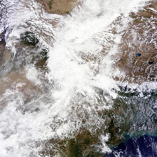
The annual monsoon season typically begins in June, and lasts until September. Flooding in Nepal coincided with 2024 floods in neighbouring and nearby states of India, such as Uttar Pradesh and Assam. Nepalese weather official Binu Maharjan stated that a low-pressure system lingering over nearby regions of India and over the Bay of Bengal was the primary cause of the increased and prolonged flooding in 2024. [5] [6] In response, several flood warnings were issued by the Nepalese government, along with a ban on travelling on highways at night and a warning against driving cars in general due to the risk of accidents or being caught in deadly flooding or mudslides. [7]
As of 7 July 2024 at least 14 people were killed by flooding and nine were reported missing. [8]
On 16 August 2024, two glacier lakes burst in the village of Thame in the Everest region of Solukhumbu District. The flood damaged a number of households in Khumbu Pasanglhamu Rural Municipality. [9] [10]
Initially, the flood was believed to be due to the blocked river breached by a landslide. However, an aerial inspection confirmed the cause and revealed that two lakes had broken through, one of the remaining three glacial lakes was safe, two others were still at risk. The rising temperatures since 9 August, which peaked at 15 °C (59 °F) on the day of the flood, contributed to the outburst. [9]
The sudden flood displaced 135 people, including 40 children. Most residents had already left for Kathmandu or were at the weekly marketplace in Namche. Because the school was closed for the day, no students were hurt. Search and rescue operations was done by the Nepali Army and Nepal Police. The Ministry of Home Affairs coordinated disaster response efforts, and local officials provided the relief. The flood also disrupted key road networks and communication services. [11]
On 18 August 2024 the Department of Hydrology and Meteorology issued warnings for potential further flooding and landslides, advising evacuation for those living along the Dudhkoshi River. [12]
Beginning on 26 September, torrential levels of rain impacted most of Nepal, bringing the most rainfall to the nation's Eastern and Southeastern regions. South-eastern Nepal saw the Kosi River's water level surpass the danger level. [5] [6] Bagmati Province was heavily impacted [13] [14] by the flooding of the Bagmati River and the Nakkhu River. [15] [16] Kathmandu Valley received between 240 millimetres (9.4 in) and 322.2 millimetres (12.69 in) [16] of rain over a period of 24 hours from the mornings of 28–29 September, representing the capital's largest recorded rainfall since 1970 at the latest. [13] [17] As of October 1 at least 217 deaths and 28 missing were confirmed due to flooding. [18] Another 4,000 people required rescue. [19] [20] [21]
In the capital Kathmandu, the Bagmati River rose two meters above its safe level, causing severe flooding, including a large section in the south of the city. [16] [19] Many residents took refuge on upper floors of homes, with some being rescued from their rooftops by helicopters and inflatable rafts. Much of the city also lost power and internet, and multiple water pipes were broken. [15] [13] Thousands of residents were displaced. [19] At least 37 people were killed in the city, and 56 total deaths were reported in the wider Kathmandu Valley. [22] Across Nepal, at least 322 houses and 16 bridges were damaged. [20] Nepalese media described the rainfall as the worst that Kathmandu had suffered from in decades. [5] [6] [13] Casualties were also reported in the regions of Bhaktapur, Dhading, Dolakha, and Makwanpur, [15] and rescues were performed in Lalitpur. [23] The city of Pokhara also sustained heavy flooding. [19]
The UN Children's Fund (UNICEF) expressed particular concern over the impact of the disaster on children, including the deaths of 35 children under the age of eighteen (as of 1 October 2024) and the potential exposure to violence and exploitation. Pointing to the destruction of at least 12 schools and severe damage to many others, the agency also raised alarm over the loss of learning opportunities and a place where children could find comfort and normalcy. [24] [25]
Three highways (including Prithvi Highway) and multiple roads which connected Kathmandu to eastern Nepal were taken out by landslides caused by the rain. [13] At least 35 bodies were recovered on Prithvi Highway, from vehicles which had been buried under landslides. [15] Kathmandu was cut off from transport. In addition, 14 bodies were recovered from two buses that were travelling to Kathmandu before being struck by and buried in a landslide. Many more vehicles were found to have been buried nearby the buses. [5] [6] [13] In response, officials discouraged cars and banned buses from travelling at night on highways. [13] Debris and damage to roads caused the obstruction of highways at twenty-eight locations. [5] By 30 September, officials were able to temporarily open Prithvi Highway. [26] By 1 October, only nine of the county's 37 highways were open for travel. [4] Meanwhile BP Highway was expected to open only after Dashain. [27]
Over 3,000 security personnel from all forces, including the army, were assigned to aid rescue and recovery operations using motorboats, rafts, and helicopters. [5] [13] [19]
On 27 September, all domestic flights departing from Kathmandu were cancelled, impacting over 150 departures. [5] Flights had largely resumed by 29 September. [28]
Nepalese schools and universities were shut down for three days. [6]
The International Centre for Integrated Mountain Development stated that improper investment into Nepal's infrastructure and its poor planning contributed to the magnitude of the disaster. More specifically, unplanned settlement, construction and urbanisation on floodplains, a lack of areas to hold water, and growing human settlement along the Bagmati River were each noted as significant contributors to the scale of the tragedy. The centre insisted that the government invest more in its infrastructure, including flood prevention mechanisms such as underground stormwater systems. [7]
A cloudburst is a enormous amount of precipitation in a short period of time, sometimes accompanied by hail and thunder, which is capable of creating flood conditions. Cloudbursts can quickly dump large amounts of water, e.g. 25 mm of the precipitation corresponds to 25,000 metric tons per square kilometre. However, cloudbursts are infrequent as they occur only via orographic lift or occasionally when a warm air parcel mixes with cooler air, resulting in sudden condensation. At times, a large amount of runoff from higher elevations is mistakenly conflated with a cloudburst. The term "cloudburst" arose from the notion that clouds were akin to water balloons and could burst, resulting in rapid precipitation. Though this idea has since been disproven, the term remains in use.
Floods in the United States (2000–present) is a list of flood events which were of significant impact to the country during the 21st century, since 2000. Floods are generally caused by excessive rainfall, excessive snowmelt, storm surge from hurricanes, and dam failure.
The effects of the 2009 Pacific typhoon season in the Philippines were considered some of the worst in decades. Throughout the year, series of typhoons impacted the country, with the worst damage occurring during September and October from Typhoons Ketsana (Ondoy) and Parma (Pepeng).
The 2010 China floods began in early May 2010. Three hundred and ninety-two people died, and a further 232 people were reported missing as of June 30, 2010, including 57 people in a landslide in Guizhou. Fifty-three of the deaths occurred from the flooding and landslides between May 31 and June 3, and 266 deaths occurred between June 13 and June 29. Four hundred and twenty four people were killed by the end of June, including 42 from the Guizhou landslide; 277 more were killed and 147 were missing in the first two weeks of July, bringing the death toll as of August 5 to 1,072. A landslide in early August in Gansu killed at least 1,471 people and left 294 missing. In total, the flooding and landslides killed at least 3,185 people in China by August 31. More than 230 million people in 28 provinces, municipalities, and regions, especially the southern and central provinces and regions of Zhejiang, Fujian, Jiangxi, Hubei, Hunan, Guangdong, Guangxi, Chongqing Municipality, Gansu, Sichuan, and Guizhou, and the northeastern province of Jilin were affected, while at least 4.66 million people were evacuated because of the risk of flooding and landslides in the latter half of June. By early August, over 12 million people were evacuated, and that number rose to 15.2 million by August 31.
The 2011 Sikkim earthquake occurred with a moment magnitude of 6.9 and was centered within the Kanchenjunga Conservation Area, near the border of Nepal and the Indian state of Sikkim, at 18:10 IST on Sunday, 18 September. The earthquake was felt across northeastern India, Nepal, Bhutan, Bangladesh and southern Tibet.
Nepal was hit by serious flooding in May 2012.
In June 2013, a mid-day cloudburst centered on the North Indian state of Uttarakhand caused devastating floods and landslides, becoming the country's worst natural disaster since the 2004 tsunami. The rainfall received that month was far greater than the rainfall the state usually received. Debris blocked the rivers, causing major overflow. The main day of the flood was 16 June 2013.
This is a list of notable recorded floods that have occurred in India. Floods are the most common natural disaster in India. The heaviest southwest, the Brahmaputra, and other rivers to distend their banks, often flooding surrounding areas.
The 1995 India cyclone was a tropical cyclone that struck southeastern India which later spawned a rare snowstorm in Nepal, triggering the deadliest mountain trekking incident in the country's history in November 1995. The storm originated from the monsoon trough on November 7 in the Bay of Bengal, east of India, becoming the penultimate storm of the 1995 North Indian Ocean cyclone season. Moving northwestward, the system gradually intensified while moving toward land, eventually developing an eye in the middle of the convection. Reaching peak winds of at least 120 km/h (75 mph), the India Meteorological Department (IMD) classified the system as a very severe cyclonic storm on November 8, in line with intensity estimates from the American-based Joint Typhoon Warning Center (JTWC). On November 9, the cyclone made landfall near the border of Andhra Pradesh and Orissa. A typical for most November storms, the system continued to the north and dissipated over Nepal on November 11.
Widespread monsoon flooding occurred in the South Asian countries of Afghanistan, Bangladesh, India, Nepal and Pakistan from July through September 2017. More than 45 million people were affected by the floods, including 16 million children.
In mid-March 2019, monsoonal downpours caused widespread flooding and landslides across South Asia.
The 2019 Indian floods were a series of floods that affected over thirteen states in late July and early August 2019, due to excessive rains. At least 200 people died and about a million people were displaced. Karnataka and Maharashtra were the most severely affected states. People died but many were rescued with the help of the Indian Navy.
In June 2021, the flood in Melamchi River caused damage in the Melamchi Bazar in Sindhupalchowk District of Nepal killing several locals and some foreigners
2021 Nepal floods were a series of flash floods caused by heavy rains causing landslides and flash floods.
From January to October 2022, excessive rainfall and widespread monsoon flooding occurred in the South Asian countries of Afghanistan, Bangladesh, India, Nepal, Pakistan, and Sri Lanka. It has become the region's deadliest floods since 2020, with over 4,700 people dead.
Events in the year 2024 in Nepal.
Heavy rainfall during the 2024 monsoon season resulted in severe flooding and landslides across several regions of India. Rainfall caused significant flooding first in Assam State and later end of August also in Gujarat, India.
The Madan Ashrit Highway disaster was a road accident on July 12, 2024 that was caused by a large landslide that pushed two buses carrying a total of 65 passengers on the Madan Ashrit Highway into the Trishuli River in Nepal. The disaster left at least 11 people dead, injured three people and left 51 people missing.
On 16 August 2024, two glacier lakes burst in Thame village of the Everest region in Solukhumbu District of Nepal. The flood damaged a number of households of Khumbu Pasanglhamu Rural Municipality.