The Dwight D. Eisenhower National System of Interstate and Defense Highways, commonly known as the Interstate Highway System, is a network of controlled-access highways that forms part of the National Highway System in the United States. The system extends throughout the contiguous United States and has routes in Hawaii, Alaska, and Puerto Rico.

In the United States, a farm-to-market road or ranch-to-market road is a state highway or county road that connects rural or agricultural areas to market towns. These are better quality roads, usually a highway, that farmers and ranchers use to transport products to market towns or distribution centers. Historically used throughout the country, today the term is primarily associated with a large state-maintained highway system in Texas.

U.S. Route 80 or U.S. Highway 80 (US 80) is a major east–west United States Numbered Highway in the Southern United States, much of which was once part of the early auto trail known as the Dixie Overland Highway. As the "0" in the route number indicates, it was originally a cross-country route, from the Pacific Ocean to the Atlantic Ocean. Its original western terminus was at Historic US 101 in San Diego, California. However, the entire segment west of Dallas, Texas, has been decommissioned in favor of various Interstate Highways and state highways. Currently, the highway's western terminus is at an interchange with Interstate 30 (I-30) on the Dallas–Mesquite, Texas city line. Its eastern terminus is in Tybee Island, Georgia near the Atlantic Ocean. Between Jonesville, Texas and Kewanee, Mississippi, US 80 runs parallel to or concurrently with Interstate 20. It also currently runs through Dallas, Texas; Shreveport, Louisiana; Jackson, Mississippi; Montgomery, Alabama; Columbus, Georgia; Macon, Georgia; and Savannah, Georgia.

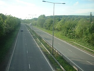
A dual carriageway (BrE) or a divided highway (AmE) is a class of highway with carriageways for traffic travelling in opposite directions separated by a central reservation (BrE) or median (AmE). Roads with two or more carriageways which are designed to higher standards with controlled access are generally classed as motorways, freeways, etc., rather than dual carriageways.
A routenumber, designation or abbreviation is an identifying numeric designation assigned by a highway authority to a particular stretch of roadway to distinguish it from other routes and, in many cases, also to indicate its classification, general geographical location and/or orientation. The numbers chosen may be used solely for internal administrative purposes; however, in most cases they are also displayed on roadside signage and indicated on maps.

A concurrency in a road network is an instance of one physical roadway bearing two or more different route numbers. When two roadways share the same right-of-way, it is sometimes called a common section or commons. Other terminology for a concurrency includes overlap, coincidence, duplex, triplex, multiplex, dual routing or triple routing.

Texas state highways are a network of highways owned and maintained by the U.S. state of Texas. The Texas Department of Transportation (TxDOT) is the state agency responsible for the day-to-day operations and maintenance of the system. Texas has the largest state highway system, followed closely by North Carolina's state highway system. In addition to the nationally numbered Interstate Highways and U.S. Highways, the highway system consists of a main network of state highways, loops, spurs, and beltways that provide local access to the other highways. The system also includes a large network of farm to market roads that connect rural areas of the state with urban areas and the rest of the state highway system. The state also owns and maintains some park and recreational roads located near and within state and national parks, as well as recreational areas. All state highways, regardless of classification, are paved roads. The Old San Antonio Road, also known as the El Camino Real, is the oldest highway in the United States, first being blazed in 1691. The length of the highways varies from US 83's 893.4 miles (1,437.8 km) inside the state borders to Spur 200 at just 0.05 miles long.

State Highway 71 is a Texas state highway that runs 253 miles (407 km). The northern terminus is at US 87 and US 377 south of Brady and its southern terminus is at SH 35 near Blessing. This highway is designated the "10th Mountain Division Highway" from SH 95 to Interstate 35.

The Pan-Philippine Highway, also known as the Maharlika Highway, is a network of roads, expressways, bridges, and ferry services that connect the islands of Luzon, Samar, Leyte, and Mindanao in the Philippines, serving as the country's principal transport backbone. Measuring 3,379.73 kilometers (2,100.07 mi) long excluding sea routes not counted by highway milestones, it is the longest highway in the Philippines that forms the country's north–south backbone component of National Route 1 (N1) of the Philippine highway network. The entire highway is designated as Asian Highway 26 (AH26) of the Asian Highway Network.

There are 9 routes assigned to the "N" zone of the California Route Marker Program, which designates county routes in California. The "N" zone includes county highways lying in Los Angeles and Orange counties.

At least 15 special routes of U.S. Route 78 have existed and at least seven have been deleted.


