
Ilorin is the capital city of Kwara State located in the North Central region of Nigeria. As of the 2006 census, it had a population of 777,667, making it the 7th largest city by population in Nigeria. Surrounding the historic central district with its traditional single-story red-mud houses with thatched straw roofs and numerous mosques, all protected by a mud wall, the modern city is an industrial, commercial, and educational centre.

New Hampshire Route 10 is a 122.25-mile-long (196.74 km) north–south state highway in western New Hampshire, United States. Its southern terminus is in Winchester at the Massachusetts state line, where it continues south as Massachusetts Route 10. Administratively, the northern terminus is at a junction with U.S. Route 302 in Haverhill.

Kwara State is a state in North Central Nigeria, bordered to the east by Kogi State, to the north by Niger state, and to the south by Ekiti, Osun, and Oyo states, while its western border makes up part of the international border with Benin Republic. Its capital is the city of Ilorin and the state has 16 local government areas.

State Highway 7 is a 150.5-mile (242.2 km) highway in southern Oklahoma. This lengthy highway connects many towns in Oklahoma's "Little Dixie" area. It runs from Interstate 44 in Lawton to U.S. 69/US-75 in Atoka.
New York State Route 5S (NY 5S) is a 72.92-mile-long (117.35 km) east–west state highway located in the Mohawk Valley of New York in the United States. It extends from a continuation of NY 5A at an interchange with NY 5, NY 8, NY 12, and Interstate 790 (I-790) in Utica to an interchange with NY 890 in Rotterdam. The route runs along the south side of the Mohawk River for its entire length and parallels NY 5, which runs along the north side of the Mohawk River. NY 5S intersects several primary routes including NY 28 in Mohawk, NY 30A in Fultonville, NY 30 south of Amsterdam, as well as intersecting the New York State Thruway (I-90) several times. The route is part of New York State Bicycle Route 5 west of its junction with NY 103 in Schenectady County.

State Route 4 (SR 4) is a state highway in the eastern part of the U.S. state of Georgia. Except for its northernmost portion, it is completely concurrent for its entire length with U.S. Route 1 (US 1). It traverses south-to-north through portions of Charlton, Ware, Bacon, Appling, Toombs, Emanuel, Jefferson, and Richmond counties in the southeastern and east-central parts of the state. The highway begins at the Florida state line, on US 1/US 23/US 301/SR 15 at the St. Marys River. It travels to its northern terminus at the South Carolina state line, on the Augusta–North Augusta, South Carolina city line, on US 25 Business at the Savannah River.
Busa, or Bisã, is the Mande language of the former Borgu Emirate in northwestern Nigeria and northern Benin. It is called Busanci in Hausa, and has also been called Zugweya.

Kaiama is a Local Government Area and town in northwestern Kwara State, Nigeria. Its headquarters are in the town of Kaiama.
Kisi is a large town in Oyo State, Nigeria. It is the headquarters of the Irepo Local Government Area. Kishi, is located at the northern part of Oyo State. Kisi is very close to old Katunga which collapsed in the 18th century as a result of Jihad activity by the Hausa/Fulani of Ilorin, Kwara State. Kisi is reputed as a town whose people were never conquered or defeated in battles, hence many people from old Oyo migrated and settled in Kishi during and after the Fulani Jihadist invasion. Kisi is about 240 km from Ibadan, the capital city of Oyo state, and about 200 km and 110 km from Oyo Alaafin and Ilorin respectively.
The A4 highway is a major north–south route in Nigeria that spans from the southern coast to the eastern inland region, connecting various cities and regions.
The A5 highway is a major highway in Nigeria. It connects the cities of Lagos, Abeokuta, and Ibadan in an eastward direction.

The A8 highway is a roadway in Adamawa State, Nigeria. It spans approximately 100 kilometers, running from west to east. This highway connects two towns located to the south of the Benue River: Numan and Jimeta.
The A9 highway is a major highway in Nigeria, located in the northern region of the country. It serves as a vital transportation link, connecting several key cities and facilitating both domestic and international trade.
Transportation in New England encompasses the region's rail and highway networks, seaports, and airports. New England has one of the United States' oldest intercity transportation systems, which remain important to the region's economy. It is also home to the continent's first subway system. The densely populated area has many cities and towns connected by rail and road, and the larger cities each have commercial airports with daily flights to destinations outside of the region.

The 2023 Kwara State gubernatorial election will take place on 18 March 2023, to elect the Governor of Kwara State, concurrent with elections to the Kwara State House of Assembly as well as twenty-seven other gubernatorial elections and elections to all other state houses of assembly. The election—which was postponed from its original 11 March date—will be held three weeks after the presidential election and National Assembly elections. Incumbent APC Governor AbdulRahman AbdulRazaq has been renominated by his party.
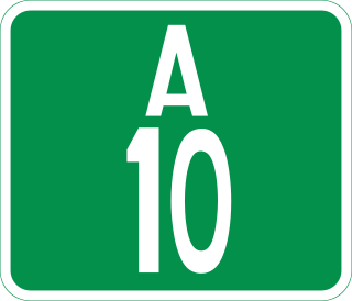
The A10 highway is a major highway in Nigeria, connecting the western and eastern regions of the country. This highway spans approximately 452 kilometers and plays a crucial role in facilitating transportation and commerce.
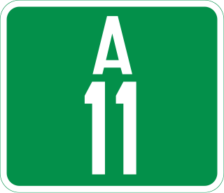
The A11 highway is a major highway in Nigeria. It serves as a crucial transportation route connecting various cities and regions across the country.

The A14 highway is a major highway in Nigeria that connects the city of Ilorin in the east to Bode Sadu in the west. It spans a distance of approximately 80 kilometers and plays a crucial role in the regional transportation network.

F101 is a major east–west Federal highway in Nigeria. It connects various cities and regions within Lagos State.
