Nigeria’s transport network has expanded in recent years to accommodate a growing population. The transport and storage sector was valued at N2.6trn ($6.9bn) in current basic prices in 2020, down from N3trn ($8bn) in 2019, according to the National Bureau of Statistics (NBS). This was reflected in a lower contribution to GDP, at 1.8% in the fourth quarter of 2020, down from 2.1% during the same period the previous year but higher than the 0.8% recorded in the third quarter of 2020. One of the most significant challenges facing the sector is meeting the needs of both large coastal cities and rural inland communities in order to fully unlock the country’s economic potential. This is especially the case with mining and agriculture, both of which are expected to benefit from two large-scale projects: the Lekki Port in Lagos and the Kano-Maradi rail line in the north of the country.

Katsina is a Local Government Area and the capital city of Katsina State, in northern Nigeria.

Kano State is one of the 36 states of Nigeria, located in the northern region of the country. According to the national census done in 2006, Kano State is the most populous state in Nigeria. The recent official estimates taken in 2016 by the National Bureau of Statistics found that Kano State was still the largest state by population in Nigeria. Created in 1967 out of the former Northern Region, Kano State borders on Katsina State to the northwest for about 210 km, Jigawa State to the northeast for 355 km, Bauchi State to the southeast for 131 km, and Kaduna State to the southwest for 255 km. The state's capital and largest city is the city of Kano, the second most populous city in Nigeria after Lagos. The incumbent governor of the state is Abba Kabir Yusuf. He was sworn in on 29 May 2023.

Kaduna State is a state in the northwest geopolitical zone of Nigeria. The state capital is its namesake, the city of Kaduna, which was the 8th largest city in the country as of 2006. Created in 1967 as North-Central State, which also encompassed the modern Katsina State, Kaduna State achieved its current borders in 1987. Kaduna State is the fourth largest and third most populous state in the country, Kaduna State is nicknamed the Centre of Learning, owing to the presence of numerous educational institutions of importance within the state such as Ahmadu Bello University.

Katsina State is a state in the northwestern geopolitical zone of Nigeria. Katsina State borders the Republic of Niger to the north for 250 km and the States of Jigawa for 164 km and Kano to the east, Kaduna to the south for 161 km and Zamfara to the west. States. Nicknamed the "Home of Hospitality", Both the state capital and the town of Daura have been described as "ancient seats of Islamic culture and learning" in Nigeria.

A controlled-access highway is a type of highway that has been designed for high-speed vehicular traffic, with all traffic flow—ingress and egress—regulated. Common English terms are freeway, motorway, and expressway. Other similar terms include throughway or thruway and parkway. Some of these may be limited-access highways, although this term can also refer to a class of highways with somewhat less isolation from other traffic.

The A9 motorway is a north–south motorway in Croatia, with a length of 78.3 kilometres. Beginning in Pula, the largest city on the Istrian peninsula, it runs north to the Croatian motorway and expressway network at the Kanfanar interchange. Here it meets the A8 motorway, forming the Istrian Y road system. The A9 continues north from here to the Kaštel and Plovanija border crossings into Slovenia. The motorway represents a significant north–south transportation corridor in Croatia and is a part of the European route E751. The motorway's national significance is reflected in the positive economic impact on the cities and towns it connects, as well as its importance to tourism in Croatia. Importance of the motorway for tourism is particularly high during summer tourist seasons, when traffic volume increases by more than 80%.
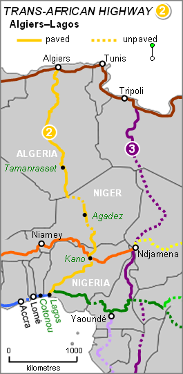
The Trans-Sahara Highway or TAH 2, formally the Trans-Saharan Road Corridor (TSR), and also known as the African Unity Road, is a transnational infrastructure project to facilitate trade, transportation, and regional integration among six African countries: Algeria, Chad, Mali, Niger, Nigeria, and Tunisia. It runs roughly 4,500 km north to south across the Sahara desert from Algiers, Algeria on the Mediterranean coast of North Africa to Lagos, Nigeria on the Atlantic coast of West Africa; subsequently, it is sometimes known as the Algiers–Lagos Highway or Lagos–Algiers Highway.

The Trans-Sahelian Highway or TAH 5 is a transnational highway project to pave, improve and ease border formalities on a highway route through the southern fringes of the Sahel region in West Africa between Dakar, Senegal in the west and Ndjamena, Chad, in the east. Alternative names for the highway are the Dakar-Ndjamena Highway or Ndjamena-Dakar Highway and it is Trans-African Highway 5 in the Trans-African Highway network.

The European route E751, or E751, as defined by the Declaration on the Construction of Main International Traffic Arteries of 1975, and subsequent documents which amended the treaty, is an east–west Class-B branching European road route. Originating in Rijeka, Croatia, where it diverges from European route E61 before passing through the Kanfanar interchange, the route connects Pula, Rovinj, Poreč and Umag in Croatia with Koper in Slovenia. The route provides a high-performance road link in Istria and Slovenian Littoral. Unlike most routes, the E751 centers on the Kanfanar interchange and has three arms, each extending to Rijeka, Pula and Koper. The total length of the route, including all the route arms, is 160 km (99 mi).
The A8 in Northern Ireland is a 26.1 km route connecting the city of Belfast with the harbour town of Larne. One of the busiest routes in the region, the road forms part of the unsigned European routes E01 and E18.
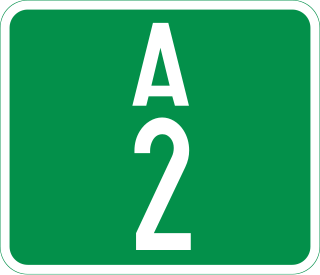
The A2 highway is a federal highway in Nigeria that spans 1,200 kilometres (750 mi). It serves as a vital transportation route, connecting the country's southern and northern regions.
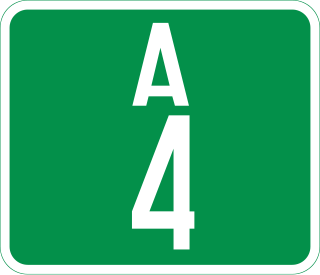
The A4 highway is a major north–south route in Nigeria that spans from the southern coast to the eastern inland region, connecting various cities and regions.
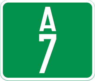
The A7 Highway is a major highway in Nigeria, connecting the city of Ilorin, the capital of Kwara State, in the eastern direction to the border with Benin in the northwest. It plays a crucial role in regional transportation, passing through several cities and towns along its route.
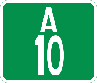
The A10 highway is a major highway in Nigeria, connecting the western and eastern regions of the country. This highway spans approximately 452 kilometers and plays a crucial role in facilitating transportation and commerce.
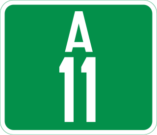
The A11 highway is a major highway in Nigeria. It serves as a crucial transportation route connecting various cities and regions across the country.
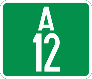
The A12 highway is a major highway in Nigeria, connecting the town of Katsina Ala in the east to the city of Jalingo in the west. It spans approximately 350 kilometers and serves as an important component of the regional transportation network.
The A9 road is a road in Kenya spanning a total distance of 398 kilometers. It traverses the central region of the country in a north–south direction, connecting the towns of Subuiga, Meru, and Embu, before terminating in Kibwezi. The road plays a role in facilitating the movement of people and goods within the region.
