
The A12 is a major road in Eastern England. It runs north-east/south-west between London and the coastal town of Lowestoft in the north-eastern corner of Suffolk, following a similar route to the Great Eastern Main Line until Ipswich. A section of the road between Lowestoft and Great Yarmouth became part of the A47 in 2017. Between the junctions with the M25 and the A14, the A12 forms part of the unsigned Euroroute E30. Unlike most A roads, this section of the A12, together with the A14 and the A55, has junction numbers as if it were a motorway.

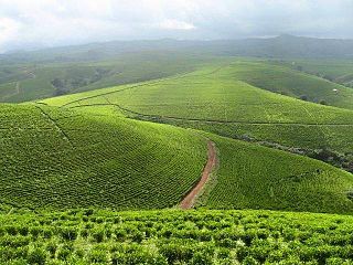
Benue State is one of the North Central states in Nigeria with a population of about 4,253,641 in 2006 census. The state was created in 1976 among the seven states created at that time. The state derives its name from the Benue River which is the second largest river in Nigeria after the River Niger. The state borders Nasarawa State to the North; Taraba State to the East; Kogi State to the West; Enugu State to the South-West; Ebonyi and Cross-Rivers States to the South; and has an international border with Cameroon to the South-East. It is inhabited predominantly by the Tiv, Idoma and Igede. Minority ethnic groups in Benue are Etulo, Igbo, Jukun peoples etc. Its capital is Makurdi. Benue is a rich agricultural region; popularly grown crops include: oranges, mangoes, sweet potatoes, cassava, soya bean, guinea corn, flax, yams, sesame, rice, groundnuts, and Palm Tree.
Taraba State is a state in North Eastern Nigeria, named after the Taraba River, which traverses the Southern part of the state. Taraba State capital is Jalingo. Its slogan is Nature's Gift to the Nation. The main ethnic groups are the Fulbe or Fulani, Mumuye, Mambilla, Jukun, Tiv, Kuteb, Wurkun, Yandang, Ndola, Itchen, Jenjo, Tigun, Jibu. The northern part is mainly dominated by the Fulbe or Fulani Mumuye, Wurkuns, Yandang, Jenjo, and Kona. The southern parts are dominated by the Jukun, Chamba, Tiv, Kuteb and Ichen.The central region is mainly occupied by Fulbe or Fulani Mambilla, Ndola, Tigun, Jibu, Wurbo and Daka peoples. There are 77 distinct ethnic groups, and their languages in the State.

Nigeria has 774 local government areas (LGAs), each administered by a local government council consisting of a chairman, who is the chief executive, and other elected members, who are referred to as councillors. Each LGA is further subdivided into a minimum of ten and a maximum of twenty wards. A ward is administered to by a councillor, who reports directly to the LGA chairman. The councillors fall under the legislative arm of the local government, the third tier of government in Nigeria, below the state governments and the federal government.

The A120 is an A-road in England, which runs between Puckeridge in Hertfordshire and Harwich in Essex.

Funtua is a local government area in Katsina State, Nigeria. Its headquarters is in the town of Funtua on the A126 highway.
Charanchi is a town and Local Government Area (LGA) in Katsina State, northern Nigeria. The town, on the A9 highway, is the headquarters of the LGA. The chairman of the LGA is Dr.Badamasi Lawal Charanchi, the population is approximately 79,000 (2003), and the area is 471 km2. The local government was created from the former Rimi local government in 1996. Currently there are 11 councillors representing their wards in the administration of the local government council. These councillors have the right to impeach the Local Government Chairman in case of any misconduct or misappropriation of the government's fund.
Provincial Trunk Highway 13 is a provincial highway in the Canadian province of Manitoba. It is an RTAC route capable of handling RTAC vehicles such as trucks, truck and pony trailers, trucks and full trailers, truck tractors and semi-trailers, A-trains, B-trains, or C-trains. The route extends south to north from its junction with PTH 3 and PR 245 in Carman to its junction with PTH 1 and PR 430 north of Oakville. The northern terminus of PTH 13 is located between Portage la Prairie and Manitoba's capital city Winnipeg. The Central Manitoba Railway (CEMR) shortline rail intersects PTH 13 north of Carman, the Canadian Pacific Railway (CPR) intersects at Elm Creek, and the Canadian National Railway (CNR) at Oakville.
Lowestoft Corporation Tramways was the operator of the electric tramway system that served Lowestoft from 22 July 1903 until 8 May 1931.
The A2 highway is a federal highway in Nigeria that spans 1,200 kilometres (750 mi). It serves as a vital transportation route, connecting the country's southern and northern regions.
The A4 highway is a major north–south route in Nigeria that spans from the southern coast to the eastern inland region, connecting various cities and regions.

The A8 highway is a roadway in Adamawa State, Nigeria. It spans approximately 100 kilometers, running from west to east. This highway connects two towns located to the south of the Benue River: Numan and Jimeta.
The A13 highway is a major road in Nigeria spanning approximately 615 kilometers. It connects the city of Jimeta in Adamawa State in the south to its northern terminus near Bama in Borno State. The highway plays a significant role in regional transportation.
The A9 highway is a major highway in Nigeria, located in the northern region of the country. It serves as a vital transportation link, connecting several key cities and facilitating both domestic and international trade.
The A344 highway is a highway in Nigeria. It is one of the east-west roads linking the main south-north roads..
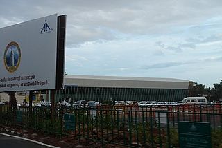
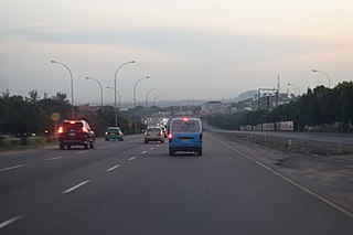
Coimbatore is a city in the state of Tamil Nadu, India. Most transportation in the city and suburbs is by road. Coimbatore is well-connected to most cities and towns in India by road, rail, and air, but not through waterways. The city has successful transport infrastructure compared to other Indian cities, though road infrastructures are not well maintained and developed according to the growing needs of transport, making traffic congestion a major problem in the city. A comprehensive transport development plan has been made to address many traffic problems.
The Federal Highway System of Nigeria also known as Trunk A national roads connects economic and political centers within the country, in addition it links Nigeria with its neighboring countries.These roads are constructed and maintained by the Federal Government of Nigeria through the Federal Ministry of Works and the Federal Roads Maintenance Agency. In 1974, some roads previously maintained by the states were transferred to the Federal Government, this created a classification called Trunk F roads.
The A10 highway is a major highway in Nigeria, connecting the western and eastern regions of the country. This highway spans approximately 452 kilometers and plays a crucial role in facilitating transportation and commerce.
The A11 highway is a major highway in Nigeria. It serves as a crucial transportation route connecting various cities and regions across the country.

F101 is a major east–west Federal highway in Nigeria. It connects various cities and regions within Lagos State.
