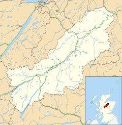
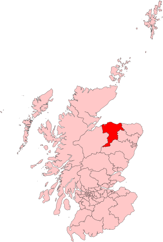
Abernethy and Kincardine is a civil parish, and former registration district and ecclesiastical parish, in the Highlandcouncil area of Scotland. The name is not in use for any modern administrative entity, but remains as the usual description for historical purposes, in the case of the registration district being only a name change.
The name "Abernethy" is derived from the local River Nethy ("aber" is Pictish for a river mouth or junction). The name Kincardine is of mixed Gaelic and Pictish origin, "ceann" being Scots Gaelic for head and "cardden" the Brythonic/Pictish for a wooded area; the latter element also features as "garten" in other nearby placenames.
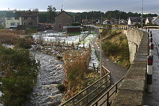
The current main village, Bridge of Nethy, now more well known as Nethy Bridge was located around the confluence of the River Nethy and the Duack Burn, at grid referenceNJ001206; its earlier growth was mostly upriver along the banks of the Nethy.
The Ecclesiastical Parish
The Church of Scotland parish was created in the 16th century by the combination of the parishes of Kincardine and Abernethy, both of which have ancient origins and past or later associations with other churches. Both parish churches (and associated burial grounds) remain in use.
The baptism registers (up to 1856, since deposited with the Registrar General with microfilm copies at a number of places) have poor coverage around the 1820s, apart from those events not recorded if the parishioners were members of other churches. The pre-1855 marriage registers are in a similar condition but also contain some "extra" entries concerning parishioners who married in other parishes or denominations, including some Roman Catholic marriages (indicated as "married by a priest").
Changes in modern church-going habits have led to Church of Scotland ministers usually covering more than one of the original parishes, in this case resulting in the once "United Parish" of Abernethy and Kincardine becoming separated again and the parts joined to neighbouring parishes; the 2006 circuits for the area are now advertised[1] as "Abernethy, Cromdale and Advie" and "Boat of Garten and Kincardine with DuthilCarrbridge".
Abernethy Kirk
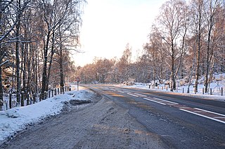
This church[2] is on the West side of the Nethy Bridge to Grantown-on-Spey road, beside the ruins of Castle Roy. The burial ground has been extended in recent years and is in current use for new lairs. Most pre-1855 inscriptions have been recorded and published [3] A rough-surfaced roadside parking area with space for a number of vehicles gives level access to the church and also serves Castle Roy (to which casual pedestrian access is officially not recommended for safety reasons).
Kincardine Kirk
This church[4] is on a small knoll set back from the road between Auchgourish and West Croftmore. It is somewhat smaller than Abernethy Kirk and few new lairs have been created in recent years but burials still take place in existing lairs. Most pre-1855 grave inscriptions have been recorded and published.[5] The churchyard contains a very old Yew tree as often found where such a site has pre-Christian associations. There is usually room for two or three vehicles to park on a grassed area beside the churchyard gate; the lane leading to the church is gated to protect animals in the adjacent fields but not locked.
The Civil Parish and Registration District
The civil parish (based on the boundary of the ecclesiastical parish) originally straddled parts of Inverness-shire and Morayshire; county boundary changes in the latter half of the 19th century resulted in the entire parish being contained within Inverness-shire. The parish council has since been abolished.
It remained as a registration district (since 1972 renamed as Nethybridge) until 2001, generally matching the 19th century census district; from 2002 it became part of the Grantown on Spey and Nethybridge registration district.[6] Due to a combination of registration district boundaries not being tied to local authority boundaries and later changes of the county boundary, events will be found described as happening in Invernessshire or (until 1862) Morayshire but (barring any confusion with the Perthshire town of Abernethy) the same address within this parish is usually being referred to if only the county varies. The Glenmore area (at the southern end of the parish) was moved to the Rothiemurchus registration district on 1 October 1956[7] thus transferring some places which would have been recorded as being within Kincardine in this parish and still might be so described in some more recent registrations.
People
Colonel John Roy Stewart (1700–1752), war poet in English and Scottish Gaelic, military officer, covert operative, and Jacobite.
Rev. William Forsyth (1825–1907), parish minister and author of In the Shadow of Cairngorm; his book is now out of copyright and online copies other than those listed below can usually be found.
Thomas King, Police Constable, was killed by Allan McCallum, a local poacher, when he and a Constable MacNiven attempted to execute an arrest warrant on 20 December 1898. Allan McCallum was tried in Inverness for murder in February 1899,[8] but found guilty of culpable homicide and sentenced to 15 years imprisonment; he was released in 1910.[9] Constable King is buried at Abernethy Kirk.
External links
A Topographical Dictionary of Scotland (1846) A description of the parish; note that the supposed derivation of "Kincardine" in this book appears fanciful and the implied location of Abernethy Kirk is incorrect.
↑ Pre-1855 gravestone inscriptions from Speyside by Alison Mitchell, pub. Scottish Genealogy Society 1977
↑ "Archived copy"(PDF). Archived from the original(PDF) on 12 October 2013. Retrieved 2013-10-11.{{cite web}}: CS1 maint: archived copy as title (link) General Register Office - List of Parishes and Registration Districts
Badenoch is a traditional district which today forms part of Badenoch and Strathspey, an area of Highland Council, in Scotland, bounded on the north by the Monadhliath Mountains, on the east by the Cairngorms and Braemar, on the south by Atholl and the Grampians, and on the west by Lochaber. The capital of Badenoch is Kingussie.
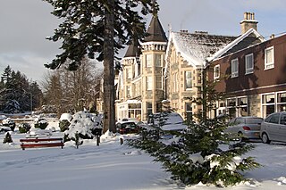
Grantown-on-Spey is a town in the Highland Council Area, historically within the county of Moray. It is located on a low plateau at Freuchie beside the river Spey at the northern edge of the Cairngorm mountains, about 20 miles (32 km) south-east of Inverness.
The County of Moray, or Morayshire, called Elginshire until 1919, is a historic county, registration county and lieutenancy area of Scotland, bordering Nairnshire to the west, Inverness-shire to the south, and Banffshire to the east. It was a local government county, with Elgin the county town, until 1975. The county was officially called Elginshire, sharing the name of the Elginshire parliamentary constituency, so named since 1708.
Cairngorms National Park is a national park in northeast Scotland, established in 2003. It was the second of two national parks established by the Scottish Parliament, after Loch Lomond and The Trossachs National Park, which was set up in 2002. The park covers the Cairngorms range of mountains, and surrounding hills. Already the largest national park in the United Kingdom, in 2010 it was expanded into Perth and Kinross.
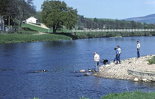
The River Spey is a river in the northeast of Scotland. At 98 mi (158 km) it is the eighth longest river in the United Kingdom and the second longest and fastest-flowing river in Scotland. (The Tay is the longest with the Clyde third in Scotland. It is an important location for the traditions of salmon fishing and whisky production in Scotland.
The Strathspey Railway (SR) in Badenoch and Strathspey, Highland, Scotland, operates a ten-mile (16 km) heritage railway from Aviemore to Broomhill, Highland via Boat of Garten, part of the former Inverness and Perth Junction Railway which linked Aviemore with Forres. It is one of only a handful of former primary/secondary main lines to be preserved in Britain today.
Moray was a county constituency of the House of Commons of the Parliament of the United Kingdom. It elected one Member of Parliament (MP) by the first past the post system of election.
Boat of Garten is a small village and post town in Badenoch and Strathspey, Highland, Scotland. In 1951, the population was less than 400; in 1971, it was almost 500; in 1981, it was almost 700, and the same in 2001.
Advie is a small village in Strathspey, in the Highland Council Area of Scotland. It lies to the south of the River Spey, and next to the A95 road, roughly halfway between Grantown-on-Spey and Aberlour.
Cromdale is a village in Strathspey, in the Highland council area of Scotland, and one of the ancient parishes which formed the combined ecclesiastical parish of Cromdale, Inverallan and Advie in Morayshire.
Nethy Bridge is a small village in Strathspey in the Highland council area of Scotland. The village lies 5 miles (8 km) south of Grantown-on-Spey within the historical parish of Abernethy and Kincardine, and the Cairngorms National Park.
Dulnain Bridge is a village in Strathspey, next to the meeting of the River Dulnain and the River Spey, three miles south-west of Grantown-on-Spey, in the Scottish Highlands and the Highland council area.
The Strathspey Railway was a railway company in Scotland that ran from Dufftown to Boat of Garten. It was proposed locally but supported by the larger Great North of Scotland Railway (GNoSR), which wanted to use it as an outlet towards Perth. The GNoSR had to provide much of the funding, and the value of traffic proved to be illusory. The line opened in 1863 to Abernethy, but for the time being was unable to make the desired connection to the southward main line. Although later some through goods traffic developed, the route never achieved its intended purpose.
The Keith and Dufftown Railway was a railway company in Scotland. Its line ran between Dufftown and Keith on the main line between Inverness and Aberdeen. The company was formed in 1857, but it struggled to attract investors and for some years was unable to proceed with construction.
Ian Charles Ogilvie-Grant, 8th Earl of Seafield, styled Viscount Reidhaven from 1853 until 1881, was a Scottish nobleman. He is numbered as the 27th Chief of Clan Grant.
The Strathspey & Badenoch Welfare Football Association is the governing body overseeing amateur Scottish Welfare football in the Badenoch and Strathspey area of Scotland. It is affiliated to Scottish Welfare Football Association and Scottish Football Association and has been running intermittently since its inaugural season in 1929–30. The winners on that occasion were the now-defunct Nethy Bridge F.C.
Drumuillie is a small hamlet, which lies 1 mile (1.6 km) north of Boat of Garten and 10 miles (16 km) northeast of Aviemore in Inverness-shire, Scottish Highlands and is in the Scottish council area of Highland. The village is located at the centre of Abernethy Forest and just to the west of the River Spey.
Broomhill railway station or Broomhill for Nethy Bridge railway station is a reconstructed railway station on the former Highland Railway main line which was originally built to serve the small villages of Nethy Bridge and Dulnain Bridge in Strathspey. It is at present the eastern terminus of the Strathspey Steam Railway.
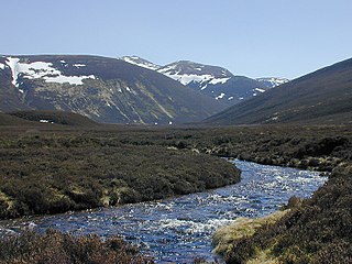
The River Nethy is a right bank tributary of the River Spey in northeast Scotland. It rises as the Garbh Allt between Cairn Gorm and A' Chòinneach on the northern slopes of the Cairngorms and flows northwards through Strath Nethy and into Abernethy Forest. Passing through Nethy Bridge where the B970 road crosses the river and gives its name to the village, the Nethy turns northwestward before entering the Spey at Broomhill. Numerous burns feed the Nethy, the most significant of which is the Dorback Burn which enters from its right bank a mile above Nethy Bridge.
The Lairig an Laoigh is a mountain pass through the Highlands of Scotland. In speech and sometimes in writing the name is reduced to "Lairig Laoigh". It is of glacial origin, dissecting the Cairngorm plateau, and it runs roughly north–south from Speyside to Deeside at one time being used as a drove road. Between the public road in the Abernethy Forest and the one at Linn of Dee the trekking distance is 31 kilometres (19 mi).
This page is based on this Wikipedia article Text is available under the CC BY-SA 4.0 license; additional terms may apply. Images, videos and audio are available under their respective licenses.