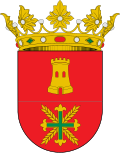
Agaete | |
---|---|
Nickname: culeto | |
Coordinates: 28°6′N15°42′W / 28.100°N 15.700°W | |
Country | Spain |
Autonomous Region | Canary Islands |
Province | Las Palmas |
Island | Gran Canaria |
Government | |
Area | |
• Total | 45.50 km2 (17.57 sq mi) |
Elevation | 43 m (141 ft) |
Population (2018) [2] | |
• Total | 5,573 |
• Density | 120/km2 (320/sq mi) |
Time zone | UTC+0 (GMT) |
Climate | BWh |
Website | Ayuntamiento de Agaete |
Agaete is a municipality of Las Palmas province, on the Canary Islands, Spain.
It is in the north-west of Gran Canaria island, and is enclosed by the Atlantic Ocean to the west, Gáldar to the north-east, and Artenara to the south. Agaete's area is 45.50 km2 (17.57 sq mi) [1] with a population of 5,796 (2003). [3]
The port of Agaete, Puerto de las Nieves, used to be the preferred place to get a view of El Dedo de Dios, a natural monument on the coastline, before the latter was destroyed during tropical storm Delta in November 2005. The port is a common end point for day tours from more touristic areas of the island.
El Maipes necropolis is on the outskirts of the town, in the south-east near the football ground.
Gran Canaria, also Grand Canary Island, is the third-largest and second-most-populous island of the Canary Islands, an archipelago off the Atlantic coast of Northwest Africa and is part of Spain. As of 2023 the island had a population of 862,893 that constitutes approximately 40% of the population of the archipelago. Las Palmas de Gran Canaria, the capital of the island, is the biggest city of the Canary Islands and the ninth of Spain.
Mogán is a town and a Spanish municipality in the southwestern part of the island of Gran Canaria, which is one of the three main islands making up the Province of Las Palmas in the Canary Islands, Spain. Its population is 21,782 (2013), and the area is 172.44 km2.
Yaiza is a municipality on the island of Lanzarote in the Canary Islands, Spain. It lies in the southwest of the island and forms part of the province of Las Palmas. The municipality is bounded by the Atlantic Ocean to the west, south and east. To the north, the Timanfaya National Park is partly within the municipality. The eastern part of the municipality is mountainous and, south west of the mountains, the Rubicon plain stretches to the coast.
Teguise is a municipality in the central part of the island of Lanzarote in the Las Palmas province in the Canary Islands. The population is 22,342, and the area is 263.98 km2. It is located north of Arrecife and south of Haría. The seat of the municipality is the town of Teguise. The municipality also comprises a number of neighbouring islands including Graciosa, Alegranza, Roque del Este, Roque del Oeste and Montaña Clara.
Puerto del Rosario is a town and a municipality in the eastern part of the island of Fuerteventura in the Las Palmas province in the Canary Islands. It has been the capital of Fuerteventura since 1860. The town's population is 29,160 (2013), the administrative district's population is 36,744 and its area is 289.95 km².
Santa Brígida is a municipality in the northeastern part of the island of Gran Canaria in the Province of Las Palmas of the Canary Islands. Its population is 18,791 (2013), and the area is 23.81 km2. It borders Las Palmas to the west and is part of its urban area.
Agüimes is a Spanish town and municipality in the eastern part of the island of Gran Canaria in the Las Palmas province in the Canary Islands.
Santa Lucía de Tirajana is a town and a Spanish municipality in the south-eastern part of the island of Gran Canaria, in the Province of Las Palmas, in the Canary Islands.
Tejeda is a village and a municipality in the mountainous central part of the island of Gran Canaria in the province of Las Palmas in the Canary Islands.
Artenara is a village and a Spanish municipality in the western part of the island of Gran Canaria in the Las Palmas province in the Canary Islands.
Gáldar is a town and a Spanish municipality in the north of the island of Gran Canaria in the Province of Las Palmas in the Canary Islands. Its population is 24,227 (2013), and the area is 61.59 km2 (23.78 sq mi).
Vallehermoso is a village and municipality in the western part of the island La Gomera in the province of Santa Cruz de Tenerife of the Canary Islands, Spain. The town of Vallehermoso, the seat of the municipality, is situated in the northern part of the municipality, 3 km from the coast and 18 km northwest of the island capital, San Sebastián de la Gomera.
Valle Gran Rey is a municipality in the western part of the island La Gomera, in the province of Santa Cruz de Tenerife of the Canary Islands, Spain. The Guanche name of the area was Orone. The seat of the municipality since 1930 is La Calera; previously it was in Arure.
Santa Cruz de la Palma is a city and a municipality on the east coast of the island of La Palma in the province of Santa Cruz de Tenerife of the Canary Islands. Santa Cruz de la Palma is the second-largest city and is the capital of the island. It is along an old lava flow coming from the Caldereta, a volcano just south of the city. Santa Cruz de La Palma has the privilege of having the first democratically elected town hall in Spain.
San Andrés y Sauces is a municipality on the island of La Palma, Province of Santa Cruz de Tenerife, Canary Islands, Spain. It is situated in the northeastern part of the island. The population of the municipality is 4,473 (2013) and the area is 42.75 km². The elevation of the largest village Los Sauces is 250 m. Los Sauces is 14 km north of the island capital Santa Cruz de La Palma. The municipality takes its name from the villages Los Sauces and San Andrés, 1.5 km southeast of Los Sauces, at the coast.
Los Llanos de Aridane is a municipality of the Province of Santa Cruz de Tenerife, Canary Islands, Spain. It is located in the west of the island of La Palma, in the Aridane Valley. With 20,930 inhabitants (2013) it is the most populous municipality of La Palma.
La Oliva is a town and a municipality in the northern part of the island of Fuerteventura in the Province of Las Palmas, Canary Islands, Spain. The population is 29,174 (2023), and the area is 356.13 km2. The municipality includes the Lobos Island to the northeast, just off Corralejo.
Betancuria is a small town and a municipality in the western part of the island of Fuerteventura in the Province of Las Palmas, Canary Islands, Spain. The population is 811 (2013), and the area is 103.64 km2 (40 sq mi). It is situated in a mountainous region, 4 km (2 mi) west of Antigua and 21 km (13 mi) southwest of the island capital Puerto del Rosario. By population it is the smallest municipality in Fuerteventura as well as all of the Canary Islands. Betancuria is named after Jean de Béthencourt, who founded the town in 1404 with Gadifer de La Salle. It was the original capital of the Kingdom of the Canary Islands, and later capital of Fuerteventura.
Antigua is a town and a municipality in the central part of the island of Fuerteventura in the Province of Las Palmas in the Canary Islands. It has a population of 11,629 (2013), and an area of 250.56 km2. It is situated 17 km southwest of the capital of the island Puerto del Rosario.
The El Maipés necropolis is an ancient burial site near Agaete on the Spanish island of Grand Canary, province of Las Palmas in the Canary Islands of the west coast of Africa.