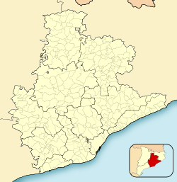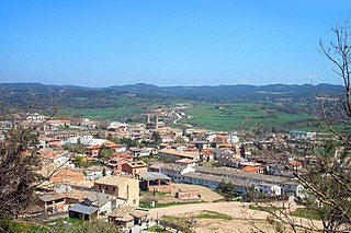
Olost is a municipality in the province of Barcelona, Catalonia, Spain. It has less than 1,200 people, situated on a plain 669 meters above sea level at 20 km from Vic in the center of the ancient shire or comarca of the Lluçanès, at present in the comarca of Osona. In the center of the village stands the church of Santa Maria d'Olost of monumental size, with a large façade and two bell towers. Its construction started in the 10th century and ended in the 18th century. Near Olost are the two small settlements of Santa Creu de Jutglars and the Vila with Sant Gil de la Vila and the unusual Castell d'Olost, built in 1155 with added elements of the 14th and 15th centuries, that lies in a depression next to a stream in the district of Orista. Even though it was a fortified farm it has the structure of a castle; it is nearly hidden from view for protection in the Middle Ages.

Piera is a municipality that covers a large portion of the southeastern corner of the comarca of Anoia in Catalonia, Spain, on the left bank of the Anoia river. The agricultural land, mostly non-irrigated, is used for the cultivation of cereals, grapes, olives and almonds. The town itself hosts a number of light industries: textiles, plastics and construction materials. Tourism during the summer months is also relatively important for the local economy.

Maldà is a municipality in the comarca of Urgell, Catalonia, Spain.

Santa Coloma de Farners is a spa town and capital of the comarca of the Selva, in Catalonia, Spain, and of the judicial district of Santa Coloma. It is situated on the edge of the Selva Depression and of the Guilleries. The local economy is mainly commercial, given the status of the town as capital of the comarca, although summer tourism, agriculture and forestry products also contribute. The urban centre is to the north and west of the main modern communication routes, although the C-253 road links the town with the main N-II route and the AP-7 autopista and to the RENFE railway station at Sils (10 km). The GE-533 runs through the northern part of the municipality, linking it with Vic to the west and with Riudellots de la Selva, Vilobí d'Onyar and Girona-Costa Brava Airport to the east.

Bassella is a municipality in the comarca of the Alt Urgell, in Catalonia, Spain. The village of Bassella, one of nine settlement which make up the municipality, is located at the confluence of the Segre river with the Salada river and at the point where the route from Solsona and the potash mines of Cardona meets the route between Lleida and La Seu d'Urgell. The ajuntament is located in Castellnou de Bassella.
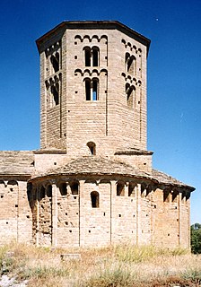
Ponts is a municipality and a town in the comarca of the Noguera in the province of Lleida, Catalonia, Spain. It is situated on the left bank of the Segre river near its confluence with the Llobregós river and at the point where the routes from Calaf and Cervera meet the route from Lleida to La Seu d'Urgell.
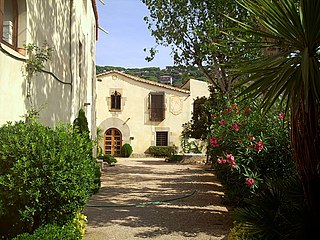
Cabrera de Mar is a municipality of the comarca of Maresme in Catalonia, Spain.

Olèrdola is a municipality in the comarca of the Alt Penedès in Catalonia, Spain. It is situated on the northern side of the Garraf massif, and the highest point of the municipality is the Puig de l'Àliga at 468 m.

Argençola is a municipality in the comarca of the Anoia in Catalonia, Spain. It is situated in the east of the comarca, bordering the Segarra and the Conca de Barberà. The Anoia river has its source on the territory of the municipality. A local road links the municipality with the main N-II road from Barcelona to Lleida.

Isona i Conca Dellà is a municipality in the comarca of the Pallars Jussà in Catalonia, Spain. It is situated in the valley of the Conques river in the south-east of the comarca. It was formed in 1970 by the fusion of the following municipalities: Isona, Basturs, Benavent de la Conca, Biscarri, Conques, Covet, Gramenet, Llordà, Masos de Sant Martí, Montodó, Orcau i Figuerola d'Orcau, Sant Romà d'Abella and Siall. The town hall is in Isona. The municipality is served by the C-1412 road between Artesa de Segre and Tremp, and is linked to Coll de Nargó by the L-511. It includes a small exclave to the south.

Castellar de n'Hug is a municipality in the comarca of the Berguedà in Catalonia, Spain. It is situated on the southern slopes of the pyrenean range of the Creueta. The Llobregat river has its source on the territory of the municipality. The village is served by the B-403 road, which links it with La Pobla de Lillet and which continues over the Creueta to the comarques of the Ripollès and the Cerdanya.

Montornès de Segarra is a municipality in the comarca of the Segarra in the Province of Lleida, in Catalonia, Spain. It is situated in the west of the comarca and is served by the L-210 road. Montornès de Segarra became part of the Segarra in the comarcal revision of 1990: previously it formed part of the Urgell. The municipality contains two urban centres, Montornès de Segarra and Mas de Bondia.

Santa Maria de Besora is a municipality in the comarca of Osona in Catalonia, Spain. It is situated on the north side of the Bellmunt range in the north of the comarca. It is linked to Sant Quirze de Besora and to Vidrà by a local road. Besora castle has an eleventh-century Romanesque church: there is also a preroman chapel at Sant Moí. Santa Maria de Besora became part of Osona in the comarcal revision of 1990: previously it formed part of the Ripollès.

Castellar del Vallès is a Spanish municipality of Catalonia in the comarca of Vallès Occidental. It is located 7 km from Sabadell and 11 km from Terrassa, the comarca's two capitals. Other villages near Castellar del Vallès are Sant Llorenç Savall, Matadepera and Sentmenat.

Verdú is a village and municipality in the province of Lleida, in Catalonia, Spain. It is traditionally associated with the Segarra region, but in 1936 was transferred to the comarca of Urgell.

Rubió is a rural municipality in the comarca of Anoia in Catalonia, Spain. Its administrative centre is the village of Rubió, and other villages include Maçana and El Pla de Rubió. As of 2014, the municipality had 228 inhabitants. At 48 square kilometres (19 sq mi) it is one of the largest municipalities of the Alta Segarra, and at one time was the most sparsely populated.
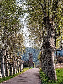
Santa Maria de Merlès is a municipality in Catalonia. It is officially within the comarca of Berguedà, but traditionally, it is a part of the natural comarca of Lluçanès. The municipality is located on the riera, or stream, of Merlès, from which the town takes its name. It is located about 14 kilometers east of Puig-reig, and 8 kilometers west of Prats de Lluçanès, the nearest market town.

Torà is a town and municipality in the North East of the comarca (county) of Segarra, in the province of Lleida, Catalonia, Spain. The urban structure of the center has retained most of its original design, with narrow, twisting streets and blocks formed by rows of attached buildings. The Medieval town grew around a castle or fortified place. A particular trait of the fortified origin of the town is the presence of a number of portals to allow several streets their pass through defensive barriers formed by the rows of buildings of the town and its walls. Torà is some 10 kilometers northeast from the more populated Guissona, a neighbor town that has experienced an important economic development in the last half century parallel to an unprecedented demographic growth sped up in the recent years.

Lluçà is a municipality in the comarca of Osona in Catalonia, Spain. It is subdivided into the town of Santa Eulàlia de Puigoriol, and the much smaller village of Lluçà. This village, prominent because of its monastery, gives its name to the surrounding natural comarca of Lluçanès.

Sant Guim de Freixenet is a municipality in the comarca of la Segarra in Catalonia, Spain.


